Southwestern USA 2025 (Page 1 of 11)
Page 1: Introductions / Hollywood Boulevard (and
a few other sites in the Greater Los Angeles Area)
Page 2:
Las Vegas,
Lake Mead, and the
Hoover Dam
Page 3: The Grand Canyon
Page 4:
Glen Canyon Dam,
Monument Valley,
Natural Bridges National
Monument,
Arches National Park,
Canyonlands National Park,
Four Corners
Page 5:
Mesa Verde National Park,
Durango and
Chimney Rock
Page 6:
Los Alamos and
Santa Fe
Page 7: Albuquerque
Page 8:
Alamogordo,
White Sands National Park, and
Roswell
Page 9:
Loving County and
EL Paso
Page 10: Ciudad Juárez, Mexico
Page 11:
T-or-C to
Lake Havasu City (inc.
Very Large Array and
Meteor
Crater) /
Endnotes
Introductions / Hollywood Boulevard (and a few other sites in the Greater Los Angeles Area*)
General Introduction to the Road Trip
The following webpages (11 in total) document a 15-night tour through some of the highlights of the southwestern United States. The trip began with a (return) flight from London to Los Angeles International Airport on British Airways, with tickets offering excellent value at the time. A hire car collected at the airport made it possible to explore the region in the form of a road trip – a style of travel with deep roots in American culture, long associated with freedom, open highways, and discovering landscapes at one’s own pace. Accommodation was arranged along the way, mainly in motels, keeping costs low and flexibility high.
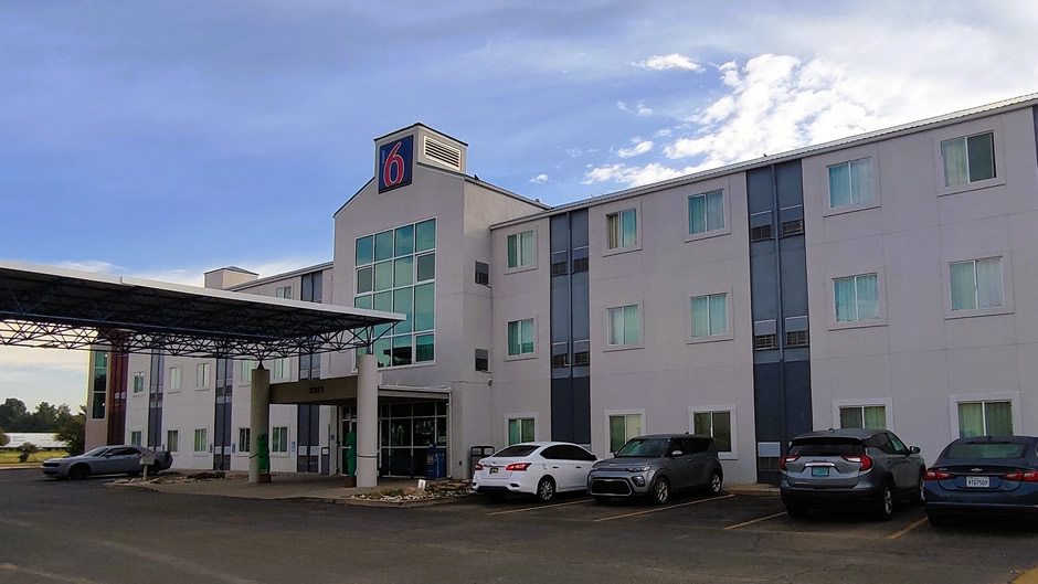
Above: Motel 6, Roswell, New Mexico. Some people prefer luxury hotels. However, this trip was not only done on a budget but being a road trip, often little time was spent at the accommodation. The places we found were on the whole clean, all had en-suite and were perfect as places to crash for the night. Being Roswell, two alien figures stand by the doorway to greet guests.
These pages include photographs and descriptive text of the places visited, arranged geographically rather than strictly chronologically to reflect the route taken within each area. The journey took place in late September and early October 2025, coinciding with an atypical U.S. government shutdown (subsequently resolved) that left some park facilities closed, though many sites remained accessible and because of the shutdown, free to enter. The Southwest proved an ideal destination, offering the striking scenery, cultural depth, and memorable experiences that make it a popular choice for travellers seeking both adventure and variety.
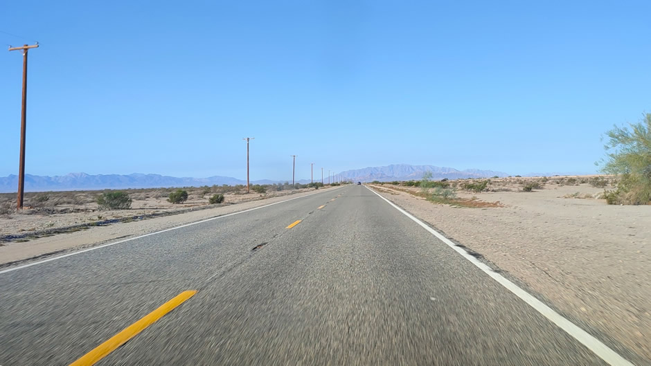
Above: On the Road - Travelling westwards along California State Route 62, approximately 11 miles southwest of Vidal Junction. Along this stretch of highway, there are no services for 100 miles (until the city of Twentynine Palms).
The Greater Los Angeles Area*
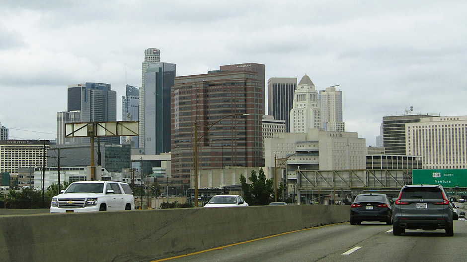
The city of Los Angeles itself has long been a magnet for creative industries, but its layered neighbourhoods also reveal a patchwork of immigrant histories that continue to shape the city’s cultural identity. Further out from its urban core, the Greater Los Angeles Area stretches far beyond the city itself, encompassing deserts, mountains, and coastal communities that together form one of the most diverse urban regions in the United States.
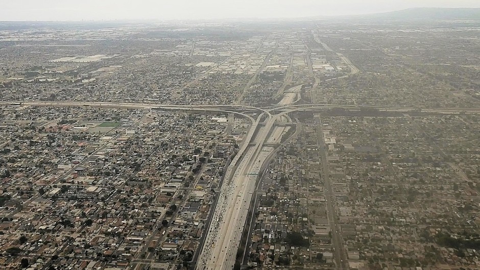
Above: The approach to LAX and downtown Los Angeles
The sights that follow were visited during the very start and end of the road trip. For the reader wondering why more time wasn’t spent exploring Los Angeles itself, due to the sheer size of the city and number of attractions it has to offer visitors, the entire 15-nights could have easily be spent here and the whole point of taking a road trip would have been missed! Some of the sights seen in this area may seem a bit random, but the authors’ brother had a few personal choices from film and television in mind. It is hoped sometime in the future to return to Los Angeles and explore further, but for now at least one main highlight of the city was seen and that is Hollywood Boulevard, where we start off with.
*Note that the term “Greater Los Angeles Area” here refers to what is officially known as the “Los Angeles-Long Beach, CA Combined Statistical Area”. It encompasses five counties in Southern California – Ventura County, San Bernardino County, Riverside County, Orange County, and the city of Los Angeles and Los Angeles County:
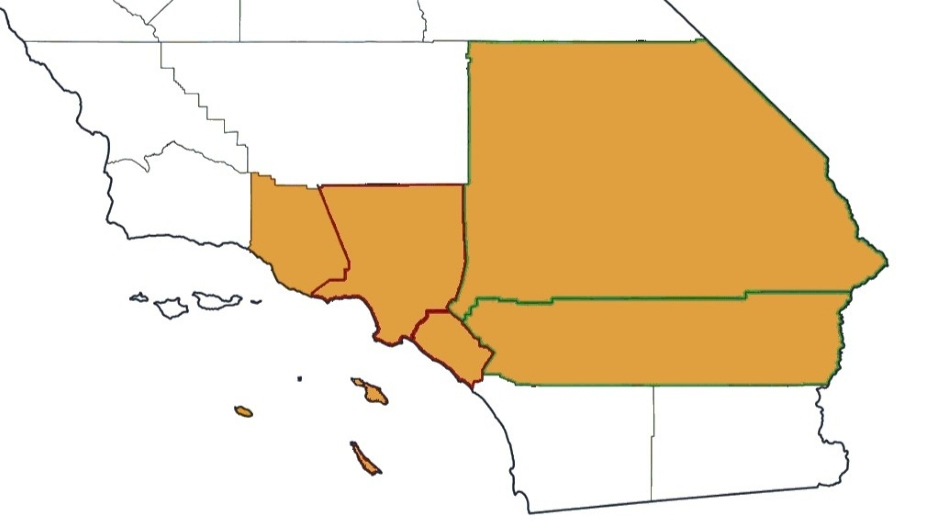
Above: Southern California with The Los
Angeles–Long Beach, CA Combined Statistical Area as defined by the U.S.
Office of Management and Budget shown in orange (modified from
Ostealthy, CC BY-SA 4.0
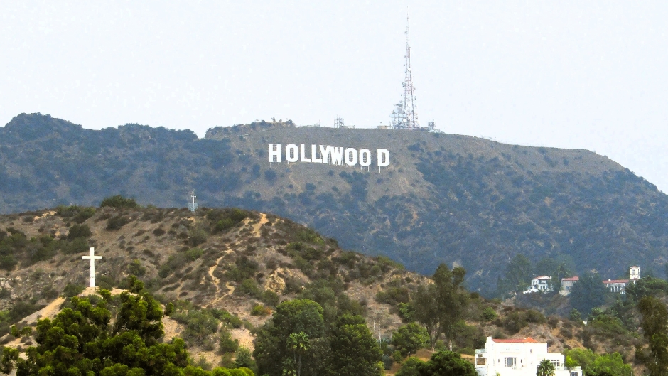
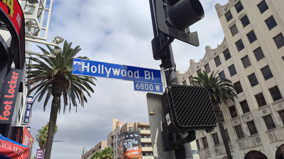
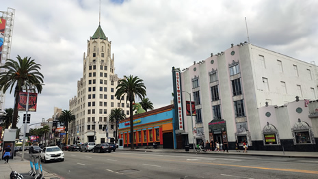
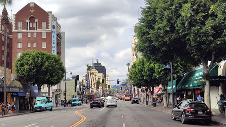
Hollywood Boulevard
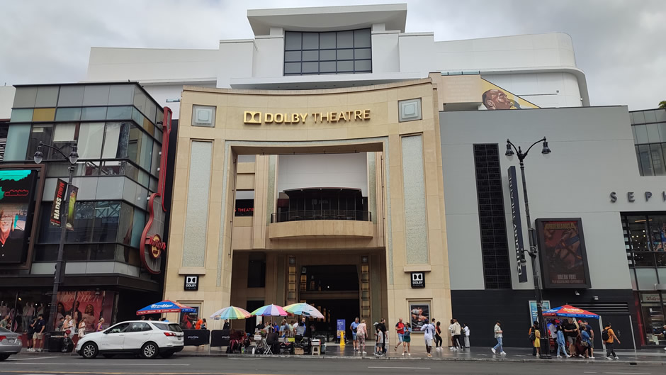
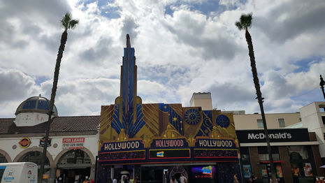
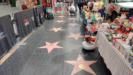
Hollywood Boulevard is one of Los Angeles’ most famous streets, stretching through the heart of Hollywood. Known for its historic ties to the film industry, it has evolved into a major tourist destination lined with landmarks, entertainment venues, and cultural attractions.
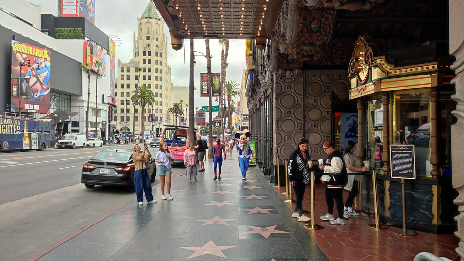
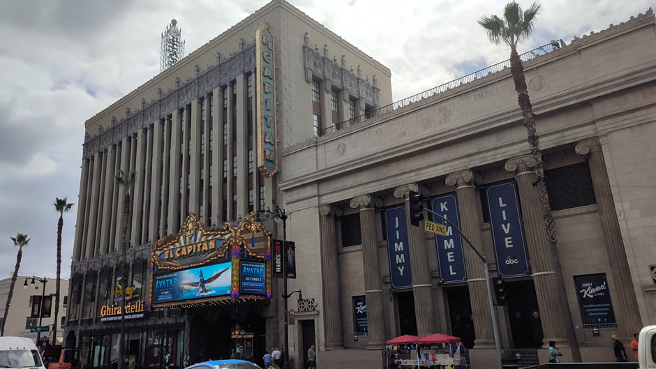
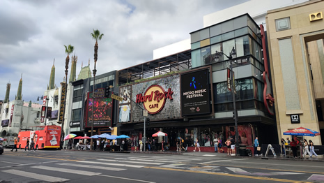
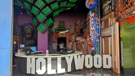
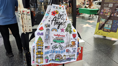
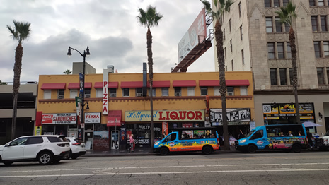
Along the boulevard, visitors encounter a mix of theatres, museums, and shops that highlight Hollywood’s cinematic legacy. Notable stops include the Dolby Theatre, El Capitan Theatre, Madame Tussauds, and the Hollywood Wax Museum, alongside shopping and dining at Ovation Hollywood. Street performers and souvenir shops add to the lively atmosphere, while the Hollywood Walk of Fame runs prominently along the sidewalks.
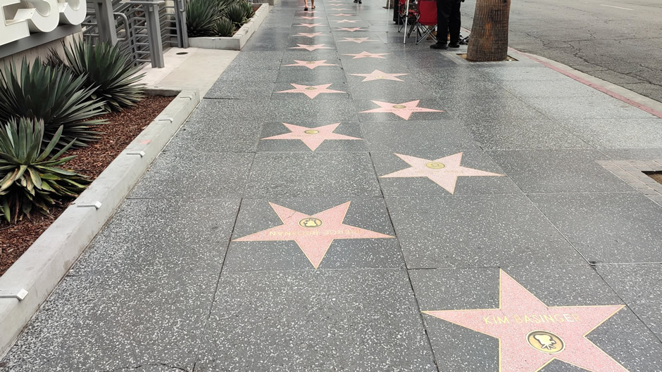
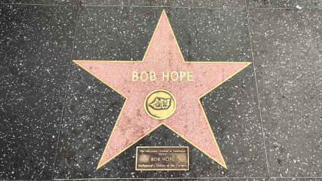
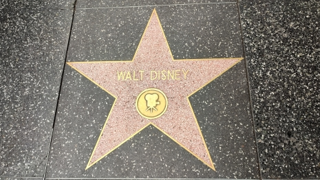
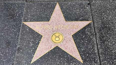
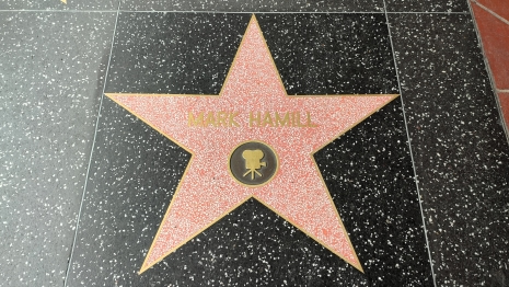
The Hollywood Walk of Fame features more than 2,800 terrazzo-and-brass stars embedded in the pavement, honouring actors, musicians, directors, and other entertainment figures. Spanning fifteen blocks of Hollywood Boulevard and three blocks of Vine Street, it attracts around ten million visitors annually and continues to add new honourees each year. Plenty of photos were taken here of the stars on the ground, so only a small sample is shown!
 |
||
 |
 |
|
 |
 |
|
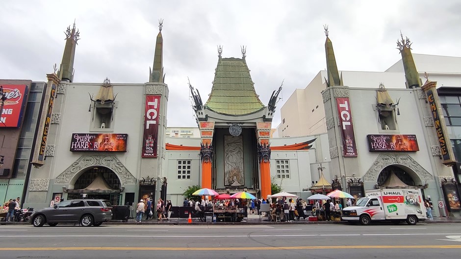
The TCL Chinese Theatre, below, (formerly Mann's Chinese Theatre and originally Grauman's Chinese Theatre) was opened in 1927 by showman Sid Grauman. It is a landmark movie palace famous for its pagoda-style architecture and forecourt of celebrity handprints and footprints. Today, it hosts premieres and screenings with IMAX technology, making it both a historic site and a modern cinema experience.
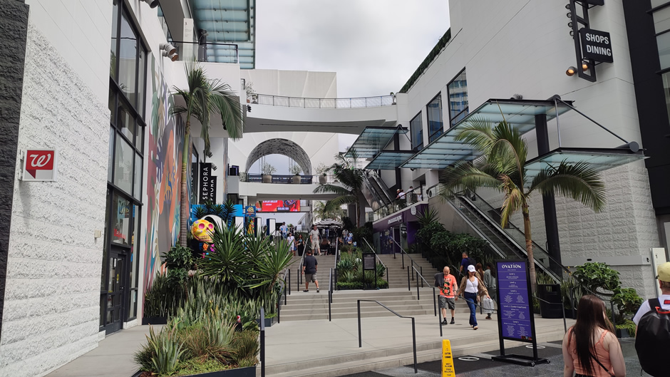
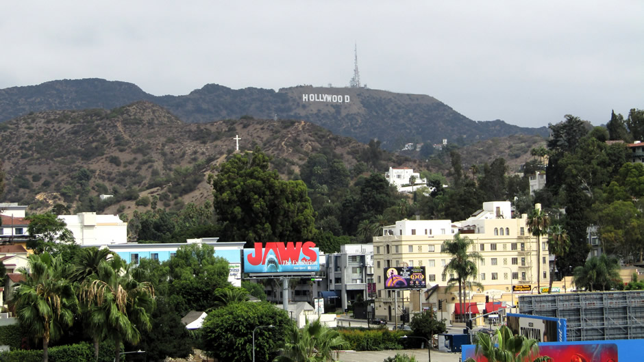
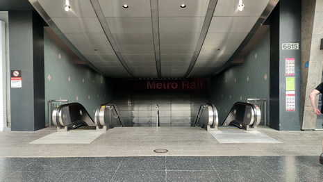
Ovation Hollywood, formerly Hollywood & Highland, is a large shopping and entertainment complex that houses the Dolby Theatre and offers rooftop and terrace viewpoints. By taking the elevators up to designated viewing areas, visitors can enjoy clear and direct views of the Hollywood Sign, making it one of the most accessible vantage points in the city:
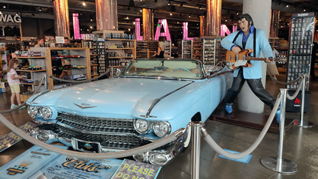
A few more photos taken during the visit to Hollywood Boulevard follow:
 |
 |
|
 |
 |
|
 |
 |
|
 |
 |
|
 |
 |
|
 |
 |
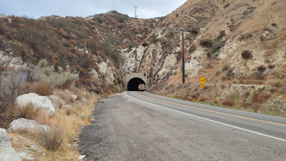
Duel Scene Tunnel
The Duel scene tunnel (shown below), located on Soledad Canyon Road in Southern California, is one of the most recognizable filming spots from Steven Spielberg’s 1971 thriller Duel (his first feature-length film). In the movie, salesman David Mann (played by Dennis Weaver) is menaced by a tanker truck, and the tense sequence at the tunnel, where a school bus also appears, has become a standout moment in the film. Today, fans of Spielberg’s debut often visit the site to retrace the movie’s locations, making the tunnel a small but memorable landmark in cinematic history.
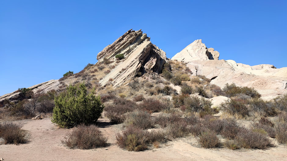
Vasquez Rocks Natural Area in northern Los Angeles County is a striking park known for its jagged sandstone formations, rich cultural history, and frequent appearances in film and television.
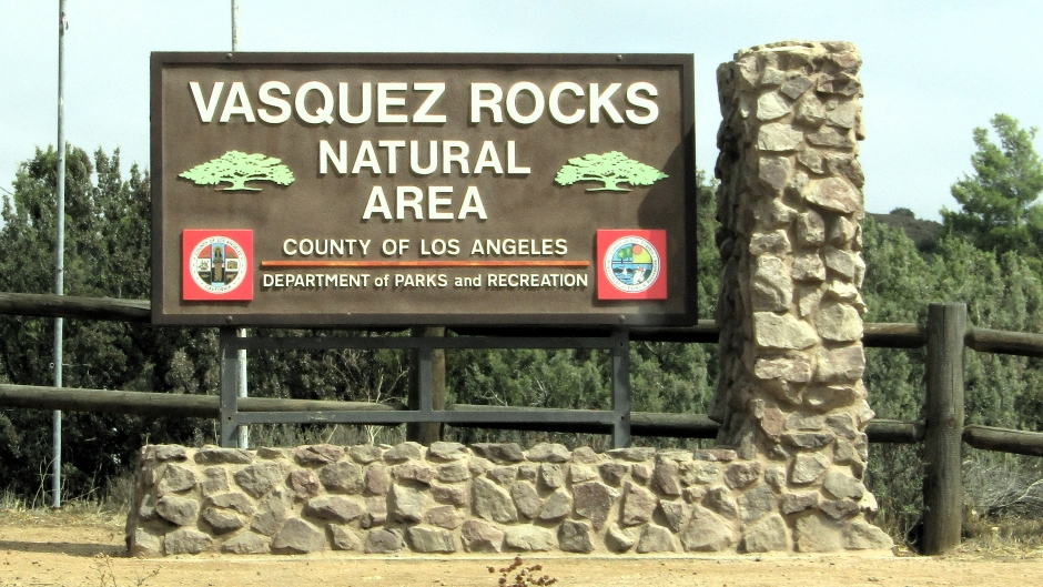
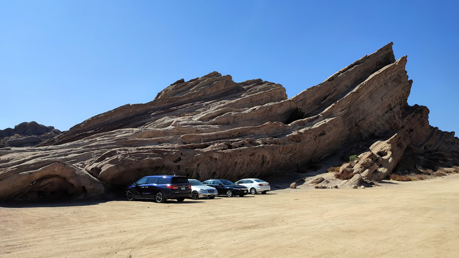
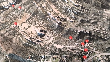
The park covers nearly 932 acres and is easily accessed from the 14 Freeway near Agua Dulce. Visitors enter through a main gate leading to parking areas close to the interpretive centre and trailheads. The layout is straightforward: paved lots near the entrance serve day visitors, while dirt roads extend toward the central formations, including the well-known “famous rocks” that rise at sharp angles from the ground.
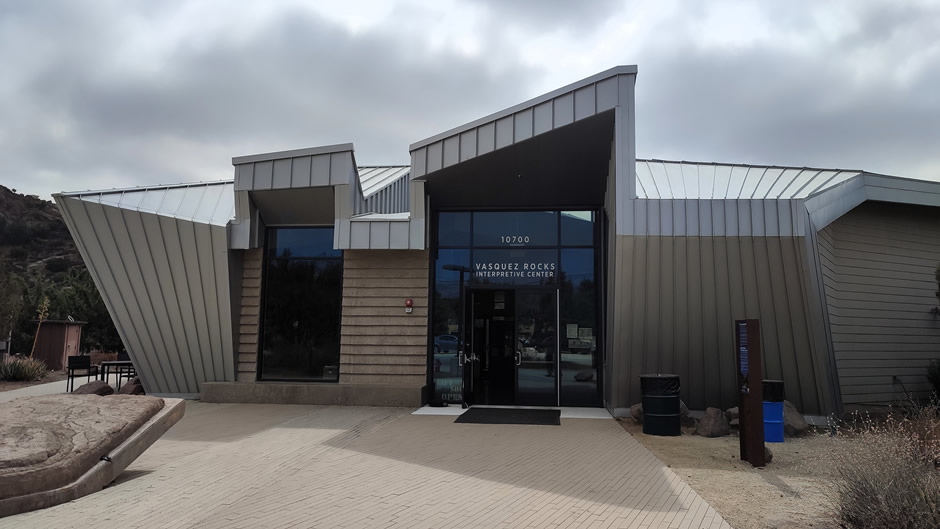
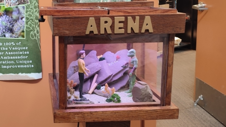
Above: Vasquez Rocks Interpretive Center, near the entrance to the park provides exhibits on local history, geology, and ecology.
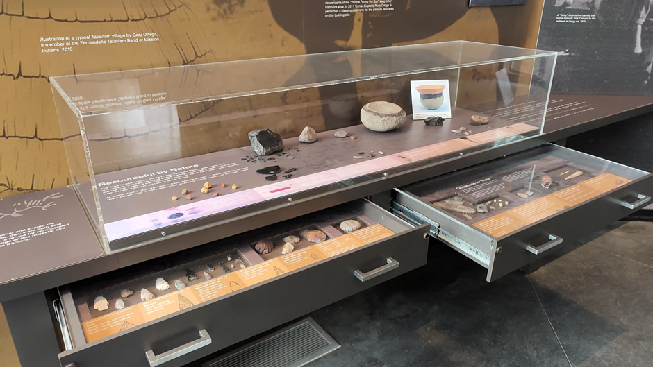
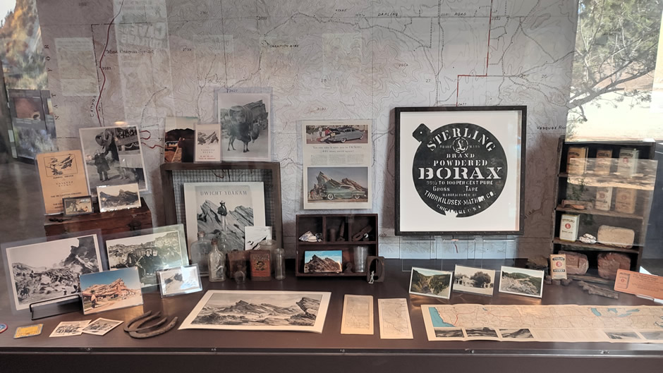
Historically, the site was used by Native American groups such as the Tataviam, who left evidence of habitation in the area. In the 19th century, the rocks became associated with Tiburcio Vásquez, a Mexican bandit who used the formations as a hideout while evading law enforcement. This dual heritage of ancestral and European adds depth to the park’s cultural significance.
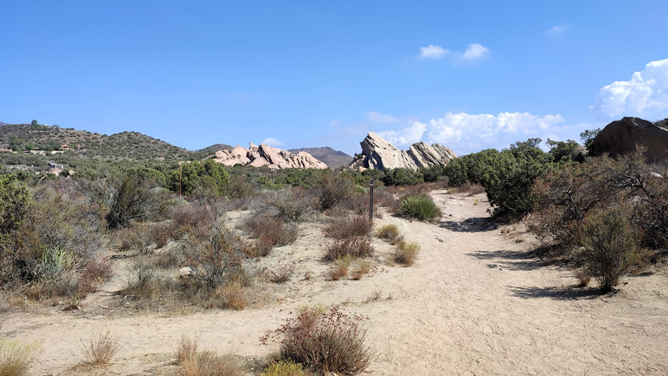
Geologically, the formations were created by uplift and erosion along the San Andreas Fault, producing tilted layers of sandstone that date back millions of years. The unusual angles and exposed strata make the rocks a natural classroom for understanding plate tectonics and sedimentary processes. The surrounding area also supports chaparral vegetation and wildlife typical of California’s high desert.
 |
 |
|
 |
||
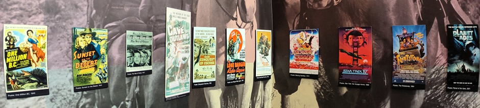
The rocks are famous far beyond geology. They have appeared in countless productions, including Star Trek (notably the original series episode “Arena”), Mighty Morphin Power Rangers, “The Flintstones” movie, and Michael Jackson’s “Black or White” music video. Their proximity to Hollywood and distinctive “alien” look have made them a go-to filming location for decades. A full list of productions using the Vasquez Rocks as a filming location is beyond the scope of this webpage, but may be found on a Wikipedia page Here (external link).
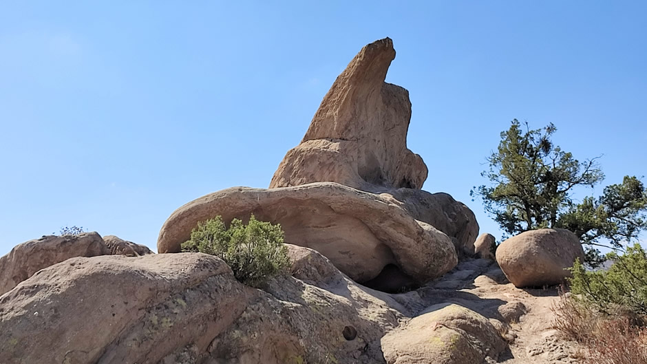
Above: The Witch’s Hat at Vasquez Rocks
As well as the central “famous rocks,” which are the most photographed and climbed in the park, notable features include the “Witch’s Hat”, a pointed rock formation caused by uplift, weathering, and differential erosion of sandstone sedimentary layers.
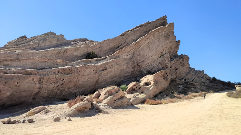
Above: Vasquez Rocks – for scale, note the person about to walk up the track on the right-hand side of the photo
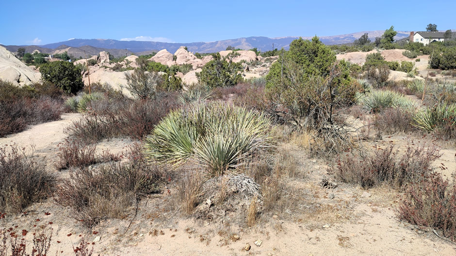
Several trails run through the natural area. The main loop trail circles the central formations, offering close views of the tilted rocks. Other paths branch into the surrounding chaparral (vegetation consisting chiefly of tangled shrubs and thorny bushes), including routes that connect to the Pacific Crest Trail. Shorter trails near the parking areas provide easy access for families, while longer hikes extend into the backcountry for more experienced visitors.
Vasquez Rocks Natural Area is a place where geology, history, and popular culture intersect, and the park can offer both casual visitors and dedicated hikers a memorable experience.
Oldest McDonalds in Operation
Not exactly the first tourist sight people think of when visiting Los Angeles, but the oldest McDonald’s still in operation (shown below) is located in Downey, California. It opened in 1953 as the third McDonald’s ever built (the first, located in San Bernardino opened in 1940, was demolished in 1972, and today no longer functions as a restaurant but is home to an unofficial McDonald’s Museum). The Downey branch continues to serve customers today. It retains its distinctive Googie-style architecture** with the classic red-and-white design and golden arches, making it both a working fast-food outlet and a recognised historic landmark.
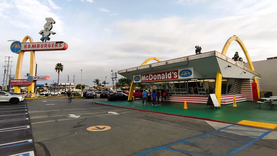
Above: The Oldest McDonalds in Operation, located in Downey, California
Due to declining sales, structural damage from the 1994 Northridge earthquake, and the absence of both indoor seating and a drive-up window, the Downey McDonald’s was closed, with plans to demolish it and replace it with a modern “retro” restaurant nearby. In 1994, however, the site was placed on the National Trust for Historic Preservation’s list of the 11 Most Endangered Historic Places. Public pressure and preservationist efforts led McDonald’s to restore the building over two years, reopening it with an adjacent museum and gift shop inside a replica of the original San Bernardino McDonald’s. A drive-thru window was later added in 2016. Visitors can still enjoy a meal there while experiencing a piece of early McDonald’s history.
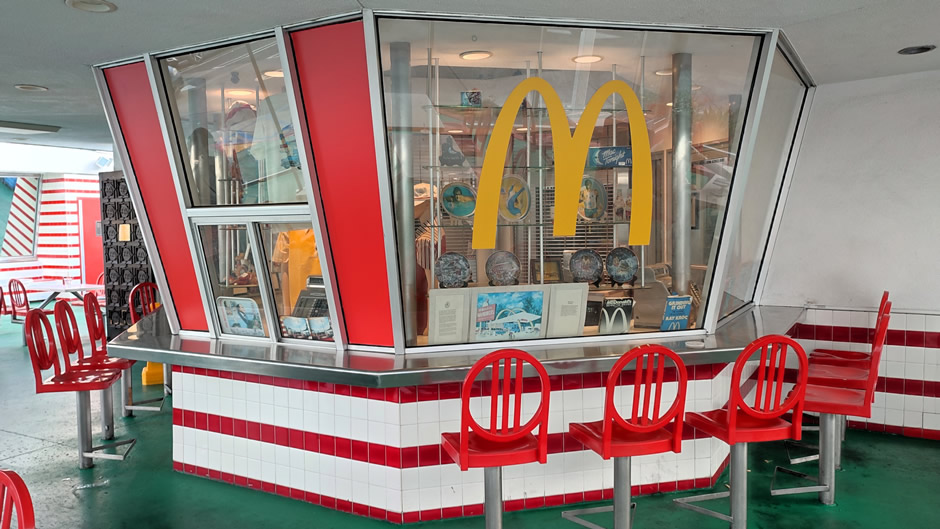
Above: Replica of the original San Bernardino McDonald’s at the site, which contains a small museum.
**Googie is an ultramodern architectural style popular in mid-20th century America, defined by futuristic shapes, bold angles, and dramatic, oversized neon signs designed to be eye-catching from a car.
Falling Down "Breakfast at Whammy Burger" Scene Location
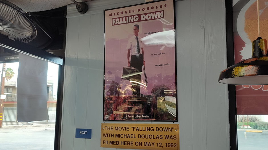
Falling Down (1993) is a drama directed by Joel Schumacher, starring Michael Douglas as William Foster, an unemployed defence worker whose frustration with modern life erupts into a violent journey across Los Angeles. The film explores themes of alienation, societal pressure, and the breaking point of an ordinary man.
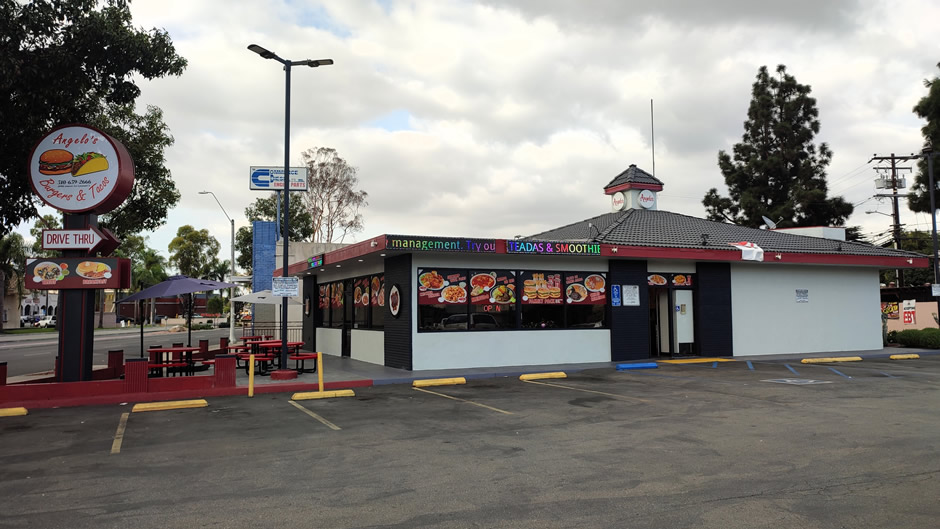
The memorable “Breakfast at Whammy Burger” scene in the movie was filmed at Angelo’s Burgers at 10990 Atlantic Ave, Lynwood, California. This scene is one of the film’s most iconic moments. Foster stops at a fast-food restaurant called Whammy Burger but is told he's missed the breakfast cutoff by four minutes. He becomes enraged, pulls out a submachine gun, changes his mind about breakfast and then forces the staff to let him have lunch instead. He orders a "Double Whammy Burger" and fries and becomes upset when the burger he receives is nothing like the advertised poster, but he eats it anyway before leaving. His confrontation in the scene over rigid breakfast hours highlights the character’s growing frustration with inflexible rules and modern life.
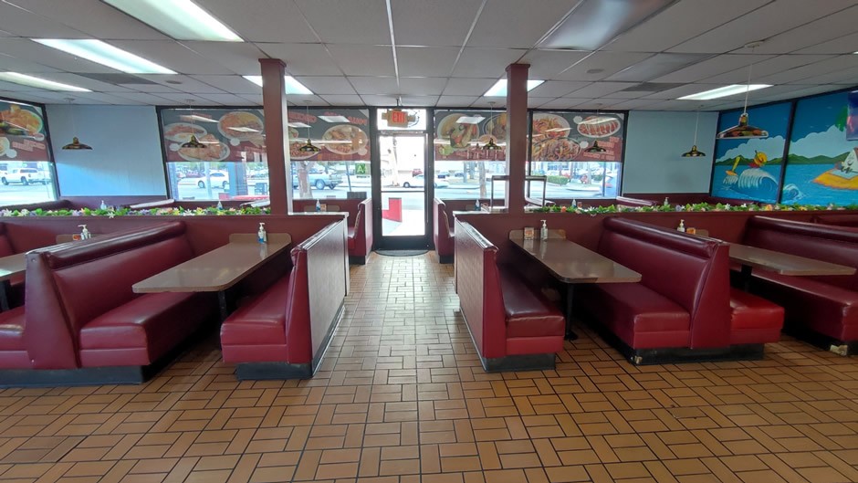
At the time of filming, Angelo’s was a straightforward roadside burger spot. Today, operating as Angelo’s Burgers and Tacos, it continues as a neighbourhood eatery with a menu that now features Mexican favourites alongside burgers. Though the menu and ownership have changed, the building itself remains recognizable to film fans – a reminder of how ordinary places can become part of cinematic history.
Baker
On the road trip heading away from Los Angeles to Las Vegas (next page), a stop was made in Baker, California. This small town is positioned directly on the route of Interstate 15, roughly 140 miles from Los Angeles and approximately 90 miles from Las Vegas, making it a common rest stop for drivers on this highway. Whilst there are several other options for making stops along this route, attention was drawn to the fact that “The World's Tallest Thermometer” was marked on the map – seeing the world’s largest this and that is all part of the road trip experience! And so a bit more about the town and a look at some of the highlights of Baker CA, population 482 (2023 data), follows:
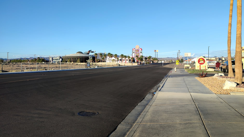
Baker, California was founded in 1908 as a station on the Tonopah and Tidewater Railroad and later established in 1929 by Ralph Jacobus Fairbanks as a service town along the desert highway. Today it remains a small Mojave Desert stop on Interstate 15, known for its quirky roadside attractions.
The town is often called the “Gateway to Death
Valley”, serving as a convenient stop for travellers heading into the
Mojave National Preserve or north toward the park itself. However, it
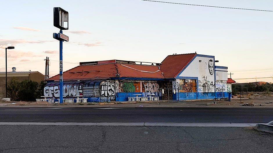
has also been called a “graveyard of broken dreams” due to its many
shuttered gas stations, diners, and motels along the freeway; these
abandoned businesses tell the story of its boom-and-bust desert past.
Despite all of the challenges of its past, Baker has reinvented itself
from a fading desert town into a pop-culture roadside attraction by
tapping into the fascination with Area 51. It’s less about proximity to
the top-secret military installation and more about branding the mystery
of it, turning conspiracy into commerce.
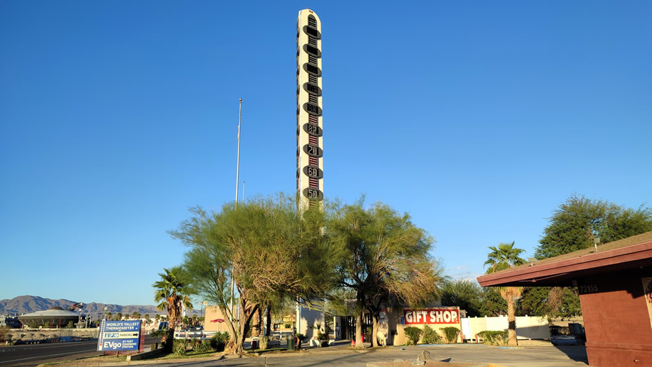
“The World’s Tallest Thermometer”, above, is a 134‑foot steel landmark built in 1991 to commemorate the record 134°F temperature once recorded in nearby Death Valley.
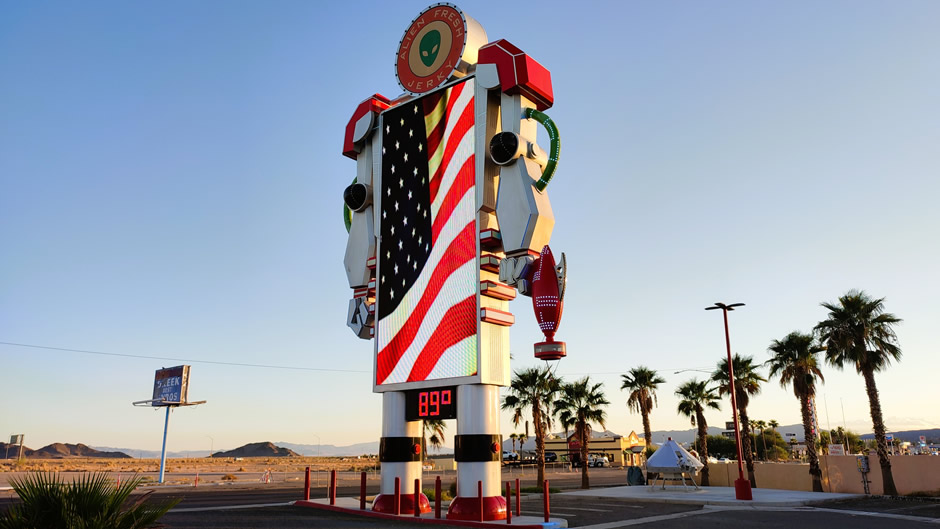
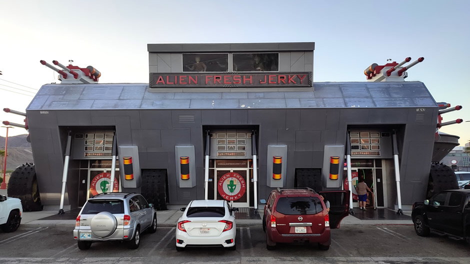
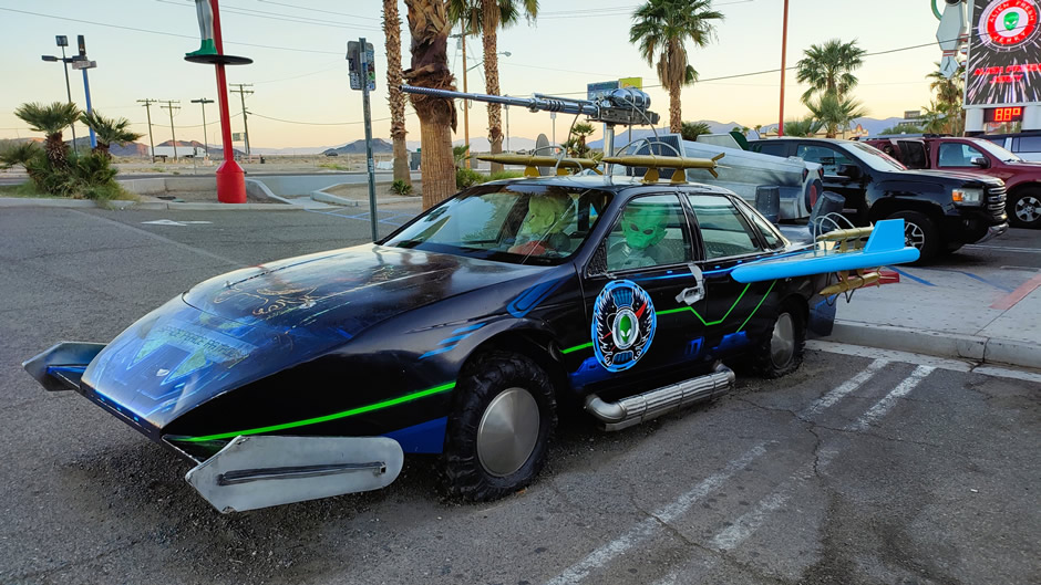
Alien Fresh Jerky (above) is a themed jerky store founded in 2000, now expanded into a sci‑fi attraction with alien statues and the Alien Jerky Car, a UFO‑styled vehicle parked outside (below). The store itself has a large selection of “Alien Fresh Jerky”, alongside a huge selection of “Area 51 Souvenirs”.
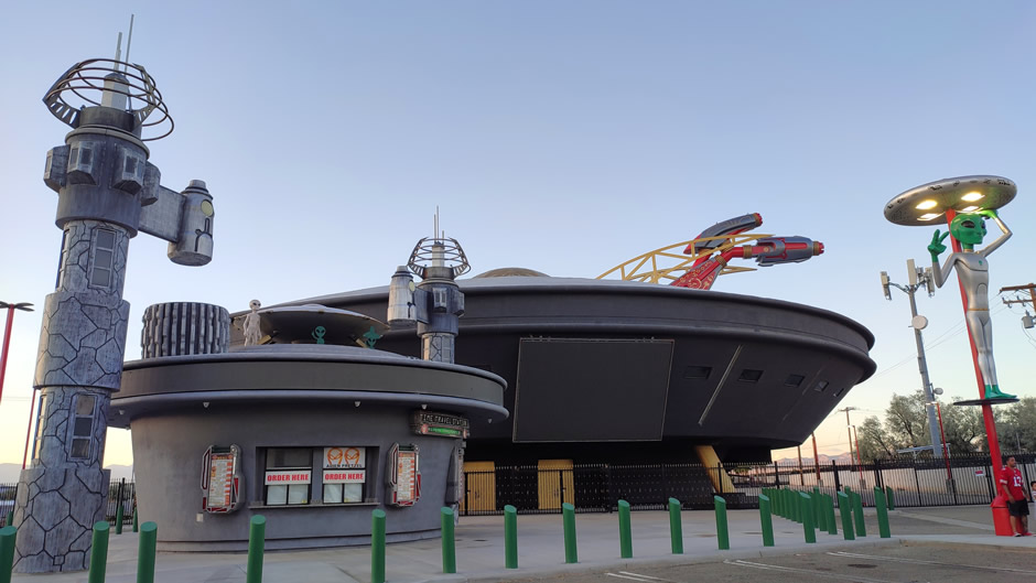
The UFO Hotel behind Alien Fresh Jerky (shown below) is a new venture in Baker, designed in the shape of a landed mothership with plans for themed rooms, dining, and retail.
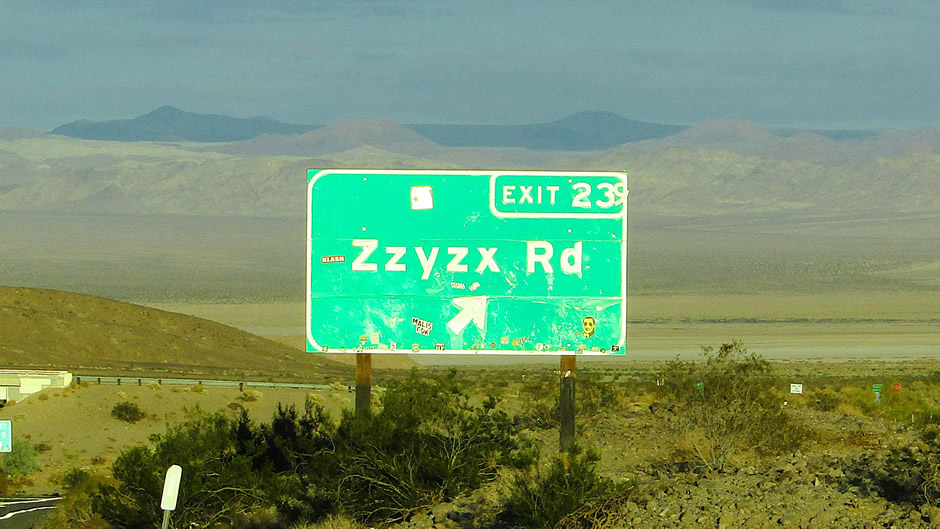
One final oddity: Approximately 7 miles south of Baker, Zzyzx Road stretches 4.5 miles through the Mojave Desert, partly paved and partly dirt, linking the Interstate southward to the settlement of Zzyzx. The settlement was originally founded in 1944 by American evangelist Curtis Howe Springer as the site of the Zzyzx Mineral Springs and Health Spa. Springer invented the name Zzyzx for the site, presenting it as the “last word” in the English language. Today it is managed as part of the Mojave National Preserve and is home to the Desert Studies Center.
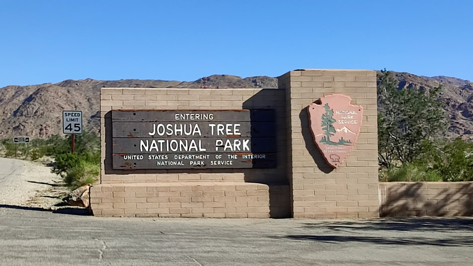
Cottonwood Springs – Southern Gateway to Joshua Tree N.P.
Cottonwood Springs sits at the southern edge of Joshua Tree National Park, southern California, reached via Cottonwood Springs Road from the Interstate 10 turnoff. This section of the National Park was visited during the road trip on the way back to Los Angeles and sadly time didn’t allow for exploring the rest of the park; Joshua trees themselves were seen elsewhere on the trip in Arizona at Joshua Tree Forest near the Grand Canyon – this species of plant, Yucca brevifolia, is native to the Mojave Desert, which extends into parts of western Arizona.
Despite there being a US government shutdown at the time of the visit, the park and more specifically the Cottonwood Visitors Center were open. This visitors centre is a useful stop for those entering the park from the southern side, offering maps, park information, and exhibits on desert ecology. There are also a small bookstore and restrooms here, making it extra convenient for anyone heading northwards into the park.
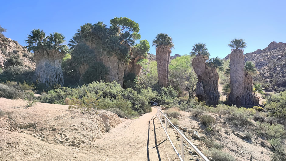
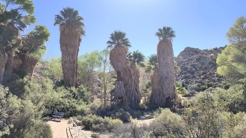
As mentioned above, time was limited, and so it was decided to visit the nearby Cottonwood Spring and this (relatively) small detour from our main journey was certainly worthwhile. A short drive from the Cottonwood Visitor Center down a sideroad leads to a parking area and from here, a short trail leads down to Cottonwood Spring itself. The oasis here is shaded by cottonwood trees, with fan palms and mesquite adding to the greenery. This natural water source has long been important in the desert landscape, and the cluster of trees makes it a distinctive contrast to the surrounding arid terrain.
Joshua Tree National Park certainly warrants another visit, with more time set aside to explore its wider landscapes. However, as the reader will find out in the continuing webpages, this road trip included exploring many other national parks and scenic landscapes in America’s Southwest, including most in much more detail.
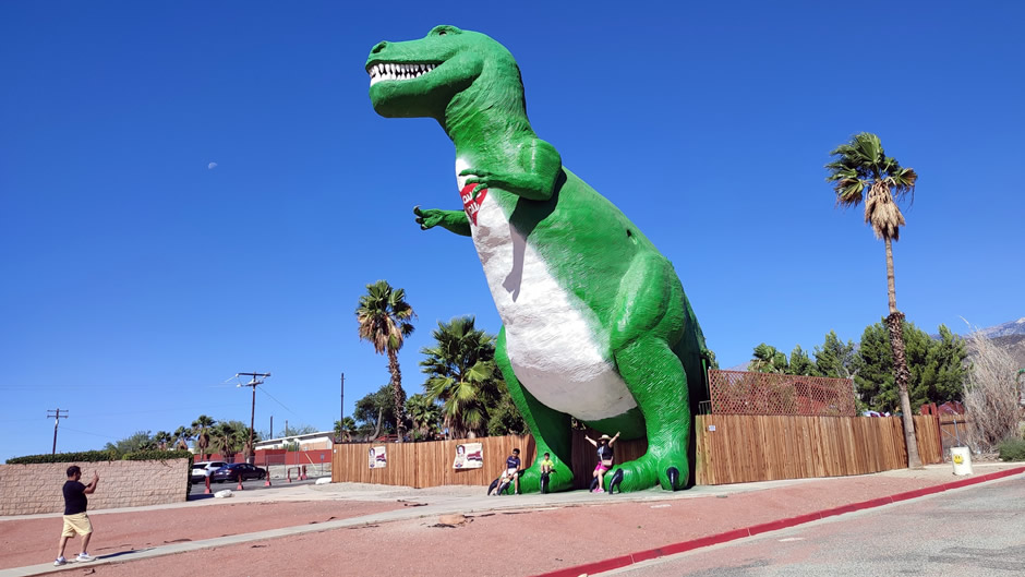
Cabazon Dinosaurs
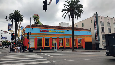
The Cabazon Dinosaurs are a roadside attraction in Cabazon, California, located just west of Palm Springs along Interstate 10. Built by sculptor Claude K. Bell, Dinny the Apatosaurus was completed in 1975 and Mr. Rex the Tyrannosaurus followed in 1986, both made of steel and concrete.
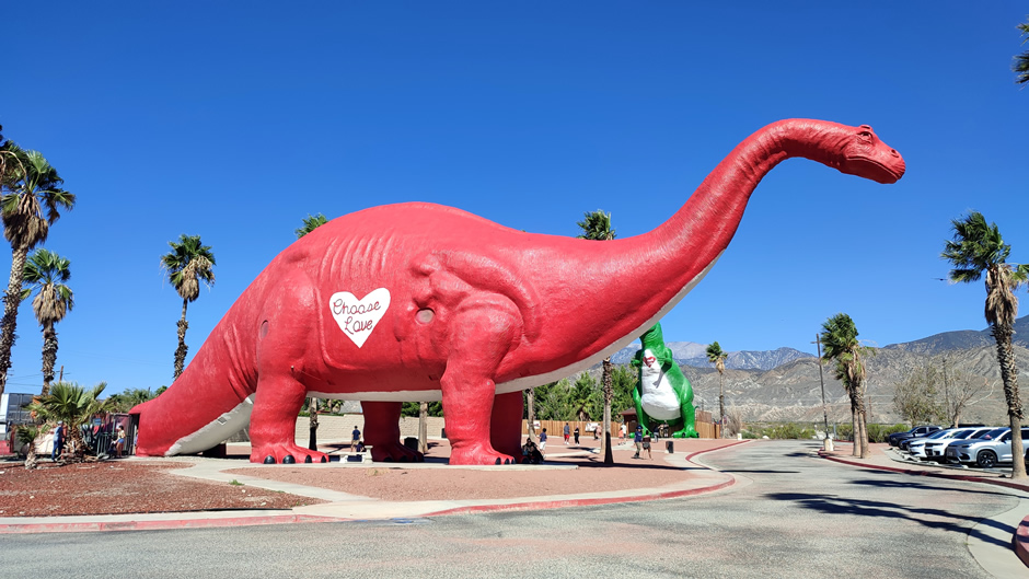
Originally intended to draw visitors to Bell’s nearby restaurant, the dinosaurs became landmarks visible from the freeway. Over time, they gained pop culture fame, appearing in films such as Pee-Wee’s Big Adventure and The Wizard, as well as in music videos and commercials. Today, the site includes a small museum and gift shop inside Dinny, while Mr. Rex remains a popular photo spot, making the attraction both a nostalgic piece of roadside Americana and a continuing tourist stop.
Link to Next Page (Page 2 of 11)
Back to Top