Southwestern USA 2025 (Page 9 of 11)
Quick links to other Southwestern USA 2025 pages and/or sections Here
Loving County and EL Paso
Heading out of southeast New Mexico, the road trip continued into the very western most part of Texas.
With this road trip starting and ending in the most populous county in the United States (Los Angeles County, population about 9.8 million at the time of the visit), natural curiosity led to making what would turn out to become a very memorable visit to the least populous county in the United States (Loving County, Texas, permanent population about 64 people, depending on source of data).
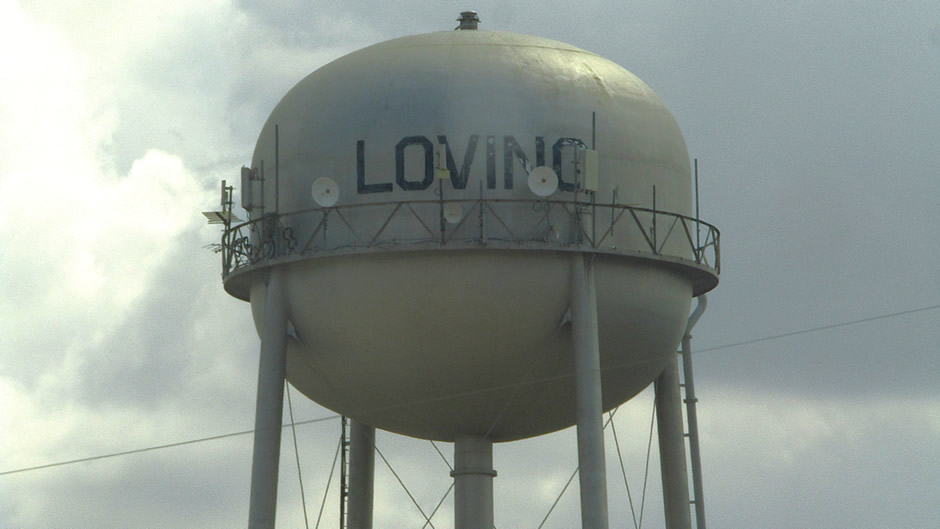
Although Loving County is the least populated county in the United States, it sits at the heart of one of the busiest oil and gas regions in West Texas. Located in the Permian Basin near the New Mexico border, the county covers about 680 square miles of desert terrain, with flat scrubland, mesquite, and wide horizons broken only by pump jacks and dusty roads. The landscape is stark and open, a reminder of how isolated this corner of Texas remains despite the industrial activity that now defines it.
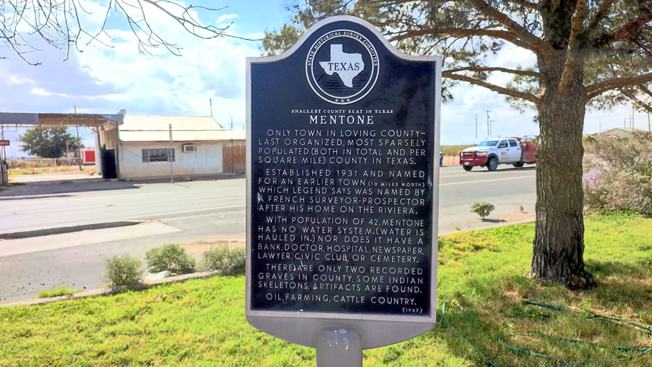
The county was established in 1887 and named after Oliver Loving, a cattle rancher whose partnership with Charles Goodnight helped open the cattle trails of Texas. Loving County’s early attempts at settlement faltered, and by the 1930s oil prospecting briefly brought growth before fading again. For decades, Mentone, the county seat, has been the only permanently inhabited town, with fewer than 100 residents recorded in recent censuses. However, despite its small population, the county has become one of the top oil and gas producers in Texas, ranking among the top five counties statewide for production, meaning there is plenty of activity here with workers coming and going.
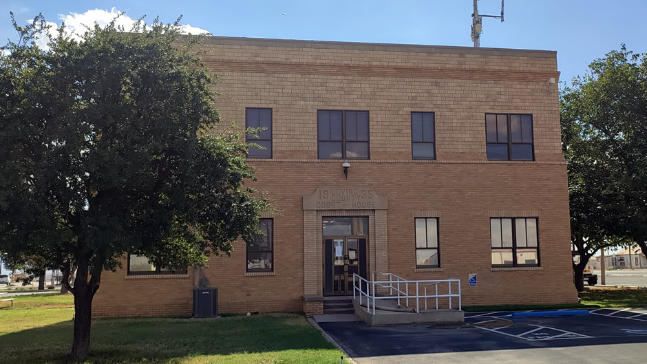
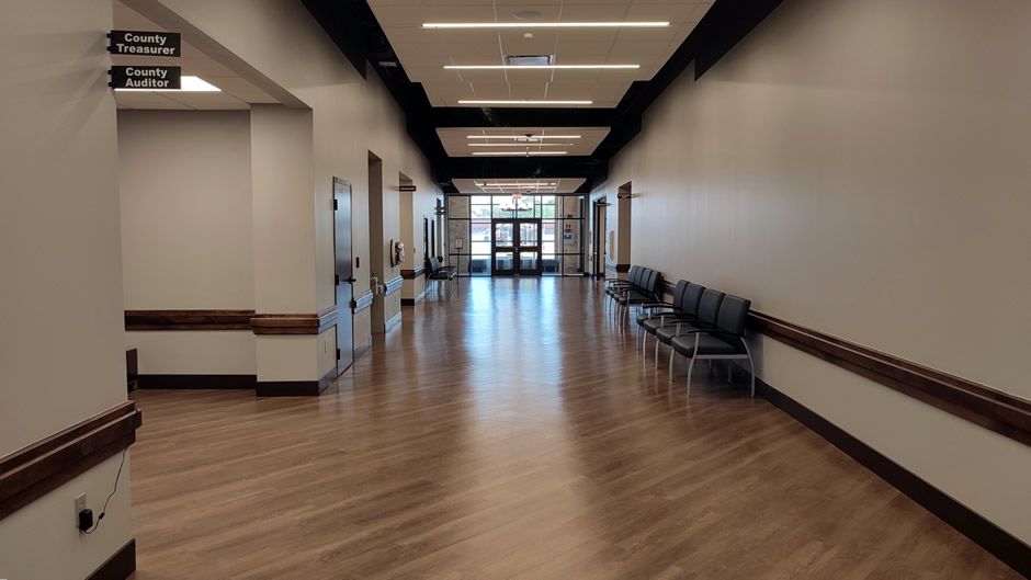
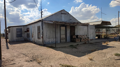
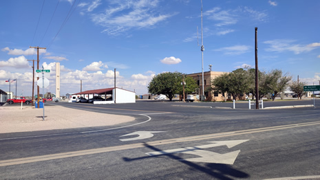
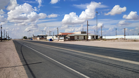
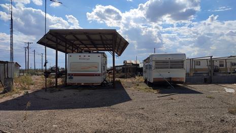
On our visit, we headed straight for Mentone and parked at the Loving County Courthouse, shown above, the only two-story building in town and a registered historic site. We expected a quiet community but instead found the area dominated by oilfield traffic. Trucks rumbled through town, and the presence of temporary workers was clear. Many live in RVs, trailers, or modular housing set up near drilling sites, reflecting the transient nature of the workforce. The industry here is not limited to conventional drilling – hydraulic fracturing is a major part of operations, contributing to the county’s surge in production.
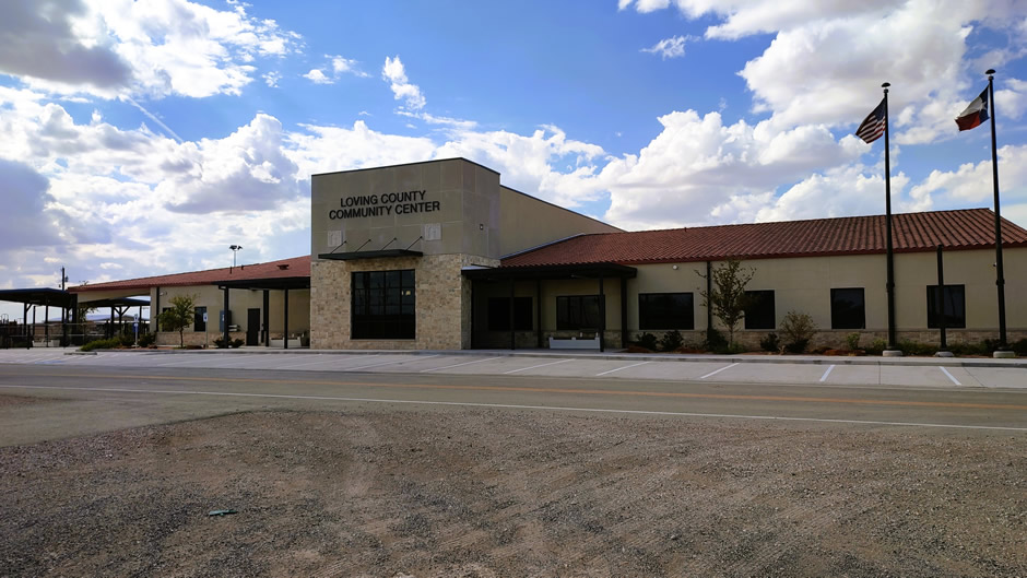
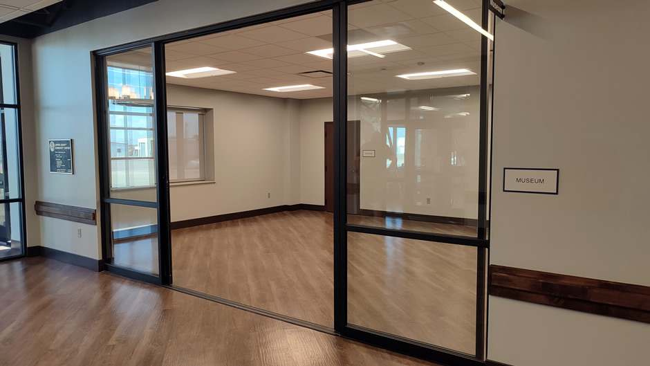
Above: Loving County Community Center, a very smart looking focal point for the community. However, the museum inside appears to be a work-in-progress.
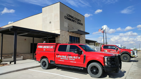
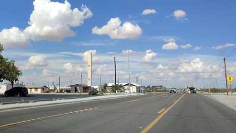
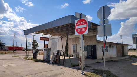
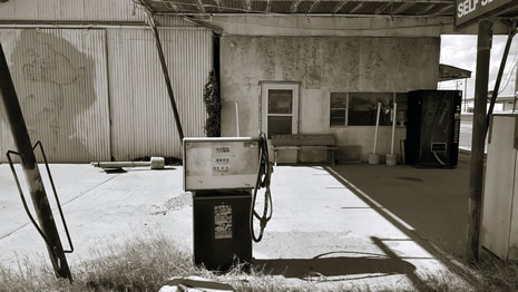
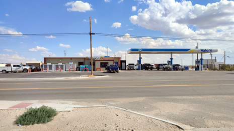
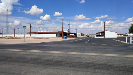
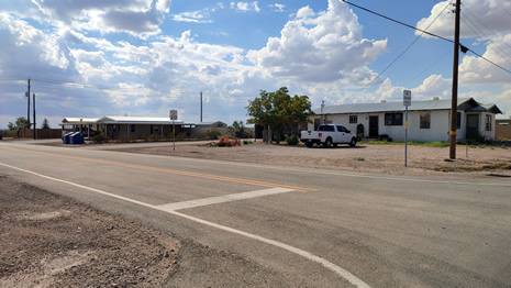
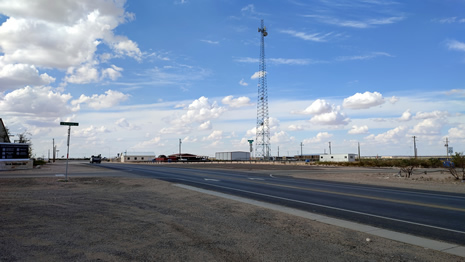
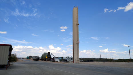
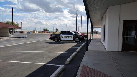
Walking through Mentone, we stopped at the Loving County Community Center. Inside, staff from the fire department were preparing for a volunteer meeting. They welcomed us warmly and invited us to their fire station, where we chatted in the canteen about their long shifts – often 24 hours on duty, followed by 48 hours off, a schedule common in rural Texas fire departments. Conversation drifted to broader topics about life in the U.S. and the U.K., and their hospitality stood out in a place otherwise defined by transience. After posing for photos by a fire truck, we continued exploring Mentone. 14 further photos of Mentone follow, with the objective of helping the reader at the very least get a small feel for the place, although bear in mind that the heavier traffic on the main road isn’t apparent from them:
 |
 |
|
 |
 |
|
 |
 |
|
 |
 |
|
 |
 |
|
 |
 |
|
 |
 |
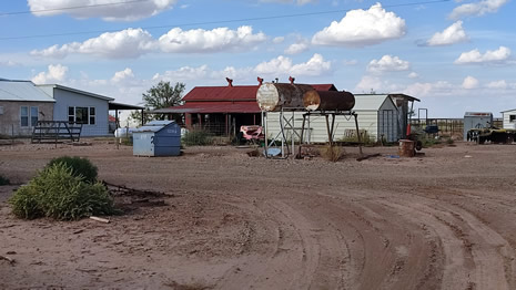
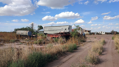
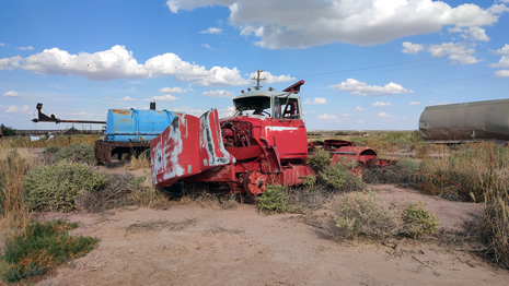
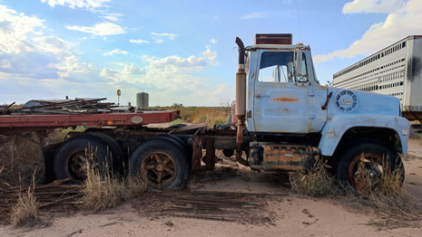
Explorers often note that Loving County is dotted with abandoned homes, many dating back to the oil booms of the 1920s and 1930s. Online searches suggest three ghost towns (Hay Flat, Porterville, and Woody) although they are not marked on modern maps. In hindsight, they can still be located using geographic coordinates, but on this visit our own satellite map search led us to a location just south of Mentone, where we found what looked like an abandoned settlement. There were several derelict properties along the way, although we didn’t stop long at our target site as there appeared to be possible activity of some sort going on nearby. Some parcels in this area have been used for different projects, including RV encampments tied to attempted land takeovers. We took a few photos before moving on:
 |
 |
|
 |
 |
We left Loving County with lasting impressions. The hospitality we experienced from the fire department contrasted sharply with the county’s reputation as nearly abandoned. It is a place where history and modern industry collide – old businesses and decaying homes sit beside drilling rigs and temporary housing. The question remains how Loving County will look once the oil and gas companies move on, and whether its population will again dwindle to near extinction or find new ways to sustain itself.
El Paso, Texas is a vibrant border city framed
by the Franklin Mountains and the Rio Grande. Alongside its sister city
on the other side of the river, Ciudad Juárez in the Mexican State of
Chihuahua, it forms part of a single cross-border metropolitan area, the
El Paso–Juárez metropolitan region (also called the Borderplex or Paso
del Norte). While each city belongs to a different nation, they function
together as a shared urban space, with daily cross-border movement for
work, education, and family ties.
The city is a true cultural crossroads where Mexican and American
traditions meet. From vibrant murals and historic missions to authentic
cuisine and desert trails, the city offers travellers a unique mix of
history, art, and adventure. El Paso serves as a hub for trade,
education, and regional culture and also hosts Fort Bliss, one of the
largest military complexes in the country.
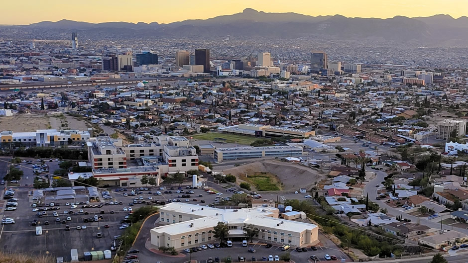
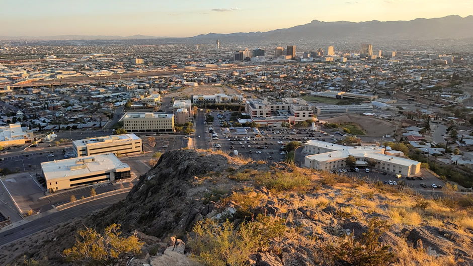
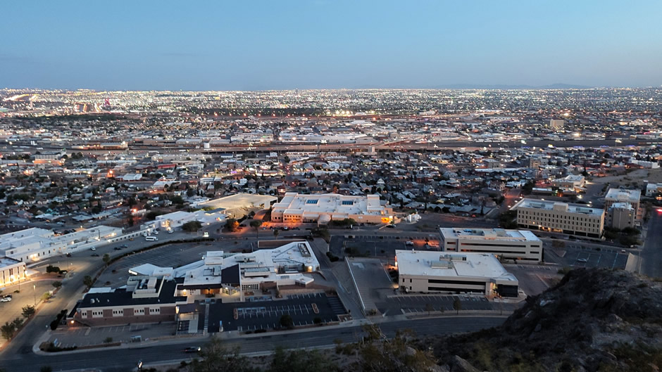
Above: El Paso, as seen from Murchison Rogers Park on The Scenic Drive (more on this further down this webpage)
During the road trip, some time was spent looking around El Paso. A visit was also made over the border (on foot and during the daytime) to take a quick look around Ciudad Juárez and this is detailed on the next webpage – this webpage covers just the El Paso part of the trip.
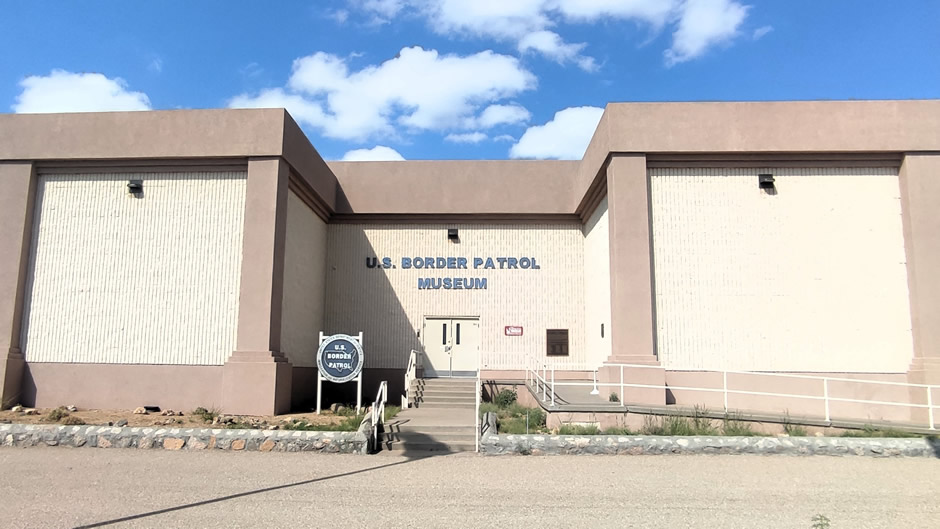
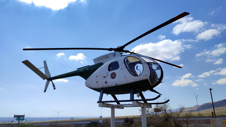
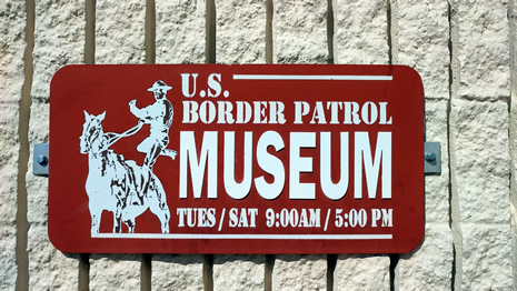
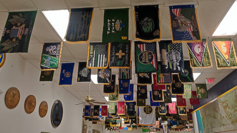
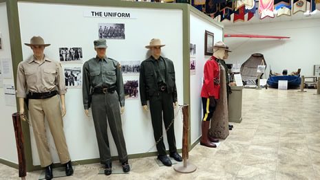
National Border Patrol Museum
After spending the night in a local motel, our first stop in El Paso was at The National Border Patrol Museum. This is the only museum in the United States devoted entirely to the history of the U.S. Border Patrol. Established in 1980, it operates as a nonprofit and is run by the Border Patrol Museum and Memorial Library Foundation.
 |
||
 |
 |
|
 |
 |
|
 |
 |
|
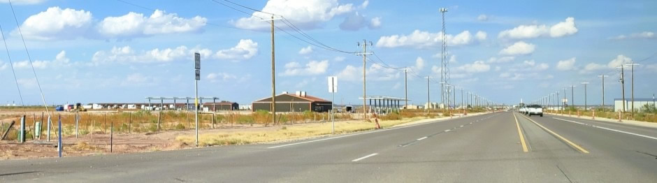
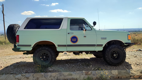
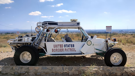
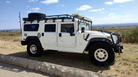
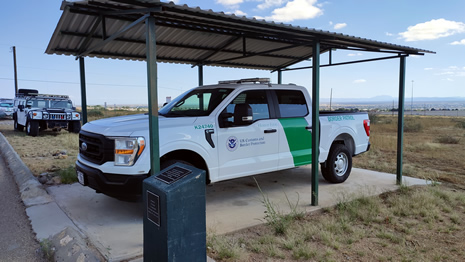
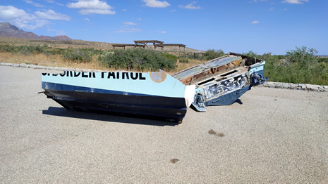
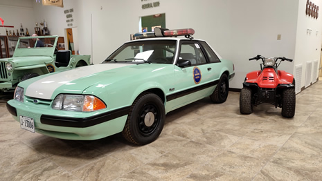
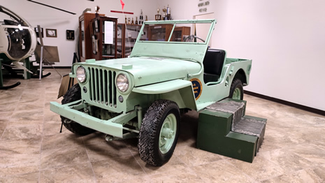
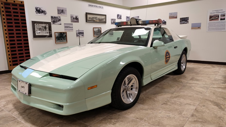
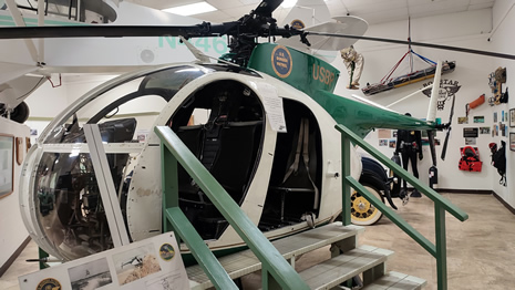
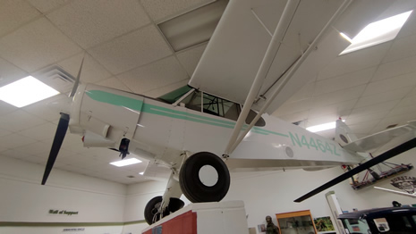
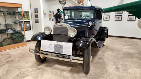
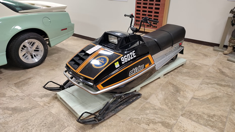
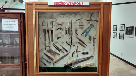
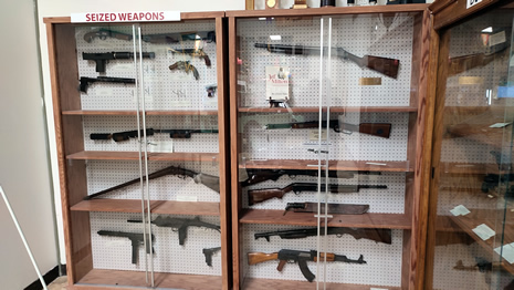
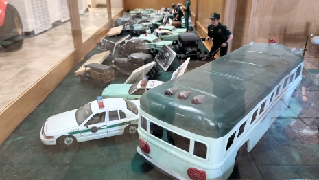
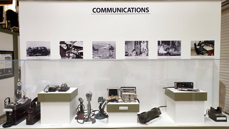
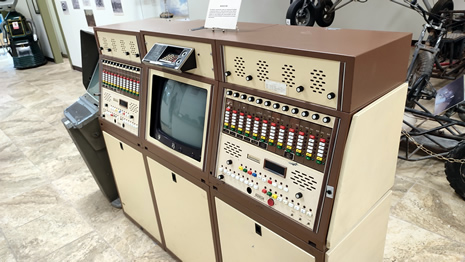
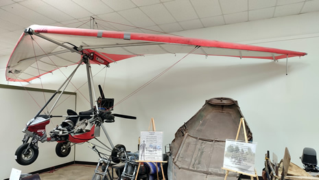
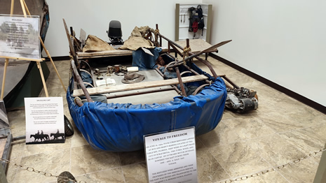
Located on Woodrow Bean Transmountain Drive, the museum presents a chronological view of the agency’s development, from its early work in the Old West and Prohibition era through World War II and into modern operations. Exhibits include documents, photographs, and equipment, along with vehicles such as jeeps, boats, snowmobiles, and helicopters that were used in patrol work.
 |
 |
|
 |
 |
|
 |
 |
|
 |
 |
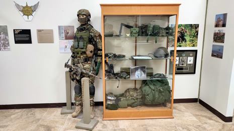
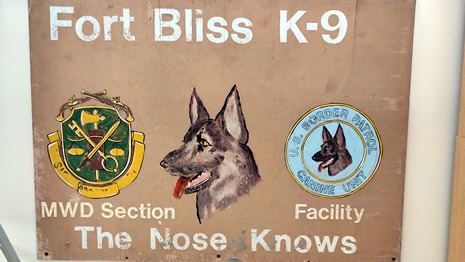
The museum highlights the role of agents in different historical contexts, offering visitors a clear overview of how border enforcement has evolved over time. Admission is free with the museum accepting donations to support its mission of showcasing U.S. Border Patrol history and guided tours can be arranged in advance. It is suggested to spend about two hours to see everything here, which is probably about what we spent here.
 |
 |
|
 |
 |
|
 |
 |
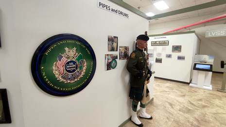
While general photography is usually allowed at the museum, visitors need to be aware that (as per the posted signs) taking photos is not allowed in the memorial sections which honour fallen agents. This is to preserve the solemnity of the space and to protect memorial visitor privacy. A few more photos taken from inside the museum follows:
 |
 |
|
 |
 |
|
 |
 |
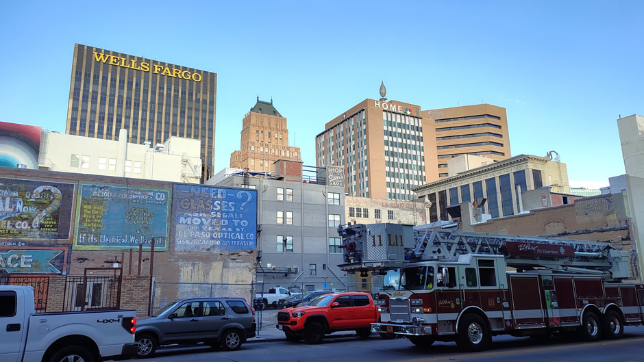
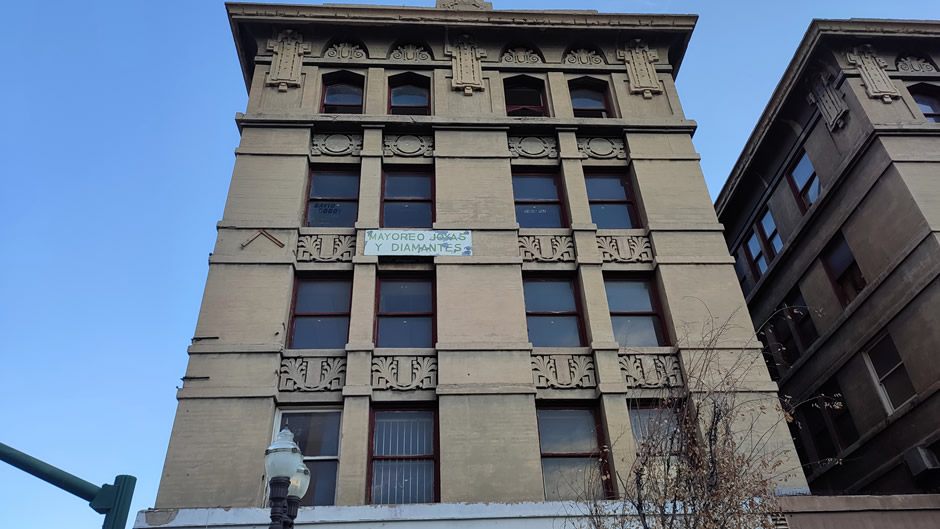
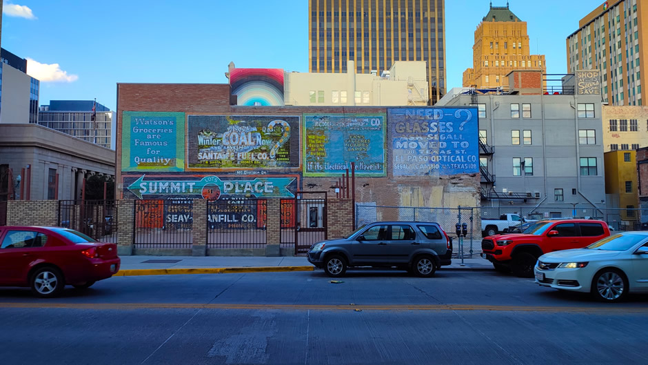
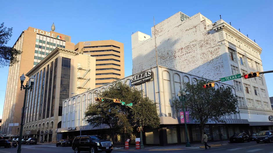
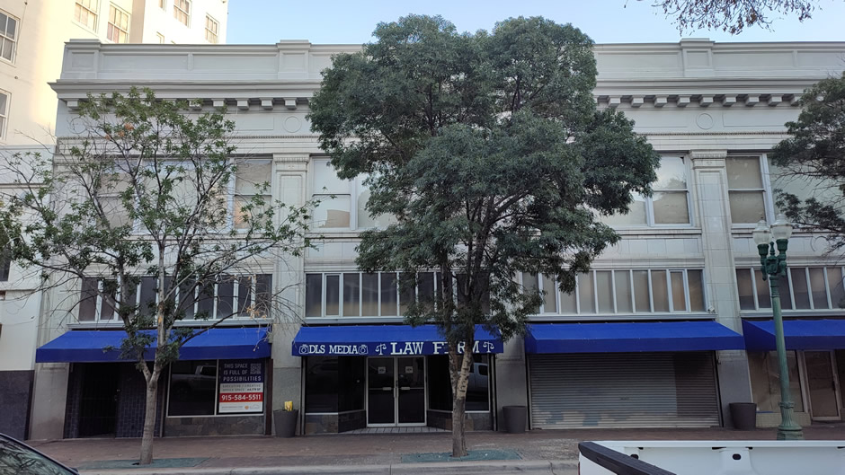
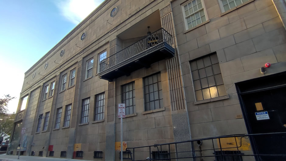
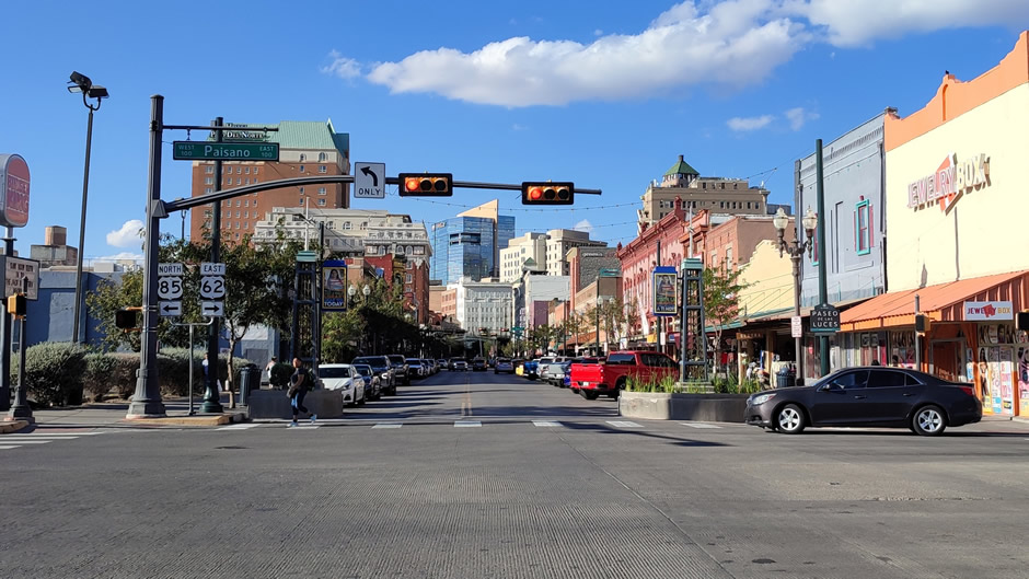
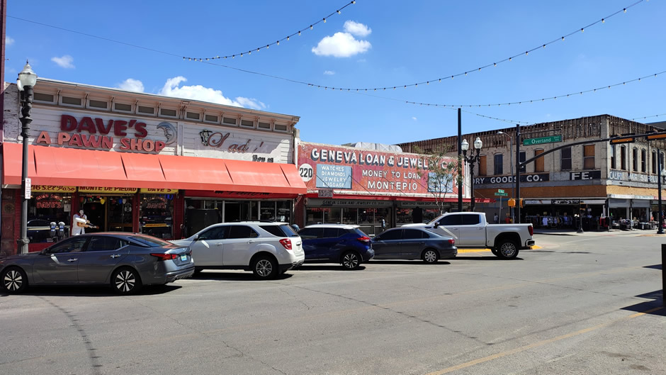
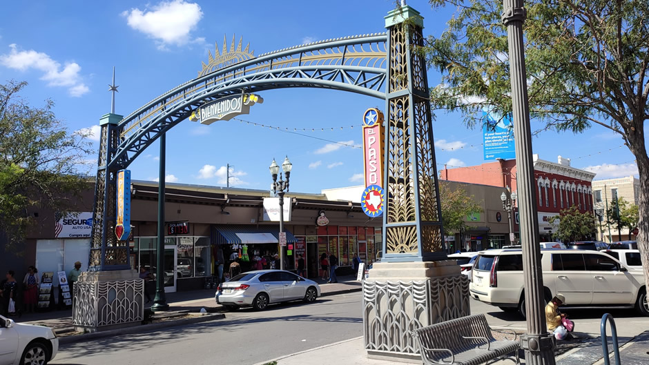
Downtown El Paso
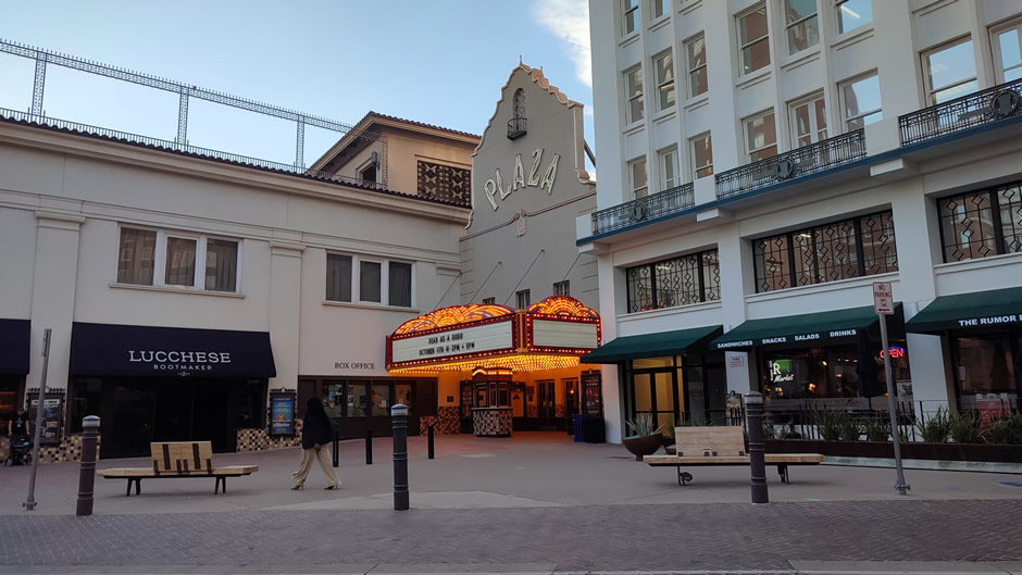
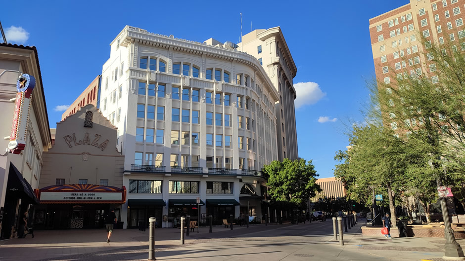
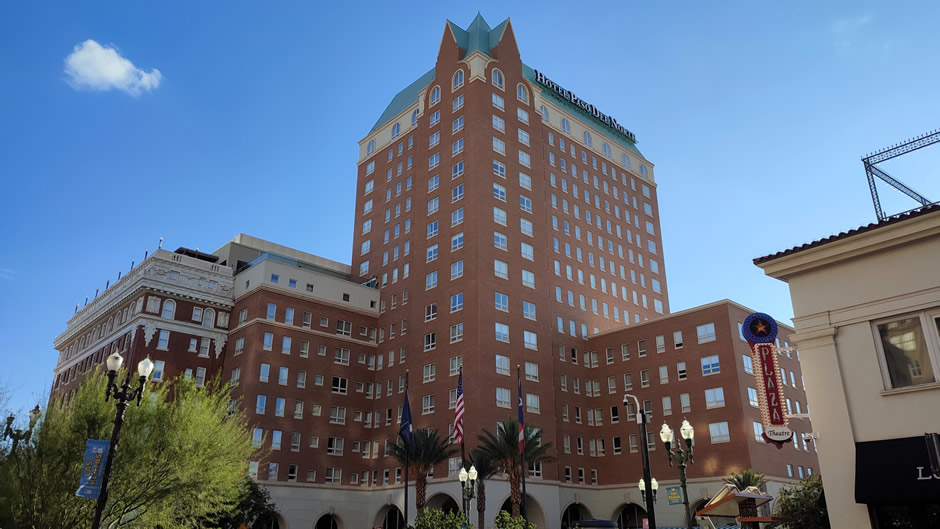
Downtown El Paso offers a compact area that reflects the city’s layered history, with architecture ranging from early 20th-century theatres and civic buildings to modern office blocks. Parking was found in a large multistorey lot on South El Paso Street, which provided convenient access for exploring on foot. The walk revealed structures that speak to El Paso’s role as a border city, where Spanish colonial influences mix with Art Deco and revivalist styles, particularly visible in restored landmarks such as the Plaza Theatre.
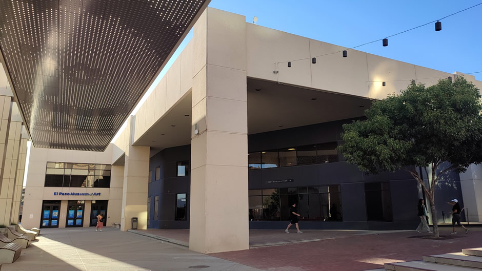
Among the main sights, the El Paso Museum of Art stands out with its regional collections, while the nearby “star ceiling” installation adds a distinctive feature to the downtown experience:
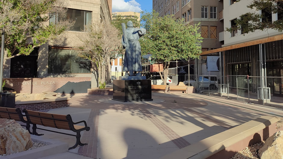
Pioneer Plaza and San Jacinto Plaza are two of downtown El Paso’s most historically significant public spaces, each reflecting different stages in the city’s development:
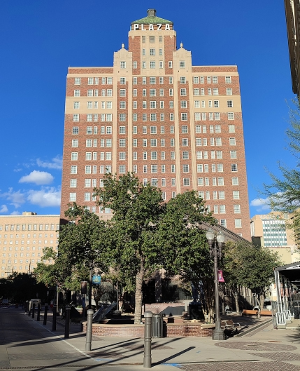
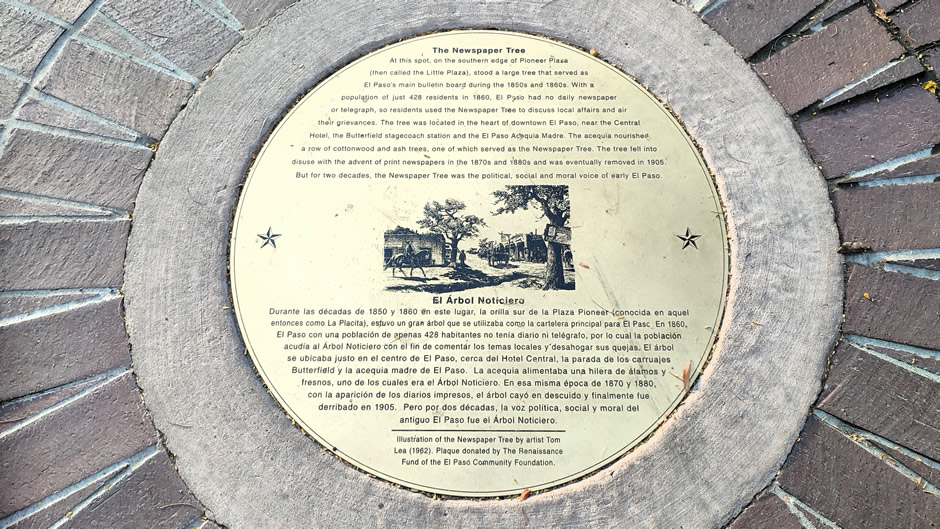
Pioneer Plaza (shown below) was one of the earliest centres of public life in El Paso, dating back to the late 19th century. It served as a hub of community activity, where military guards were once stationed to protect residents from Apache attacks, and military bands performed for the public. An irrigation ditch lined with trees gave shade to the plaza, and a famous “Newspaper Tree” was used to post public notices. Major routes passed through here, including El Paso Street leading south to Mexico and San Francisco Street connecting westward toward California, with the Butterfield Overland Stage route crossing nearby. Over time, Pioneer Plaza became closely associated with the Plaza Hotel Pioneer Park, originally the Sheldon Hotel, which played a role in the Mexican Revolution and hosted figures such as U.S. President William Howard Taft.
 |
||
 |
 |
|
 |
||
 |
||
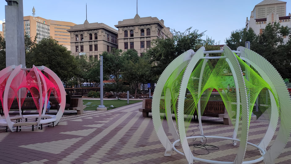
San Jacinto Plaza (shown below), located at Oregon and Mills Avenue, became the city’s main square after 1881 when land was acquired for a town plaza. Named in 1903 after the Battle of San Jacinto, it quickly became a focal point for gatherings and recreation. The plaza was famous for its live alligators, introduced in the 1880s and kept until 1974, later commemorated by Luis Jiménez’s fiberglass sculpture “Los Lagartos”. Historically, the plaza hosted U.S. Army drills and was a place where travellers and residents alike congregated. In recent years, it has been redesigned with walking paths, bridges, gaming areas, and a café, making it a modern urban park while preserving its cultural heritage. Surrounded by historic buildings such as the Mills Building and White House Department Store, San Jacinto Plaza remains a lively centrepiece of downtown El Paso, blending history with contemporary public use.
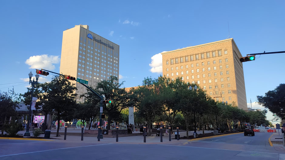
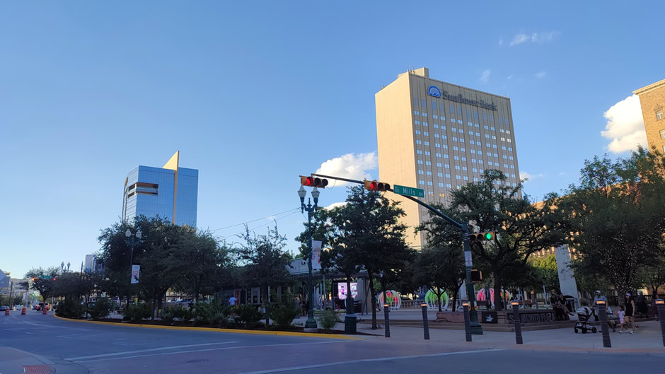
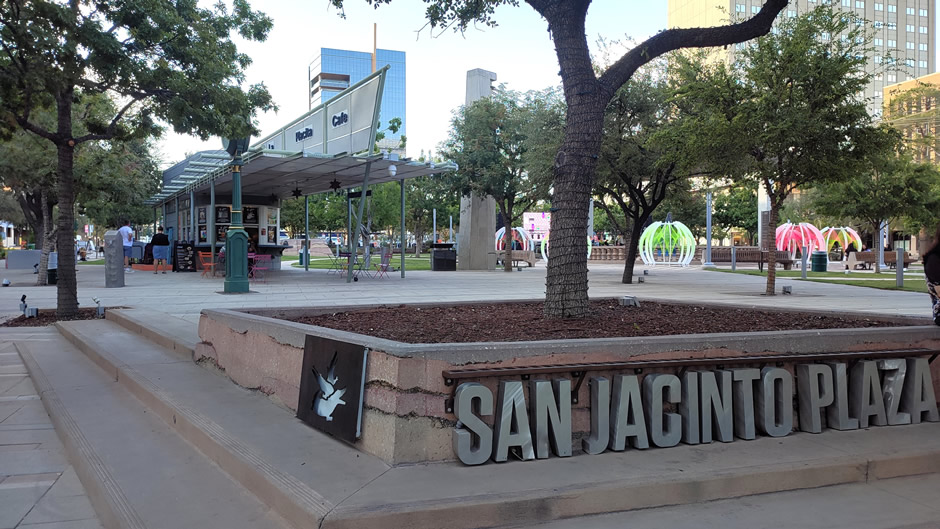
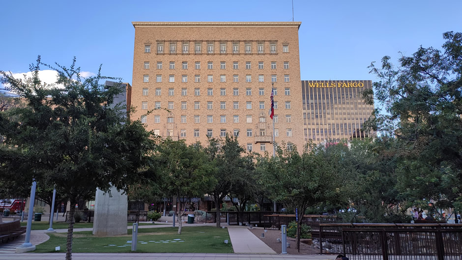
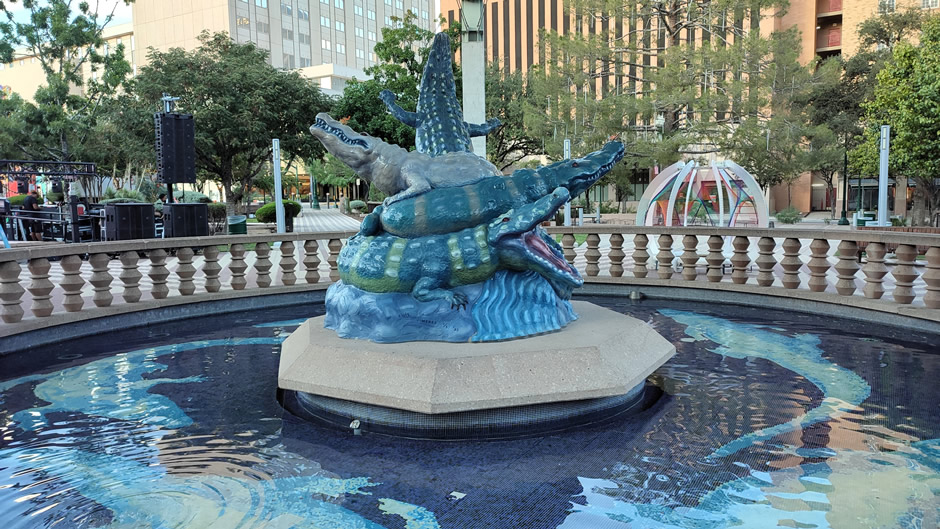
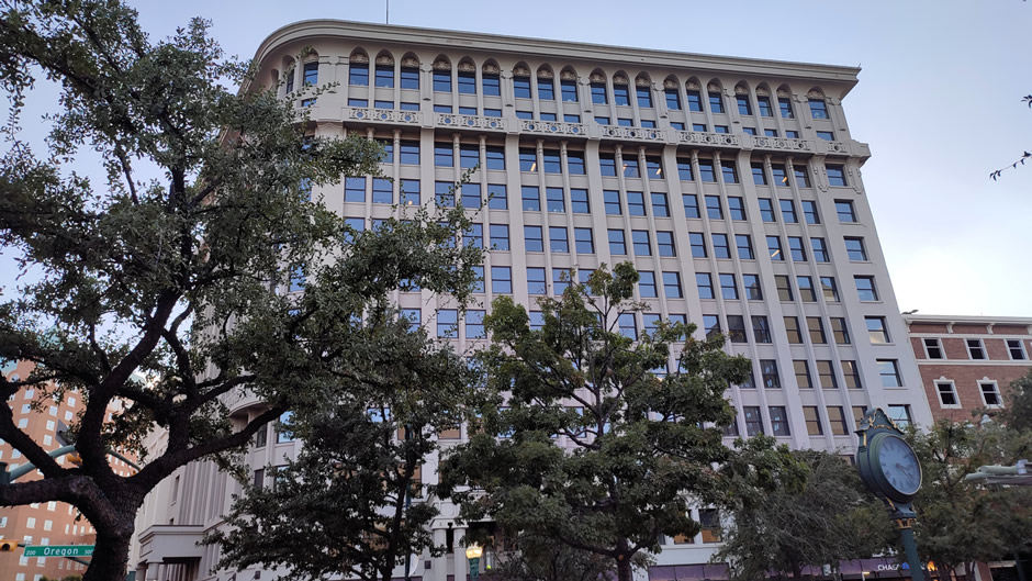
Above: San Jacinto Plaza in El Paso, including Luis Jiménez’s fiberglass sculpture “Los Lagartos”. The bottom photo shows the Mills Building, originally constructed in 1910 and beautifully restored in 2010, bringing it back to its original splendour.
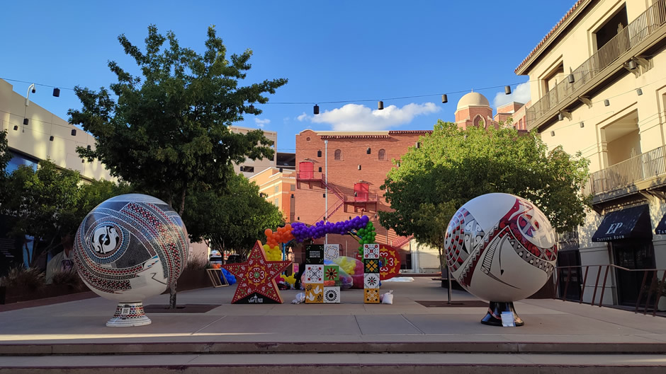
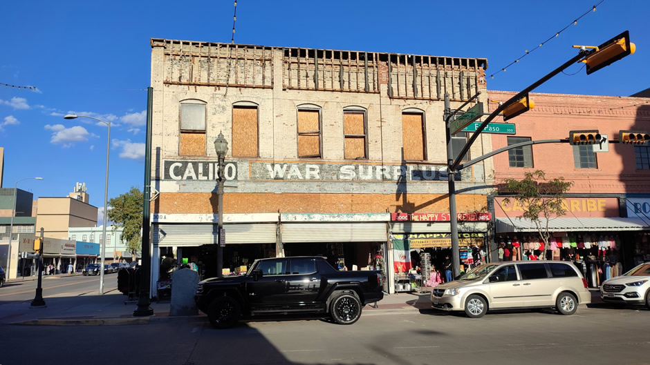
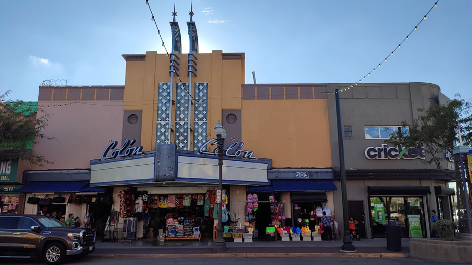
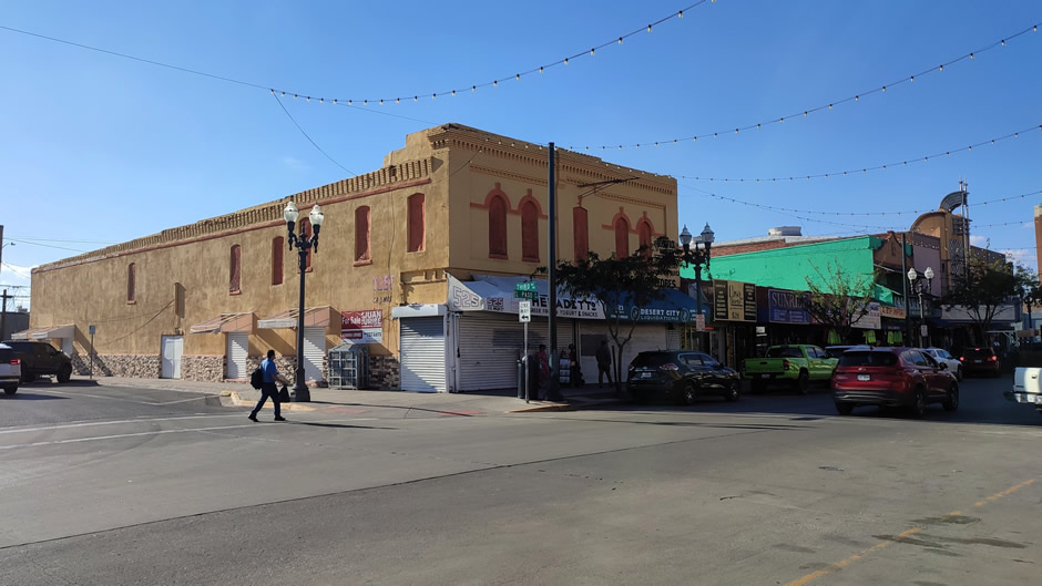
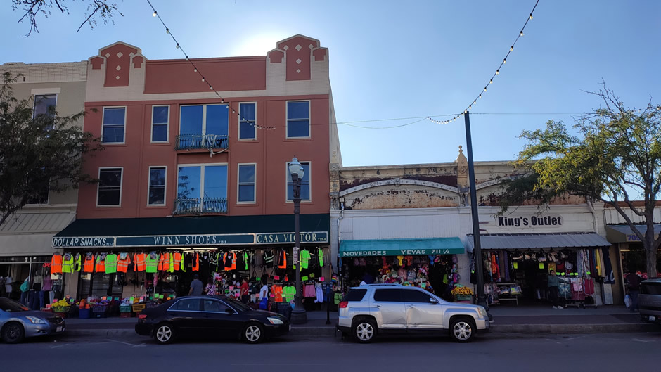
A few more photographs taken from the downtown area of El Paso follow, showing some more of the various styles of architecture found here:
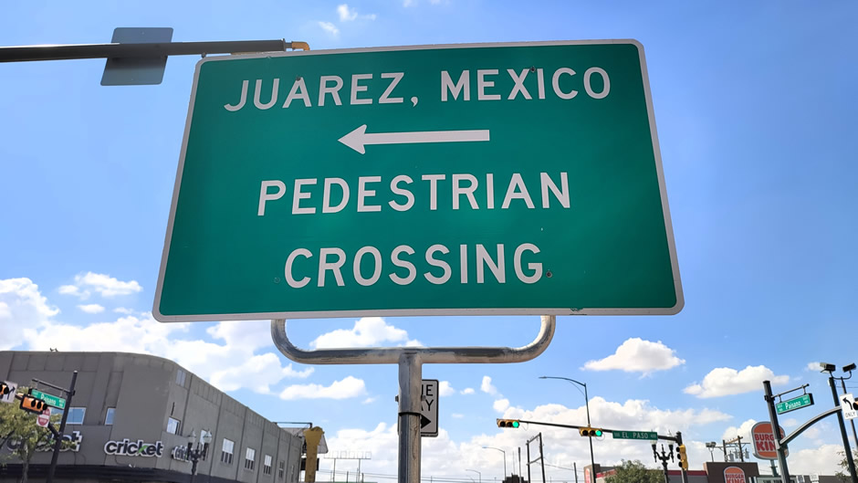
Walking south along South El Paso Street leads directly to the Paso del Norte International Bridge, a pedestrian-focused crossing over the Rio Grande. This bridge connects seamlessly to Avenida Benito Juárez in Ciudad Juárez, creating a direct link between the two downtowns. For visitors, it offers easy access to Juárez’s busy shopping areas, markets, and food stalls just steps from the U.S. side, underscoring the close relationship between the two streets as parallel arteries of cross-border life. Ciudad Juárez is discussed on the next webpage and particular attention should be made to the “Important Note” section there. Some photos of South El Paso Street follow:
Scenic Drive, EL Paso
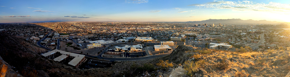
The Scenic Drive in El Paso (shown below) winds along the southern tip of the Franklin Mountains, offering panoramic views of El Paso and Ciudad Juárez. The road itself is about 2 miles long, with several overlooks. From Downtown El Paso, it can be reached by taking Stanton Street north to Rim Road, or via Mesa Street or Alabama Street. Because of its proximity, Scenic Drive is often included in short itineraries for visitors staying downtown. The visit here was made at sunset, a time when the drive is especially popular.
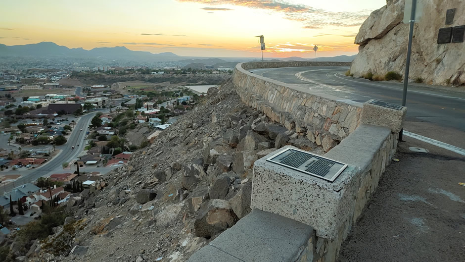
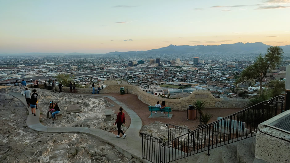
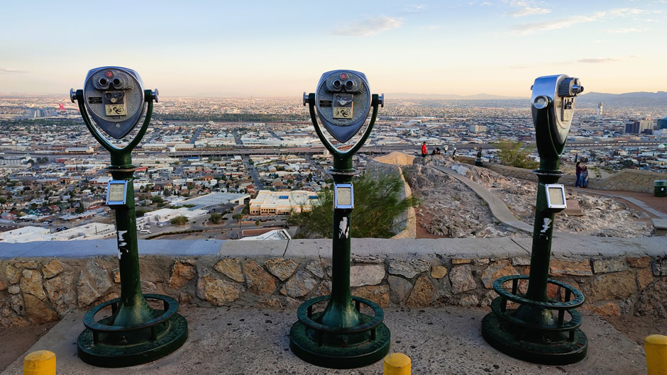
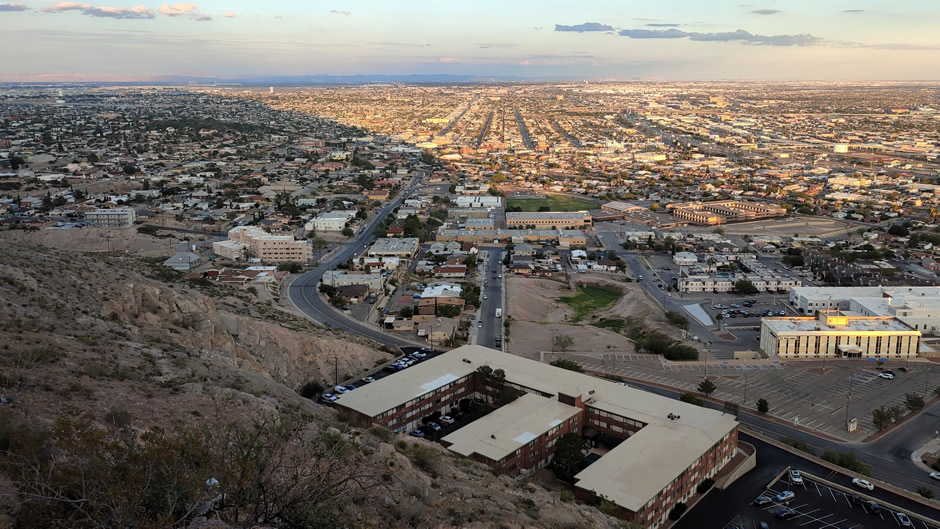
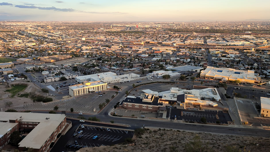
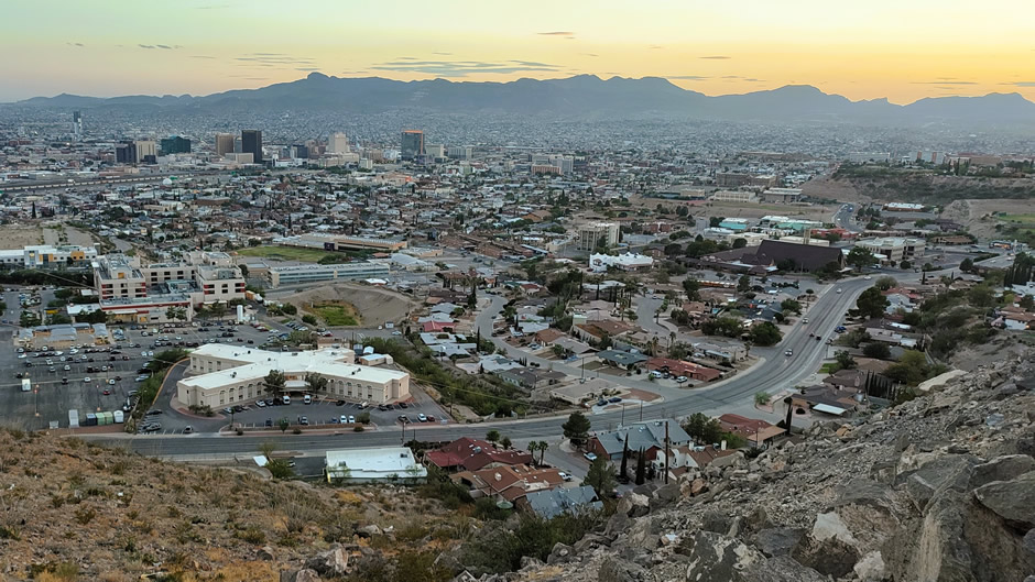
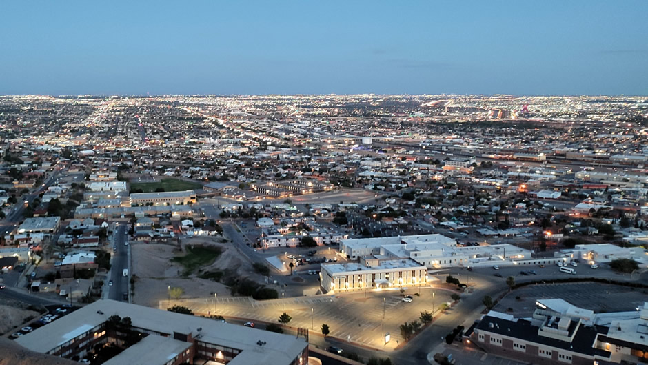
One of the main stopping points on the scenic drive is Murchison Rogers Park, a smallish overlook area that provides a clear vantage point over the urban landscape. From here, the mountains frame the horizon while the grid of downtown streets, the Rio Grande, and the adjoining neighbourhoods of Ciudad Juárez spread out below. Visiting at sunset allows the scene to shift gradually, first in warm daylight, then in the muted tones of dusk, and finally in the glow of the city lights after dark, giving three distinct impressions of the same panorama.
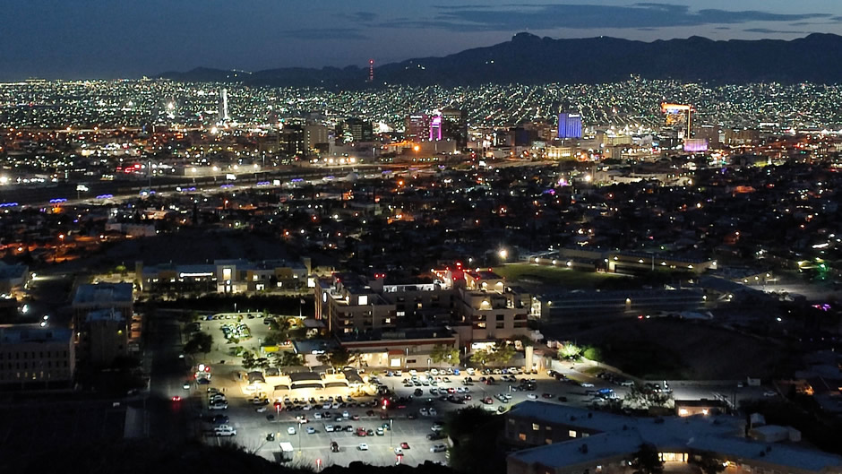
On a sidenote, not visible from Murchison Rogers Park itself, the nearby El Paso Star is another landmark tied to the mountains. Installed on the southern slope of the Franklin Mountains, this illuminated star has been a symbol of the city since the 1940s and is lit nightly, visible for miles across both El Paso and Juárez.
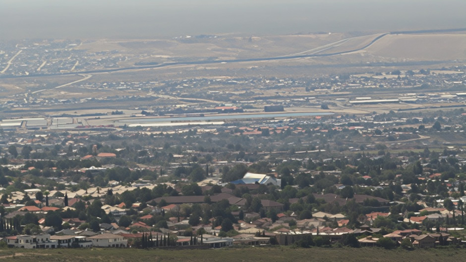
Above: Photo taken with a zoom lens with the U.S. – Mexico border wall seen clearly from a distance. The border wall is a series of physical barriers and surveillance systems built along portions of the 1,749-km border to reduce unauthorised crossings. During his terms, President Donald Trump pushed to expand the wall with new funding and construction projects, aiming to add hundreds of miles of additional barriers.
Link to Next Page (Page 10 of 11)
Link to Previous Page (Page 8 of 11)
Back to Top