Southwestern USA 2025 (Page 4 of 11)
Quick links to other Southwestern USA 2025 pages and/or sections Here
Glen Canyon Dam, Monument Valley, Natural Bridges National Monument, Arches National Park, Canyonlands National Park, Four Corners
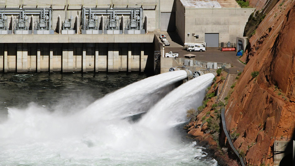
Glen Canyon Dam, completed in 1966, is a massive arch-gravity dam on the Colorado River in northern Arizona. Rising 710 feet and stretching 1,560 feet across, it created Lake Powell, one of the largest reservoirs in the United States. Built by the U.S. Bureau of Reclamation, the dam was a centrepiece of the Colorado River Storage Project, designed to provide water storage, hydroelectric power, and flood control for the region.
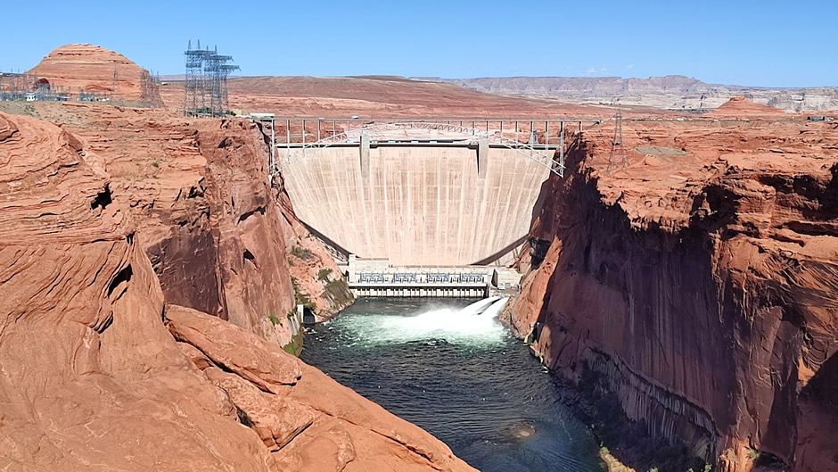
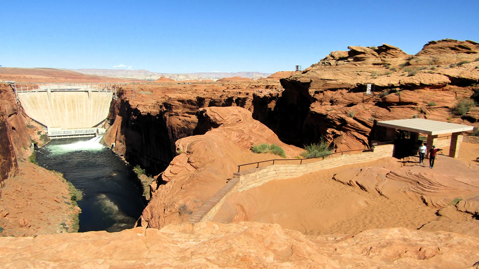
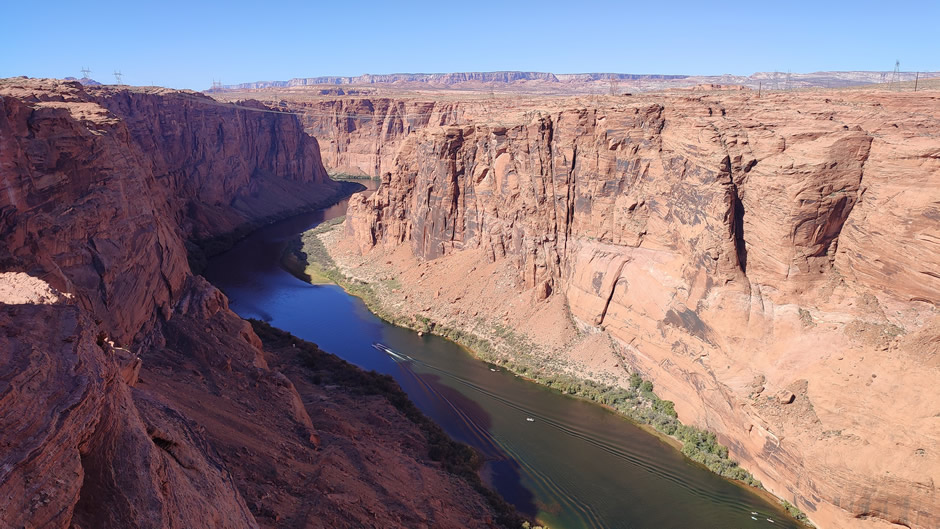
Just south of the dam on the northwestern edge of the city of Page, the Glen Canyon Dam Overlook offers a striking vantage point. A short walk along sandstone steps and railings leads to a perch nearly 1,000 feet above the Colorado River. From here, visitors can take in panoramic views of the dam and the canyon’s first bends. The overlook is less crowded than nearby Horseshoe Bend, making it a quieter spot for photography and reflection.
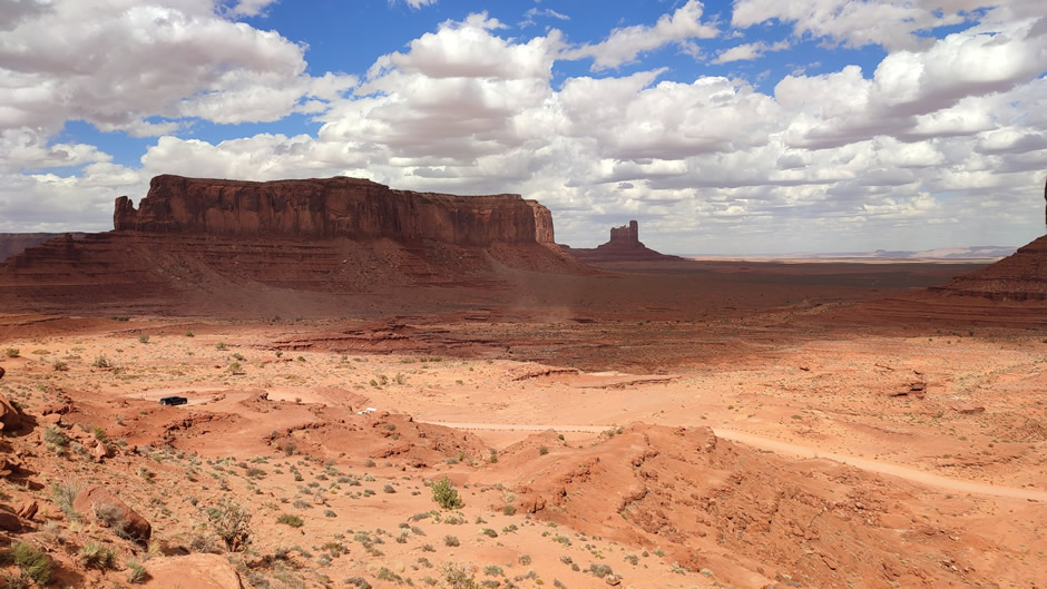
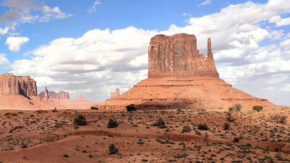
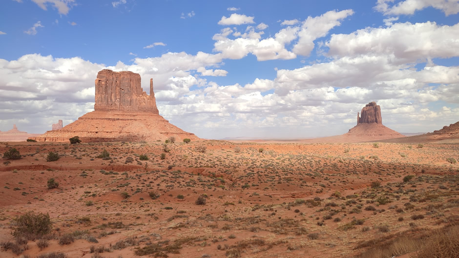
Monument Valley lies on the Arizona–Utah border within the Navajo Nation. It is known for its striking sandstone buttes and mesas rising from the desert floor. The valley is laid out as a broad, open plain punctuated by isolated rock formations, with the most recognizable buttes visible directly from the main visitor area.
The valley’s history is closely tied to the Navajo people, who call it Tsé Biiʼ Ndzisgaii, meaning “valley of the rocks”. It became widely recognised in the 1930’s when director John Ford used it as the backdrop for his western films, cementing its image as the quintessential American West. Geologically, the formations are composed of Permian-age sandstone, shaped over millions of years by erosion. The buttes rise up to 1,000 feet above the valley floor, their layered red rock reflecting the desert’s long geological history.
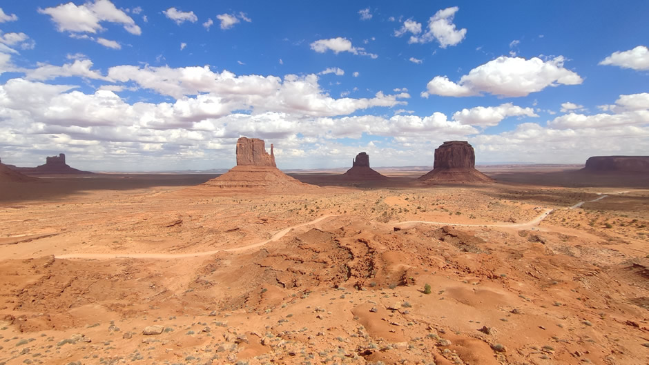
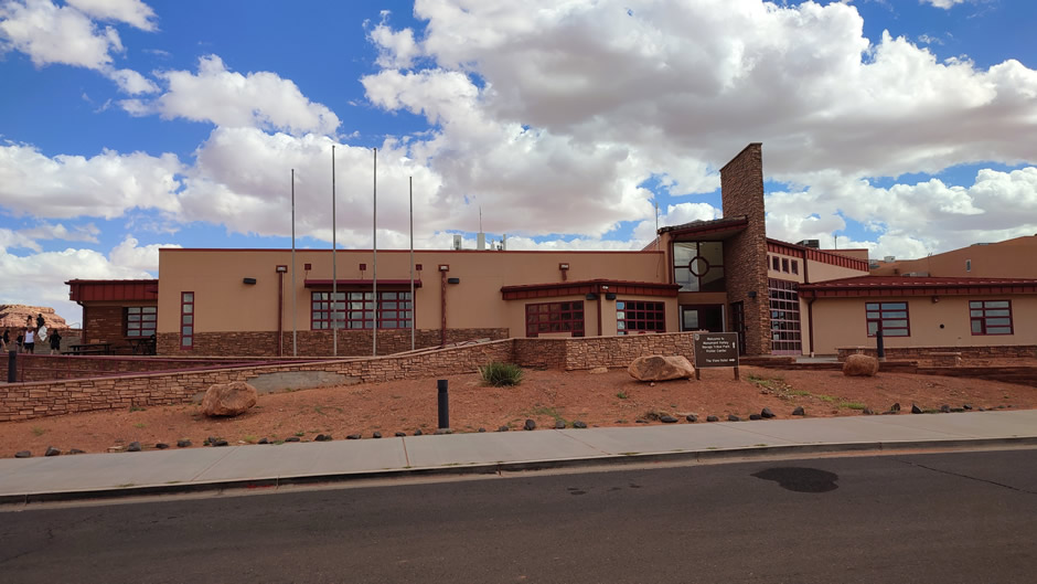
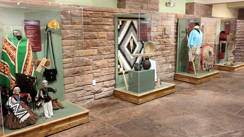
The Monument Valley Visitors Center sits at the entrance to the Navajo Tribal Park. It provides panoramic views of the valley, including the famous West Mitten, East Mitten, and Merrick Buttes, which dominate the landscape. The centre also offers cultural exhibits, a gift shop, and access to guided tours, giving visitors both practical information and insight into Navajo heritage.
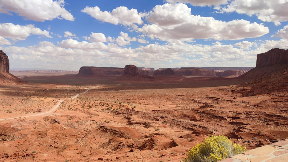
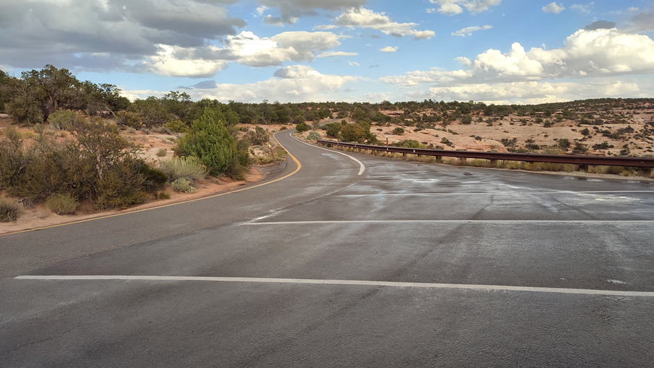
The Valley Loop Road in Monument Valley is a 17-mile unpaved track beginning near the visitor’s centre, winding past formations like the Three Sisters, Elephant Butte, and John Ford Point. Most standard vehicles can manage the drive in dry conditions, though the surface is rough and slow-going, with ruts and soft sand; after rain, high-clearance SUVs or trucks are better suited. RVs and long wheelbase vehicles are not permitted, and guided Navajo jeep tours are available for those preferring comfort and cultural context, with the added benefit of accessing areas closed to private cars. During this particular visit, time was limited and so only a short section of the Valley Loop Road was taken.
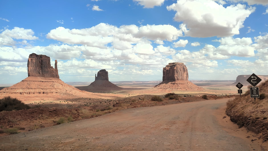
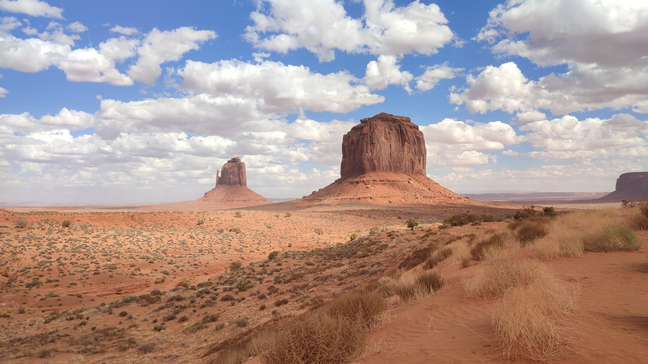
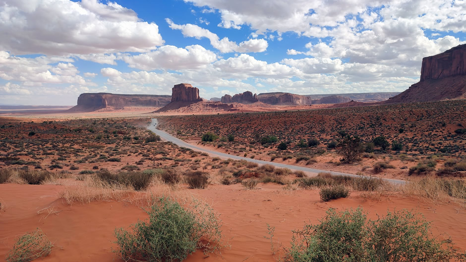
Above: Views from the first part of the Valley Loop Road. For identification purposes, the first photo shows the Mittens and Merrick Butte.
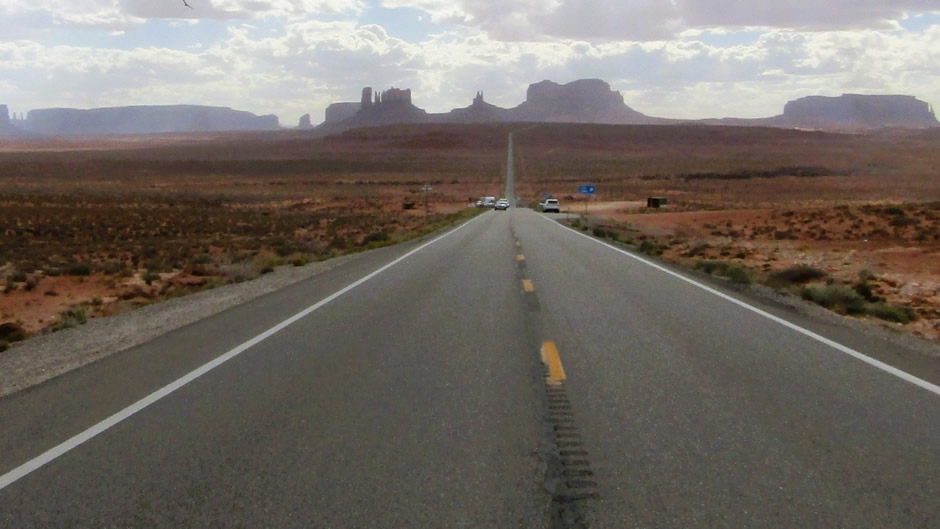
Ever since the 1930’s, Monument Valley has appeared in countless films and commercials. One of the most famous modern references is in Forrest Gump, where the character ends his cross-country run along U.S. Route 163 north of the valley. Today, visitors often try to stop at the exact spot to recreate the scene, though parking directly on the road is unsafe; instead, nearby pull-offs provide a safer way to enjoy the view:
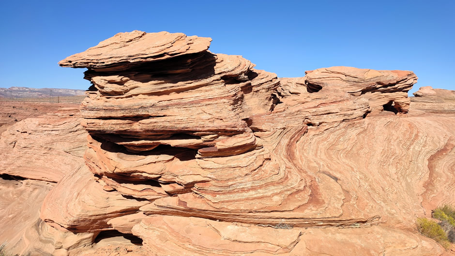
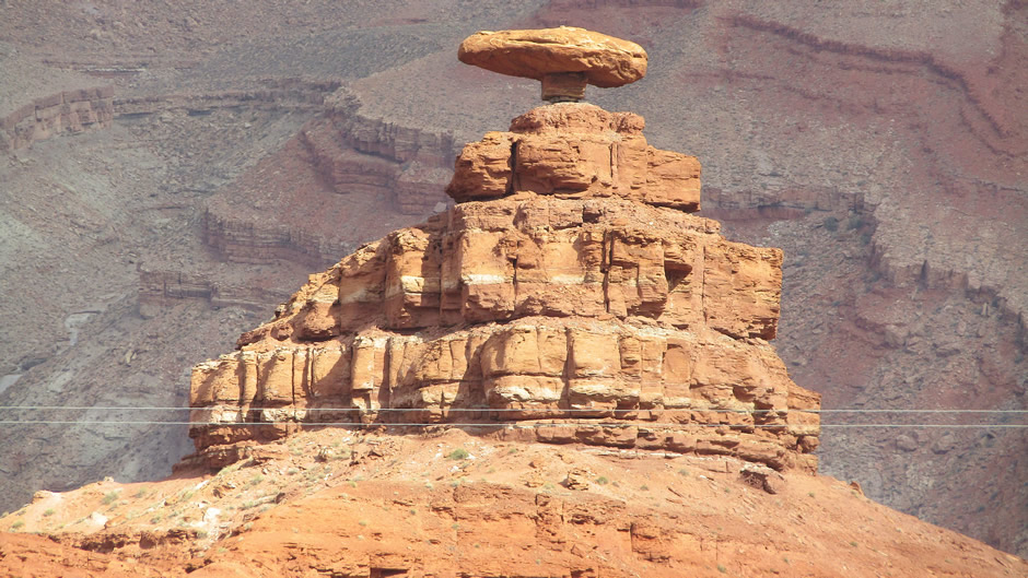
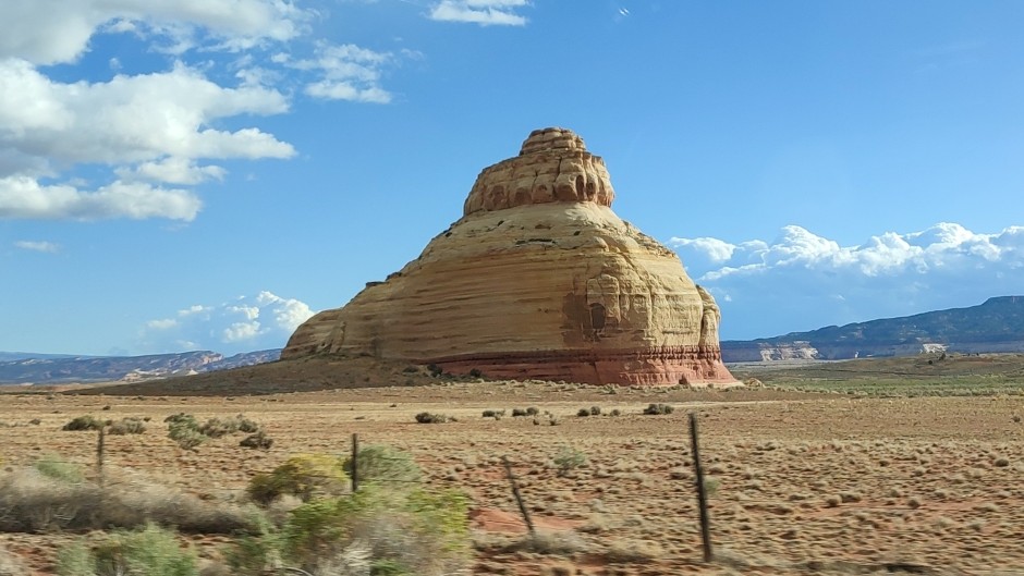
On a sidenote, on the way to the next destination, we passed Mexican Hat, a tiny desert town in southeastern Utah, named after a nearby sombrero-shaped sandstone formation that sits just northeast of the settlement. The rock formation here is a striking balanced rock – a broad Cedar Mesa sandstone “caprock” sits atop a narrow pedestal of softer shale and siltstone, creating its famous sombrero shape. The formation vividly shows geological processes at work: harder sandstone resists erosion while the underlying “Halgaito Formation” weathers away, revealing layers deposited by ancient coastal plains and shallow seas over 250 million years ago:
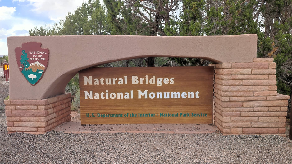
Natural Bridges National Monument
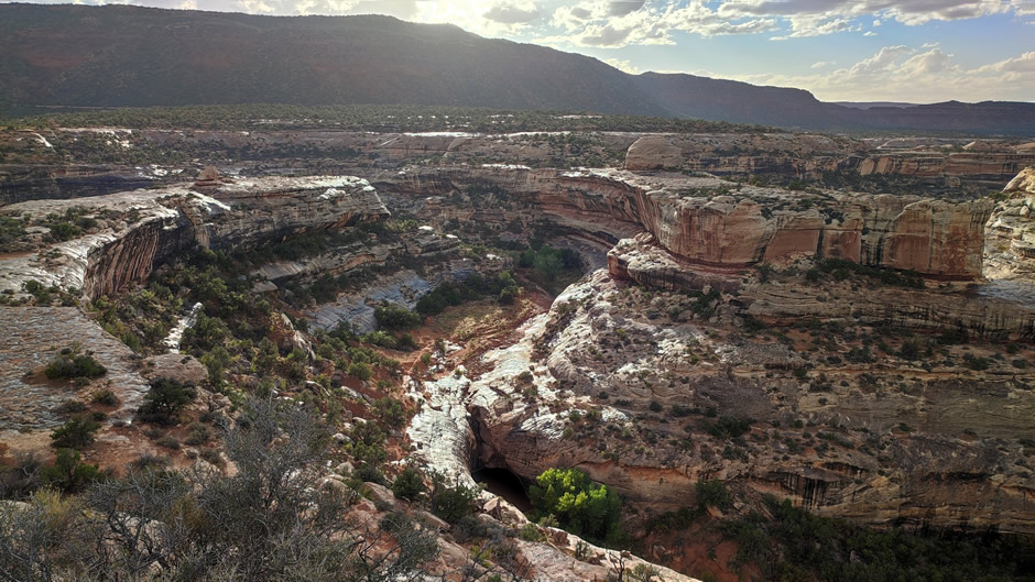
Natural Bridges National Monument in southeastern Utah preserves three remarkable natural stone bridges, each accessible along a short scenic loop drive. The site combines striking geology with cultural history, making it one of the earliest protected areas in the state. Located about 50 miles northwest of the Four Corners, the monument covers 7,636 acres at the junction of White and Armstrong Canyons. A paved loop road connects overlooks and trailheads for the three bridges, allowing visitors to view them from above or hike down into the canyons for closer perspectives.
The bridges were first documented in 1883 by prospector Cass Hite, who stumbled upon them while searching for gold. Public attention grew after a 1904 National Geographic article, and in 1908 President Theodore Roosevelt proclaimed the area a national monument – the first in Utah. The bridges were later given Hopi names: Sipapu, Kachina, and Owachomo, reflecting cultural ties to Native traditions.
Above: Scenic loop drive, Natural Bridges National Monument
Geologically, the bridges formed through erosion by water cutting through sandstone layers deposited about 260 million years ago. Streams carved meandering channels, eventually undercutting bends to leave spans of rock. Unlike arches formed by wind, these bridges are products of flowing water, making them, geologically speaking, relatively rare and short-lived features.
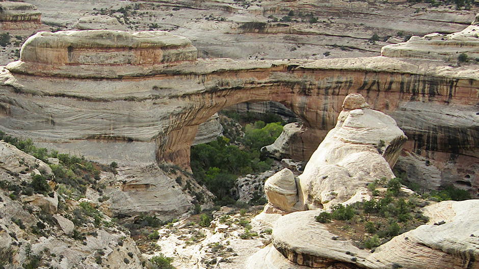
Sipapu Bridge, above, is the largest of the three, Sipapu rises 220 feet and spans 268 feet. Its name means “place of emergence” in Hopi tradition, symbolising the entryway by which ancestors came into this world. Trails descend steeply to its base, offering dramatic views of its massive scale.
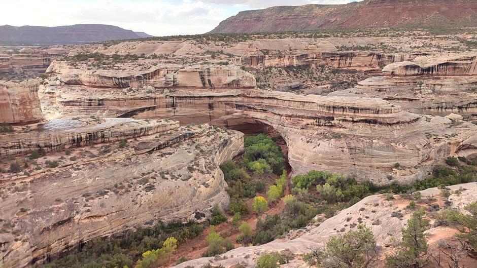
Kachina Bridge, above, is notable for its thickness and bulk, measuring 204 feet high and 192 feet across. It was named for nearby rock art resembling kachina symbols. Kachina continues to widen as floods and debris enlarge its opening, making it a dynamic example of ongoing erosion.
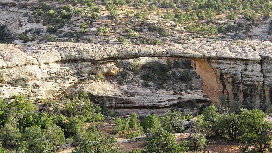
Owachomo Bridge, above, is the most delicate and slender of the three natural bridges here. Owachomo stands 106 feet high with a 180-foot span. Its name means “rock mound,” referring to a nearby feature. Because the stream that carved it has largely dried, Owachomo is considered geologically stable compared to the other two.
Together, the three bridges at Natural Bridges National Monument illustrate the interplay of water, rock, and time, while also preserving cultural connections to Native peoples and early explorers.
On another side note, before reaching our next destination in southeastern Utah (and an overnight stop), we passed an interesting isolated sandstone formation, Church Rock. The formation is a tall knob of reddish sandstone located near U.S. Route 191 in San Juan County, standing in a wide open plain. It was shaped by erosion that wore away the softer rock around it. It has a large opening that looks like a church window, which inspired its name, though a local rancher enlarged the hole with dynamite in the 1940s to store cattle feed. The formation is located on private land, so it can only be admired from a distance:
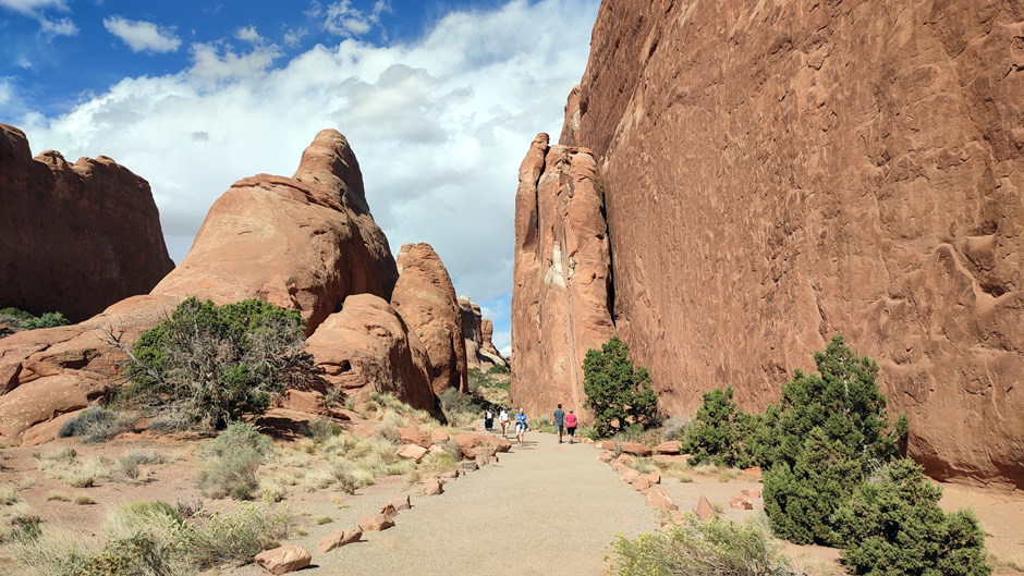
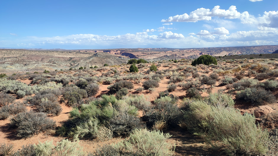
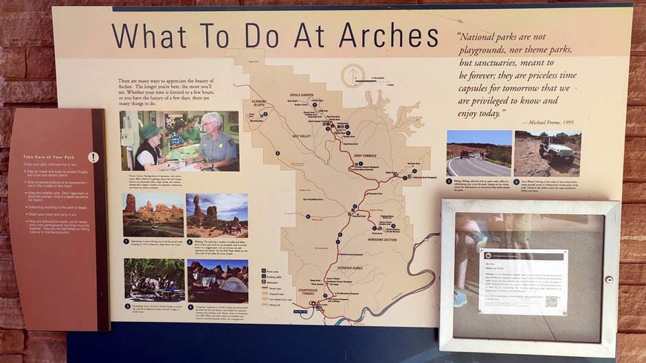
Arches National Park in Utah is home to more than 2,000 natural stone arches, along with towering pinnacles, massive rock fins, and striking balanced rocks. The entrance station and visitor centre sit just north of Moab, where visitors begin a scenic drive that winds upward through the park. The main road continues to Devils Garden trailhead, with branch roads leading to the Lower Delicate Arch viewpoint and the Windows Section. Numerous trails of varying lengths provide access to formations across the park.
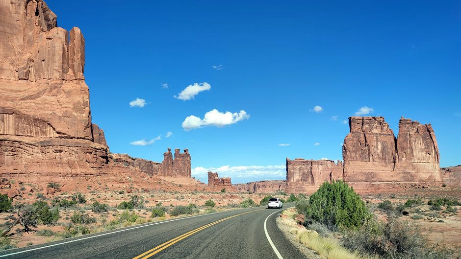
Above: About 3 miles from the start of the scenic drive through Arches National Park in southeastern Utah. The rock formations seen on the right side of the road are specifically known as the Courthouse Rocks.
The park requires timed-entry reservations (made ahead) during peak seasons to manage crowds. This did not appear to be the case when this visit was made in 2025 during a US government shutdown (the park and visitors centre were open, but many services were not available). After arriving, it was evident that many days could be spent in the park on the various trails to see a great number of landmarks in this spectacular landscape. Furthermore, some of the first parking areas were full and it was found driving right through the park to the end at Devils Garden trailhead, then working back worked out well (hence the order of sights here). With limited time, visiting a good selection of some of the park highlights was possible and these follow below:
Above: Start of the Devils Garden Trail
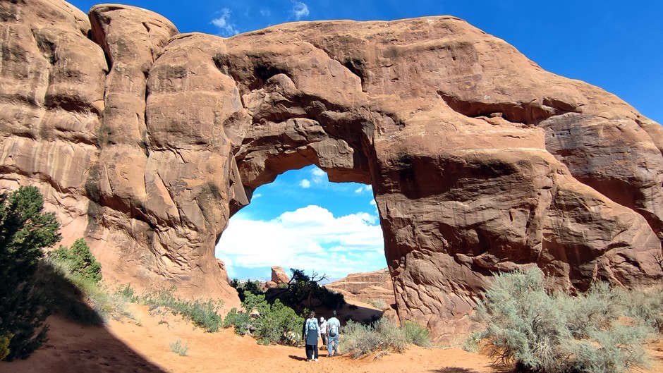
Accessed from the Devils Garden Trailhead Parking Lot, Pine Tree Arch (shown above), is a smaller but graceful arch tucked along the trail system, offering a quieter stop compared to the more famous arches. Its modest size makes it easy to overlook, but it provides a good example of the park’s diversity of formations.
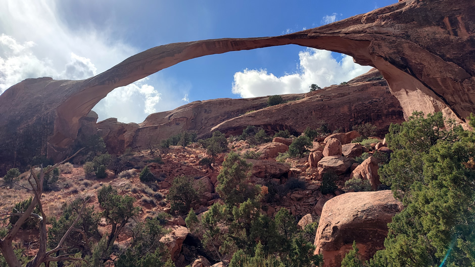
Also accessed from the Devils Garden Trailhead Parking Lot, Landscape Arch (above), stretches 306 feet and is one of the longest natural stone arches in the world. The arch is thin and fragile-looking, and visitors can view it from a maintained trail in Devils Garden.
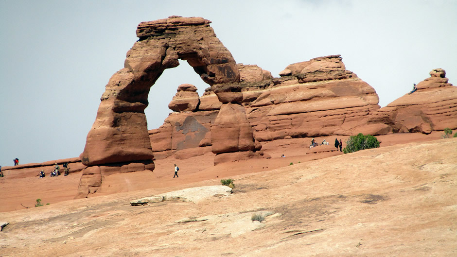
Above: Delicate Arch (photo taken with a zoom lens from the Lower Delicate Arch Viewpoint)
Delicate Arch, above, is the most celebrated landmark in Arches National Park — a freestanding sandstone giant rising 52 feet (16 metres) tall and spanning 32 feet (10 metres) across. Instantly recognisable from Utah license plates and countless photographs, it’s the kind of natural formation that feels almost sculpted on purpose. Google Maps describes it as the park’s “star attraction,” and visitors consistently echo that sentiment in their reviews, calling it beautiful, peaceful, and absolutely worth the effort.
There are three main ways to see Delicate Arch, depending on conditions, time available, level of fitness and/or accessibility requirements:
1) A moderately strenuous trail, with steady uphill sections, exposed slickrock, and no shade, runs to the base of Delicate Arch. Considered a classic experience, the walk (from the Wolfe Ranch trailhead) takes an average of 2 to 3 hours for the 3.2-mile round trip, including time to enjoy the view. While a fast-paced hiker can complete it in about 1.5 hours, it is recommended to allow more time for a leisurely experience, especially if you want to take photos or avoid the midday sun.
2) For visitors who want a rewarding view without committing to the full hike, the Upper Delicate Arch Viewpoint offers an excellent middle ground. From the Delicate Arch Viewpoint parking area, it’s a short 10 to 15-minute uphill walk to a perch that looks across the canyon toward the arch. From here, visitors get a clear, satisfying view that captures its scale and setting.
3) The Lower Delicate Arch Viewpoint is the easiest and most accessible option. Just a brief, mostly flat walk from the same parking area, it provides a distant but unobstructed look at the arch. It is recommended for anyone who doesn’t want to hike but still wants to see the formation; it’s a gentle way to appreciate the landscape without the physical demands of the main trail.
Each viewpoint offers a different relationship with Delicate Arch, from the intimate, up-close encounter at its base to the more contemplative, scenic overlooks across the canyon. Together, they make the landmark accessible to nearly every type of visitor, ensuring that this extraordinary sandstone icon can be experienced in whatever way suits.
Above: View from Panorama Point
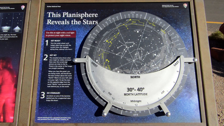
Panorama Point is a quick but rewarding stop in Arches National Park, perched on a small rise that opens into sweeping views of the red-rock landscape and the distant La Sal Mountains. Visitors typically spend just a few minutes here, taking advantage of the shaded tables and restrooms while soaking in the scenery. After sunset, the viewpoint transforms into one of the park’s most accessible sky-watching spots, offering unobstructed horizons ideal for stargazing events hosted by the National Park Service.
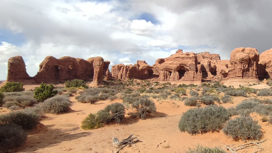
Parade of Elephants, above, is a cluster of rock formations resembling elephants marching in line, located near the Windows Section Parking Lot. It is a playful highlight for visitors exploring the nearby arches.
Also near the Windows Section Parking Lot (and visible from it), the Double Arch (shown above) comprises two arches joined at one end, forming a dramatic opening. It is popular for both photography and short hikes. Note: for scale, close inspection of the photo above reveals some people walking in front of and on the ground between the two arches.
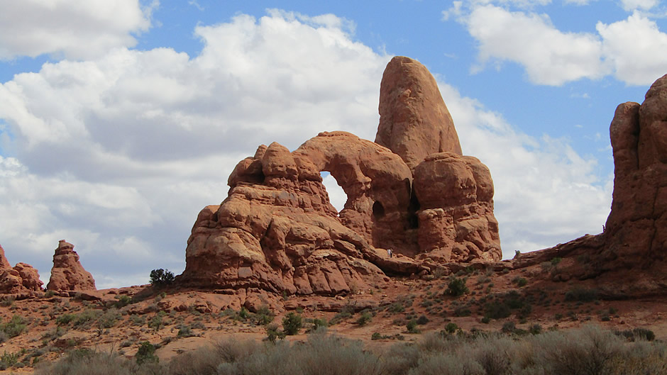
Above: Turret Arch, Windows Section of the park
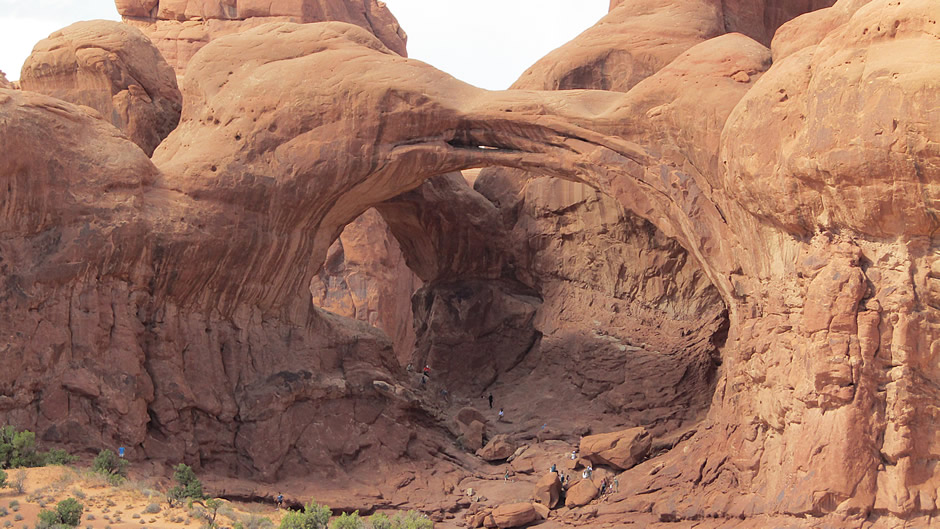
Above: Hikers approaching the North Window Arch
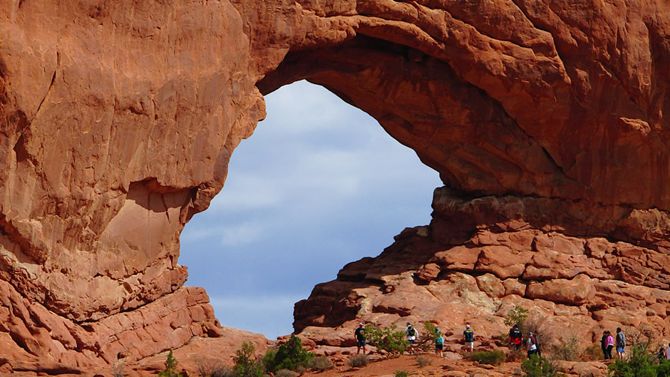
The North and South Windows are large arches side by side, often called “the Spectacles”. They frame expansive views and are reached by an easy, scenic loop trail, the Windows Trail, which is taken from the Windows Section Parking Lot. The trail leads visitors to the North and South Windows along with nearby Turret Arch. The walk is short and gentle, offering big views with very little effort. From the car park, the North Window is the standout feature (its massive opening is clearly visible) while the South Window remains tucked behind a rock feature known as the “nose bridge”, until after the trail has begun.
Above: View from the Fiery Furnace Viewpoint
The Fiery Furnace is a maze of towering sandstone fins and tight passages, glowing deep red in late-day light and offering one of the most intricate landscapes in Arches National Park. Because the area is easy to get lost in, access is limited to ranger-led hikes or visitors with a special permit. From the Fiery Furnace Viewpoint, visitors get a sweeping, safe, above-the-maze perspective; a panoramic look over the dense fins and rugged canyons without needing to enter the labyrinth itself.
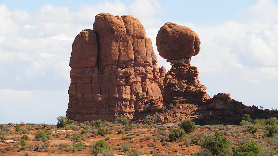
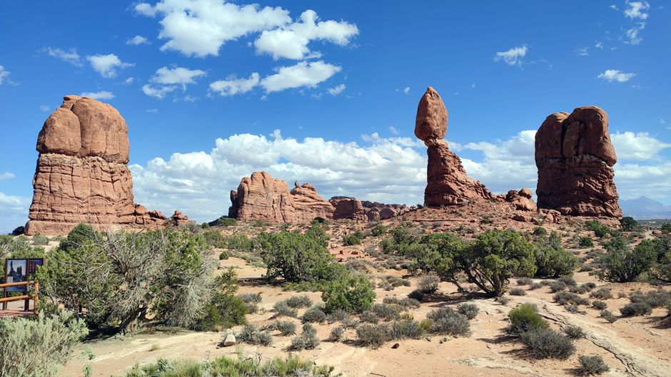
Balanced Rock, above, is a massive boulder perched on a narrow pedestal, visible from the main road. It is one of the park’s most photographed landmarks.
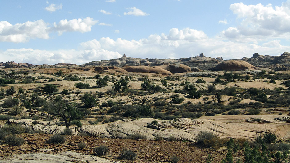
The Petrified Dunes in Arches National Park (shown above) are ancient sand dunes that hardened into stone under layers of sediment and were later exposed again through erosion. They sit between the Courthouse Towers and Balanced Rock, forming a rolling landscape of solid sandstone waves.
This concludes the main sites seen during this visit to Arches National Park. The following text suggests other things to do here and some safety information, although this should not be taken as official or comprehensive advice – always check with the National Park staff themselves for advice!
Things to Do
Visitors can join ranger programmes for guided learning, though availability varies seasonally. Four-wheel driving is permitted on designated routes outside the main paved road. The park is recognised for stargazing, with clear desert skies offering excellent night views. Cycling is allowed on roads but not trails. Popular activities include hiking and backpacking to arches and viewpoints, climbing and canyoneering on sandstone walls, and photography throughout the day and night.
Safety and Practical Information
Roads are paved but narrow, so careful driving is essential, especially near trailheads. Popular hikes include the Delicate Arch Trail, Devils Garden Loop, and the Windows Section. The park is open year-round, with hours varying slightly by season. Lodging is available in nearby Moab, while camping is limited to Devils Garden Campground. Pets are restricted to roads and campgrounds, not trails. Accessibility is provided at several viewpoints, though terrain can be uneven. Visitors should carry water, prepare for desert heat, and respect fragile sandstone surfaces.
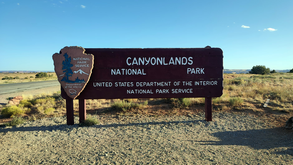
Canyonlands National Park (Island in the Sky Section)
Canyonlands National Park lies in southeastern Utah near Moab, covering over 300,000 acres of rugged desert terrain. The park is shaped like a “Y,” divided into three main districts – Island in the Sky, The Needles, and The Maze, each with its own entrance located miles apart, making them effectively separate destinations. The “Y” shape of the park is formed where the Green River flows south-southeast and meets the Colorado River flowing southwest; the two join at the Confluence in the heart of the park. Both rivers carve deep canyons through the landscape, further isolating the park’s districts from one another.
The park was established in 1964 to protect this dramatic section of the Colorado Plateau. Its geology reflects more than 300 million years of deposition and erosion, with layers of sandstone, shale, and limestone exposed in colourful cliffs, mesas, and spires. Forces of water and wind sculpted the terrain into sheer-walled canyons and towering rock formations, creating one of the most striking desert landscapes in the American Southwest.
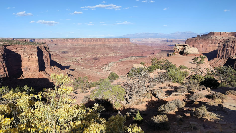
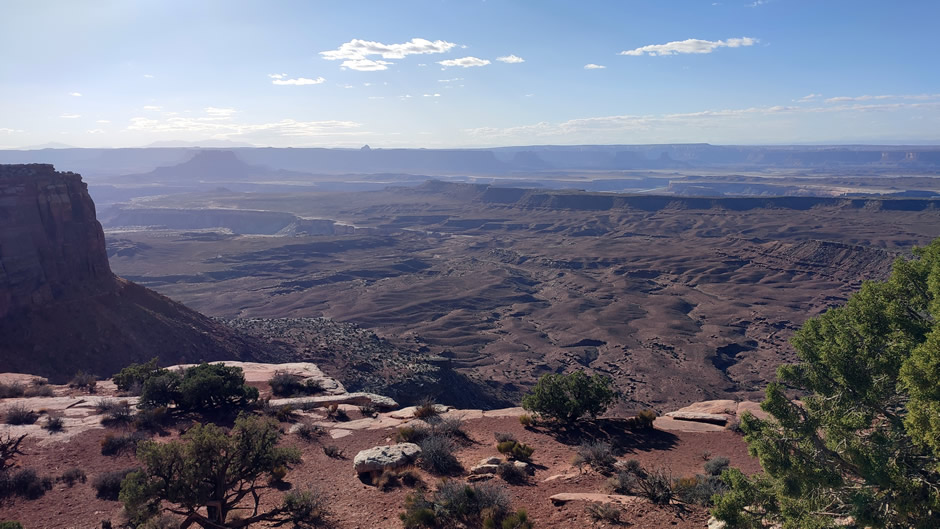
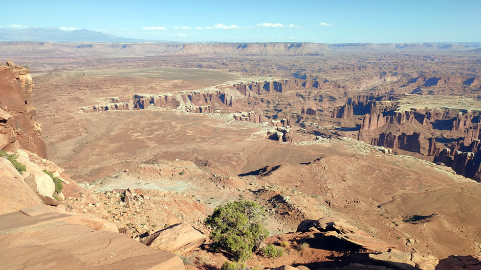
Above: Looking eastwards from near the Island in the Sky Visitor Center
The Island in the Sky district is the most accessible and popular section of Canyonlands (and the one seen here on this trip). Sitting atop a massive mesa, it offers panoramic views from sheer cliffs that rise 1,000 feet above the surrounding canyons. A paved scenic drive runs the length of the mesa, leading to several overlooks and short trails. This district is closest to Moab and has a dedicated visitor centre, making it the main entry point for most travellers.
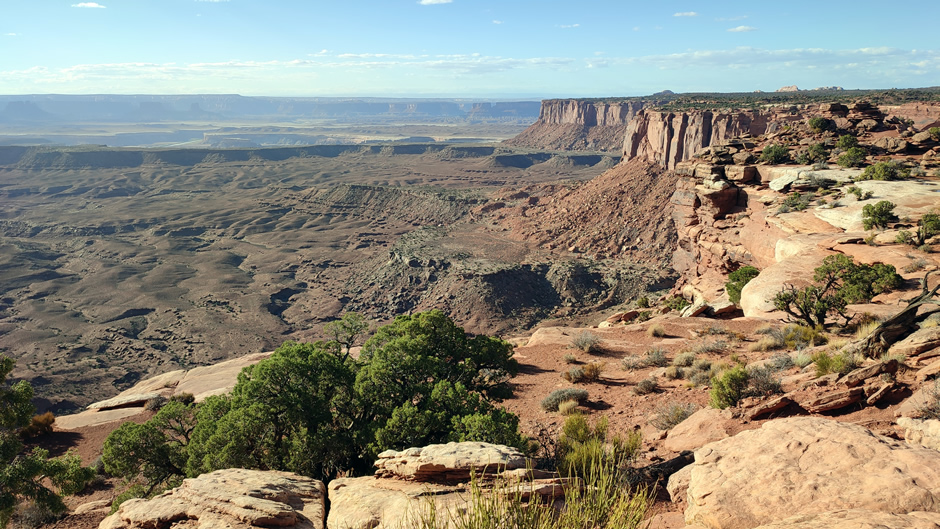
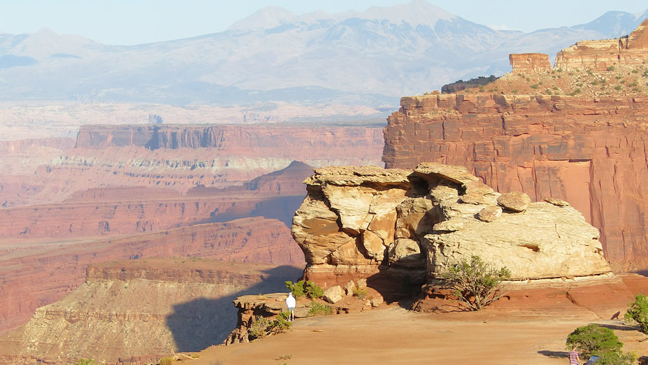
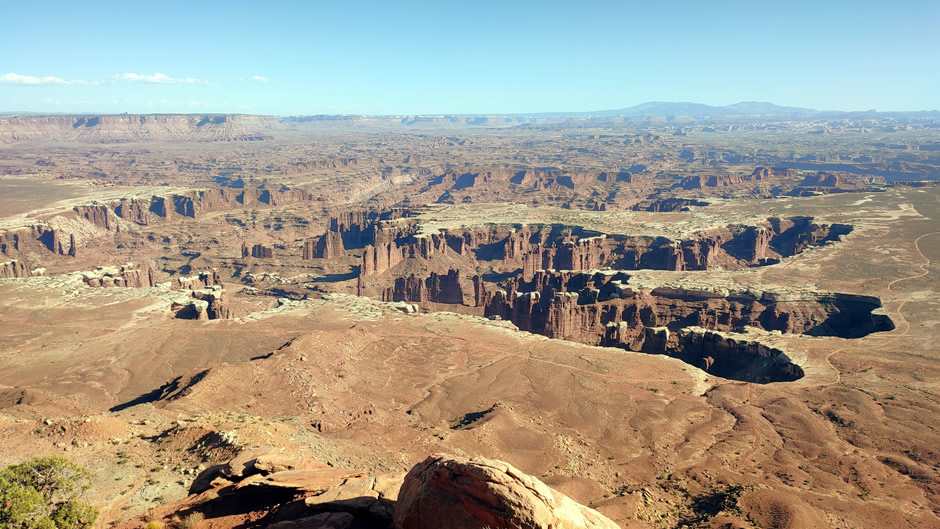
Above: Looking westwards from Island in the Sky
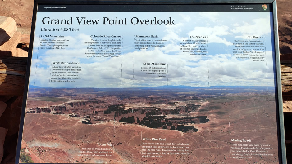
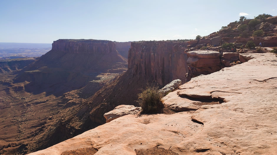
Driving south along the mesa rim brings visitors to Grand View Point Overlook, the highlight of Island in the Sky (photos shown below). The overlook sits at the end of the scenic drive and provides sweeping vistas across miles of canyons, the White Rim, and distant features in The Needles and The Maze. A short-paved path leads to the viewpoint, and a longer trail extends about a mile along the rim for even broader perspectives. From here, the scale of Canyonlands becomes clear, with layered cliffs, winding river channels, and distant mountains visible on the horizon. On reflection, the photos probably don’t do justice to the sheer vastness of this place, which felt like standing on another planet:
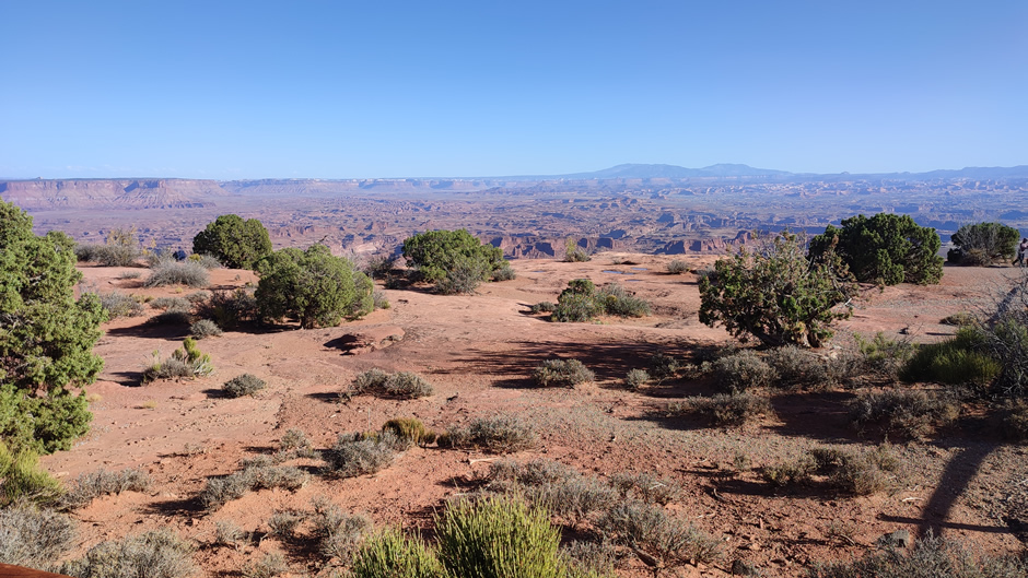
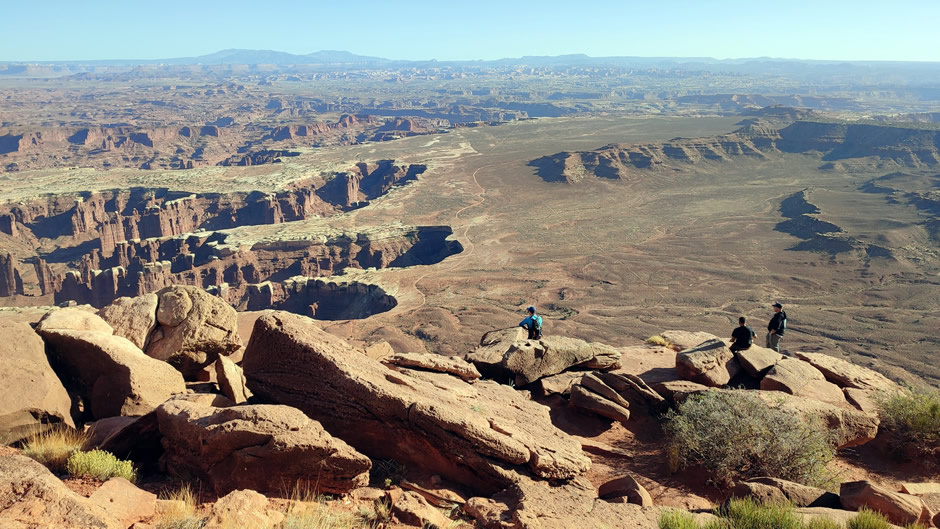
Canyonlands is vast and divided, but the Island in the Sky section offers the most accessible introduction to this national park and the panoramic views from Grand View Point were a truly unforgettable experience; being able to stand at the canyon edge without unobtrusive barriers and crowds of people made the encounter with this vast landscape very impactful.
The Four Corners Monument marks the only point in the United States where four states meet (Arizona, Colorado, New Mexico, and Utah).
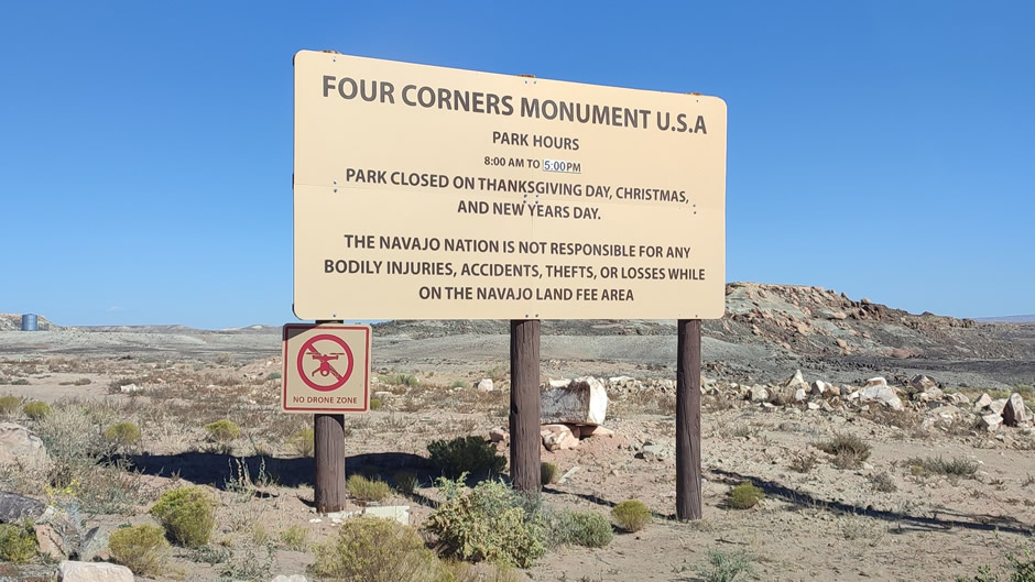
Established in 1912 after surveys dating back to 1868, the site was formalised with a granite and brass marker and later reconstructed in 2010. The monument is owned and managed by the Navajo Nation, and it also lies adjacent to the Ute Mountain Ute Tribe Reservation, making it a boundary between two tribal lands.
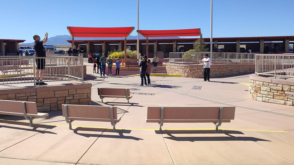
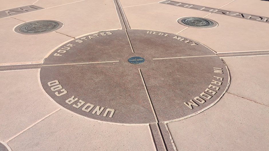
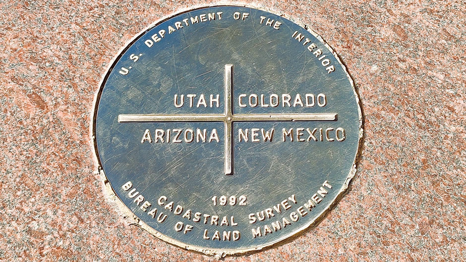
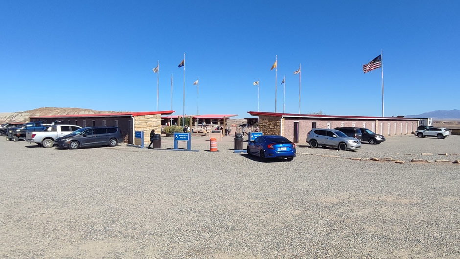
Facilities include a visitor area with vendor stalls where Native artisans sell jewellery, crafts, and traditional foods. The central marker itself is a circular granite disk with bronze inlay, surrounded by the official seals of the four states. Additional monuments and plaques highlight the cultural significance of the site, and the location’s appeal comes from the novelty of standing in four states at once. Despite its remote desert setting, it remains a popular stop for travellers, symbolising both geographic uniqueness and Native stewardship.

Link to Next Page (Page 5 of 11)
Link to Previous Page (Page 3 of 11)
Back to Top