Southwestern USA 2025 (Page 3 of 11)
Quick links to other Southwestern USA 2025 pages and/or sections Here
The Grand Canyon
The Grand Canyon, located in northern Arizona, is one of the largest and most iconic natural landmarks in the United States and famous worldwide. Stretching 277 miles in length, up to 18 miles in width, and over a mile deep, it was carved by the Colorado River over millions of years. The canyon exposes nearly two billion years of geological history through its layered rock formations. Human presence dates back thousands of years, with ancestral Puebloans and other Native American groups considering the canyon sacred. European exploration began in the 16th century, with Spanish expeditions followed by American surveyors in the 19th century. Today, the Grand Canyon National Park encompasses the South Rim and North Rim, while other visitor areas such as Grand Canyon West are managed separately.
At the time of this visit in early October 2025, the North Rim part of the national park was closed due to a recent major wildfire that had taken place during the summer (the Dragon Bravo Fire). Sparked by lightning, it was first reported on July 4, 2025, and quickly grew into a megafire. By the time it was declared fully contained on September 29, just 3 days before the visit, the blaze had burned 145,504 acres. The scale of the fire forced extended closures across the North Rim, restricting visitor access for reasons of safety.
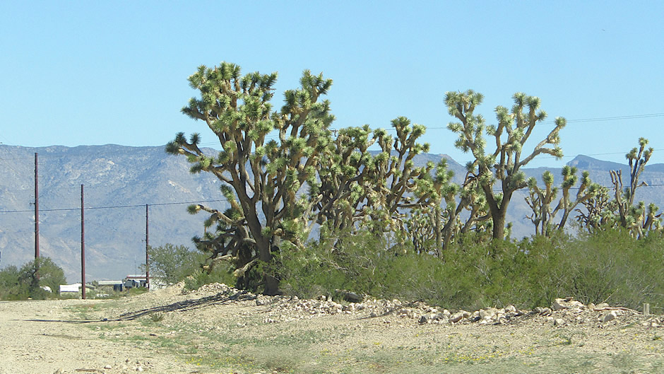
Above: Driving past Joshua Trees in Arizona's Joshua Tree Forest
The visit began with a brief look along the road
leading from U.S. Route 93 to Grand Canyon West to see Arizona's Joshua
Tree Forest. The forest lies near Meadview, just west of the Grand
Canyon, and is considered the densest stand of Joshua trees in the
world. The Joshua tree is a distinctive desert species native to the
Mojave region.
Long before highways and park rangers, Joshua trees depended on giant
ground sloths to carry their seeds across the Mojave Desert. These
massive creatures ate the trees’ fleshy fruits and deposited the seeds
far from the parent plant, wrapped in nutrient-rich dung that gave them
a head start. Since the sloths vanished over 11,000 years ago, Joshua
trees have lost their long-distance couriers; today, rodents scatter
seeds only a few feet away, leaving human conservation projects to step
in and mimic the ancient dispersal that once allowed these desert icons
to roam freely.
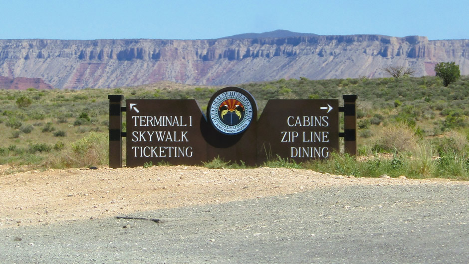
Further up the road (and for those spending longer in the area) is Grand Canyon West, operated by the Hualapai Tribe and situated outside the boundaries of the national park iteslf. The main attraction there is the glass Skywalk which requires a park-and-ride bus journey and separate admission fees.
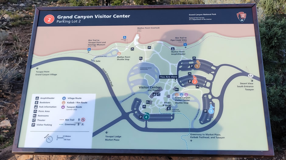
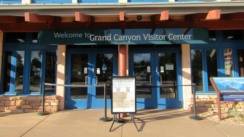
With some (relatively) minor backtracking, the visit continued with spending a large part of the day exploring the South Rim side within Grand Canyon National Park. The South Rim, centred on Grand Canyon Village, is the most visited area of the Grand Canyon. It offers the greatest accessibility, with straightforward routes, numerous viewpoints, and a wide range of hiking trails. Visitors can explore the South Rim in a single day or extend their visit over several days to take in more of the sights. That said, at the time of the visit the South Rim remained open despite a US government shutdown taking place. Admission was free as a result, though most facilities and guided excursions were unavailable. Maps of the rim were still distributed at the entrance, allowing visitors to follow the scenic drive eastward along Desert View Drive and the stops made along here follow:
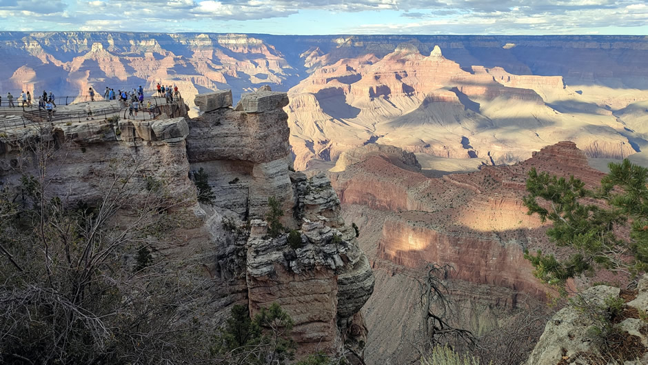
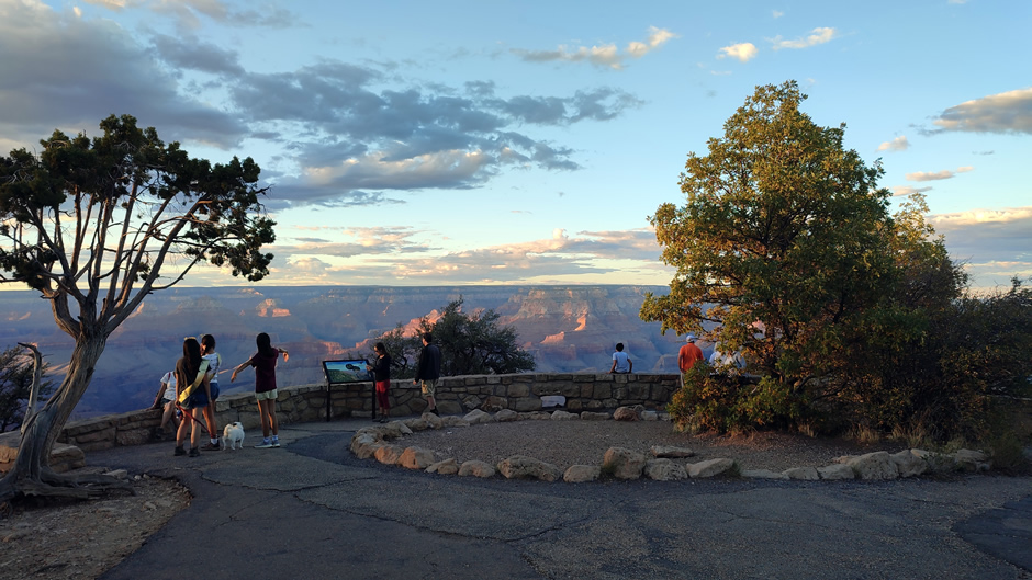
Above: Visitors viewing the Grand Canyon from Mather Point
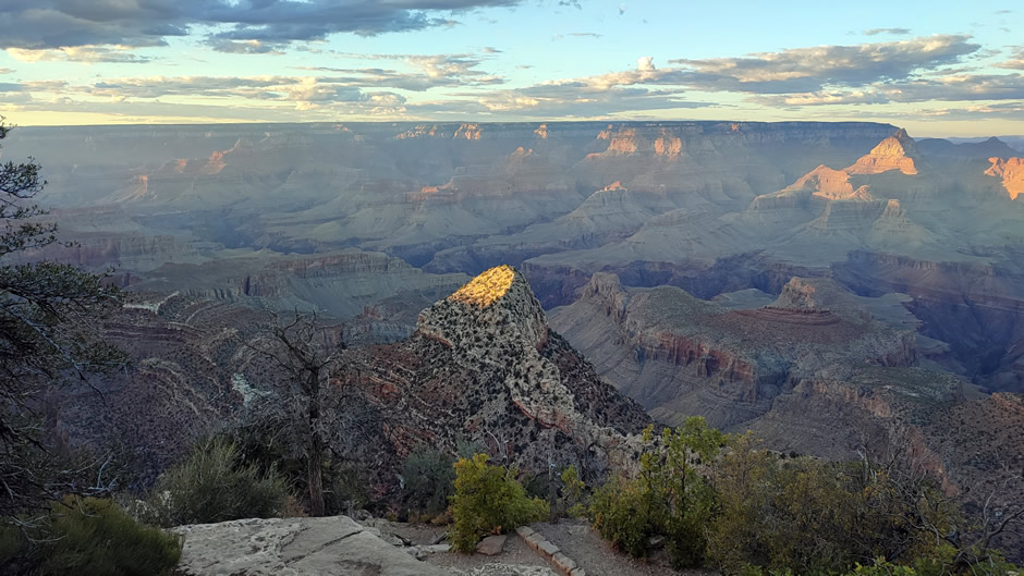
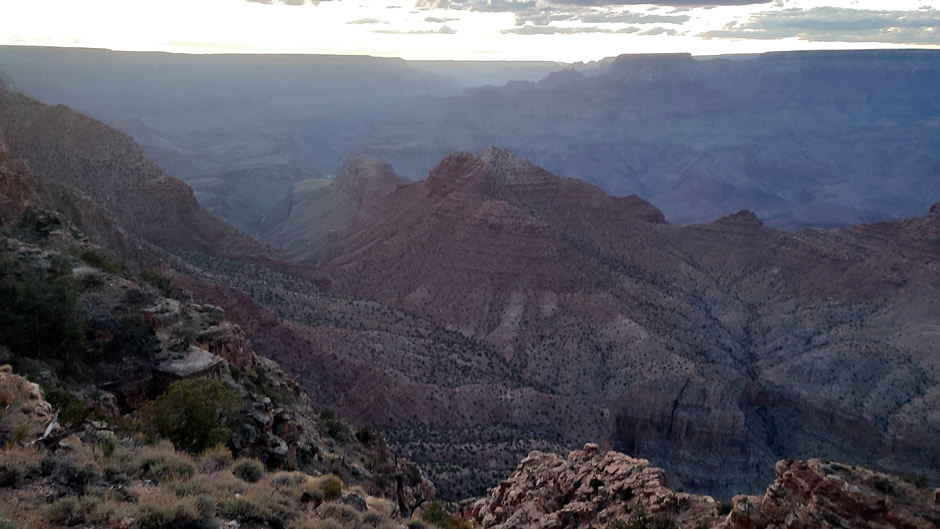
The first major stop was at Grand Canyon Village and nearby Mather Point (views shown below). Large parking areas near the visitor centre made access straightforward, with a short walk leading to the overlook. Mather Point provides panoramic views across the canyon, with the Colorado River visible in the distance.
Above: Mather Point is one of the most visited viewpoints in Grand Canyon National Park, offering easy access and broad visibility.
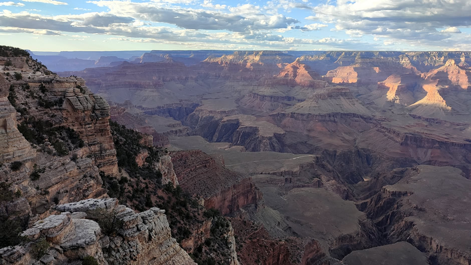
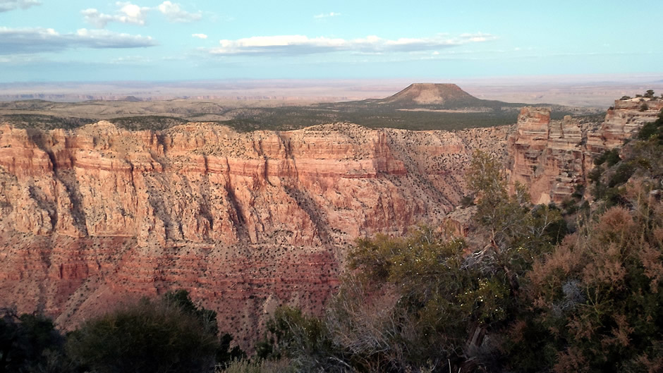
Continuing east, Duck on a Rock Viewpoint (shown below) offers a smaller roadside pullout with limited parking. From here can be seen a formation resembling a duck, set against expansive canyon layers. The quieter setting made it less crowded than the main overlooks.
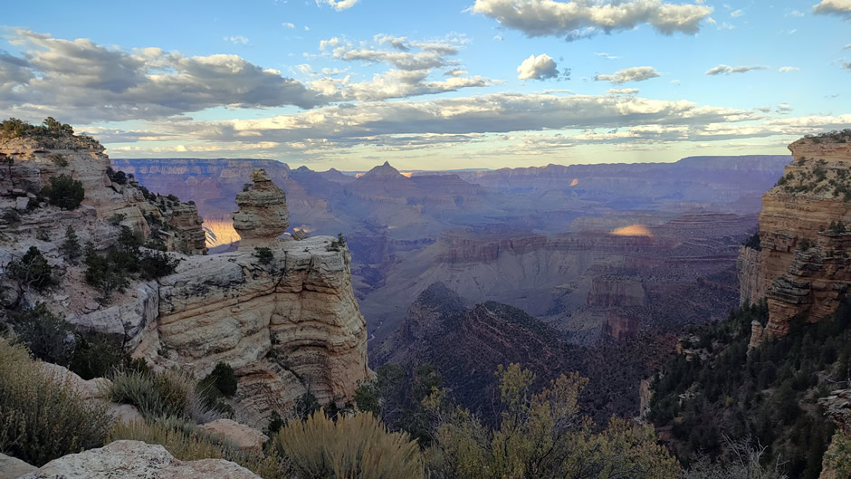
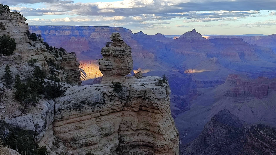
Above: Duck on a Rock Viewpoint is less crowded than the major overlooks, and can provide a quieter stop.
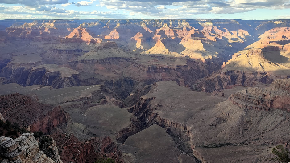
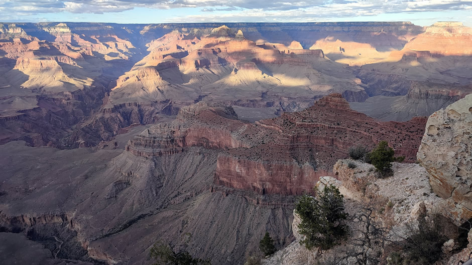
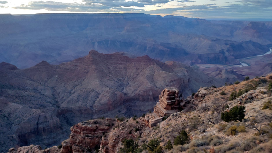
Further along the drive, Grandview Point (shown below) provided a wide-angle perspective of the canyon. Parking is available here in a medium-sized lot, with a short but slightly steeper walk to the overlook. This site is notable for its history as a copper mining location in the late 19th century, adding context to its sweeping vistas:
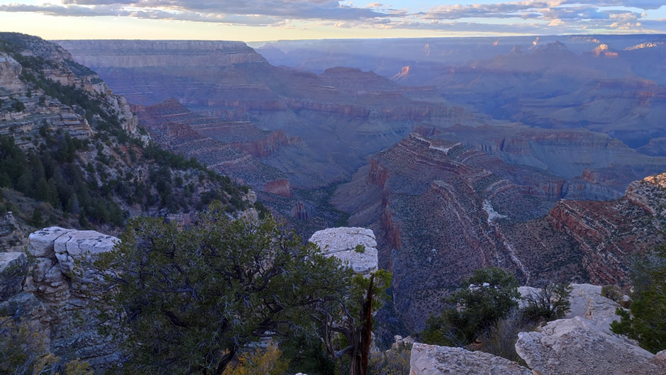
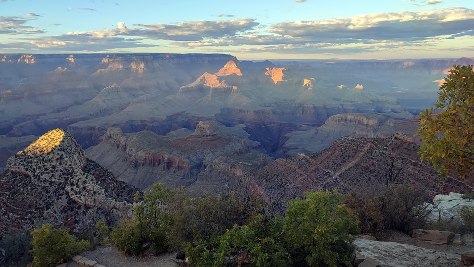
Above: Grandview Point, known for its sweeping vistas and historical connection to copper mining. A trail from here, the Grandview Trail, is a strenuous, historic, and steep path built by the miners, leading down to the Horseshoe Mesa with remnants of the Last Chance Mine, known for rugged terrain, significant elevation change, and breathtaking views, requiring experience and caution, especially in summer heat.
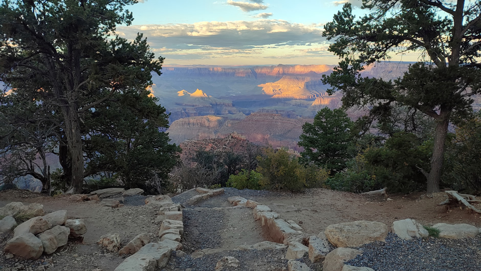
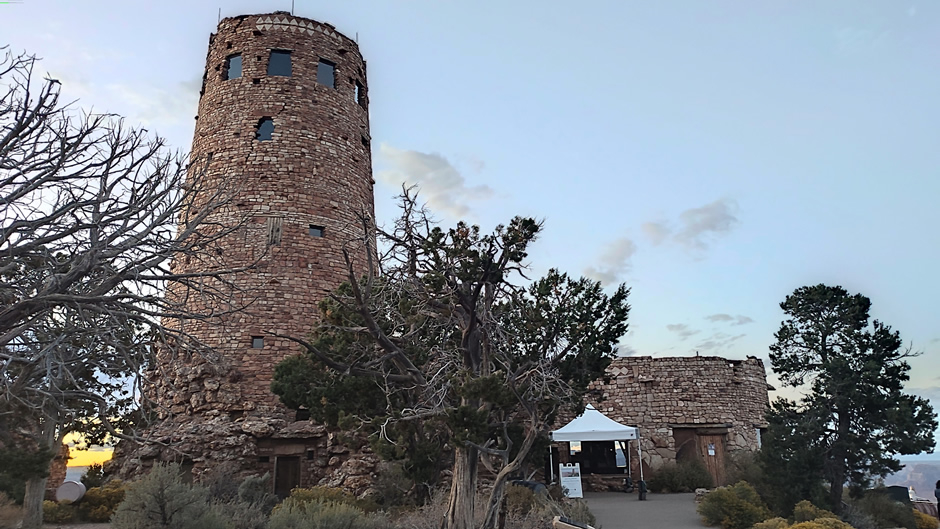
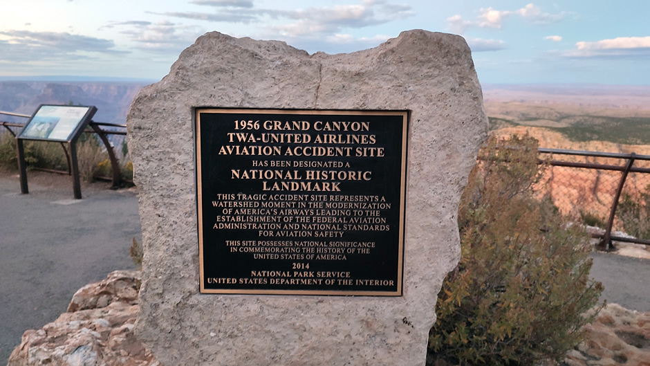
As darkness set in, the final stop was Desert View Point at the eastern end of the drive. As well as a visitor centre, it is known for Desert View Watchtower, a historical landmark. A good-sized parking lot provides direct access to the stone tower, designed in 1932 by architect Mary Colter to reflect Native American styles. From its elevated vantage point (as well as the Desert View Point itself) visitors can see the Colorado River entering the canyon from the east, making it one of the most striking views along the rim. On a sombre note, visitors to the viewpoint can also see a National Historic Landmark plaque and stone memorial that mark the 1956 Grand Canyon TWA-United Airlines Aviation Accident Site. This mid-air collision was one of the deadliest aviation accidents in U.S. history. On June 30, 1956, a Trans World Airlines Lockheed Super Constellation and a United Airlines Douglas DC-7 collided at 21,000 feet over the canyon, killing all 128 people aboard. The disaster exposed shortcomings in air traffic control and led to major reforms that shaped the modern aviation safety system.
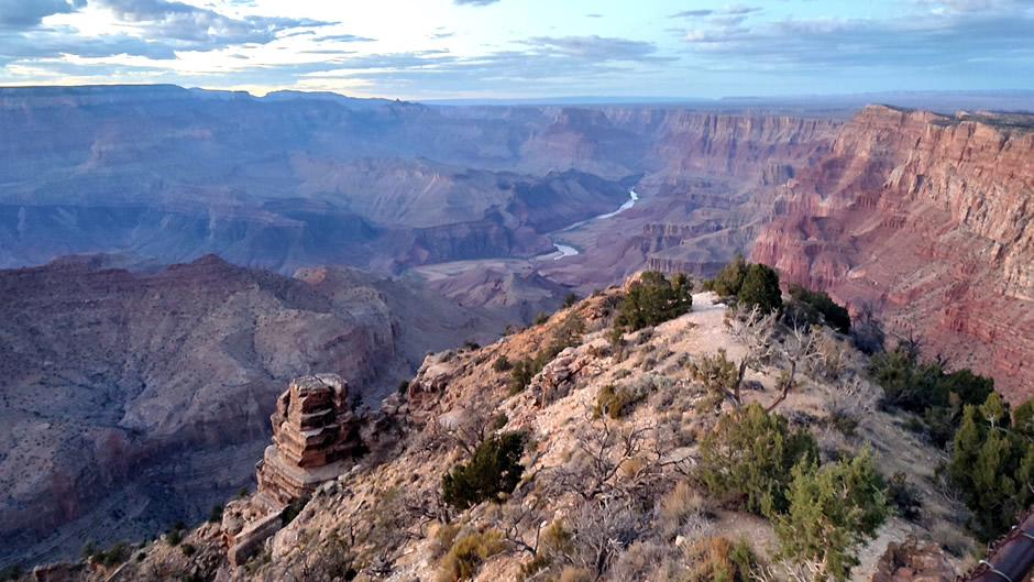
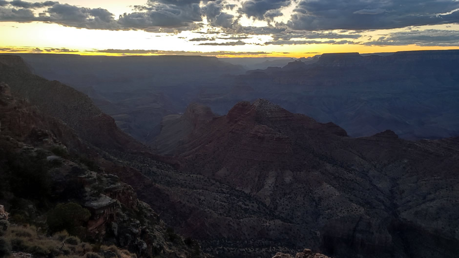
Above: Desert View Point provides one of the best vantage points of the Colorado River.
In conclusion, despite closures caused by the recent wildfire at the North Rim and a government shutdown affecting facilities at the South Rim, the route from Grand Canyon Village eastward along Desert View Drive still offered accessible viewpoints and clear opportunities to experience the canyon’s sheer scale as much as one can, without taking a hike all the way down!
Link to Next Page (Page 4 of 11)
Link to Previous Page (Page 2 of 11)
Back to Top