Southwestern USA 2025 (Page 11 of 11)
Quick links to other Southwestern USA 2025 pages and/or sections Here
T-or-C to Lake Havasu City (inc. Very Large Array and Meteor Crater) / Endnotes
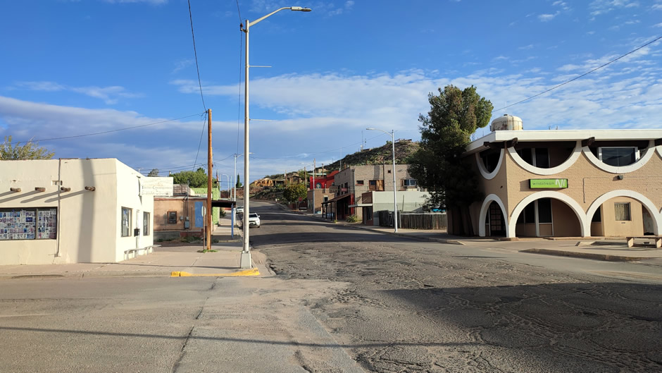
Truth or Consequences (T-or-C)
The next night of the road trip was spent staying in the small city of Truth or Consequences. Often called T-or-C, it is located in Sierra County, New Mexico, and known for its unusual name and proximity to space exploration.
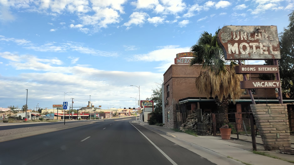
Before heading off, we took a quick look around the city. T-or-C was originally named Hot Springs but changed its name in 1950 after a radio show host, Ralph Edwards, challenged communities to adopt the title of his popular game show Truth or Consequences. Edwards had announced he would broadcast his show from the first town willing to adopt the programme’s name. Hot Springs residents voted overwhelmingly in favour, and the new name quickly stuck. True to his word, Edwards aired the show from the town and continued to visit every May for the next 50 years, headlining the annual Truth or Consequences Fiesta and bringing other celebrities along. This quirky publicity stunt not only gave the city its unusual identity but also cemented a lasting connection between the community and the show, celebrated with parades and festivities long after the broadcast era ended.
Today, the city is best known as the gateway to Spaceport America, located about 20 miles southeast. Spaceport America is the world's first purpose-built Spaceport and is FAA-licensed. Tenants at Spaceport America include Virgin Galactic, part of Sir Richard Branson’s Virgin Group, who operate a reusable spaceflight system to take private individuals and researchers on spaceflights.
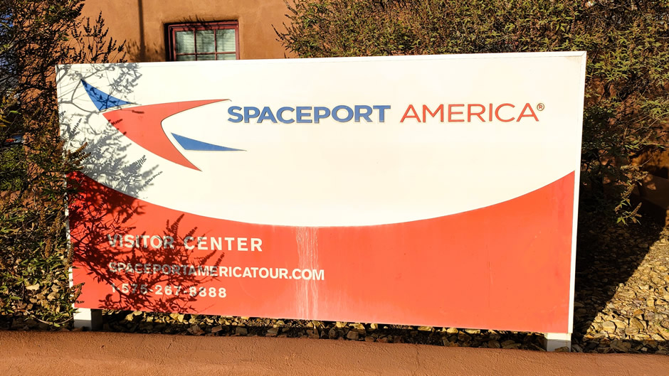
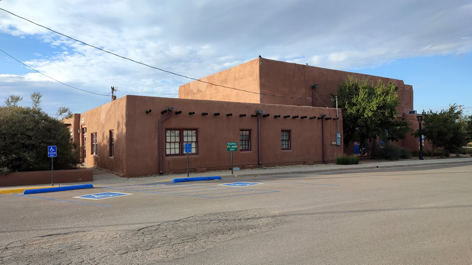
The (former) Virgin Galactic Visitor Center (shown above) previously served as the starting point for tours to Spaceport America. Visitors would begin at the centre in Downtown T-or-C, where they could learn about the history of commercial spaceflight and the development of Spaceport America. From there, guided tours transported guests to the secure spaceport site. However, the Visitor Center closed in 2020 because the original vision of a bustling commercial spaceport with multiple tenants and constant public access didn't materialize as expected. The company shifted its focus to operations directly at Spaceport America, rather than maintaining a separate facility in town. The closure reflected a consolidation of resources as Virgin Galactic prepared for regular commercial flights, with public tours now offered through Spaceport America itself.
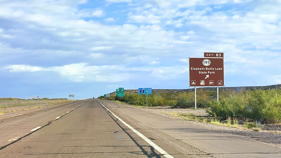
Beyond its space connections, T-or-C is famous for its natural hot springs, which remain a popular attraction, and it sits near Elephant Butte Lake, the largest reservoir in New Mexico, offering boating and fishing opportunities. The city’s quirky history, geothermal waters, and role in commercial spaceflight make it a distinctive stop in the Southwest.
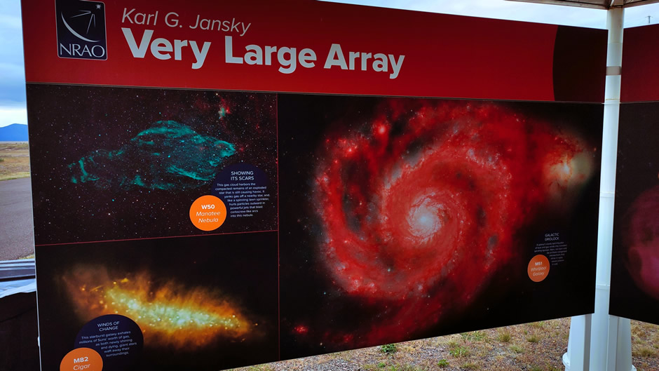
The Karl G. Jansky Very Large Array (VLA)
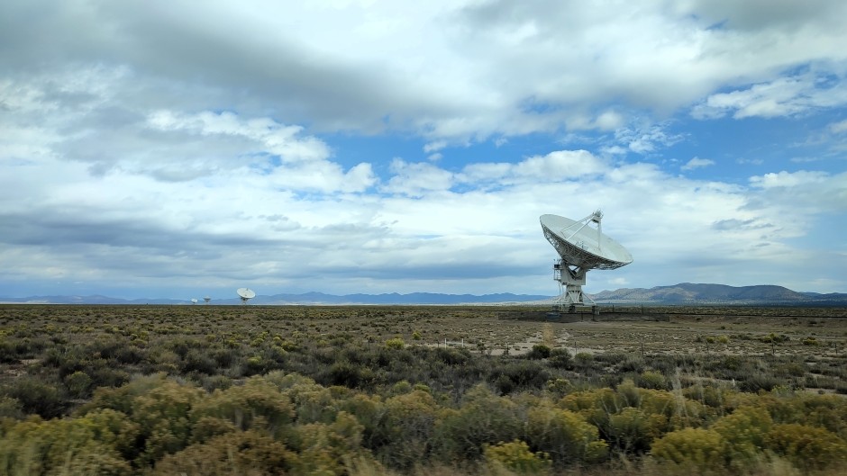
The Karl G. Jansky Very Large Array (VLA) is a world-class radio astronomy observatory located on the Plains of San Agustin, about 50 miles west of Socorro, New Mexico, and a two-hour drive from Albuquerque. It consists of 27 giant dish antennas that work together to study the universe in radio wavelengths. The VLA has appeared in films and television, most famously in Contact (1997), where Jodie Foster’s character works at the site. It has also been featured in numerous documentaries and science programmes.
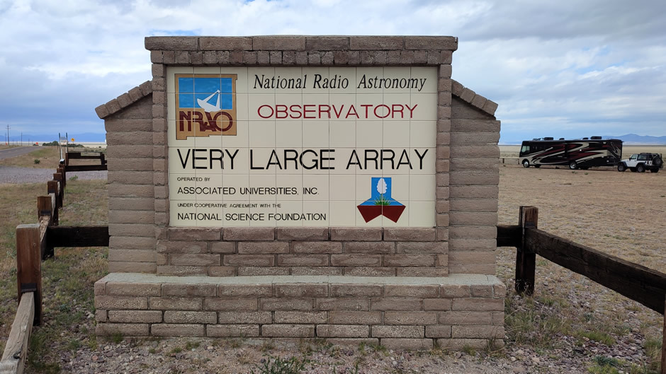
The VLA was previously known simply as the Very Large Array, and during its major upgrade phase (2000s-2012), it was called the Expanded VLA (EVLA). On March 31, 2012, it was officially renamed the Karl G. Jansky Very Large Array. The renaming was announced by the National Radio Astronomy Observatory (NRAO) earlier that year, naming it in honour of the engineer and physicist credited as the founder of radio astronomy, Karl Guthe Jansky (1905-1950), a genius who passed away too early in life.
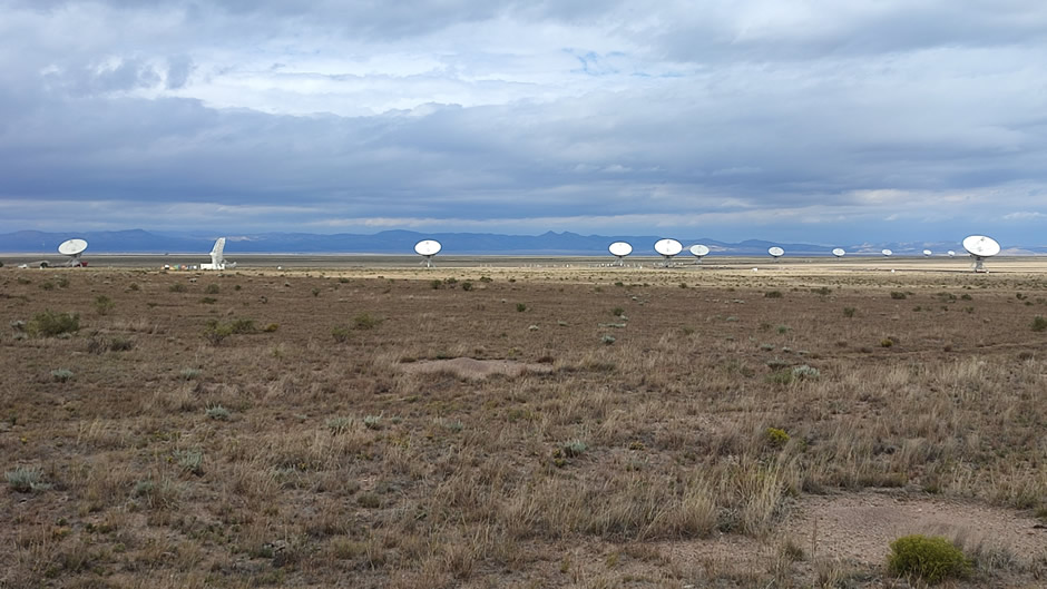
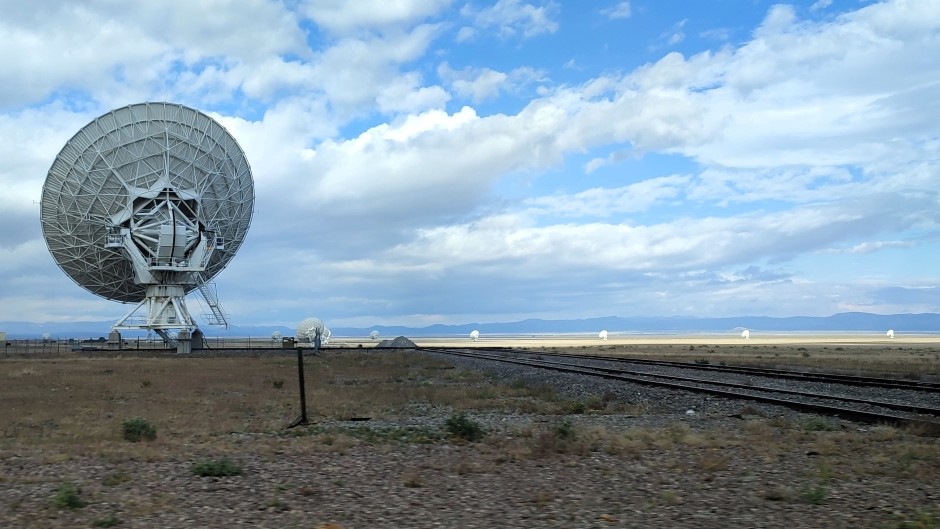
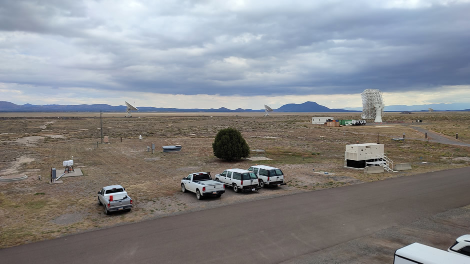
Above: The parking lot along Old Highway 60 provides the first sweeping view of the array. From this vantage point, visitors see the antennas spread across the desert landscape, emphasising the vastness of the installation before entering the main site.
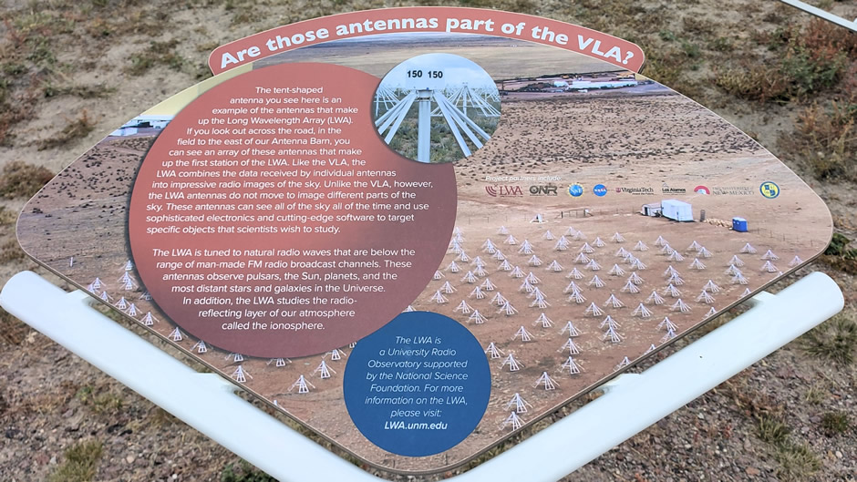
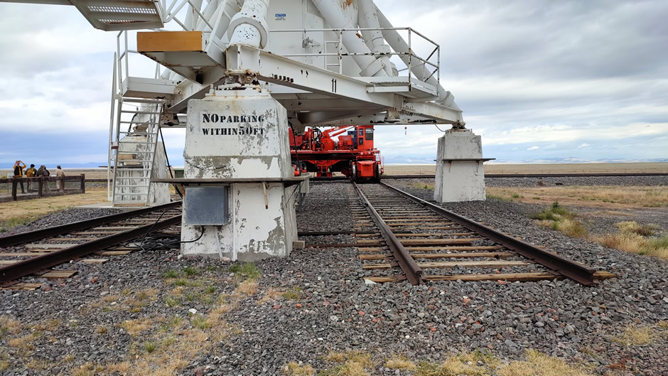
A radio telescope works by collecting invisible radio waves coming from space, much like a giant satellite dish picking up faint signals. Instead of looking at light like normal telescopes, it “listens” to the universe using antennas that focus and amplify radio energy from stars, galaxies, and other cosmic objects. The Very Large Array (VLA) takes this a step further by using 27 huge dishes spread out across the desert. Each dish picks up part of the signal, and computers combine them so the whole array acts like one enormous telescope. By moving the dishes farther apart or closer together along railroad tracks, astronomers can change how sharp the images are, similar to zooming in or out with a camera lens. The VLA operates across wavelengths from 0.6 cm to 410 cm, within the radio wave portion of the electromagnetic spectrum, specifically the microwave and longer radio bands.
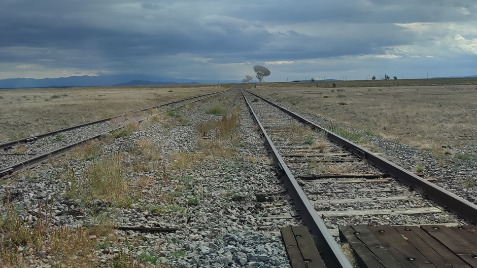
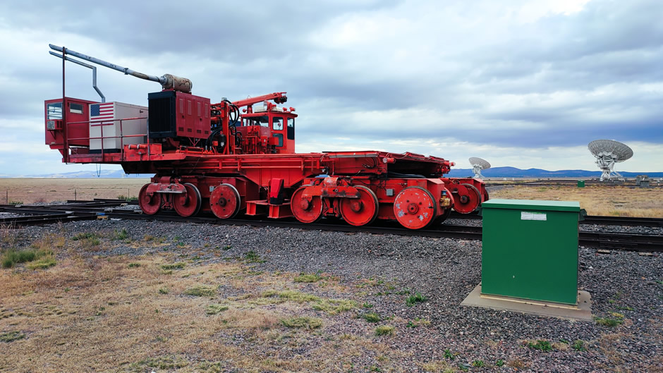
The railroad track system at the VLA is designed to change the telescope’s resolution by moving the dishes into different set positions. The tracks form a large Y-shaped layout, with double rails on each arm and curved connectors that let transporters shift antennas between arms. Each arm stretches 13 miles (21km), and together the system uses more than 80 miles of track. By relocating the antennas, astronomers can adjust the array from a compact setup about 2,000 feet (600m) across to its widest configuration spanning 22 miles (36km), giving the telescope flexibility to capture both broad views and fine details in distant galaxies and black holes that a single dish could never capture on its own.
Construction of the VLA began in 1973 and was completed in 1980. The Expanded VLA project, completed in 2012, greatly improved its sensitivity and frequency coverage. The telescope uses interferometry, combining signals from multiple antennas to simulate a single enormous dish. This allows astronomers to study phenomena such as black holes, galaxies, pulsars, and cosmic magnetic fields. The VLA has contributed to key discoveries, including detailed imaging of quasars, mapping hydrogen gas in galaxies, and observing radio emissions from planets and supernova remnants. The VLA has also been central to projects like the study of the Milky Way’s centre and collaborative work such as the Very Long Baseline Array (VLBA) and the Event Horizon Telescope (EHT). The VLBA links ten telescopes across the U.S. to act like one giant telescope the size of the continent and here, the VLA joins in to make the pictures clearer and fill in missing data. Meanwhile, the EHT is a global network of radio telescopes acting as one Earth-sized virtual telescope and is used for imaging black holes. Here, the VLA provides supporting observations at different radio wavelengths and this extra information helps scientists better understand what’s happening around black holes and inside distant galaxies.
A Look Around the Site
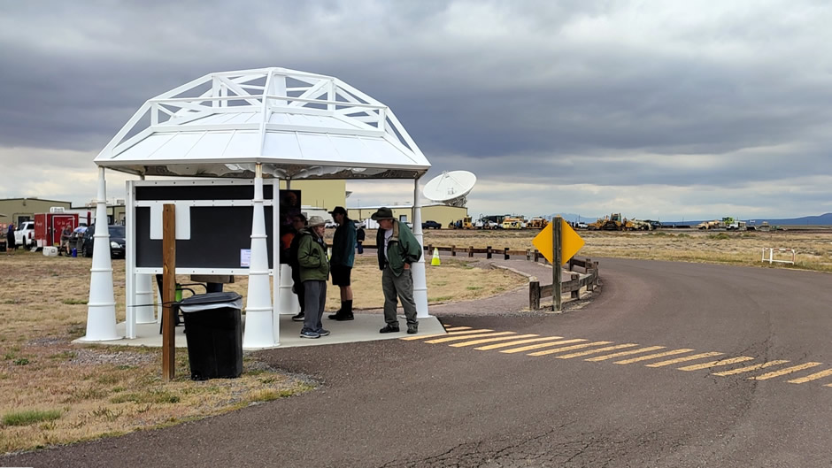
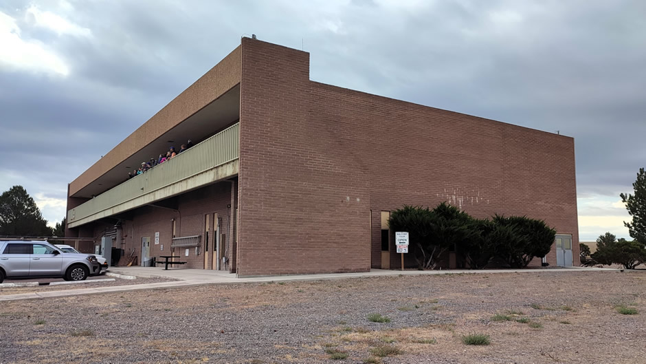
The Visitor Center, shown below, offers exhibits on radio astronomy, a short documentary narrated by Jodie Foster and a gift shop. From here, guests begin the self-guided walking tour. A map/leaflet of the walk is available and some main points of interest follow (only in a very rough order):
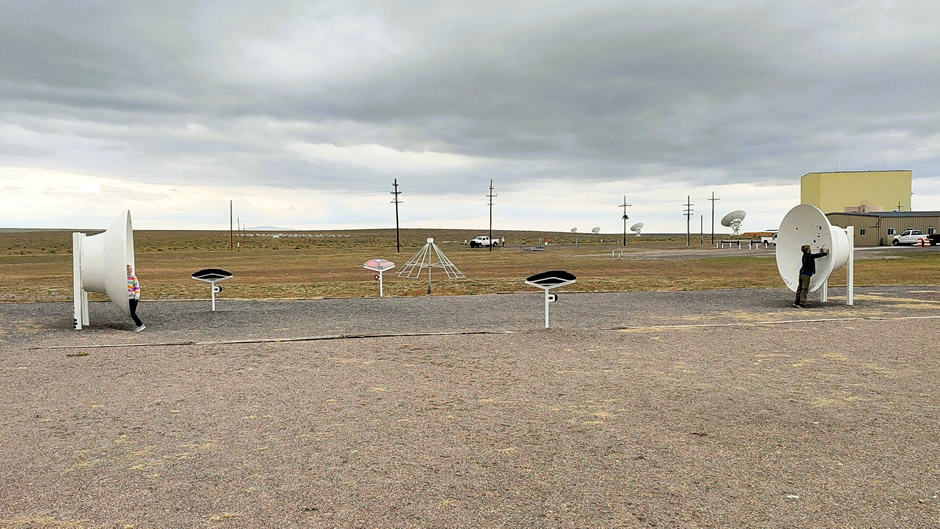
The Solar Radio Telescope (shown below) is a small instrument demonstrating how astronomers study the Sun’s radio emissions. It shows visitors how radio telescopes detect solar activity, including flares and bursts, which can affect Earth’s communications and satellites.
The Bracewell Radio Telescope (shown below) is named after Ronald Bracewell, an Australian-born radio astronomer who pioneered interferometry techniques. This telescope is part of the educational exhibits. It illustrates how paired antennas can be used to cancel or enhance signals, a principle central to modern radio astronomy.
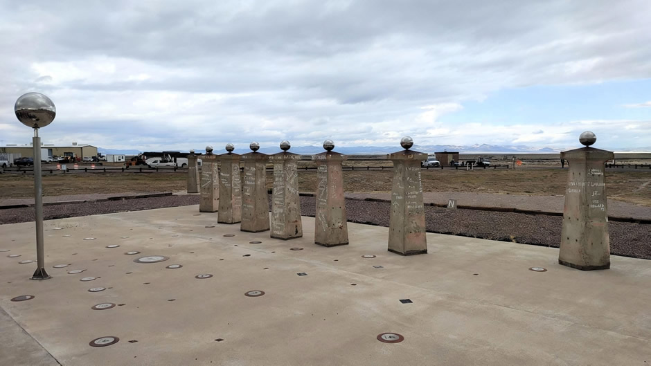
The Bracewell Sundial (shown below) is both a functional timepiece and a commemorative monument. Like any sundial, it uses the position of the Sun’s shadow to mark the time of day. What makes it special is that it was designed by radio astronomer Ronald Bracewell, who contributed greatly to the field of interferometry. The sundial is supported by concrete piers, and many of them bear the signatures of scientists and engineers who worked on the VLA. In addition to showing solar time, it serves as a symbolic link between astronomy, engineering, and human history, reminding visitors that measuring time and observing the skies are deeply connected.
Great fun for kids (real ones or grown-up ones), two parabolic dishes face each other across a distance, allowing visitors to whisper into one dish and be heard clearly at the other. This interactive exhibit (“Whisper Dishes”) demonstrates how radio waves are focused and collected by the VLA’s giant antennas:
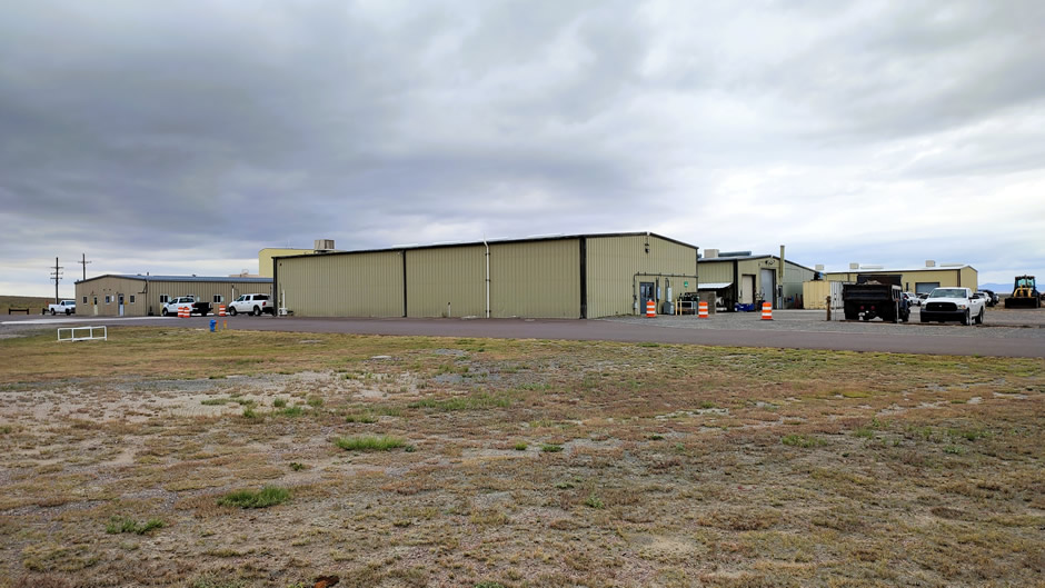
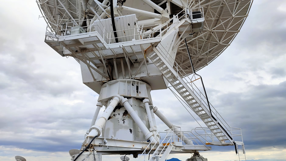
The larger tall yellowish beige building seen at the top and towards the right of the first photo below is the Antenna Barn. This is the maintenance facility where antennas are serviced. Here, dishes undergo mechanical and electronic repairs, ensuring the array remains operational. It highlights the scale of upkeep required for 230-ton antennas. The VLA site also includes smaller structures for administration, storage, and technical support. These are used for staff operations and equipment housing rather than direct antenna maintenance.
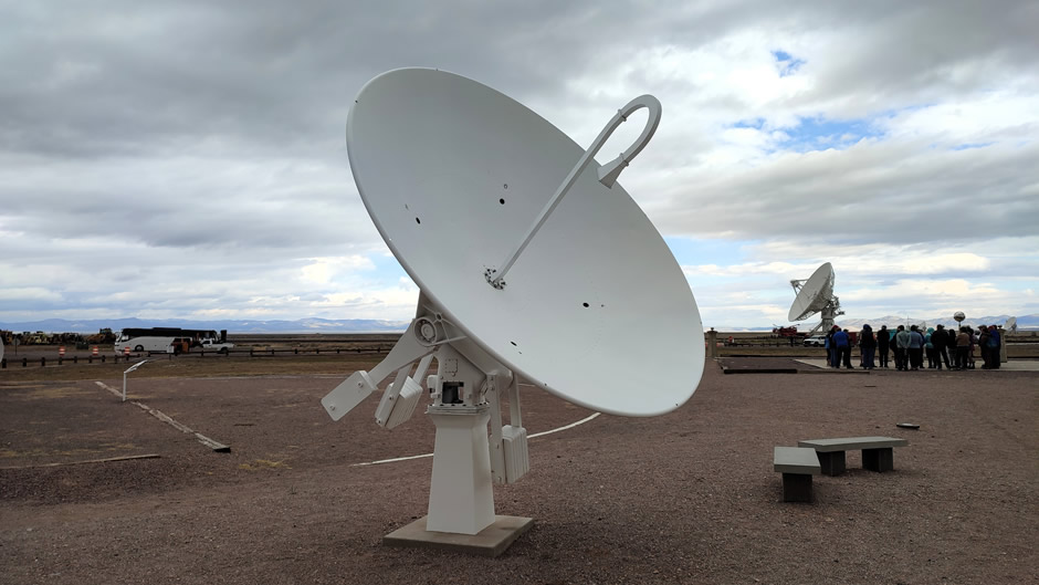
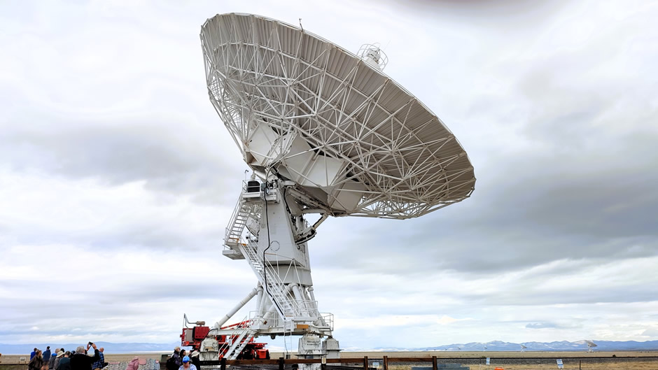
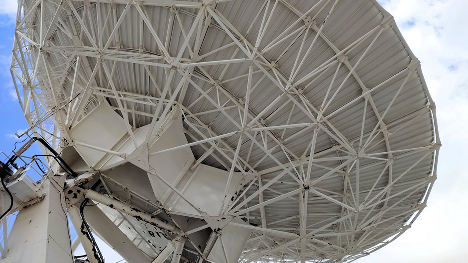
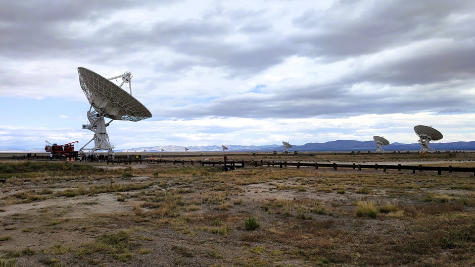
VLA Antenna Up Close (shown below) – Visitors can stand near one of the dishes to appreciate its size. Each antenna is mounted on railroad tracks and can be moved using massive transporters to different positions along the array’s arms, changing the telescope’s resolution. Each antenna weighs about 230 US Tons and has a dish 82 feet (25m) wide.
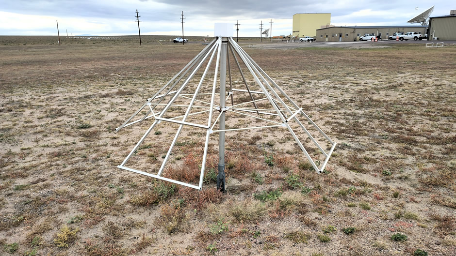
Radio Universe Gallery in the Gazebo (shown below) – A small exhibit inside here features images and explanations of cosmic radio sources, from pulsars to galaxies. It helps visitors visualize what the VLA detects, translating invisible radio waves into meaningful scientific data.
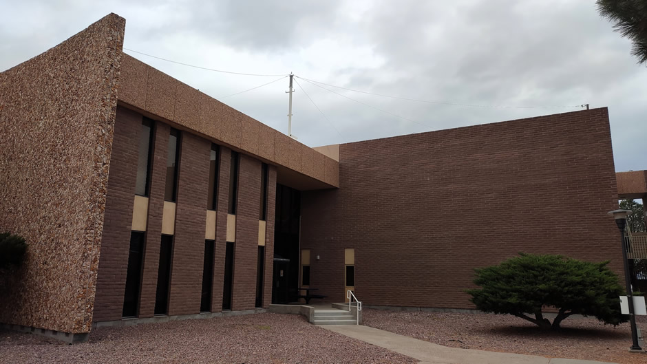
The Control Building (shown below) is the central hub for operations and where signals from all antennas are combined and the data is processed. It houses computers and staff who monitor telescope operations, ensuring accurate data collection.
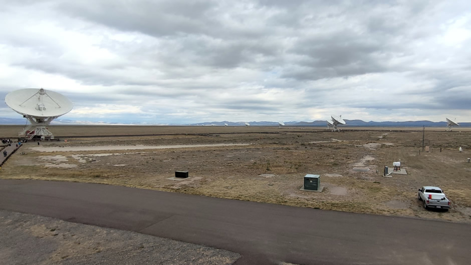
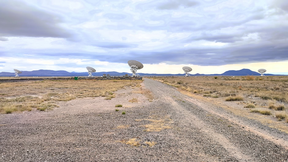
Steps on the outside of the Control Building lead up to an observation balcony, which offers panoramic views of the array. From here, visitors can see the Y-shaped configuration stretching across the plains:
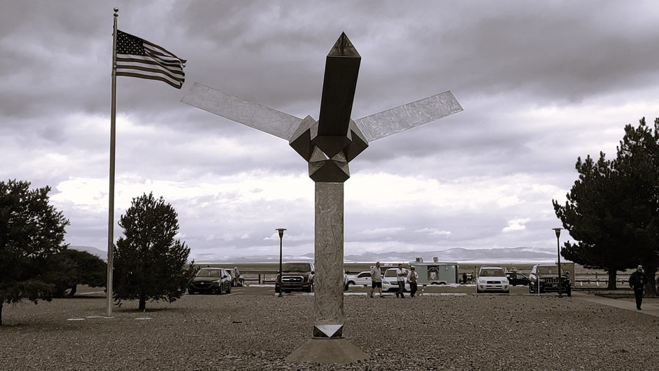
The stainless-steel Shiva Shiwana Sculpture (below) is a cultural artwork located at the site. It was created by American sculptor Jon Barlow Hudson in 1980 as a representation of the design and purpose of the VLA. Just as the antennas study distant objects in space and are moved along three Y-shaped rail tracks, the sculpture’s tetrahedral form and wings point outwards, echoing the array’s alignment with the cosmos. Its name, Shiwana, comes from the local Tewa language and refers to a healer believed to have gained power after being struck by lightning.
At the time of writing, VLA opening times are seven days a week from 9:00 A.M. to 4:00 P.M., with no visitors permitted on site after 4:00 P.M. without prior authorisation. Advanced admission purchase is strongly encouraged. The facility observes holiday closures on Thanksgiving Day and Christmas Day.
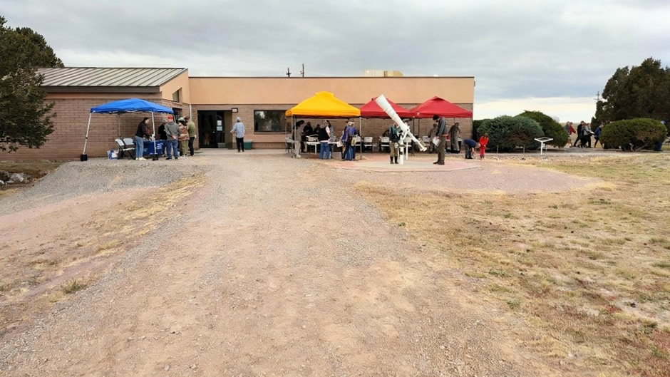
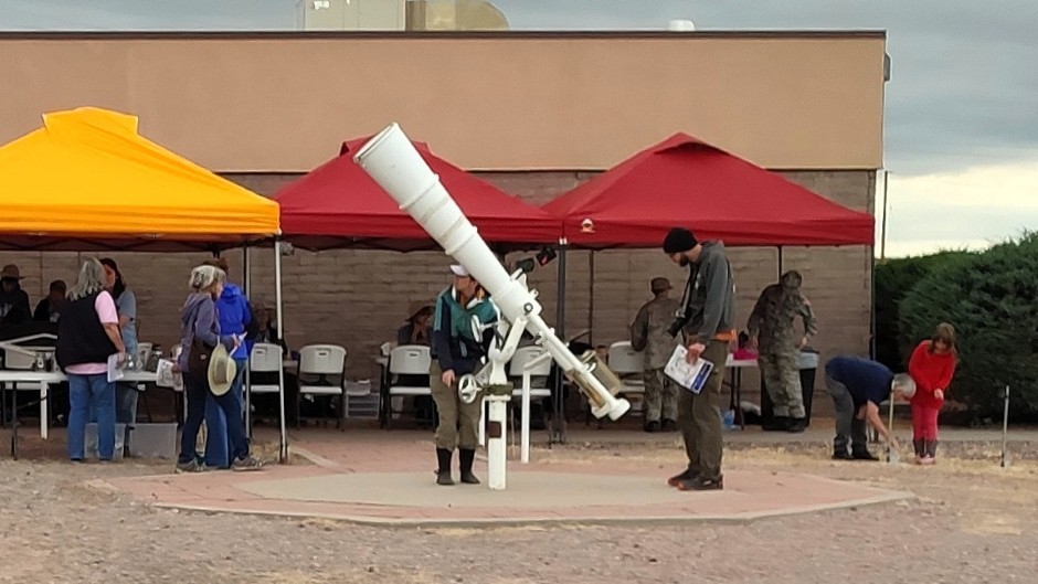
On this particular visit, we were fortunate enough to be in the area during one of their free Annual Open House events which take place twice a year (in Spring & Fall/Autumn). These events offer visitors a rare opportunity to explore the observatory beyond regular admission. They typically run from 9:00 A.M. to 4:00 P.M. and feature guided tours led by scientists and engineers, expert talks, hands-on learning activities, and family-friendly programmes. Guests can enjoy both self-guided and scheduled tours, with presentations repeated throughout the day to accommodate different arrival times. The open houses also include special attractions such as t-shirt making, food trucks, and photo opportunities across the Plains of San Agustin. Advanced registration is typically required to manage parking and visitor flow, although unaware of the Open House events, we were fortunate enough to be able to register upon arrival. The whole visit was both inspiring and informative from start to finish and the VLA is a true marvel of modern science.
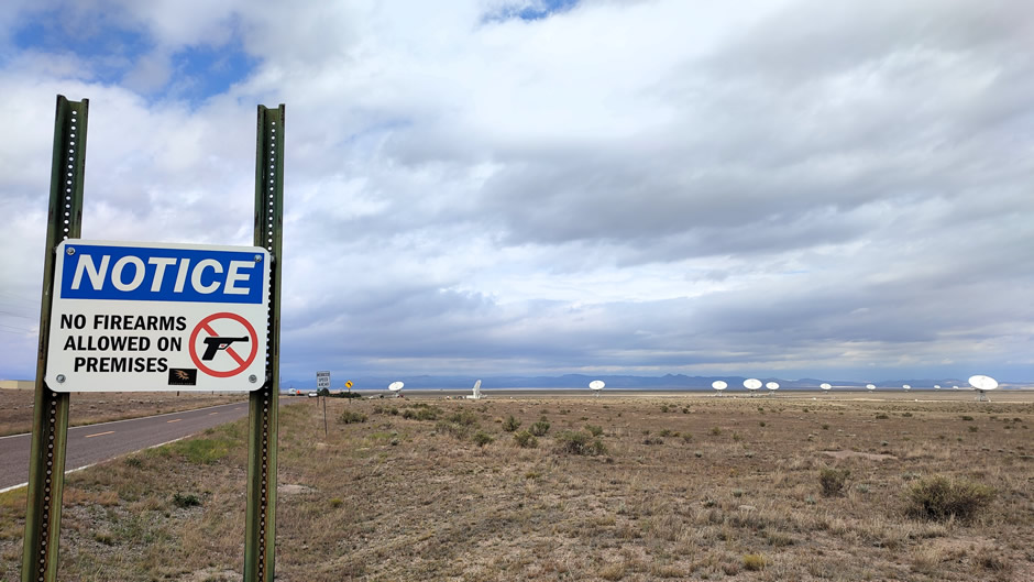
Finally, an important note about visiting worth mentioning here is that mobile phones must be set to airplane/flight mode at the site and turned completely off when not taking pictures. This is because their signals create powerful radio frequency interference (RFI) that can completely disrupt the telescope's sensitive astronomical observations. Drones are also strictly prohibited at the site.
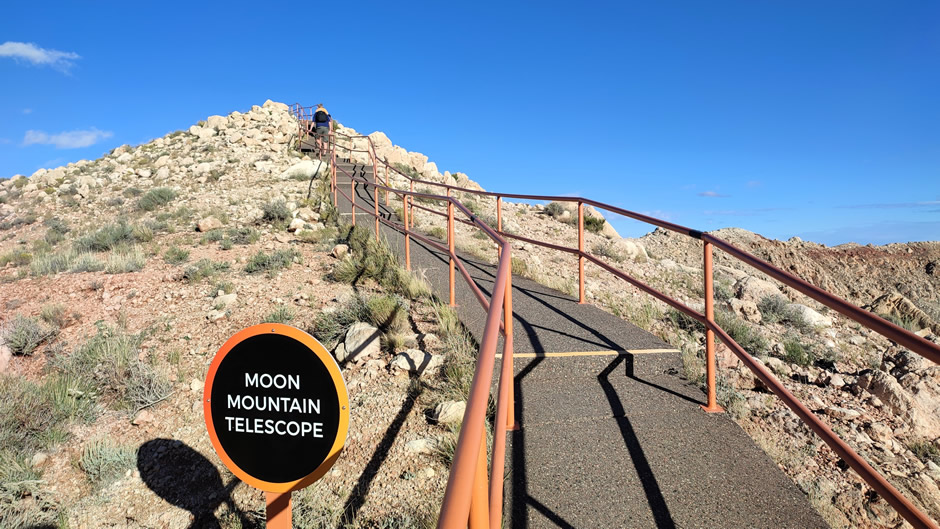
Meteor Crater Natural Landmark
Continuing on the space sciences theme, Meteor Crater in northern Arizona is one of the world’s best-preserved meteorite impact sites, notable for its scientific importance, historical associations, and ease of access for visitors.
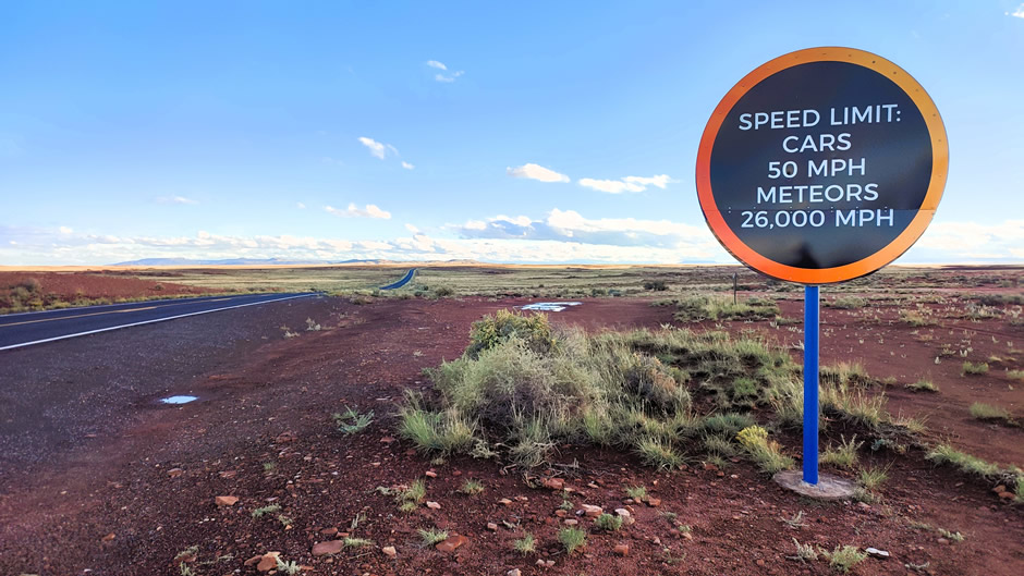
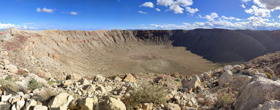
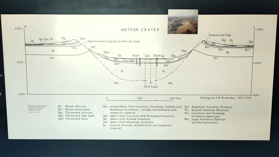
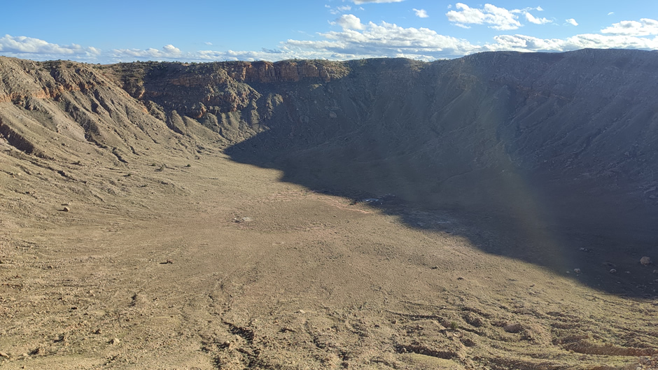
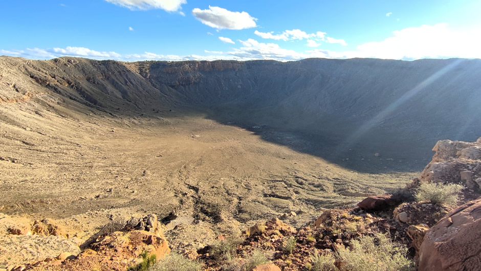
Meteor Crater, also known as Barringer Crater, lies about 37 miles (60km) east of Flagstaff and 18 miles (29km) west of Winslow. It measures 4,000 feet (1.2 km) in diameter, 560 feet (170m) deep, and rises 150 feet (45m) above the surrounding plains. Formed around 50,000 years ago when an iron meteorite struck at tremendous speed, the site is globally significant as the first recognised meteorite impact crater on Earth.
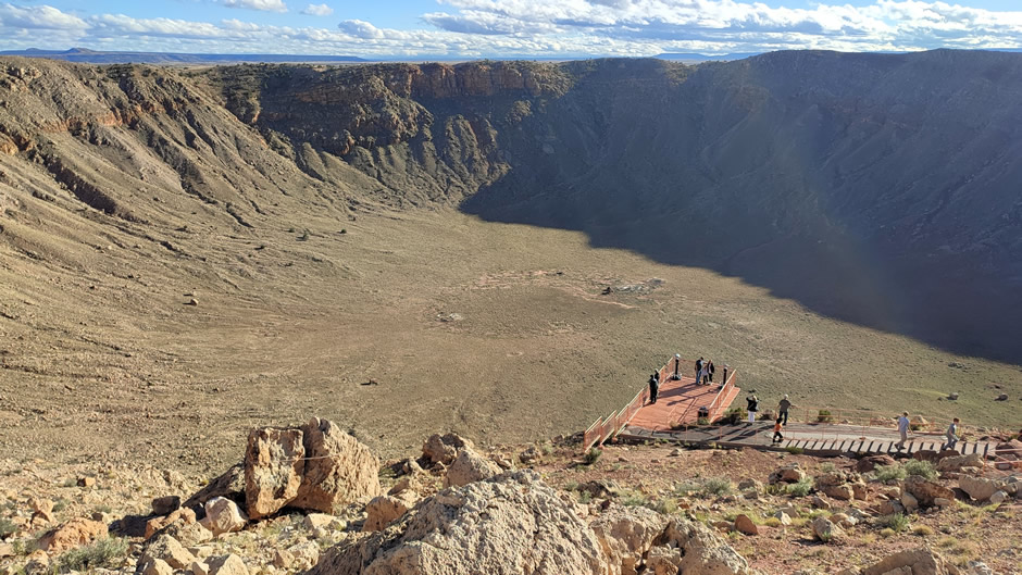
Above: Composite image of the 560-foot-deep crater (stereographic projection).
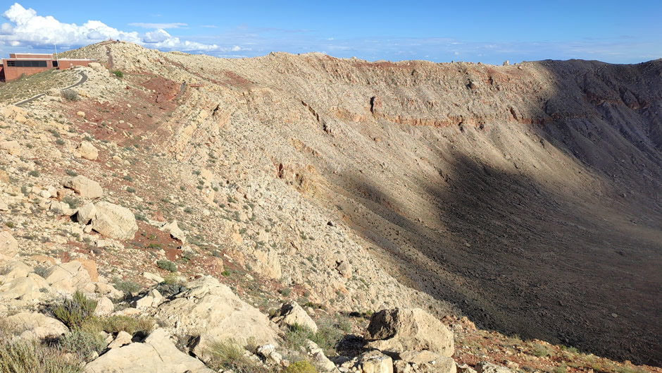
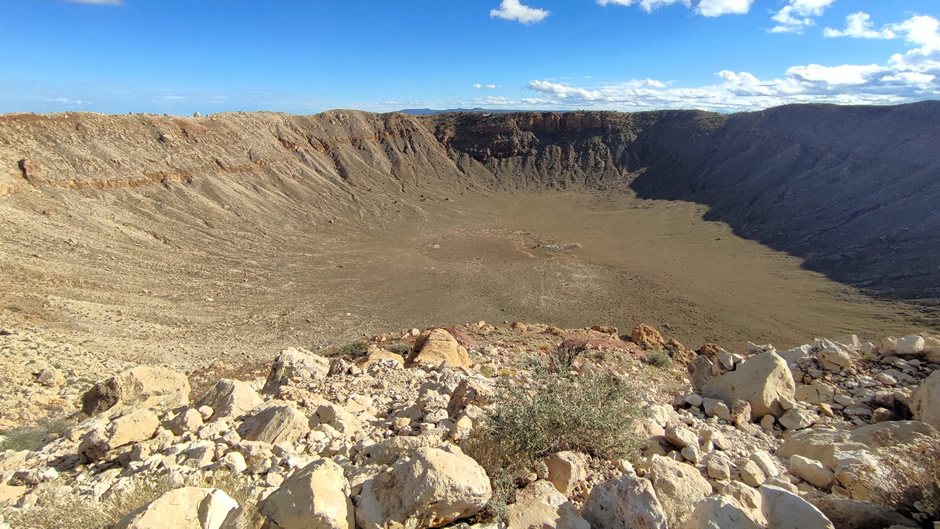
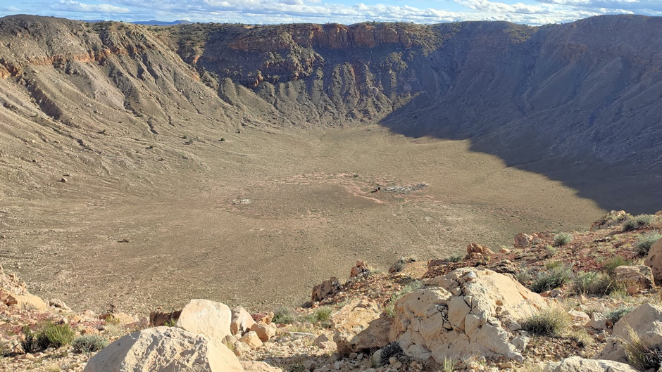
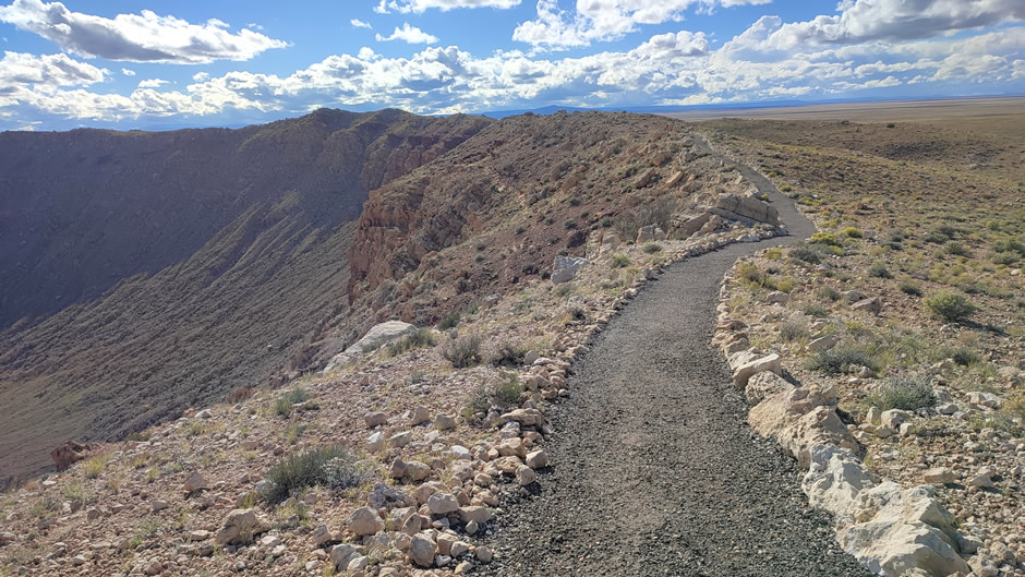
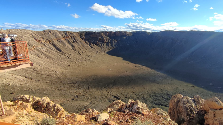
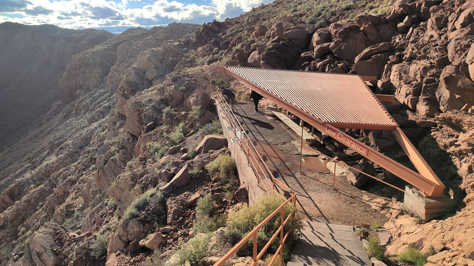
Above: Photos taken on the guided rim walk included with the entrance ticket. From here, it is possible to see not only the crater itself, but the rim of the crater caused by the impact, in an otherwise flat landscape.
The meteorite collision released energy equivalent to millions of tons of TNT, scattering fragments known as the Canyon Diablo meteorite (named after a small gorge located about 3-4 miles west of the crater and where the meteorite fragments were found). Early geologists debated whether the crater was volcanic, but mining engineer Daniel Moreau Barringer argued in the early 20th century that it was meteoritic. He invested heavily in drilling operations, hoping to find the meteorite’s remains, but discovered only fragments rather than a large buried mass. In 1960, a natural occurrence of coesite from the crater was reported by Edward C. T. Chao in collaboration with Eugene Shoemaker (the letter being co-discoverer of Comet Shoemaker–Levy 9 which collided with Jupiter in 1994). Coesite is a form of silicon dioxide that is formed when very high pressure and moderately high temperature are applied to the common mineral quartz. The presence of this high-pressure mineral provided evidence that the crater must have been formed by an impact, rather than the earth’s natural geological processes. This work helped establish criteria for recognising other impact craters worldwide.
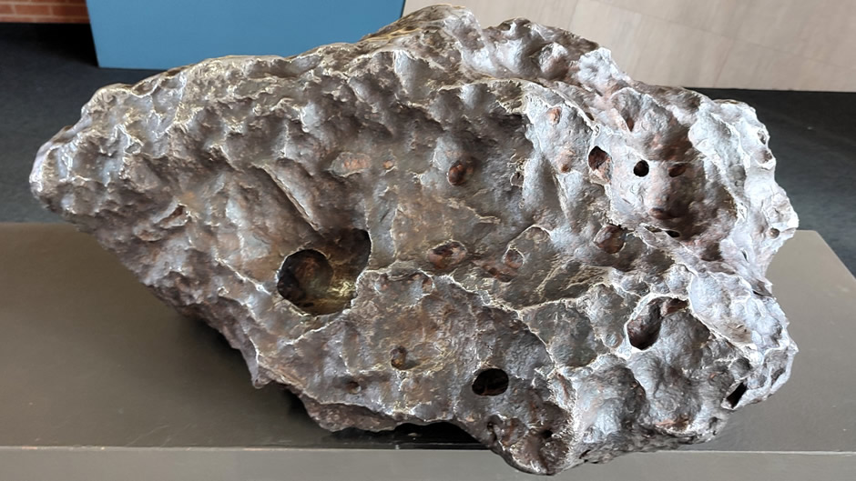
Above: The Holsinger fragment, at roughly 2½ feet (0.8m) across and weighing 1,409 pounds (639kg), is the largest discovered piece of the 150-foot (45m) meteorite that created Meteor Crater, and it is exhibited in the crater visitor centre. It is the largest surviving piece of the Canyon Diablo meteorite, and it is composed primarily of iron and nickel. The sample’s more than a dozen identifiable minerals include troilite (FeS), which has been important in geologic dating studies.
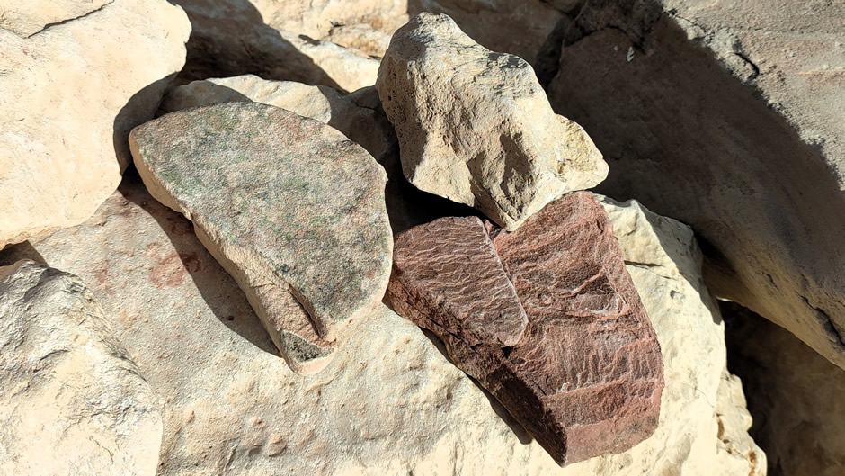
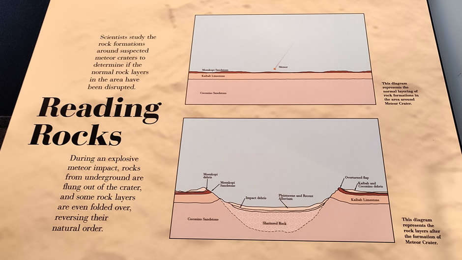
Above: Three primary types of rock shown on the guided walk at Meteor Crater. They are all sedimentary rocks found in the local stratigraphy that was overturned by the impact. They are 1) Coconino Sandstone – a grey to whitish eolian (windblown) sandstone that makes up most of the visible crater walls, 2) Kaibab Formation – primarily a greyish-yellow dolomite and limestone layer containing marine fossils, which was deposited in a shallow sea environment, and 3) Moenkopi Formation – a dark reddish-brown mudstone found near the surface outside the rim, which includes ripple marks from an ancient coastal floodplain environment. These layers, originally deposited horizontally over millions of years, were dramatically uplifted and overturned by the immense force of the impact. The guides use samples of these specific rocks, along with fragments of the Canyon Diablo iron-nickel meteorite itself, to explain the geology of the crater's formation and the evidence for the impact origin.
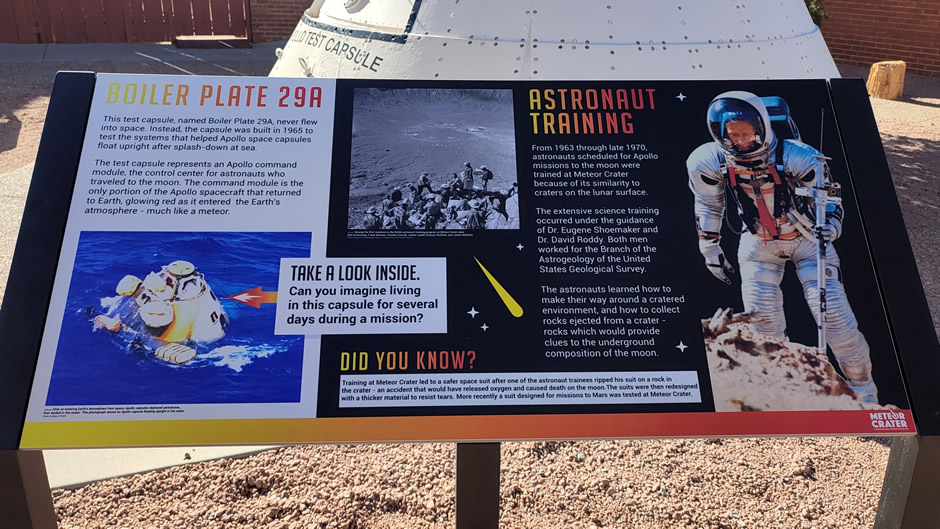
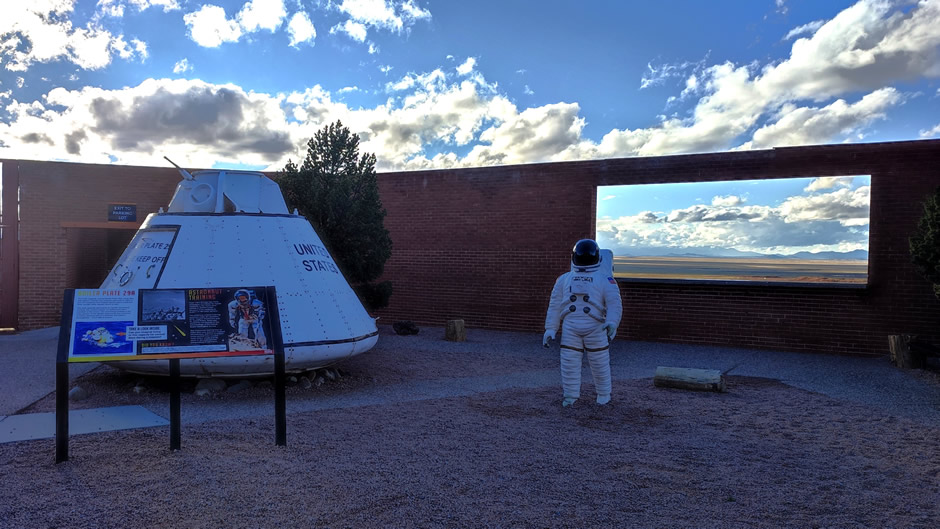
Ownership of the Meteor Crater site passed through families including the Tremaines and Chilsons, who managed access and preservation. The crater also became linked with popular culture; Apollo astronauts trained here to prepare for lunar geology, and the dramatic landscape attracted filmmakers and celebrities. Notably, a light-plane crash at the crater in 1964 due to a stall and "unwarranted low flying" added to its unusual history (no one was killed).
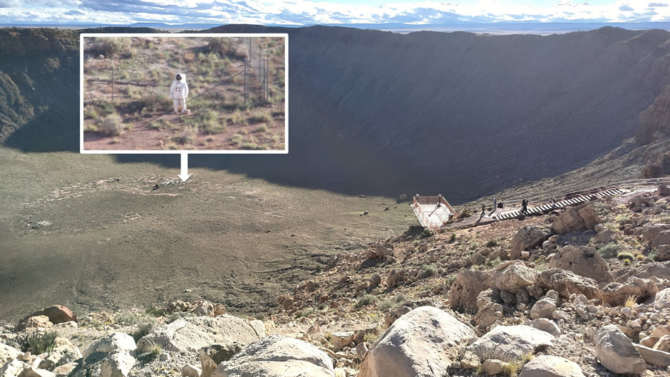
Above: A life-sized astronaut mannequin placed at the bottom of the crater to help visitors grasp the immense scale of the impact site, as it looks much smaller from the rim. It also commemorates the site's use by NASA for training Apollo astronauts for lunar missions, as its landscape strongly resembles the Moon. Astronauts practiced geology, tested spacesuits, and learned about lunar terrain in the crater, which is one of Earth's best-preserved impact craters. Inset photo taken with a camera zoom lens (approx. x90).
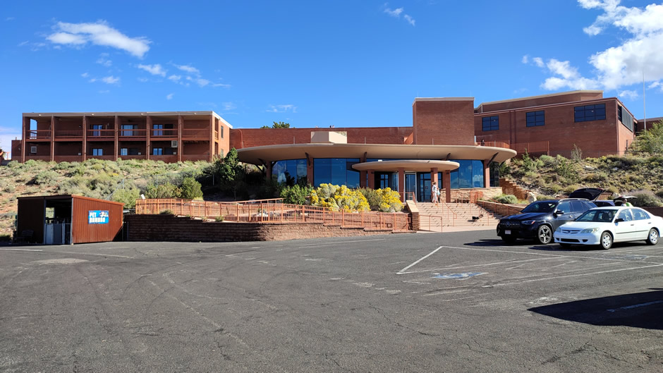
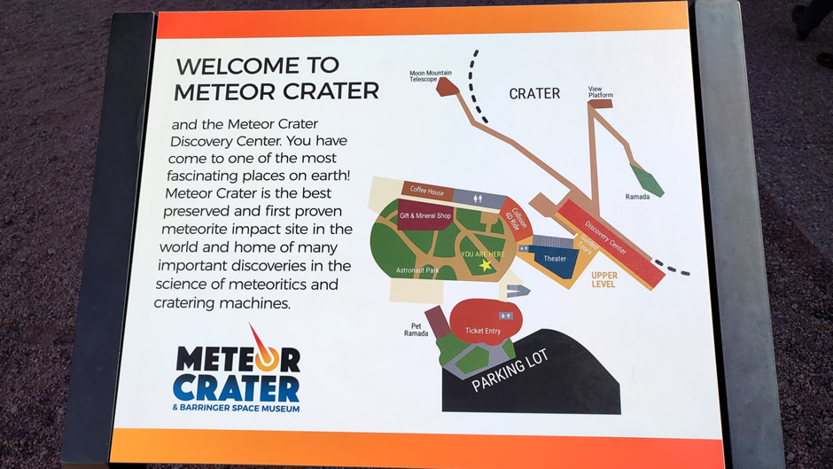
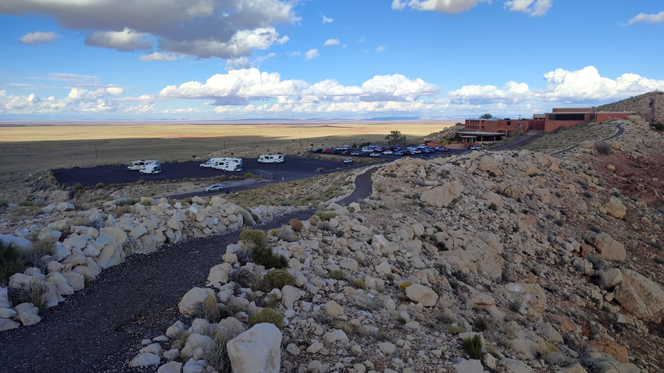
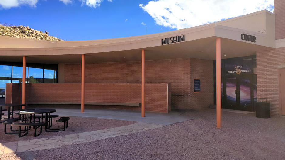
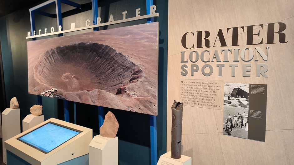
Today, Meteor Crater is privately managed by the Barringer Crater Company. For visitors, there is an excellent discovery centre and space museum with interactive exhibits, and guided rim walks. Viewing platforms provide panoramic perspectives of the crater’s scale, while the museum highlights its role in planetary science and space exploration. The site cannot be accessed by the public without tickets purchased on entry.
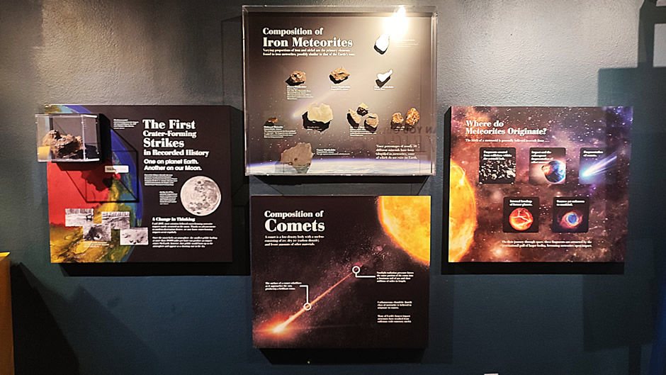
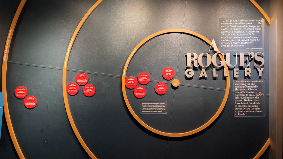

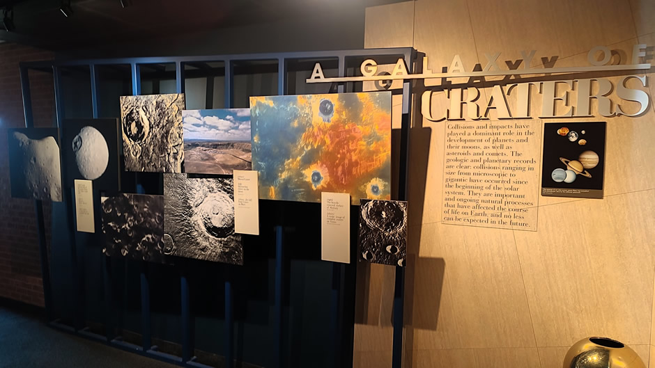
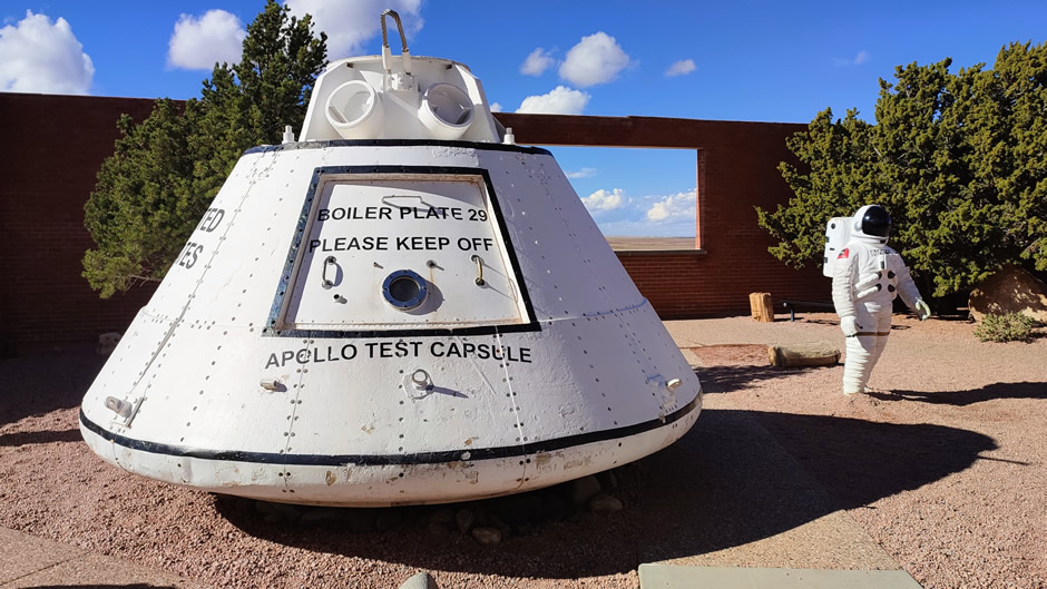
Above: A few photographs taken at the museum
Meteor Crater is considered worth the admission fee by many visitors because it is the world’s best-preserved meteorite impact site. The sheer scale alone creates a breathtaking “wow factor” that is even more impressive in person. Beyond its natural grandeur, factors such as the excellent visitor’s centre, educational value, engaging displays, and well-designed viewing platforms make it worth the visit. However, admission is not cheap, and some visitors question the for-profit model. Access to the crater floor is typically restricted, though creative displays help convey its immense size. Ultimately, whether the visit feels “worth it” depends on the individual’s personal interest in geology, space exploration, or extraordinary natural landmarks. In essence, the fee grants access to a world-class, privately-owned scientific site that delivers an immersive and educational experience unlike anywhere else and the author of this webpage considered it one of the highlights of the road trip.
Above: Photos including those taken from the viewing platform areas accessed from the Discovery Center and Space Museum (not-guided), and the giftshop.
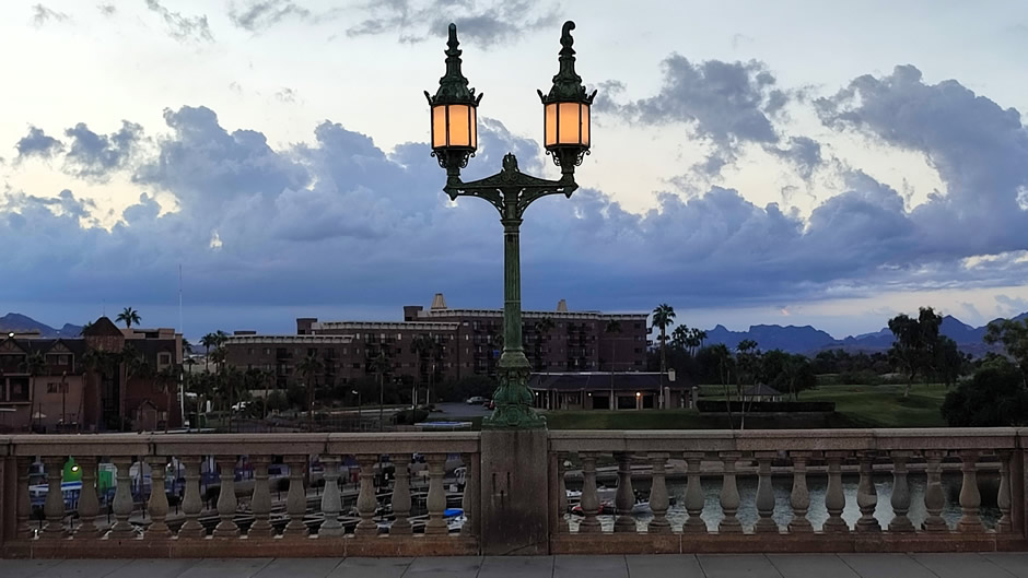
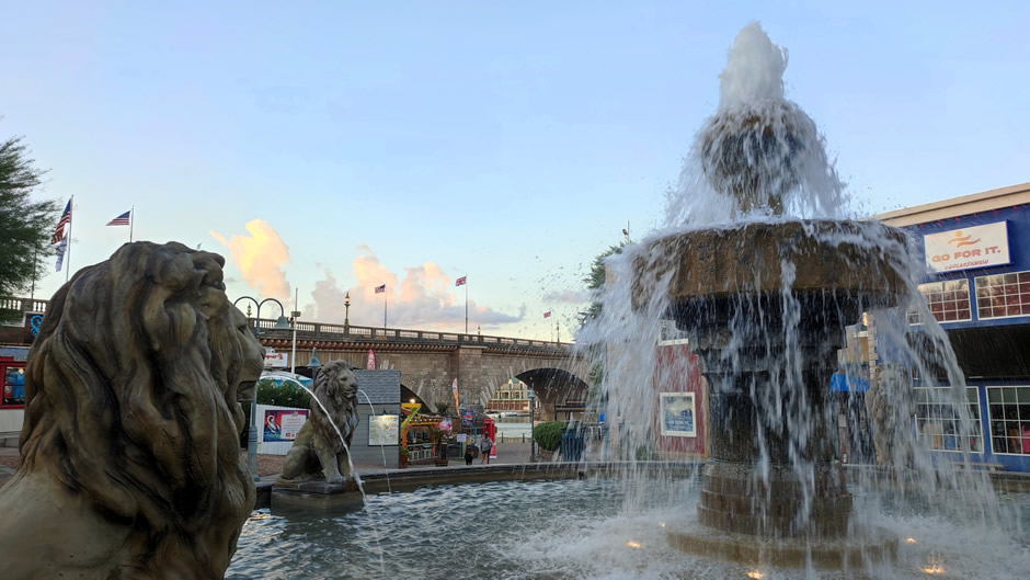
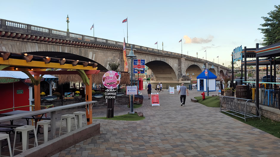
The final stopover on this road trip (before a long drive back to Los Angeles) was at Lake Havasu City. This major resort destination is best known for its iconic London Bridge, relocated from London, and the adjacent English Village, which together form the centrepiece of this community. It is also well-known as a base for trails in the nearby desert and for its vibrant water recreation scene, with boating, jet skiing, and fishing on Lake Havasu.
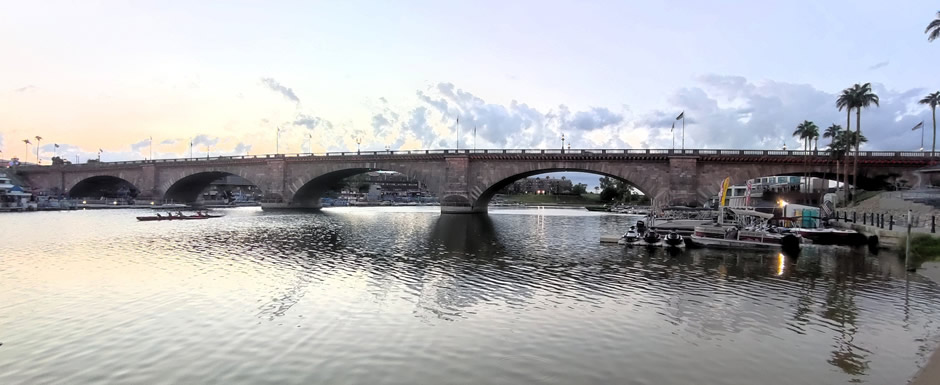
Above: London Bridge in Lake Havasu City is 930 feet long with five spans, originally crossing the River Thames in London. When it was relocated to Arizona in 1971, the bridge was reconstructed stone by stone using 10,276 hand-numbered granite blocks weighing a total of 33,000 US tons.
Located in western Arizona along the Colorado River, Lake Havasu City was founded in 1963 and gained international attention in 1971 when the historic London Bridge (the 1831 version) was reconstructed here after being purchased and relocated from London.
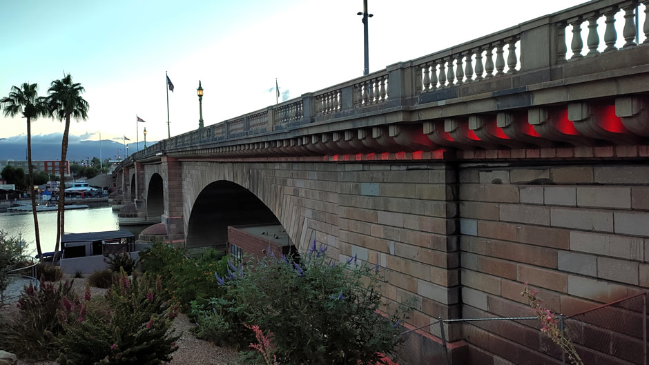
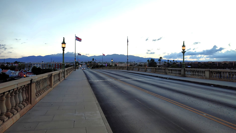
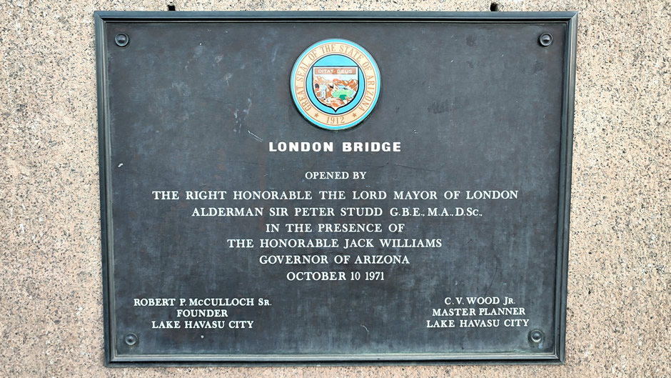
The bridge was sold in 1968 because it was sinking into the River Thames and couldn't handle modern traffic loads; it was purchased by American entrepreneur Robert McCulloch, who dismantled it and rebuilt it as a tourist attraction in Lake Havasu City. The city needed a new, functional bridge, and McCulloch wanted a landmark to draw visitors to his new desert development. The popular myth that he mistook it for Tower Bridge is false, but the story helped generate publicity.
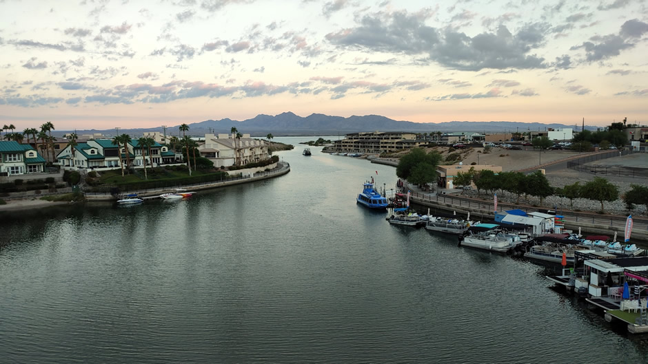
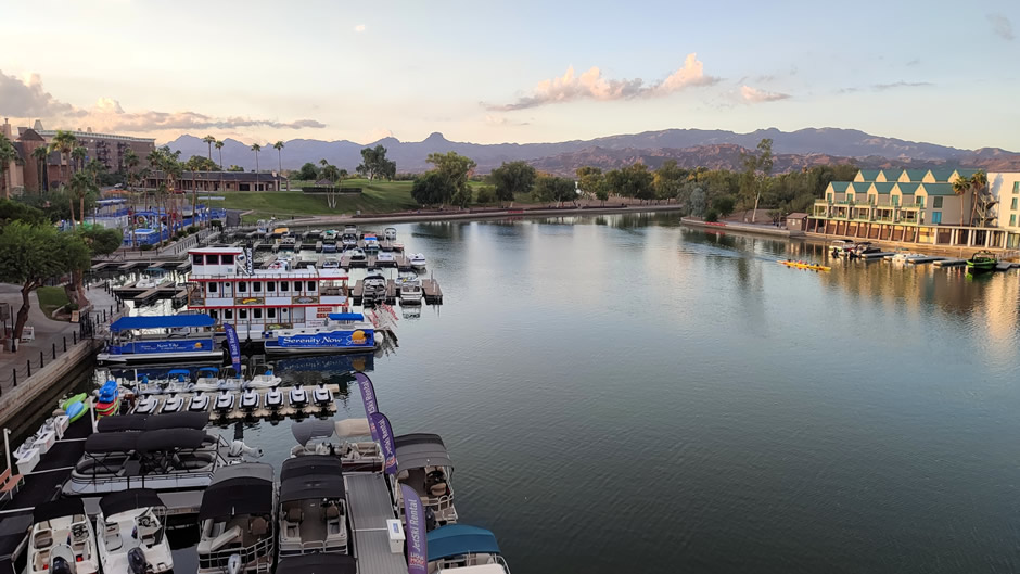
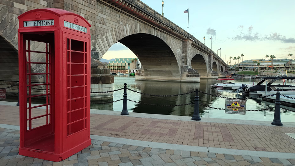
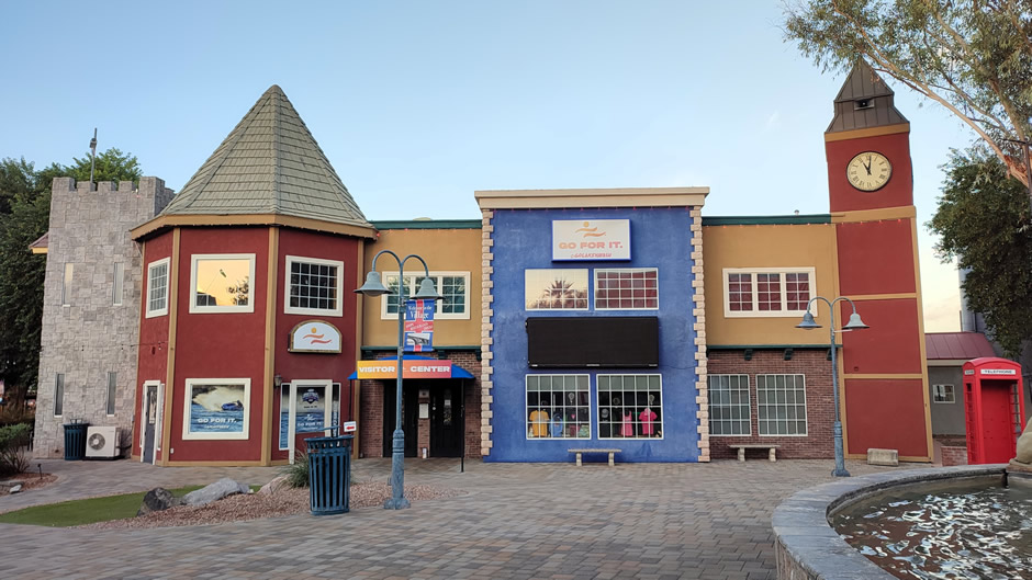
Today, the bridge crosses the Bridgewater Channel and leads directly into the English Village, a waterfront area with shops, dining, and the official Lake Havasu City Visitor Center, which provides maps, guides, and local information. The city has a population that includes many retirees, drawn by the warm climate and recreational opportunities.
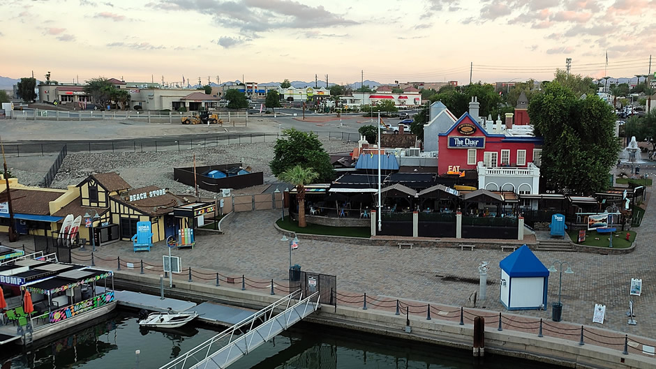
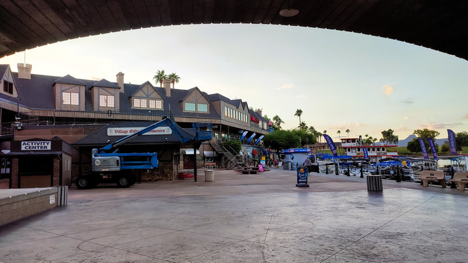
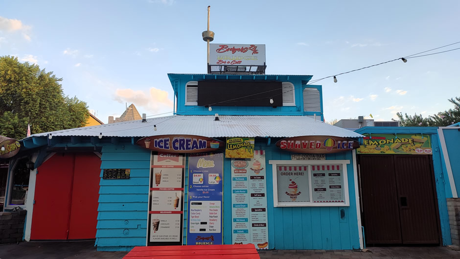
Visitors can enjoy a wide range of activities. On the lake, options include boating, launching from marinas and ramps, fishing, and swimming at beaches. In the surrounding desert landscape, there are opportunities for off-roading, cycling, hiking, and walking trails. The city also hosts annual events, supports birdwatching and wildlife viewing, and features unique attractions such as replica lighthouses along the shoreline. For leisure, there are parks, sports facilities, shopping areas, art galleries, performing arts venues, and gaming. Dining ranges from casual eateries to waterfront restaurants, and accommodation options include hotels, resorts, and vacation rentals. Day trips to nearby desert and river destinations add to the appeal.
A lot was packed in during the 15-night road trip. Although at the time of the visit (in 2025), there was a cost-of-living crisis affecting many countries, the price of the flights was the lowest ever seen, and combined with the flexible mode of travel and accommodation (hire-car, inexpensive motels, supermarket shopping), the total cost was kept to a minimum. Clearly much more time could have been spent at many of the locations, such as the Grand Canyon, and Arches National Park, not to mention Los Angeles itself, which could have kept us busy for longer than the whole of the trip itself. However, this was a road trip and it certainly provided an excellent overview of the American Southwest, whether it be its outstanding geography and geology, its native and European history, the science and engineering places of interest, the attractions of Las Vegas, or the seemingly endless film and television locations, and so forth.
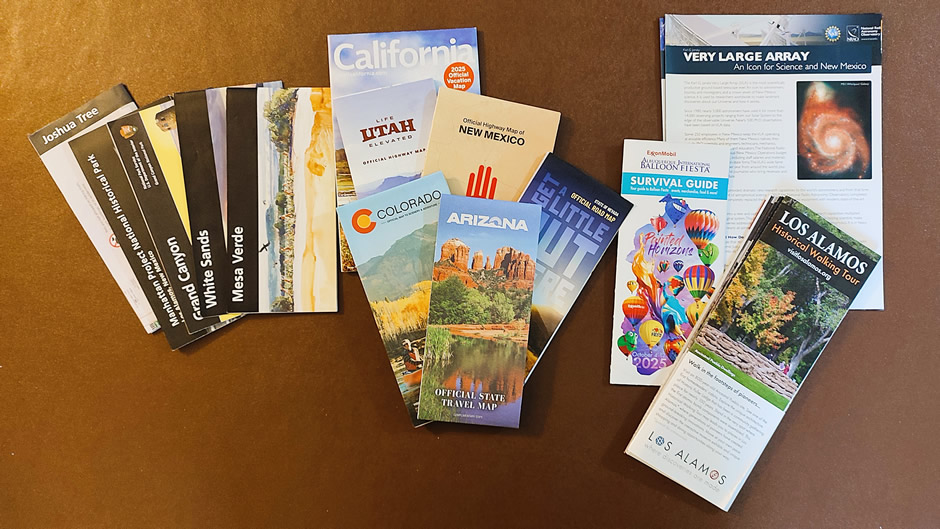
Above: Some informative literature and maps picked up along the way
America is a land where every road trip offers its own unique experience. A land of contrasts – not just from region to region, but from area to area within a given region. Like previous such visits to America (from the UK), this trip didn’t fail to surprise, nor disappoint. Having had the chance to make this journey and the memories that came with it is something to be truly grateful for.
Above: Some souvenirs picked up along the way (purchased and freebies!)
Link to Previous Page (Page 10 of 11)
Link to First Page (Page 1 of 11)
Back to Top