The Great Lakes of North America
The Great Lakes are a well-known chain of five freshwater lakes in central North America bound by Canada and the United States. Formed at the end of the last Ice Age from depressions carved by the Quaternary ice sheet, from West to East, the Great Lakes are lakes Superior, Michigan, Huron, Erie and Ontario. Connected by straits, rivers and canals, they provide a continuous waterway, drained by the St. Lawrence River/St. Lawrence Seaway, which leads out into the Atlantic Ocean. The opening of the Erie Canal in 1825 connected Lake Erie with the Hudson River, New York and the Atlantic Ocean, whilst the deepening of the St. Lawrence River opened up the lakes to global shipping. Meanwhile, the Illinois Waterway connects the lakes with the Mississippi River, which flows out into the Gulf of Mexico via the Mississippi River Delta. Heavy industrialization along the fringes of the Great Lakes has greatly increased pollution, particularly lakes Erie, Ontario and Michigan. Major cities to be found on their shores include Buffalo, Chicago, Cleveland, Detroit, Hamilton, Milwaukee, Rochester, Toledo and Toronto.
Above: Fully zoomable map centred on the Great Lakes (courtesy of Openstreetmap.org)
There are several other pages on this website dedicated to various places visited by the author which are to be found around the Great Lakes, and so the purpose of this webpage is to provide a comprehensive summary of the lakes themselves, along with a series of internal links to the relevant pages also to be found on this website.
At 94,250 square-miles (244,106 km²) total, the Great Lakes make up the largest group of freshwater lakes on Earth by surface area. However, in terms of total volume (5,439 cubic-miles, or 22,671 km³ measured at the low water datum), they are (by a relatively small margin) the second-largest on Earth; they contain 21% of the world's surface fresh water by volume, whereas Lake Baikal in Russia (which has an estimated maximum depth of a little over a mile) contains some 22-23% of the world's surface fresh water by volume.
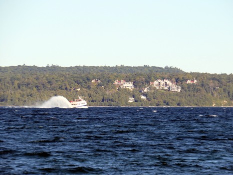
Lake Superior
Lake Superior is the world's largest freshwater lake by surface area and the third-largest freshwater lake in the world by volume (after Lake Baikal in Siberian Russia and Lake Tanganyika in the African Great Lakes of the East African Rift zone). Lake Superior is surrounded by the Canadian province of Ontario to the north and east, and three U.S. States, namely Minnesota to the west, and Wisconsin and Michigan’s Upper Peninsula to the south.
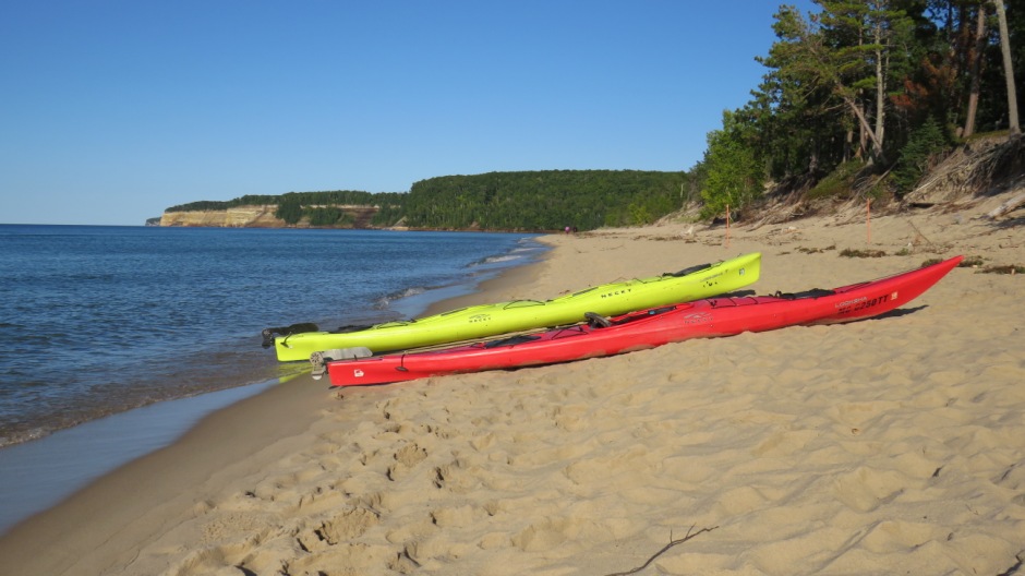
Above: Lake Superior as seen from Pictured Rocks National Lakeshore, Michigan
Lake Superior was discovered in 1622 by Étienne Brulé. It flows into the St Mary’s River and is connected to Lake Huron and the St. Lawrence Seaway by the Sault Sainte Marie Canals, or Soo Canals (Link Here). A centre for commercial and recreational fishing, the lake is also a major commercial transportation route, particularly for grain and iron ore. Also featured on this website is a page on the Pictured Rocks National Lakeshore, which is located on Lake Superior’s south-eastern shores on Michigan’s Upper Peninsula (Link Here).
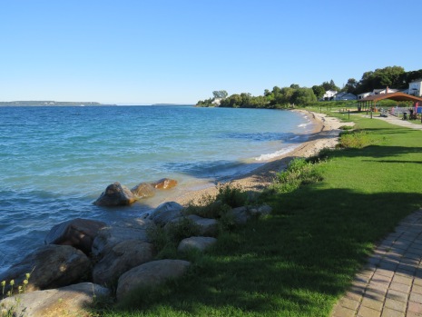
Lake Michigan
Lake Michigan is the third-largest of the Great Lakes and is connected with Lake Huron by the Straits of Mackinac. It is the only one of the Great Lakes which lies entirely within the United States. It was discovered by the French explorer Jean Nicolet in 1634 and like the other Great Lakes, the St. Lawrence Seaway opened it up to international trade.
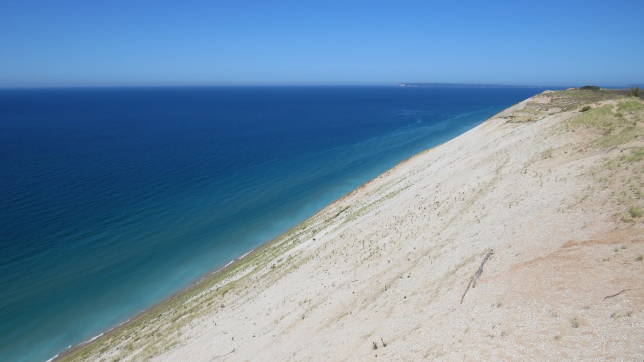
Above: Lake Michigan as viewed from the Sleeping Bear Dunes National Lakeshore
On its south-western shore is the city of Chicago (Link Here) and to the north of Chicago along its shores is the city of Milwaukee (Link Here). Also featured on this website, on the eastern side of the lake and in the northwest of Michigan’s Lower Peninsula is the Sleeping Bear Dunes National Lakeshore (Link Here) and on its southern shores, in Indiana, is the Indiana Dunes State Park (Link Here).
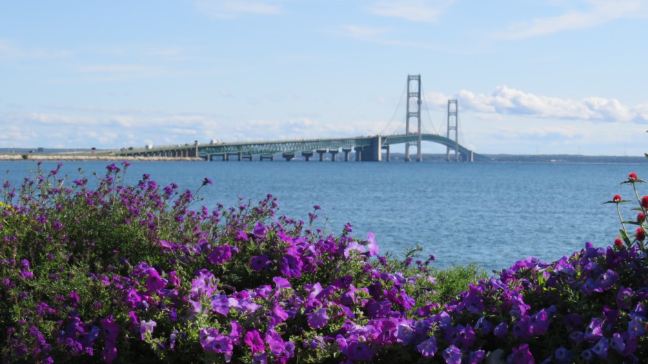
As mentioned above, Lake Michigan is connected with Lake Huron by the Straits of Mackinac. Spanning the straights is the 5-mile (8km) long Mackinac Bridge (shown above) that connects the state of Michigan’s Upper Peninsula and Lower Peninsula. The bridge opened on the 1st November, 1957, and carries four lanes of interstate highway I-75. At the bridge’s centre is a suspension section which has a main span of 3,800 feet (1,158m), supported by cables running down from towers 552 feet (168m) tall (including the deck height of 200 feet/61m). Crossing the bridge requires a toll and there is no pedestrian access, although every year on Labor Day, the Mackinac Bridge Walk takes place. This event allows people to walk over its entire length and is the only day of the year that hikers can hike this section of the North Country National Scenic Trail. Some more photographs taken from a visit to, and over, the Mackinac Bridge can be seen on a separate webpage Here.
Lake Huron
Lake Huron is the second-largest of the Great Lakes and forms part of the boundary between the United States and Canada. It drains Lake Superior and feeds Lake Erie as part of the Great Lakes-St. Lawrence Seaway system and is navigable by ocean-going vessels.
 |
||
 |
 |
|
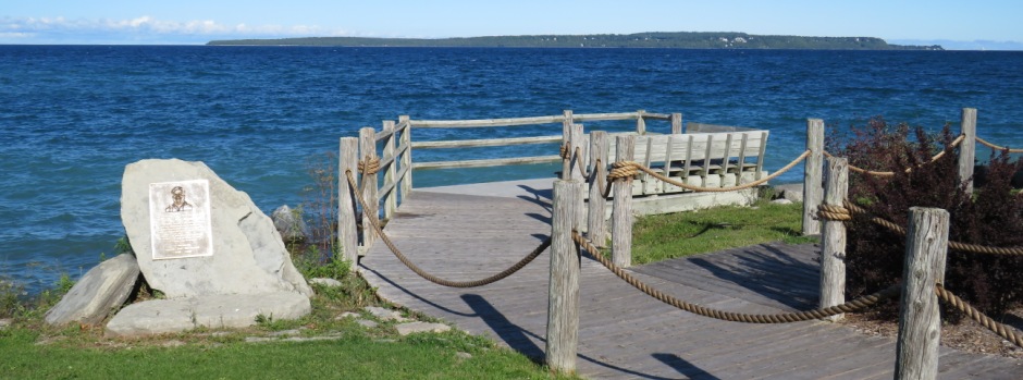
Above: Views of Mackinac Island and Lake Huron seen from St. Ignace, Michigan. Mackinac Island sits in Lake Huron, between Michigan’s Upper and Lower peninsulas.
Water from Lake Huron feeds into the St. Clair River, and then onwards into Lake St. Clair. Significantly smaller than the five Great Lakes, Lake St. Clair is rarely included as one itself, but is sometimes referred to as "the sixth Great Lake”. From here, water flows into Lake Erie via the Detroit River which, as the name suggests, the city of Detroit is located on (Link Here), as well as the city of Windsor, Ontario, across the river on the Canadian side.
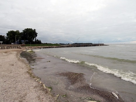
Lake Erie
Lake Erie is bordered by Ontario to the north and west, New York State to the east, Ohio and Pennsylvania to the south and Michigan to the southwest. Again, part of the Great Lakes-St. Lawrence Seaway system, it was discovered in 1669 by the French explorer Louis Jolliet. It is the shallowest and second -smallest of the Great Lakes. In its modern history, industrial cities have polluted it, although government regulations have helped with its recovery. Surrounded by cities, such as Toledo, Cleveland and Buffalo, the lake is also a focal point for leisure activities, in particular the shoreline city of Sandusky in Ohio, which is known for its family attractions, including water, wildlife and amusement parks, perhaps most famously Cedar Point, dubbed “The Roller Coaster Capital of the World”. The photographs below show Lake Erie, as seen from Luna Pier, a small city in Monroe County, Michigan.
 |
||
 |
 |
|
Above: Lake Erie, as seen from Luna Pier, Michigan
From Lake Erie, the water then flows into Lake Ontario, via the Niagara River. The river here is, of course, known for the world-famous Niagara Falls (Link Here). Shipping bypasses the Niagara River, moving between Lake Erie and Lake Ontario from Port Colborne to Port Weller via the Welland Canal in Ontario, Canada.
Lake Ontario
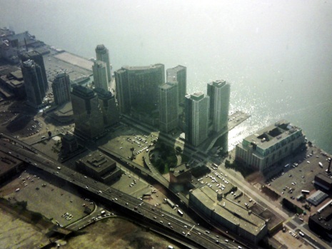
Lake Ontario is the smallest of the Great Lakes and is bounded by New York State to the south and east and the Canadian Province of Ontario to the south, west and north. The lake is fed primarily by the Niagara River and drained to the northeast by the St. Lawrence River. Forming part of the St. Lawrence Seaway, Lake Ontario is a busy shipping route and in its modern history, a serious problem has been man-made pollution. Chief cities on the lake include Toronto (Link Here), Hamilton and Kingston on the Canadian side and Rochester and Oswego on the US side.
 |
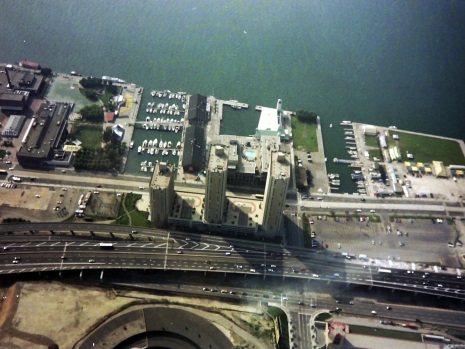 |
Above: The shores of Lake Ontario, as seen from Toronto’s CN Tower
As mentioned several times above, the St. Lawrence Seaway forms part of the Great Lakes-St. Lawrence Seaway system. This international waterway in Canada and the United States consists of a series of canals and locks in the St. Lawrence River between Lake Ontario and Montreal (Link Here). The waterway permits the passage of ocean-going vessels to the industrial lakeside ports of central North America. Chief cargoes carried along here include iron ore, coal and wheat. Construction of the waterway was authorised by Canada in 1951, and by the United States in 1954 with construction commencing in 1955 and completed in 1959.
Back to Top