Pictured Rocks National Lakeshore
Located on the Upper Peninsula in Michigan, USA, Pictured Rocks National Lakeshore covers a 42-mile (67½km) stretch along the shores of Lake Superior. With an area of 114 square miles (296km²), it is one of the scenic highlights of the state. It includes a spectacular array of multicoloured cliffs up to 200 feet high, waterfalls, rolling dunes and quiet sandy beaches. Over 1000’s of years, the effects of wind, rain, ice and the sun have resulted in the formation of arches, columns and caves along the face of the lakeshore, all stained different coloured hues. The dramatic sandstone cliffs are coloured ochre, tan and brown, sandwiched with layers of white and green and run for 15 miles northeast from the city of Munising in the direction of Grand Marais.
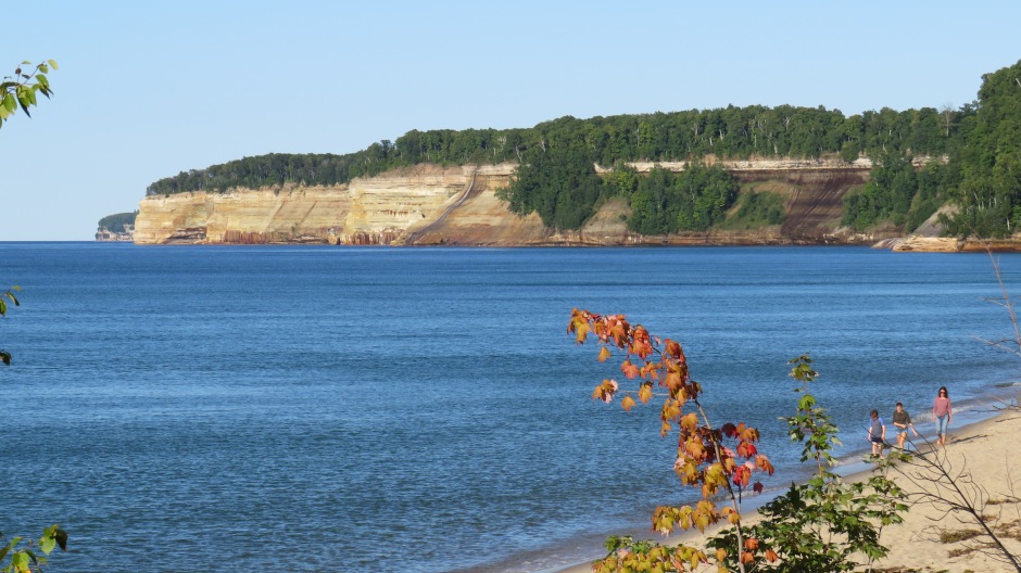
Although the best way to see the cliffs by boat, during the visit featured on this page, limited time did no permit this. However, there are excellent opportunities to view the cliffs from land, the most popular perhaps being the Miners Castle, which is located on a headland, jutting out into the lake. Commercial boat tours leave from the city dock in Munising from late spring through to the autumnal-colour season. Highway-58 runs along the edge of the park from Munising to the west, eastwards to the small village of Grand Marais. The main visitor centre is located on the edge of the former and there are smaller, seasonal visitor centres at other locations throughout the park (Munising Falls, Miners Castle and Grand Sable). Sites which can be visited along the land-based route include Miners Castle (a 9-storey sandstone pinnacle, 12 miles east of Munising) and the Log Slide (a large dune). The park contains a number of hiking trails which run from the highway out to the shoreline; of note is the loop trail to Chapel Falls and Chapel Beach. Photographs of the sites at Pictured Rocks National Lakeshore seen during a visit here in September 2018 are shown below, accompanied by some explanatory text. They show some of the highlights, although there are many more to be seen in the park if time permits:
Munising Falls
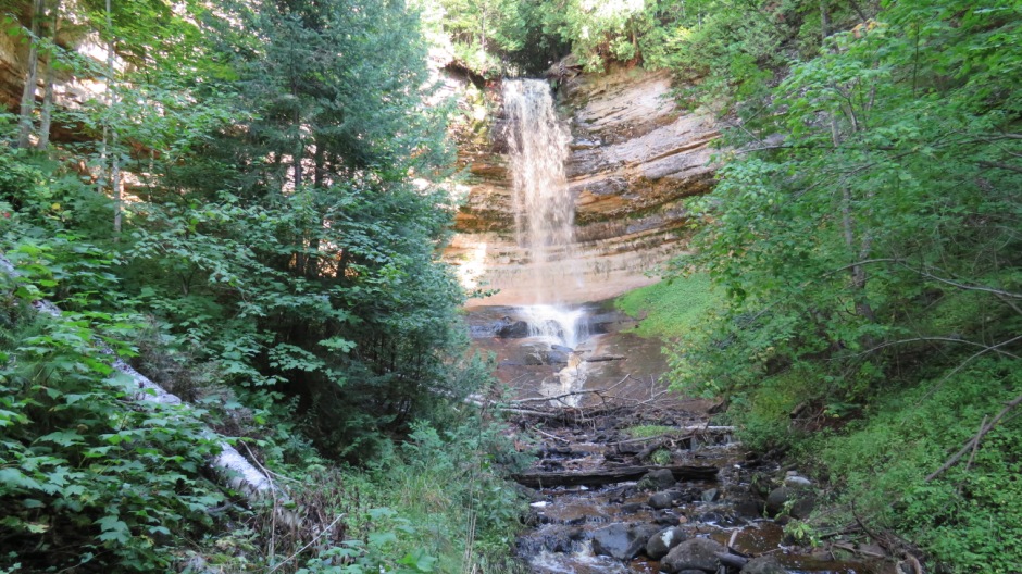
The first stop on the visit featured here was at the Munising Falls, which are shown in the photograph above. This waterfall is in the westernmost portion of the Pictured Rocks National Lakeshore. Munising creek has, through thousands of years, eroded the Munising Formation sandstone here, resulting in a horseshow-shaped valley, gradually carved out by the creek. This process is ongoing, as the waterfall continues to carve the sandstone deeper and wider over time. The resulting waterfall seen today drops some 50 feet (15m), or so over a sandstone cliff. It is fed by a natural spring, a few miles back from the top of the ridge and the water from the falls flows freely into Lake Superior. A very well-laid out set of trails, starting off on a path from the car park and Visitor Center, lead to multiple viewpoints around the beautiful falls. Apart from during springtime, during the thaw, the volume of water over the falls is at its greatest and it is during this time, erosion, often in the form of falling rock, is most common; freeze and thaw action loosens pieces of the moisture-laden wall. Cracks or faults in the rock have hastened this process. During the summer and autumn, the amount of water flowing over the falls occurs at a relatively low rate. Rockfalls have occurred several times over recent years, prompting closure of a trail running behind the falls – it is strongly advised to observe any warning signs about closed-off areas due to the risk of rockfall. During the winter months, Munising Falls freeze up completely, resulting in the formation of an ice column. Inside the seasonal Visitor Center are various displays about the natural and cultural history of the Pictured Rocks National Lakeshore. These include information about early iron smelting which took place here (at The Schoolcraft Blast Furnace, which manufactured pig iron from 1868 for nearly ten years), geology, forest history, logging, recreation and rare & endangered species. Pine, hemlock, cedar and other trees here produce tannins that darken the water in the creek to a tea-brown colour. Natural foam is also seen in the water, frothed and swirled by the currents. Since the time of the iron smelting, the forest has reclaimed the site, creating a new habitat for wildlife.
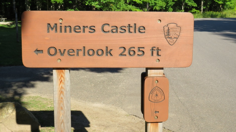
Miners Castle
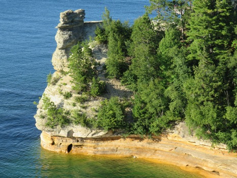
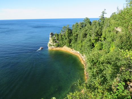
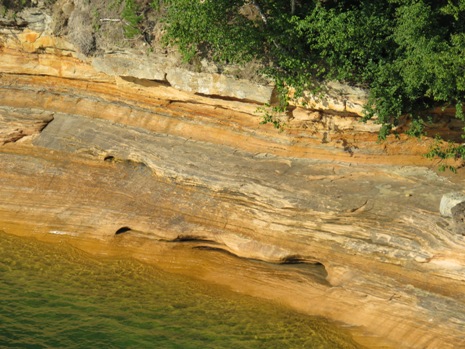
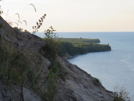
Heading eastwards inland and then taking a road northwards towards the coastline, the next stop was at Miners Castle Information Center and Overlook. The Miners Castle rock formation consists of crumbly cross-bedded sandstone, poorly cemented by secondary quartz and rises 75 feet (23m) above the shores of Lake Superior.
Like Munising Falls, the information centre here is open seasonally. Trails in the Miners Area lead to three nearby overlooks on a 0.4-mile long paved trail to view Grand Island and back towards Miners Castle. The Ojibwe people (whom are an Anishinaabe people) have lived in this area for 1000’s of years. The cliffs at Pictured Rocks hold great spiritual significance to them as a place where the Manitous reside (a Manitou is, among some North American native peoples, a good or evil spirit as an object of reverence). Miners Castle was prominently featured in Henry Wadsworth Longfellow’s 1855 Song of Hiawatha, which was an epic poem based on the history of the local natives, as recounted in Henry Schoolcraft’s Algic Researches. The proper noun “Algic” refers to an indigenous language family of North America, comprising Wiyot, Yurok, and many Algonquian languages, and was coined by Schoolcraft from the names of the Allegheny River and the Atlantic Ocean. The name Munising comes from the Ojibwe word “minisiing”, which means "at the island" - a reference to Grand Island. From Miners Castle, it is possible to see “the thumb” and the eastern side of the main portion of the island, the largest on Lake Superior’s southern shore. Grand Island is eight miles long and four miles wide and has a rich history. It was home to Ojibwe Indians for many generations; an early fishing camp dating from 4,500 years ago has been recorded here. Abraham Williams was the first white settler, arriving in 1840, operating a trading post on the southern tip of the island for many years. In the early 1900’s, Grand Island was bought by William G. Mather, president of the Cleveland Cliffs Iron Company, who used it as a private retreat. Some buildings from that era remain. Since 1991, the island has been managed as a National Recreation Area by the U.S. Forest Service and today, there are plenty of places to camp here and opportunities for hiking, biking and snowmobiling, depending on the season. Bus tours in summer offer an insight into the natural and human history of the island.
 |
 |
|
 |
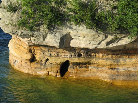 |
Above: Views from the Miners Castle Overlook, showing the Munising Rock Formation
The Miners Castle rock formation was named by Englishman Alexander Henry’s employees whilst they were exploring the area for minerals in 1771 and today, it is one of the highlights of the boat cruises which are popular with visitors to Pictured Rocks. Commercial boat tours taking in Miners Castle have been in operation since the 1940’s. From a geological perspective, the rock formation here exposes a history of the earth at the distant edge of the Michigan Basin and, indeed, the Pictured Rocks escarpment is one of the most important landscape features along the whole of Lake Superior’s southern shore. Geological history aside, in more recent times on April 13, 2006, the Inner Turret of Miner's Castle collapsed. According to chief ranger Larry Hach, the collapse was reported via mobile phone by fishermen in the area. Rockfalls along the cliffs in Pictured Rocks National Lakeshore typically occur in the spring and autumn, due to freezing-thawing action. From Miners Castle, it is possible to hike west on the North Country Trail toward Sand Point to take in the beech-maple forest and closer views of Grand Island, or eastwards along the trail one mile to Miners River and Miners Beach. Another mile further east, Bridalveil Falls cascade directly into the lake during times of high rainfall. It is worth noting that being composed of soft sandstone rocks, the cliffs at Pictured Rocks may be undercut by erosion and unstable and therefore it is strongly advised to stay back from the cliff edges.
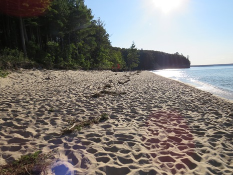
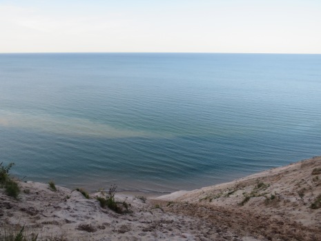
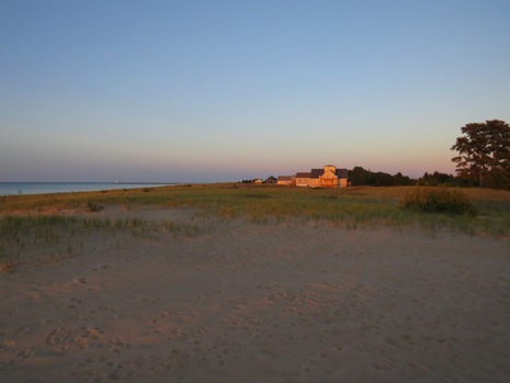
Miners Beach
Just to the east of Miners Castle is the mile-long Miners Beach (above). Whilst hiking is one option, it is also possible to take a short drive here from Miners Castle. A stop here gave the first opportunity on this visit to get right up to the shoreline of Lake Superior.
The lake certainly appears to live up to its name, although the title
“Superior” actually comes from a French usage meaning “situated above
the other lakes”. By surface area (31,700 square miles / 82,100km²), it
is the largest freshwater lake in the world. It is the largest of the
Great lakes not only in surface area but also in volume. In fact, it
could contain all of the other Great Lakes combined, plus three more
lakes the size of Lake Erie. It is 350 miles (563km) long, 160 miles
(259km) across, at its widest, and on average 489 feet (149m) deep. Its
deepest point is some 1,333 feet (406m), and lies about 26 miles (42km)
north of Pictured Rocks National Lakeshore*. Lake Superior’s shoreline
is some 2,726 miles (4,385km) long, including islands, and it takes
about 191 years for the water in it to be completely replaced. The lake
contains 10% of the planet’s freshwater and if drained, the water would
fill a hypothetical swimming pool the size of the lower 48 states to a
depth of nearly five feet.
* This figure of 26 miles is taken from local information notice boards, although in official park literature, this is quoted as about 35 miles north of Miners Castle.
 |
 |
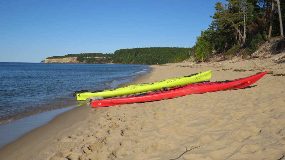
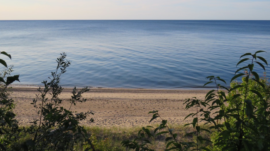
Miners Beach offers the opportunity for “sea” kayaking, swimming (the lake can be chilly), wading, sunbathing, picnicking, hiking from here along the Pictured Rocks cliffs, or simply taking gentle strolls along the sandy lakeshore. The Lakeshore Trail follows the scenic cliffs eastwards from here to Grand Portal Point, six miles away, and beyond. Alternatively, it is possible to head inland from the beach and walk along Miners River to Miners Lake and along the way, another of the area’s activities can be partaken, namely fishing. Also nearby via a relatively short trail off the Miners Castle Road is the Miners Falls.
Heading further east of Miners beach, other highlights include the Mosquito Falls, Mosquito Beach, Chapel Falls, Chapel Beach and Chapel Rock, Spray Falls, Little Beaver Lake and Twelvemile Beach, the latter being shown above. Whilst the main road heads inland, it returns to the shoreline towards the eastern end of Twelvemile Beach, where there is the White Birch Trail. The stones on Twelvemile Beach are varied - horn coral can be seen (from an ancient sea), as can polished granite, quartz rounded like eggs and disc-shaped fragments of the Jacobsville sandstone. Many of the sights just mentioned can be accessed via a couple of unpaved roads and trails. Continuing east is the Hurricane River Au Sable Light Station Trailhead from where a trail leads to the Au Sable Light Station at Au Sable Point and past here is a feature known as the Log Slide, featured next on this webpage.
Log Slide
 |
 |
Above: Approach to the Log Slide
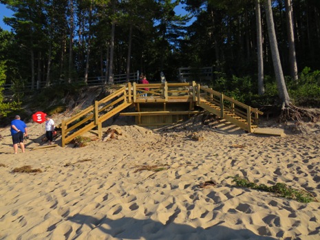
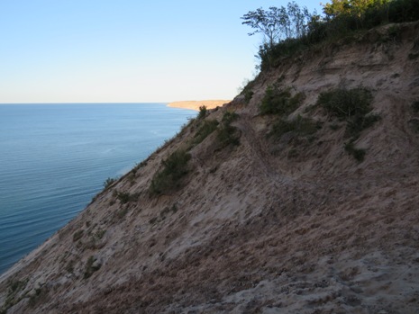
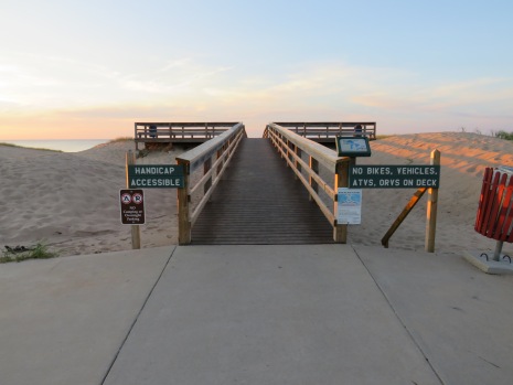
The Log Slide Overlook, shown in the photographs above and below, is accessed via a trail of about 650 yards from a car park situated about a mile off the main road towards the eastern end of the Pictured Rocks National Lakeshore. The trail leads through mature hardwoods past an old log cabin to the top of a large sand dune, but beware that the dune descends 500 feet (300 vertical) down a steep slope to the lakeshore and so whilst going down may take only a few minutes, coming up may take an hour or more. Also, there are hazards, such as sand and rocks falling down from people above and the fact that overhangs are hidden at the bottom. The Log Slide itself was a chute that loggers used to move logs from the top of the dunes down to Lake Superior to be loaded onto boats for transportation. The chute was constructed out of wood, but is no longer there and so all that remains is its name given to this spectacular location. It is difficult to imagine logs travelling down the chute, although it is said that sometimes they would catch fire due to the friction from the sand and wood, as well as the heat of the sun. From the Log Slide Overlook, it is possible to see the Au Sable Light Station at Au Sable Point to the west and the Grand Sable Dunes to the East.
 |
 |
|
 |
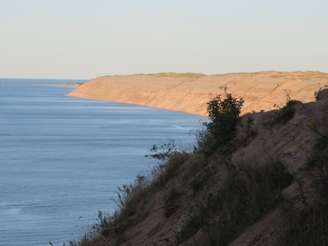 |
Above: Views from the Log Slide Overlook
Since the last ice age, the composition of the Great Lakes forest has changed. Prior to logging, the area around here had mature white and red pine mixed among the deciduous trees seen today. Inland, on less fertile sand soils, the pine species predominated and today, only a few pines are interspersed among the hardwood giants. The area around here was logged in the late 19th century for the large white and red pine and white cedar. The wood was in demand as construction work took place in the growing Midwestern cities. Logs were cut mainly in the winter (logs were moved by sleigh), processed at local sawmills in Munising and Grand Marais, and then shipped by steamer to Cleveland, Chicago and Milwaukee. Felling of white and red pine and white cedar was followed by logging of the virgin hardwoods during the 1930’s and 40’s. After this initial logging era, a large amount of the land was tax delinquent and reverted back to the State of Michigan which designated the land as state forest. Some tracts of land were sold to farmers or individuals for “camps” or cabins in the woods. One such cabin, the “Jones cabin” can be seen along the path to the Log Slide Overlook. Little is known about its history, although it represents an era of Upper Peninsula hunting camps that have been popular retreats for decades. This particular cabin was constructed on land leased from Cleveland Cliffs Iron Company. Such cabin sites are common throughout the lakeshore, although through time, ones such as this one will disappear, as nature takes over.
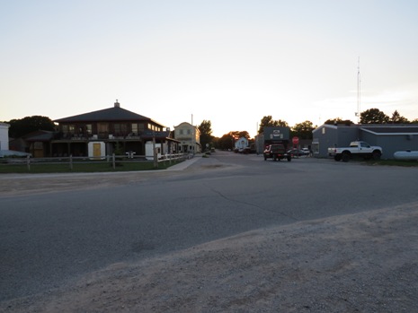
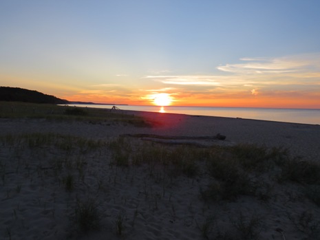
Grand Marias
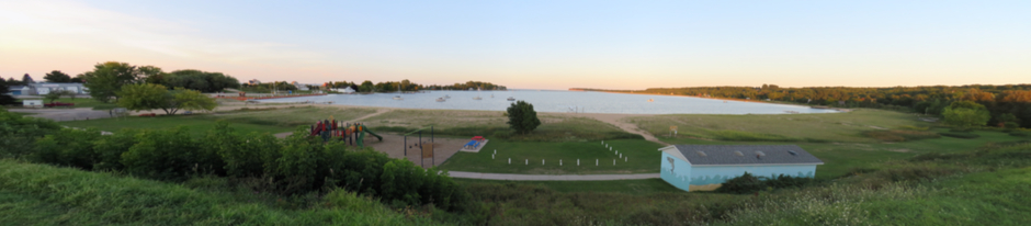
Above: Panoramic Stitch of West Bay, Grand Marias
Finishing our visit to Pictured Rocks National Lakeshore, passing Grand Sable Lake Overlook, Sable Falls and the Grand Sable Visitor Center at the eastern end of the park, takes us into the city of Grand Marias. It is known as a hub of arts, music, and crafts in the region. One of the city’s landmark features is the Grand Marais Light. The tower was first lit in 1922 and is still operational, whilst the original keeper’s house on shore is now the main museum of Cook County Historical Society. On the northern side of the city, there is a purpose-built overlook on the beach, which in this case provided a perfect spot to end the day and watch the sunset.
 |
 |
|
 |
 |
Pictured Rocks was authorised as America’s first national lakeshore in 1966, to preserve the shoreline, cliffs, beaches and dunes, and to provide a place for recreation and discovery. It comprises two zones: the Lakeshore Zone, federal land managed by the National Park Service; and the Inland Buffer Zone, a combination of federal, state and private ownership. As well as boat cruises to view the spectacular coastline (e.g. Pictured Rocks Cruises, 2½ hours, leaving from the City Pier in Munising), Shipwreck Tours, less than a mile from the City Pier in Munising, offer a 2-hour trip in a glass-bottomed boat with the highlight being the chance to see (as their name suggests) shipwrecks. For the more adventurous, kayaking tours are also available locally. Some more photographs from the visit to Pictured Rocks National Lakeshore, not shown above, may be seen in the thumbnail gallery below (click on an image to enlarge):
References and Further Information
1.
In Situ Information Boards and Literature
2. For further
information, visit the National Park Service Webpage for Pictured Rocks
National Lakeshore by clicking on the link
Here.
Back to Top