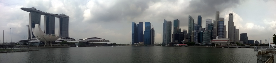
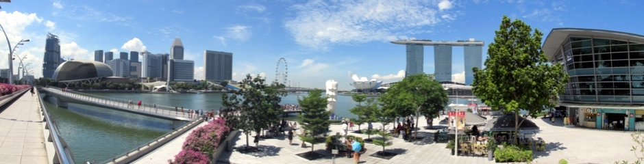
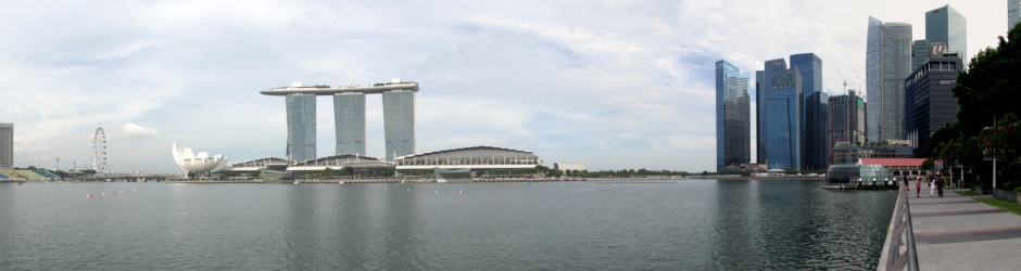
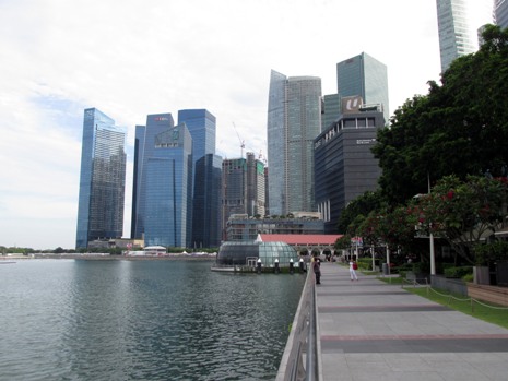
Panoramic stitch showing view of downtown Singapore from the northern side of Marina Bay.
Singapore is a sovereign state in Southeast Asia and the world's only island city-state. It's territory consists of a diamond-shaped main island, along with 62 other islets. The city of Singapore itself lies on the southern part of the main island which also bears it's name. It has a deep harbour which lies on a key shipping position along a route connecting the Indian Ocean with the South China Sea. This has played a major role in developing it into Southeast Asia's largest port and a global centre for commerce. The city-state has a population of approximately 5.4 million.
Map courtesy of OpenStreetMap
This webpage begins with a brief description of the city, followed by descriptive text accompanying photos of some of the main sites. Approximately four days were spent exploring the city on foot aided by the efficient and inexpensive Mass Rapid Transit (MRT) network of trains which run across the island both over- and underground, stretching as far east as Changi International Airport.
Singapore is often referred to as the Lion City, the Garden City, and the Red Dot and has sometimes been dubbed "instant Asia" for, as we shall see on this webpage, it can offer the visitor a snapshot into a wide variety of Asian cultures which have been brought here by immigrants from across the continent. The official languages of Singapore are English, Tamil, Malay and Standard Mandarin and although the people here are predominantly Chinese, there are notable Malay and Indian minorities.
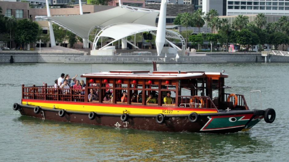
Above: Traditional-style river craft provide a popular way for visitors to take in views throughout the heart of the city.
A very brief history of the city follows; According to the Malay Annals, the Kingdom of Singapura was established in 1299 on the island as a trading port city. Portuguese raiders burned down the settlement in 1613 and for the following period, much of the region's maritime trade was under Dutch control. The modern history of Singapore began on 28th January 1819 with the arrival of Sir Stamford Raffles of the British East India Company who landed here in search of a suitable trading site; thus here, a British trading town was set up. The country was given colony rank in 1867. Steady growth of the port followed and when the Suez Canal opened in 1869, the port's importance as a bunkering station increased. Demand for tin and rubber from the Malay Peninsula ensured further growth as a place from which to export goods by sea. During World War II, the Japanese attacked Singapore and they took eventual control of the colony in February 1942, when the British surrendered. The people of Singapore suffered badly during this brief occupation, which lasted until September 1945, when the Japanese surrendered and it returned to British rule. After World War II, many people in Singapore thought the British were not as strong as before and wanted independence. In 1963 Singapore joined with Malaya, Sabah and Sarawak to form the new nation of Malaysia, until eventually gaining its own independence on 9th August 1965.
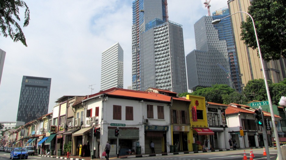
Above: Contrasts of old and new can be seen throughout Singapore.
The city of Singapore itself runs north and east of the main port area set amongst low hills and the tidal Singapore and Rochor rivers. The heart of it today lies on the site of the original settlement just north of the Singapore River near it's entrance to Marina Bay and here is the location of the main government and public buildings, the cricket club and St Andrew's Anglican Cathedral, which dates from 1862. Moving outwards from the city centre in various directions are a number of traditional cultural enclaves, including Chinatown and Little India and amongst these (Chinatown in particular) are more modern office buildings and hotels which whilst encroaching on the older parts of the city, blend with the existing colonial and traditional architecture.
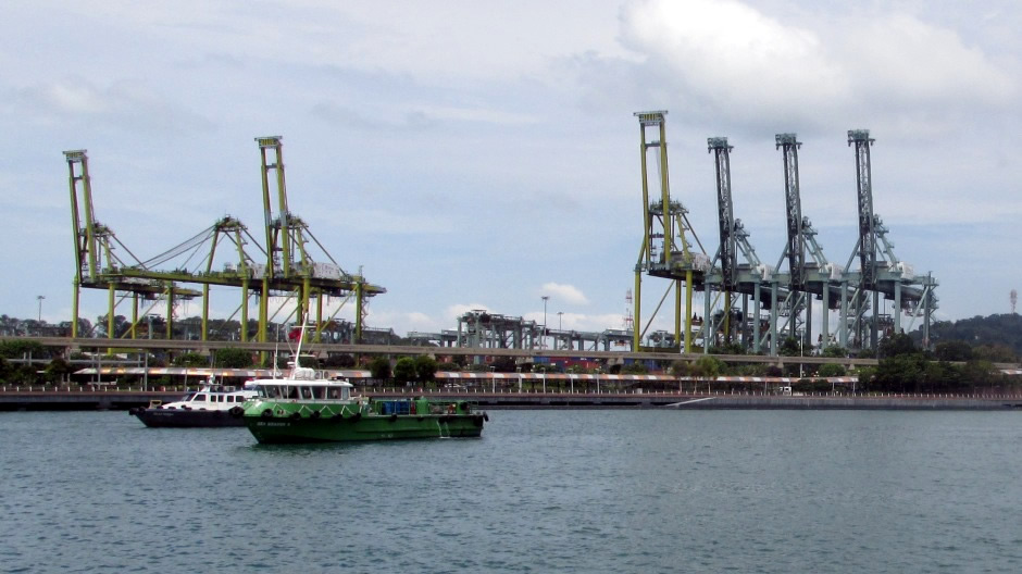
Singapore's port area covers 36 square miles in total and consists of the Container Terminal, Jurong port, Keppel, Telok Ayer, Sembawang, and Pasir wharves, catering for all manner and sizes of vessels. The Keppel wharves are protected by nearby islands and provide deepwater docks for managing large volumes of goods which include the export of oil, rubber, spices and wood and the import of rice, machinery and textiles. From Singapore runs the Malayan rail system, which connects with Kuala Lumpur in Malaysia and Bangkok in Thailand.
As well as the port itself, Singapore has a large number of manufacturing and processing plants. It is also the chief trading and financial centre of Southeast Asia as well as a major transport hub. It has been listed as the "easiest place to do business" by the World Bank for ten consecutive years and the most "technology-ready" nation by the WEF, to name but a few of it's many global accolades.
National Museum of Singapore
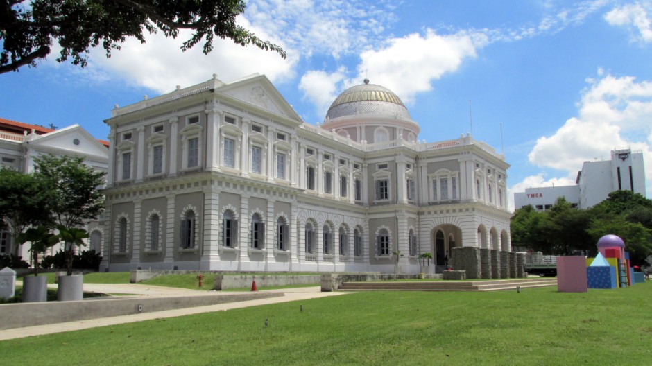
The National Museum of Singapore (above) was unveiled on Queen Victoria's Golden Jubilee in 1887. It is Following Singapore's independence in 1965, the building was transformed into a monument to the nation's history and culture. It is one of four national museums in the country It was known as the Singapore History Museum from 1993 until 2006, when a reopened after a 3½-year restoration. Behind the original building stands a modern glass and steel wing.
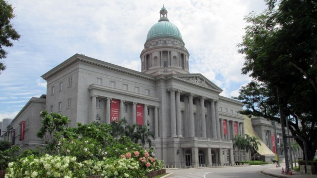
National Gallery of Singapore and the Arts House at the Old Parliament
 |
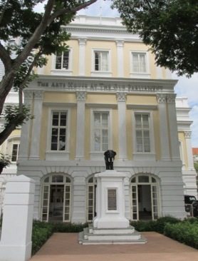 |
The National Gallery of Singapore (above, left) contains the world’s largest public collection of Singapore and Southeast Asian art. The Gallery consists of two national monuments, the former City Hall and Supreme Court Buildings. Immediately south of The National Gallery of Singapore and next door to Parliament House is The Arts House at the Old Parliament (above, right). The Old Parliament Building (built in 1827) was restored, preserving the furnishings and design, and opened in 2004 as an arts and heritage centre. Today, it forms a multi-disciplinary venue, hosting art exhibitions and concerts.
In and Around the Singapore River
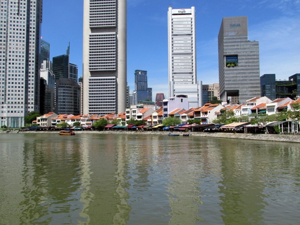
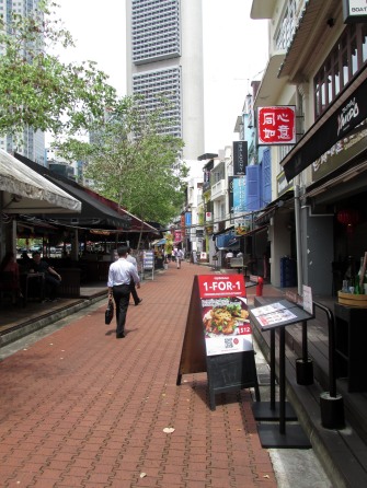
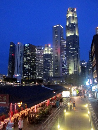
The Singapore River (general views in the thumbnail gallery, above) is around 3km in length from its source in the Central Region in the southern part of Singapore to where it empties into Marina Bay and finally the Singapore Strait. It flows past old godowns (warehouses), the fashionable Clarke Quay, Boat Quay and the Financial District and has always formed a hub of activity in the city. It was on the river bank, Sir Stamford Raffles of the British East India Company landed in search of a suitable trading site, thus founding the modern city. The river mouth was to become the old Port of Singapore, being naturally sheltered by the southern islands and ever since, as the city grew around here, this area developed to become Singapore's centre of trade, commerce and finance. For the visitor to the city, an ideal introduction to some of the city's main sites and views is to take a walk on the banks of the Singapore River, or to take a boat trip along it. Much of the river has been cleaned up and renovated in more recent years and whilst it's role of aquatic trade and commerce has diminished as newer more modern port areas were constructed away from the centre, it's role as a heart of daily life has not. Both locals and tourists alike are spoilt for choice here when it comes to places to eat, drink, shop, or simply while away some time at leisure. The following photos and accompanying text looks at some of the main sites that may interest the reader to be found along or close to the river's banks.
 |
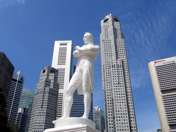 |
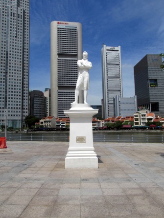
Above: A statue of Sir Thomas Stamford Raffles stands on the northern bank of the Singapore River, just upstream from Marina Bay and is best explained by an inscription (in several languages) on the plinth that reads: "ON THIS HISTORIC SITE/SIR THOMAS STAMFORD RAFFLES/FIRST LANDED IN SINGAPORE/ON 28TH JANUARY 1819/AND WITH GENIUS AND PERCEPTION/CHANGED THE DESTINY OF SINGAPORE/FROM AN OBSCURE FISHING VILLAGE/TO A GREAT SEAPORT AND/MODERN METROPOLIS".
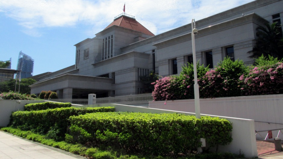
Above: The Parliament House of Singapore (as seen from the river side of the building) was designed as a modernist architectural expression of authority and stateliness. In favour of a more traditional dome, the top, designed by former president Ong Teng Cheong is in a contemporary prism shape. The Parliament of Singapore was housed in the adjacent Old Parliament Building (which now houses an arts centre - see above) from 1965 to 1999 before moving to this modern building.
 |
 |
|
 |
||
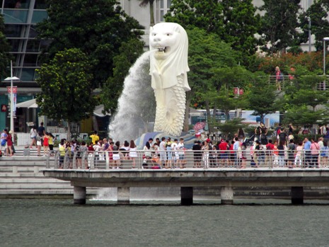
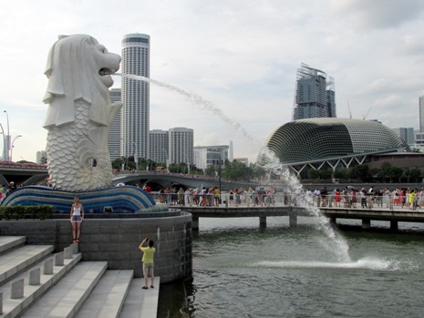
Above: Merlion Park, fronting Marina Bay. Here stands the Merlion, a half-fish and half-lion female statue which was designed to symbolise the unity of the lion city and the sea; Singapore started life as a fishing village when it was known as Temasek ('sea town'), whilst the original name of Singapura means 'Lion City'. The Merlion, spouting water, guards the river entrance like an ancient mythical beast. The Merlion was created by the tourism board in 1964 and is used as a well known marketing icon and mascot for Singapore. The present statue seen here was unveiled in 1972. Although this is the most famous Merlion statue in Singapore, officially there are five in total (of varying sizes) and these are: The 8.6m tall original statue featured here, at Merlion Park, a 2m tall cub statue standing behind the original statue, a 37m tall replica with viewing decks on Sentosa Island, a 3m tall statue at Tourism Court and a 3m tall statue on Mount Faber's Faber Point.
Above: The elaborate Cavenagh Bridge is one of the oldest bridges in Singapore and the only suspension bridge over the Singapore River. It spans the lower reaches of the river in the Downtown area. The bridge opened in 1870 and the oldest bridge seen today to exist in its original form. When it became unable to cope with the increase of traffic in the city, the government decided to build the Anderson Bridge in 1910 as a replacement. However, it was spared from demolition and converted into a pedestrian bridge. As a result of this, a preserved notice can still be seen today at both ends of the bridge which reads: "POLICE NOTICE/CAVENAGH BRIDGE/THE USE OF THIS BRIDGE IS PROHIBITED TO ANY VEHICLE OF WHICH THE LADEN WEIGHT EXCEEDS 3 CWT. AND TO ALL CATTLE AND HORSES/BY ORDER/ CHIEF POLICE OFFICER". Lighting was added to Cavenagh Bridge in the 1990's, to highlight it's architectural features after sunset.
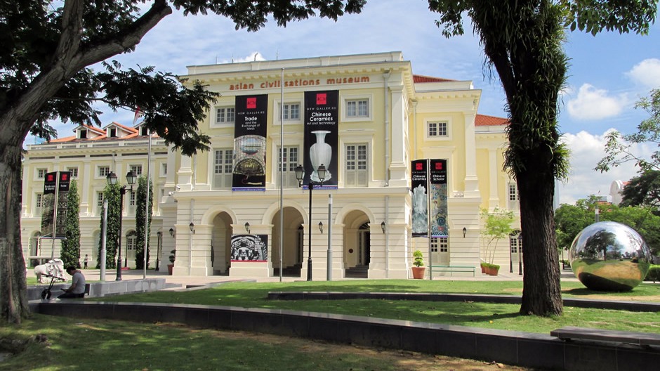
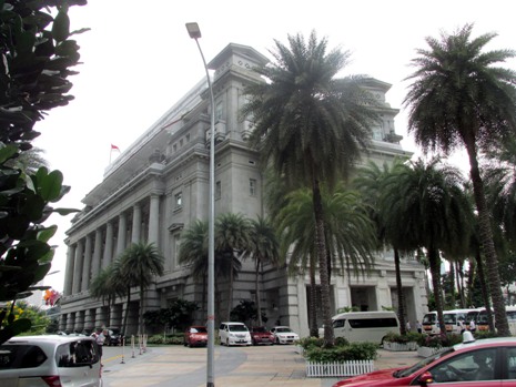
Above: The Asian Civilisations Museum (ACM) forms a part of four national museums in the country. Built in 1867, the building was previously government offices and in the early 1900's was renamed the Empress Palace Building, reopening as the ACM in 2003. The museum is one of the pioneering museums in the region to specialise in pan-Asian cultures and civilisations; a reflection of the ethnic groups to be found in Singapore throughout history and still today.
 |
 |
|
 |
 |
Above: Boat Quay is a historical quay (and name of the road running alongside) situated upstream from the mouth of the Singapore River on its southern bank. Chinese merchants first built godowns here. It was once the busiest part of the old Port of Singapore, handling ¾ of all shipping business in the 1860's. Most of the boats have now gone and the Quays primary role of maritime commerce has diminished. However, the shop-houses have been carefully conserved and now provide a popular site for bars, pubs and restaurants. As well as accommodating the needs of tourists, many financial sector buildings lie immediately adjacent to Boat Quay; at number 28 is Harry's Bar, famous as rogue trader Nick Leeson's old watering hole.
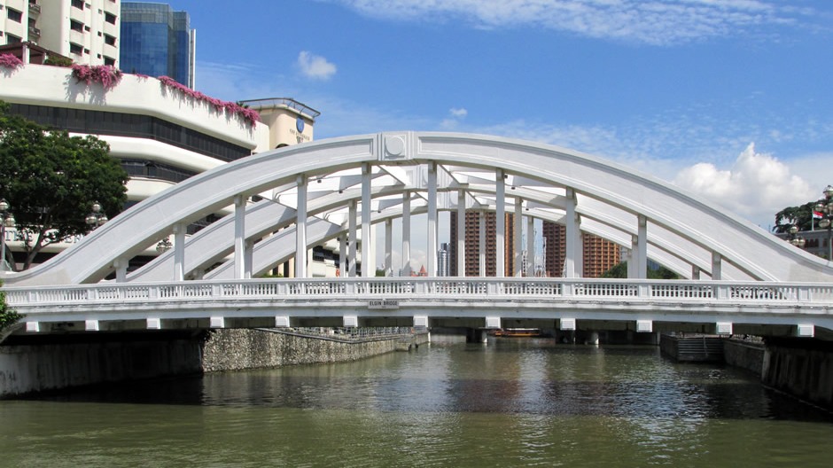
Above: Elgin bridge is the oldest crossing point on the Singapore River and links the downtown area with the Singapore River Planning Area located within Singapore's Central Area. The crossing was originally a wooden drawbridge in 1822, and possibly an unnamed footbridge as far back as 1819, the year Sir Thomas Stamford Raffles landed. Named after Lord Elgin, Governor-General of India (1862-1863), the vehicular bridge seen today was completed in 1929.
 |
 |
 |
|
 |
 |
|
 |
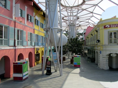 |
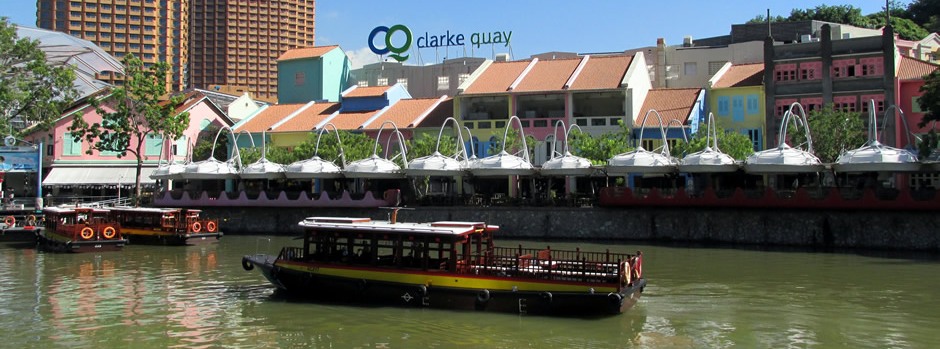
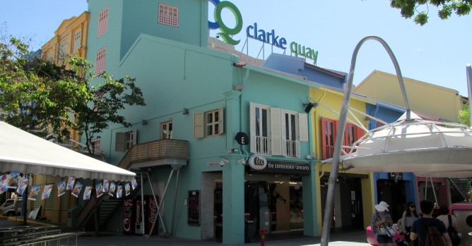
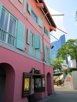
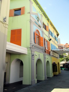
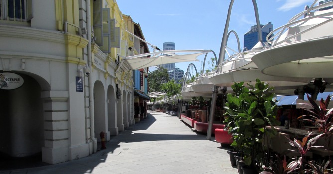
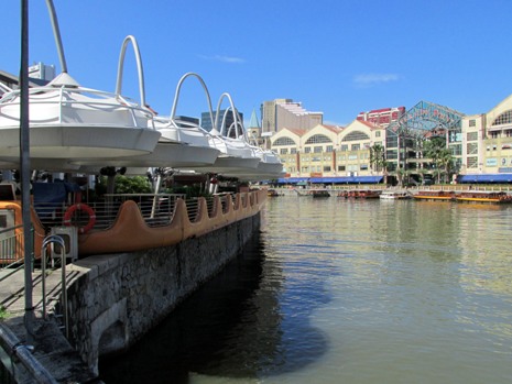
Above: Clarke Quay is another historical riverside quay (and name of the road running alongside) on the Singapore River and is located within the Singapore River Planning Area, upstream from Boat Quay. A favourite evening spot, it is the river's largest conservation project. The godowns have been thoughtfully renovated to create a stylish cluster of waterfront retail outlets, bars, nightclubs and restaurants. The quay was named after Sir Andrew Clarke, Singapore's second Governor and Governor of the Straits Settlements from 1873 to 1875 and played an important role in establishing Singapore's role as a port in the region. The newly redeveloped Clarke Quay attracts over 2 million visitors a year.
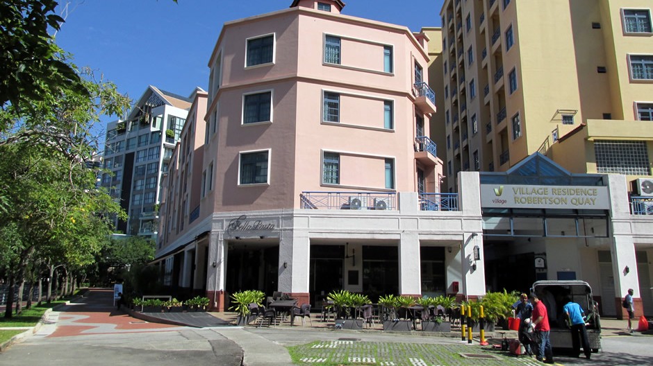
Above: Robertson Quay lies upstream from Boat Quay and Clarke Quay (these form three Wharfs that are to be found along the river). As Singapore's trade and population grew, mud flats and swamps further upstream were reclaimed in the mid 19th century and used to build godowns thus creating Robertson Quay, which lies near the river source. In the 1990's, the area was rezoned for redevelopment into residential, hotel and commercial use. Today, Robertson Quay is a fashionable waterfront location with restaurants, cafes and galleries.
 |
 |
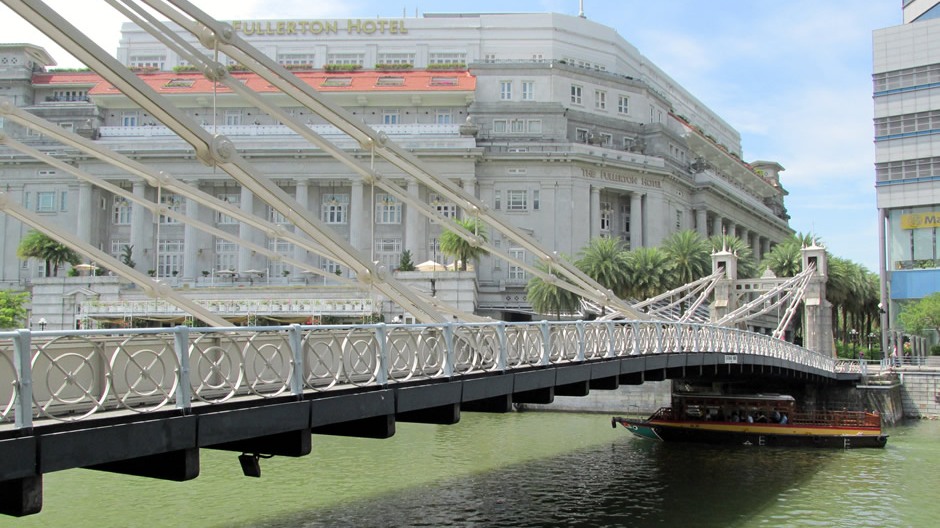
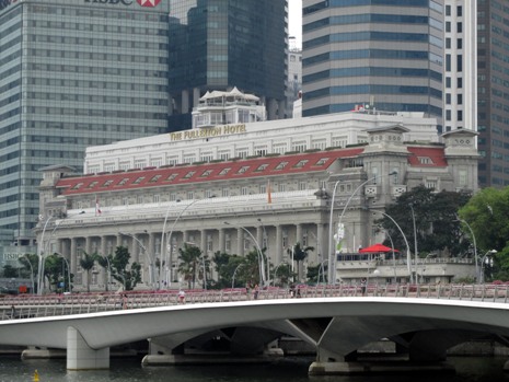
Above: The Fullerton Hotel, a 5-star hotel near the mouth of the Singapore River. It was originally known as The Fullerton Building, and also as the General Post Office Building. It was named after Robert Fullerton, the first Governor of the Straits Settlements (1826–1829).
 |
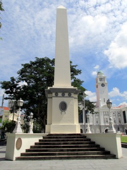 |
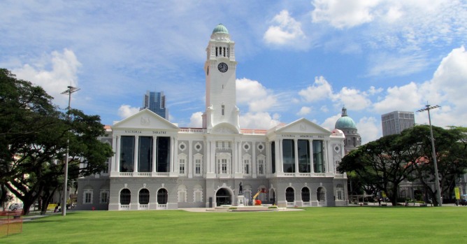
Above: The Victoria Theatre and Concert Hall (left) is a centre for the performing arts comprising two buildings and a clock tower joined together by a common corridor. The first part of the building was constructed in 1862, whilst the rest of the complex was completed in 1909. Further renovation has been carried out over the years, the most recently from 2010 to 2014. Amongst the complex's many functions, the concert hall here is used as a venue by the Singapore Symphony Orchestra. Near the Victoria Theatre and Concert Hall stands the Dalhousie Obelisk (photo, right). The obelisk was built to commemorate the second visit to Singapore, in 1850, of the Marquis of Dalhousie, the Governor-General of India from 1848 to 1856. The purpose of his visit was to look at reducing administrative expenditure and the memorial was also built to remind merchants of the benefits of free trade.
 |
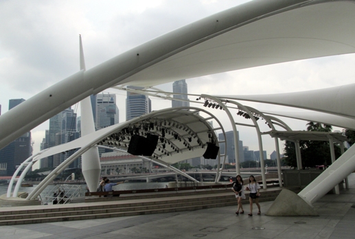 |
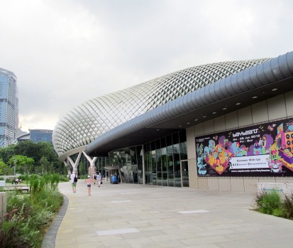
Above: The Esplanade - Theatres on the Bay was built at a cost of S$600 million and opened in 2002. This 60,000 square metre performing arts centre is located in Marina Bay near the mouth of the Singapore River. The building's appearance was somewhat debated when built and the shape of it's aluminium exterior have caused it to earn the nickname "The Durian", after the spiky local fruit. The official name, though, comes from the nearby Esplanade Park. The centre comprises a concert hall (capacity: ≈1,800) and a theatre (capacity: ≈2,000) for the performing arts. In addition, there is a recital studio and sitting on the edge of the bay is a spectacularly positioned outdoor theatre (shown in the right-hand photo above).
Thian Hock Keng Temple
The thumbnail gallery above shows the Thian Hock Keng Temple (Temple of Heavenly Happiness), which was built in 1839 and is one of Singapore's oldest Chinese temples. it is considered the most important Fukien, or Hoklo (Hokkien) temple in Singapore. It was constructed by sailors in homage to the Taoist Goddess Ma Zu, who is said to have laid down her life to give seafarers a safe passage. The temple was paid for by donors, including Hokkien leader Tan Tock Seng. It was built without the use of nails in the southern Chinese architectural style along a north-south axis. Several shrines to different deities may be found here, whilst at the back of the building is a second temple which is a Buddhist one dedicated to Kuan Yin, the bodhisattva of mercy. Highlights of Thian Hock Keng Temple include the grand entrance with a high step in front, the door paintings, the ceiling, ancestral tablets, many statues and a beautiful pagoda. Throughout the temple, these countless features form (to the western layman) a bewildering array of endlessly fascinating symbols of Taoist traditional culture and beliefs.
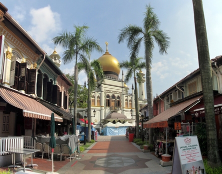
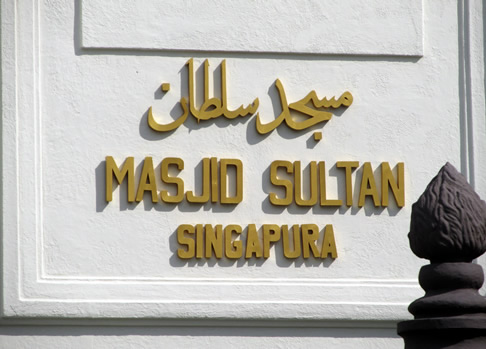
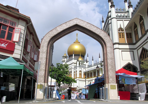
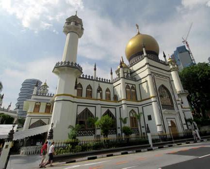
Masjid Sultan (Sultan Mosque)
 |
 |
|
 |
 |
|
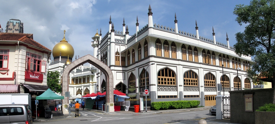 |
Masjid Sultan (Sultan Mosque), shown above, is located at Muscat Street and North Bridge Road in the heart of Singapore's Muslim community. In 1819, the neighbourhood here was assigned to the Malay Sultan of Johor who, until this period, ruled Singapore. Masjid Sultan is considered one of the most important mosques in Singapore and stands on the site of an original Mosque which was constructed in 1824. The original mosque was partially funded by the East India Company but a century later had fallen into disrepair and so planning began for the replacement we see today. The structure of the Mosque is in Saracenic style, combining Persian, Moorish and Turkish design and includes minarets, pointed arches and domes. It has remained largely unaltered since construction with some repairs in the 1960's and the addition of an annex in 1993. The interior of the Mosque, which includes a central prayer hall large enough to accommodate 5,000 devotees, is adorned with mosaics and calligraphic verses.
Sri Veeramakaliamman Temple
The Sri Veeramakaliamman Temple, shown in the thumbnail gallery above, is a Hindu temple located in the middle of the district of Little India. In 1881, Indian labourers who had settled in this part of the city built a Hindu Shrine. The original temple, which was fairly small, was demolished in 1983, to make way for the building we see today. It took three years to build, in the style of South Indian Tamil temples, employing artisans from India. The temple is dedicated to the Hindu Goddess Kali, fierce embodiment of Shakti and the god Shiva's wife, Parvati; Kali is a popular Goddess in Bengal, which is the birthplace of the labourers who built the original temple here (although the building's style today is different from those seen in Bengal). Hindus who worship here can be seen leaving with red ash smeared on their foreheads - those who pray at temples for male deities receive white ash. Kali occupies a central position on the main altar in the temple and is the Divine Mother. Images of her in the building show her in a number of situations.
The Padang
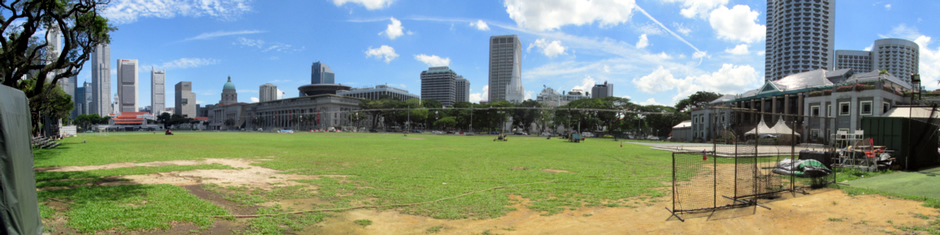
Above: Panoramic stitch of Padang
The Padang is a large playing field situated in the heart of downtown Singapore. The word Padang is Malay for 'field'. It was previously known as the Padang Cricket Ground and is surrounded by several important landmarks including City Hall and the Old Supreme Court Building (now The National Gallery) and Saint Andrew's Cathedral. Being a large open space right in the city centre (and it's historical significance), Padang has been used as a venue for a variety of events including National Day Parades on certain years.
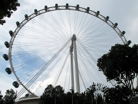
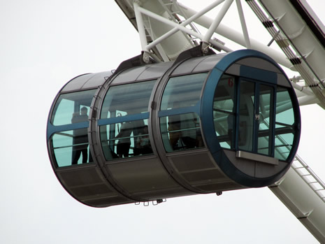
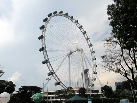
The Singapore Flyer
 |
 |
|
 |
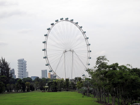 |
The Singapore Flyer is Asia's tallest observation wheel. It stands at 165m (541 feet) and opened in 2008, after an approximate 2½ years of construction (For comparative purposes, the UK's London Eye stands at 135 m/443 feet). The wheel has 28 air-conditioned capsules, each able to accommodate 28 passengers. Views offered during the 32 minute, or so, ride include those of the city and environs, the Malayan state of Johor and the neighbouring islands of Indonesia. According to Buddhists, the motion of the wheel brings positive Feng Shui.
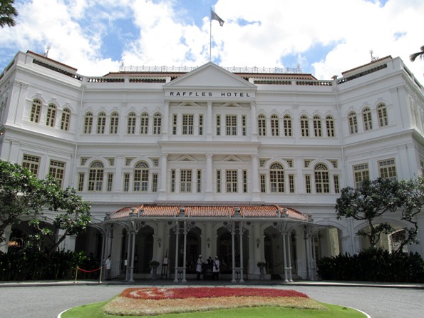
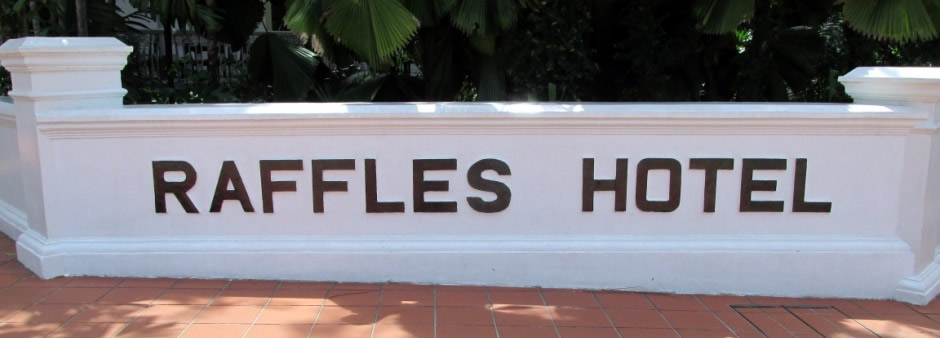
Raffles Hotel
 |
 |
|
 |
||
In the upper left photo is shown the famous Raffles Hotel, a colonial-style luxury hotel and today the flagship of Raffles Hotels & Resorts, a subsidiary of Fairmont Raffles Hotels International. The hotel was founded by the Armenian Sarkies Brothers in a beachfront bungalow in 1887 (the privately owned beach house was built in the early 1830's). Named after British statesman Sir Thomas Stamford Raffles, the founder of Singapore, behind it's façade lies a labyrinth of tropical courtyards and verandas. In 1987, a century after it first opened, the Raffles Hotel was declared a National Monument by the Singapore government. Following a two-year $160 million renovation which started in 1989, the hotel today provides a very high standard of colonial luxury. Highlights of the hotel include the Long Bar (where the national cocktail, the Singapore Sling was invented by bartender Ngiam Tong Boon), the bar & billiard room, the Jubilee Hall (a Victorian-style playhouse theatre), the writer bar (which contains the works of former guests such as Joseph Conrad and Rudyard Kipling), the Tiffin Room where it is traditional to take high tea and the gift shop. The Raffles Hotel Museum closed in 2012. Raffles Hotel has a shopping arcade with 40 specialty boutiques and here are most of the hotel's restaurants. Other famous guests who have stayed here include Charlie Chaplin, Noel Coward and Elizabeth Taylor, to name but a few.
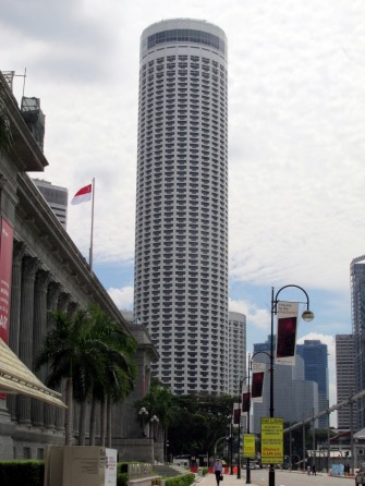
On the upper right is shown Swissôtel The Stamford (formerly the Westin Stamford), which stands 226m (741 feet) in height and is part of the Raffles City complex which is located beside the historic Raffles Hotel. It is a 5-star hotel and has 1,261 rooms. When completed 1986, the Westin Stamford was the world's tallest hotel building and held that title until 1997 when the Baiyoke Tower II was completed in Bangkok, Thailand.
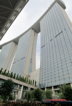
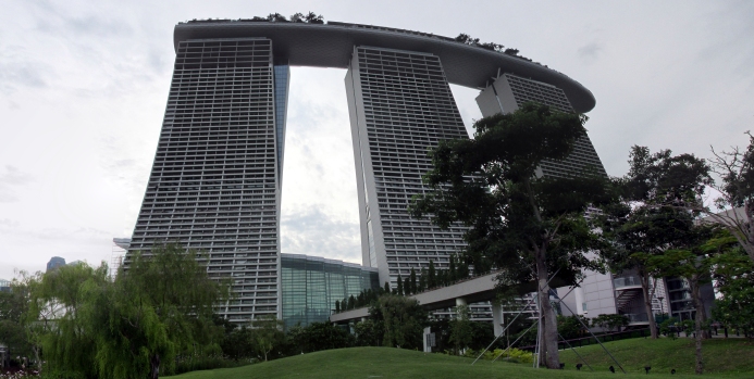
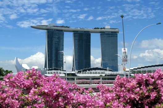
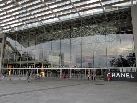
Marina Bay Sands Resort and Bay South Garden
 |
 |
 |
|
 |
 |
|
 |
 |
|
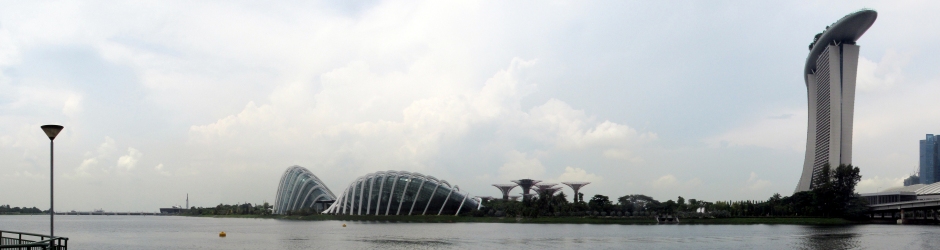 |
The 20 hectare Marina Bay Sands Resort and Bay South Garden, which lie adjacent to the resort complex. Dominating the eastern side of Marina Bay near the centre of Singapore stands Marina Bay Sands. It opened in 2010 at a cost of S$8 billion. The resort includes a 2,561-room hotel, the world's largest atrium casino, a convention-exhibition centre, a large shopping mall, restaurants (such as a Gordon Ramsey outlet), a museum, two theatres and an ice rink. Atop the complex sits the 340m long SkyPark, a cantilevered platform which overhangs the north tower by 67m. The SkyPark contains the much photographed infinity pool, a 150m swimming pool where the edges of the water seemingly have nothing between the pool and the drop below. The SkyPark can hold 3,900 people and is the world's largest public cantilevered platform.
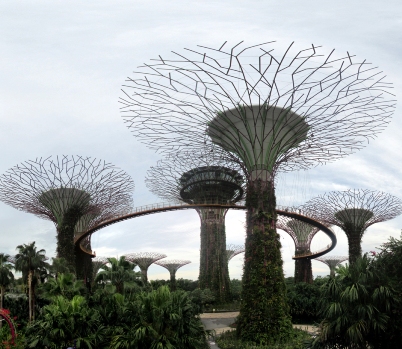
The adjacent Bay South Garden, shown here, forms the largest of three parts of a 101 hectare nature park known as Gardens by the Bay. The other two parts are Bay East Garden and Bay Central Garden. Gardens by the Bay were created on reclaimed land adjacent to Marina Bay as part of a government strategy to transform Singapore from a "Garden City" to a "City in a Garden". In 2006, a competition for the design of the park was held and the winning contract for the Bay South Garden went to a British firm, Grant Associates. Several other firms were also involved in the final design and engineering. The park attracts over six million visitors per year and popular features of it include the Cloud Forest, the Flower Dome and the Supertree Grove. Various events are held here, as well.
Sentosa Island
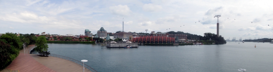
Above: Panoramic stitch photo looking towards Sentosa Island from the connecting causeway.
Sentosa Island is a local recreation spot ideal for a getaway from the stresses of city life. There is a wide range of attractions here suitable for everyone including golf courses, man-made beaches, the Images of Singapore museum, 'Underwater World', nature walks, award-winning spa retreats, the colonial Fort Siloso, a Universal Studios, cycling, yachting and the Singapore Cable car, which crosses to Imbiah Lookout on the island from Harbour Front or Mount Faber, to name but a few. There are numerous accommodations, cafes, bars and restaurants on the island, which can also be accessed via a causeway bridge by road, the Sentosa Express monorail, or for the pedestrian or those on a very tight budget, also running over the causeway is a series of moving walkways, which speed up the crossing considerably. The original name for the Island was Pulau Blakang Mati ('death from behind'), perhaps a reference to pirates of the past and the name Sentosa which came later means 'peace and tranquillity', a name I am sure many will agree sounds more fitting and rolls off the tongue easier.
***
This web page, has been far from comprehensive and other notable sites in Singapore time did not permit to visit include The Singapore Botanic Gardens (which were declared Singapore's first UNESCO World Heritage Site in 2015), the Jurong Bird Park, Singapore Zoo (which is famous for its 'night safari') and the many World War II sites open to the public. Mount Faber is treated separately on my web page Here.
 |
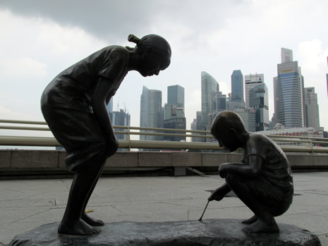 |
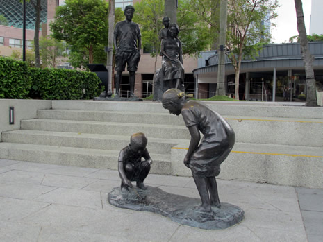
Makan Angin ('Eating Wind') by Lim Soo Ngee
References and Further Reading
1. Singapore Island & City Map. Periplus Travel
Maps. 2014. Print.
2. Bonetto, Cristian. Singapore. Footscray, Vic.:
Lonely Planet, 2015. Print.
3. Eveland, Jennifer and Atkinson, Susy. Top
10 Singapore. London: DK Eyewitness Travel, 2015. Print.
4. Frost, Mark
Ravinder and Yu-Mei Balasingamchow. Singapore. Singapore: Editions
Didier Millet, 2009. Print.
5. Lim, Richard. Rough Guide To Singapore.
Rough Guides, 2016. Print. 6. Van, Amy. Insight Guides - Explore
Singapore. London: APA Publications. Print.
Back to Top