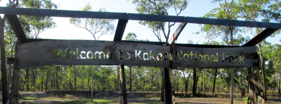
Kakadu National Park is a tropical wilderness, approximately 220km east of Darwin, in the north of Australia's Northern Territory. It consists of five major landscape types: coastal swamps, floodplains, lowland hills, escarpments and plateaux. It is a cultural landscape which over thousands of years has been shaped by the spiritual ancestors of the Bininj/Mungguy Aboriginal people during the 'creation era'.
Kakadu is just one of 25 World Heritage sites that is listed for both cultural and natural values. Today, the park is managed jointly by Bininj/Mungguy and parks Australia to protect its outstanding heritage. Every year, thousands of visitors are drawn to the park attracted by many of its assets which include exploring the world's oldest living culture and seeing internationally important wetlands, outstanding examples of rock art, and plants and animals indigenous to this part of Australia. Kakadu's many diverse physical features provide a range of habitats for a great variety of wildlife. Scientists have already recorded here about 51 mammal, 275 bird, 75 reptile and 55 fish species, as well as 4,500 species of insects. The park has an area of 13,073 km² and the land ranges from 0m in the coastal areas to 520m above sea level. The Bininj/Mungguy calendar recognises up to six seasons and the climate here is tropical monsoon with pronounced wet and dry seasons. The mean summer temperature is 34°C and in winter it is 30°C; the most popular time to visit is from May to September when the weather is comfortable and the roads are generally open. It is important for any visitor to the park to observe local rules and also advice, such as protection against the sun, insect bites and importantly observing crocodile warning signs!
The main locality of Kakadu National Park may be found at Jabiru. Access to the park by road is typically via one of two routes, namely the Arnhem Highway which runs towards Jabiru from the west and the Kakadu Highway which runs towards Jabiru from the southwest. The visit documented on this page followed the Arnhem Highway into the park, exiting back out via the Kakadu Highway.
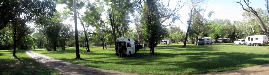
Above: Panoramic stitch showing the Aurora Kakadu Resort Campground which is situated near the South Alligator River.
Although Kakadu National Park contains a number of spectacular waterfalls, these require a 4WD or bookings via of an organised tour. For the visit to the Northern Territory featured here, where travel was via a 2WD, several waterfalls were seen elsewhere in Litchfield National Park, where they are more readily accessible (see page here). Below are a series of photographs and accompanying text highlighting a just a few of the many attractions the park has to offer.
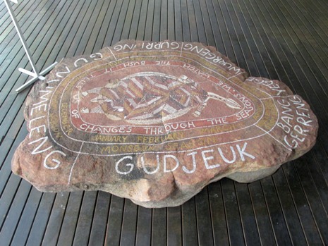
The photo gallery above shows the Mamukala Wetlands. These wetlands form a small part of the expansive South Alligator river floodplains. They are formed by rivers, creeks, floodplains, billabongs and swamps. The wetlands of Kakadu National Park were declared 'Wetlands of International Importance' under the Ramsar Convention, established in 1971, which aimed to halt worldwide loss and conservation of this type of natural habitat. Australia was one of the first nations to sign this Convention. Seasonal changes between wet and dry shapes the flora, fauna and the lives of people here throughout the year; the traditional owners of Mamukala, the Bininj (Aboriginal people) recognise six seasons throughout the year, each of which has influenced the way they have lived for countless generations. The wetlands here in Kakadu National Park are important for the survival of bamurru (magpie goose or pied goose), who arrive in their thousands during the late dry season. Bamurru have disappeared from southern Australia due to the activities of man. The wetlands at Mamukala are also seasonally visited by up to 60 or so species of water birds, some of which come from as far away as the sub-Arctic regions. Near to the car park, there is an observation platform for bird watching and also a 3km circular walk takes visitors along the edge of the wetlands to view both wetland and woodland birds.
 |
 |
 |
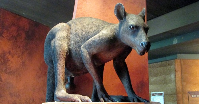 |
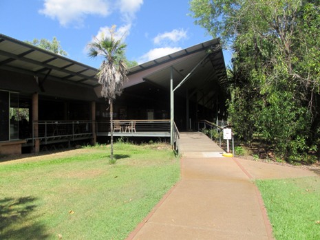
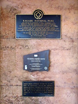
The photos above are of The Bowali Visitor Centre near Jabiru in the heart of Kakadu National Park. It is a not-to-be missed place to stop by. Named after the Bowali Creek which flows nearby, the centre provides a wealth of introductory information about many aspects of the park including flora and fauna, it's geology and the Aboriginal culture. Display boards and helpful staff are on hand to help with planning your visit whilst there is an interesting video to watch, focussing on the ecology off the park and management aspects such as keeping crocodiles away from the tourist areas. The Marrawuddi Gallery stocks Aboriginal arts and crafts, gifts and souvenirs whilst refreshments are available from the Anmak An-me Cafe.
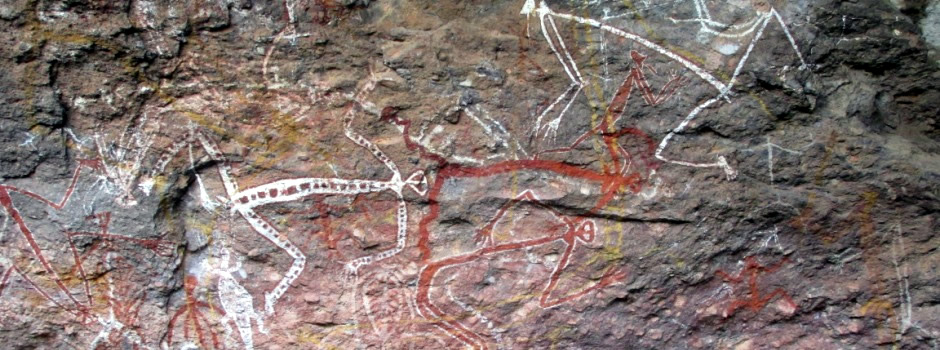
Above: Taking the main road approximately south from the Bowali Visitor Centre and following a branch road travelling some 12km further to the southeast takes you to Anbangbang Gallery. Gallery, in this context, refers to ancient Aboriginal rock art. Signposts and information boards guide the visitor along paths from the car park and there is wheelchair access to some of the main Gallery sites. Anbangbang was once Warramal clan land, although this Aboriginal clan is now extinct and the land is looked after by neighbouring clans who look after the land, following traditional law. Here, runs a rocky outcrop and the name Anbangbang refers to its lower area, whilst the upper area of the rock has always been called Burrunggui. Aboriginal people camped here for over 20,000 years due to the rocks forming a natural shelter and the plentiful supply of food to collect and hunt nearby. The gunbin (rock art) which can be found in the rock shelters is left as evidence that the site has traditionally been a place of living, working and learning. Art is an important part of traditional Aboriginal life and serves a variety of purposes from recording events, for religious purposes, storytelling and for pleasure. The rock art here in the Anbangbang shelter is more modern with respect to some of the other paintings in Kakadu and is thought to date back to sometime during the last 1,000 years. One of the representations shown [Photo 12] is of Nabulwinjbulwinj, a dangerous spirit who eats females after striking them with a yam. Another [Photo 14, upper rightmost] is of Namarrgon, the Lightning Man, who now lives as the lightning dreaming. He wears his lightning as a surrounding band which connects the ends of his limbs and head, whilst stone axes on his elbows and knees make the thunder. A path (not wheelchair-accessible) leads up to Gun-warddehwarde Lookout, from where it is possible to get panoramic views across towards the Arnhem Land escarpment. For the more adventurous, there is a further 5-6 hour 12km walk from here. The rock art here is well worth the detour and we found it at the time of the visit a quiet place to enjoy.
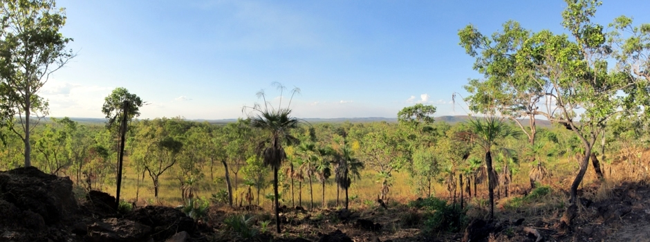
Above: Bukbukluk Lookout panoramic stitch. A contrast to the wetlands in the north of the park can be seen at the Bukbukluk Lookout. This is located to the southwest of the park and is one of the last/first lookout points just off the main road (Kakadu Highway) as you leave/enter the park. With spectacular views over the southern hills towards the old Goodparla Station, the return walk from the car park is just 400m.
References and Further Reading
1. Kakadu National Park Visitor Guide published
by Parks Australia
2. In situ public information boards
3. Top End
National Parks (Map with visitor information). Hema Maps Pty Ltd.
4.
Rawlings-Way, C., Worby, M. and Brown, L. (2013). Central Australia.
Footscray, Vic.: Lonely Planet.
Back to Top