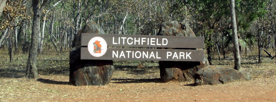
Litchfield National Park is one of the most popular recreation areas in the Top End of Australia's Northern Territory. It covers an area of some 1460km² and contains several types of habitat such as grassy floodplains, sandstone escarpments, eucalyptus woodlands, monsoon forests, year-round creeks and deep pools.
Running almost the entire length of the park are 150m high sandstone plateaux, known as the Tabletop Range. They absorb the rain during the wet season (like a sponge), releasing the water into a series of springs. The water feeds creeks that plunge over the escarpments to form numerous waterfalls.
 |
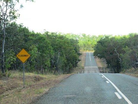 |
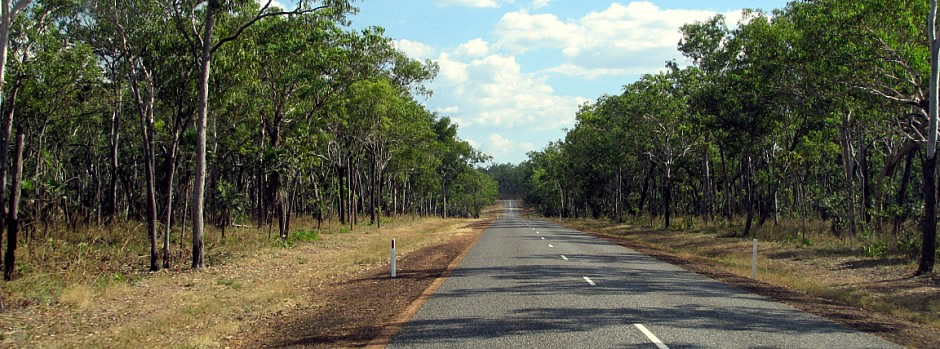
The gateway to Litchfield from the Stuart Highway comes in the form of the small town of Batchelor, which lies to the northeast of the park's boundary. One of the draws of the park is the fact that all of it's most popular attractions are accessible by sealed roads. An alternative route into the park is via Berry Springs which lies approximately 50km to the north of t he park. However, the latter route is on partially sealed roads that are subject to closure during the wet season. Whilst the park's waterfalls draw many sightseers in, their plunge pools also make ideal swimming spots. Other activities popular here are walking, bird watching, camping, picnicking and off-road driving.
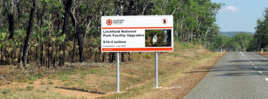
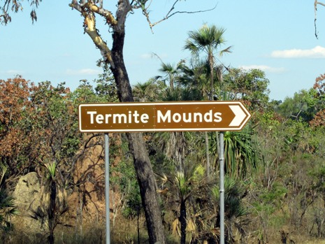
As seen in the sign above, during the time of the visit featured on this webpage (early June, 2016), Litchfield National Park was undergoing a series of upgrades. Unfortunately, this meant that a couple of the park's attractions, Tolmer Falls and Buley Rockhole, were not accessible. Tolmer Falls is known for a spectacular view of the falls via a 1.6km return wheelchair-friendly walk, whilst Buley Rockhole is a series of waterfalls and rock-holes which are popular for swimming. However, it goes without saying that amongst other attractions Litchfield has to offer, those featured on this webpage are also popular places to visit in the National Park and were a real pleasure to see.
 |
 |
|
 |
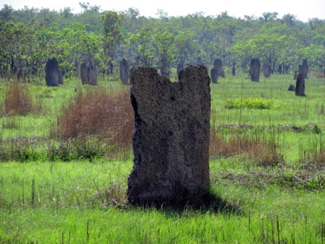 |
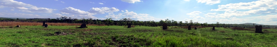
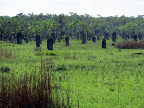
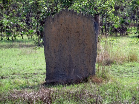
Entering the park on the road from Batchelor, the first main attraction to see is an impressive array of termite mounds (photos above). Standing on a floodplain which has required special adaptation due to the extremities of wet season rains bringing flooding and waterlogged soil to the area followed by sun-baked land in the dry season, the termite mounds found here are rather unique; they are formed by the magnetic (or compass) termite, Amitermes meridionalis, a species of eusocial insect in the family Termitidae which is endemic to the northern part of Northern Territory of Australia. The fire-proof slab-like mounds sit here in a graveyard-like manner and are aligned with their main axes running in a north-south alignment. It is generally accepted that the mounds are built in such a fashion so as to provide maximum exposure to the morning and afternoon sun and so control the temperature of the inner chambers. In addition, the temperatures here plummet at night-time. The mounds help keep the termites safe from the annually waterlogged soils and the colony's food well protected from bacteria and fungi. Other species of termite are also found in the Northern Territory of Australia (not all in mounds) and these highly adapted and socially organised insects form an important link in the ecosystem, consuming plant material and unlocking the nutrients and energy contained within it. The main predator of termites are ants, although they are also consumed by birds, frogs, lizards and spiders.
Pictured in the thumbnail photo gallery above is the Wangi Falls, which spill 70m over sandstone cliffs of the Tabletop Plateau into a large plunge pool. The falls provide a great backdrop for picnics whilst the pool is popular with bathers in the dry season. However, during the wet season, it is often closed due to dangerous currents and the increased risk of Saltwater (Estuarine) Crocodiles invading from the nearby Reynolds River (which is permanently closed to swimmers). From the car park, a short boardwalk leads to the Wangi Falls viewing platform, and as well as the falls and plunge pool, a colony of flying foxes (bats) can be seen (on this particular visit, heard). The falls flow all year, due to the sponge-like action of the Tabletop Plateau, mentioned above, and because of its year-round permanency, the plunge pool is a haven for aquatic life, including the Northern Snapping Turtle, shrimps and around a dozen types of fish, such as Black Bream, Eel-tailed Catfish, the Purple-spotted or Northern Trout Gudgeon and the Black-banded Rainbowfish. River Pandanus surrounding the plunge pool bears large fruits which provide food for the turtles and larger fish. A couple of further short walks that can be taken at Wangi Falls are an 800m return rainforest canopy treetop walk and a 1.7km loop walk which involves a moderate climb beyond the treetop deck. For the more experienced walker, the 3-5 day 39km Tabletop Track bushwalk can be taken from atop the falls.
Like Wangi Falls, Florence Falls (photo gallery above) are year-round due to the sponge effect of the sandstone plateau from which they drop. The plunge pool attracts swimmers here and there are two short walks to take. The Shady Creek Walk (1.2km return) and the Florence Creek Walk (3.2km return). To the Aboriginal people, the Florence Falls represent both a spiritual place and a resourceful system to hunt for food. The rocky area to the right of the falls protects a group of fire sensitive Cypress Pines. Cyprus Pines are water efficient and although they bear cone-like fruit, are not related to true pine trees. Their significance is that of having timber that is resistant to termites. Consequently, they have been used by Aboriginal people to make various tools and for building by the early European settlers. Cypress Pine timber is still used in the building trade today.
References and Further Reading
1. Top End National Parks (Map with visitor
information). Hema Maps Pty Ltd.
2. In situ public information boards
3.
Exploring the Stuart Highway and Oodnadatta Track Adelaide to Darwin.
Balhannah, SA: Tourist Information Distributors Australia.
4.
Rawlings-Way, C., Worby, M. and Brown, L. (2013). Central Australia.
Footscray, Vic.: Lonely Planet.
Back to Top