L'Eree Headland
North of Fort Grey along the western end of the island is situated L'Eree Headland. Located in the Parish of St Peter's (known officially as Saint Pierre du Bois), there are a number of features to be found here of interest as follows:
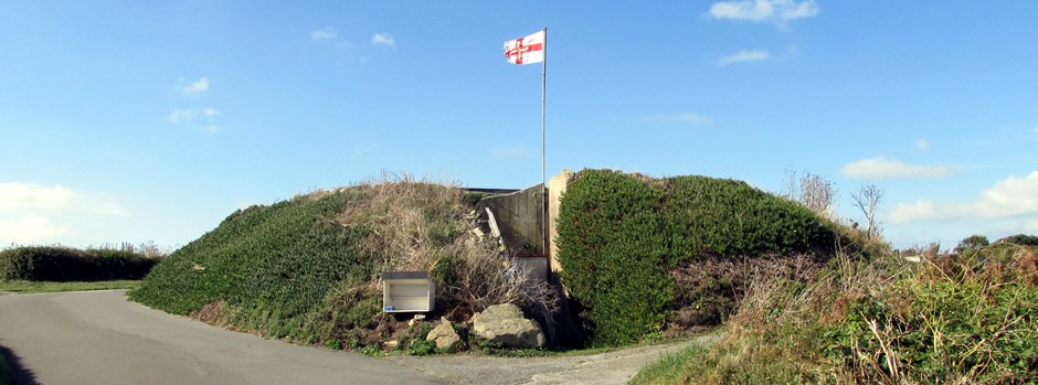
Stützpunkt Langenberg - Strongpoint Fort Saumarez
 |
 |
|
 |
||
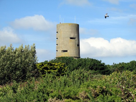
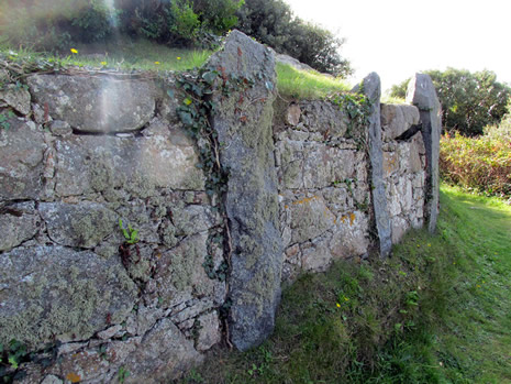
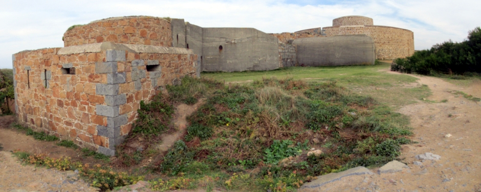
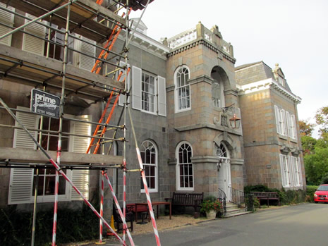
Fort Saumarez is a Martello tower on L'Eree Headland which was constructed on the headland in 1804 on the site of an existing battery, after the onset of the Napoleonic Wars. Like Fort Grey (see previous page) and Fort Hommet (see below), it was intended as a keep for the battery in which it was placed. The original tower mounted a 24lb short barrel gun on the roof to support the battery within the fort. larger guns replaced some of the existing ones during the Victorian Era. However, during the occupation of World War II, the Germans, recognising the usefulness of the site, built a four-storey concrete observation tower on top of the existing tower [above, top left]. At some point in time, the battery which had stood around the tower was demolished. Fort Saumarez is currently privately owned and not open to the public. Also on the headland, the Germans built a north-facing 4.7cm Pak 36 (t) anti tank gun casemate and a 10.5cm K 331(f) gun casemate alongside other structures including a 60cm searchlight, trenches and bunkers, as well as a similar south-facing 4.7cm anti tank gun casemate [above, top right], 10.5cm gun casemate and 60cm searchlight.
Old Cottages on L'Eree Headland
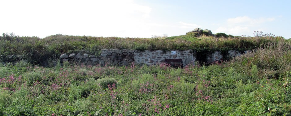
The photo above shows the remains of two cottages on L'Eree Headland which were destroyed during the German occupation. With permission from the owners, Floral St Peter's Group has uncovered the walls of the two structures along with a rambling rose which once clambered over them.
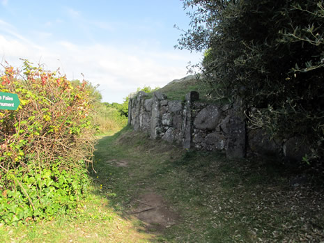
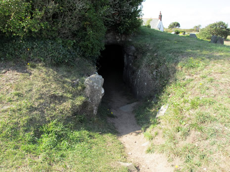
Le Creux ès Faïes
 |
 |
|
 |
 |
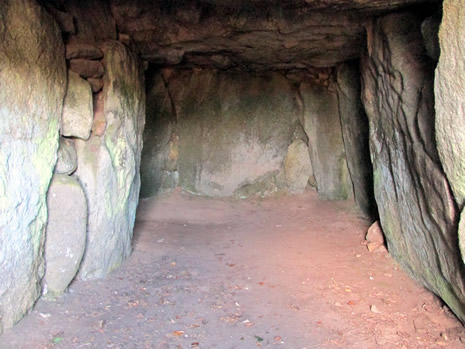
Le Creux ès Faïes [Above] is one of many examples of prehistoric passage graves to be seen on Guernsey. It was built during the Neolithic period ca. 4000-2500BC and would have been use until the Late Bronze Age ca. 1000BC. Successive burials or cremations would have been deposited within the chamber together with grave items such as pottery and tools. The tomb was excavated in 1840 and inside were found pottery of Beaker type and flint arrowheads dating to ca. 1800BC. Measuring 9m long, according to local folklore, this long tomb is the entrance to fairyland - some of the older locals will not go near the site, particularly at night-time and never when there is a full moon. It is possible to walk inside the chamber and outside are the remains of an earth mound which would have originally covered it, measuring some 18m in diameter.
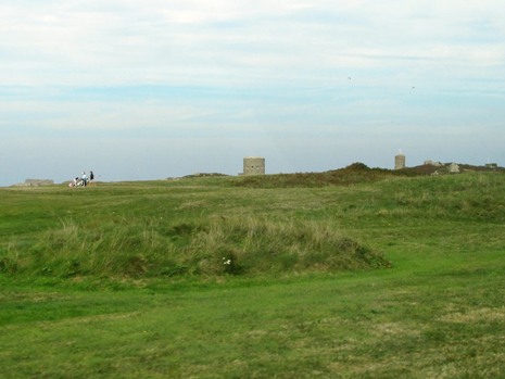
L'Eree Headland Nature Reserve
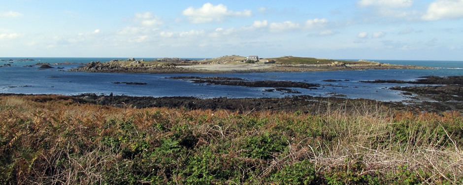
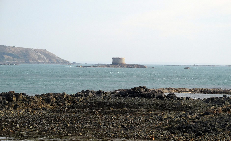
The photo above is taken from L'Eree Headland looking towards Lihou Island. Guernsey's first Ramsar site (a wetland site designated of international importance) covers 426ha around this area (including the island) as well as the intertidal area and outlying rocks and reefs. Here is found a wide range of habitats - shingle banks, marshes, reed-beds, saline lagoons and the intertidal area and consequentially has a rich diversity of flora and fauna. This includes many wild flowers, sea birds and marine organisms. The site is also of archaeological importance. Lihou island itself is connected at low tide to mainland Guernsey by an adjoining stone causeway (no cars). The causeway was built by monks who also built the now ruined priory of St Mary's Priory on the island. Although the island is accessible at low tide for a few hours for most of the year and crossing is dangerous if any water is covering the causeway - a strong current rips through the channel. Advice given is to cross with care and to check locally ((e.g. press and radio) for up-to-date advice/warnings. Obviously for anyone planning a visit, if you get cut off on the island, you will have to wait another 11 hours for the tidal cycle. Lihou is about ½ mile long and is popular for birdwatching, swimming in one of the two deep pools at it's western end or just as a place to simply relax.
Fort Hommet
Further along the island's north-western shore from L'Eree Headland lies Fort Hommet (or Fort Houmet) on Vazon Bay headland. It is built on the site of fortifications which date back to 1680 and comprises a Martello tower (from 1804), later additions from the Victorian Era and German bunkers and casemates constructed during the occupation in World War II.
A fortress with one gun is known to have existed on the headland here during the late 17th century. Following France's attempt to invade Jersey in 1781, improvements were made to Guernsey's defences and in 1795, additional gun positions were added to the headland here. The Martello tower was constructed in 1804 after the onset of the Napoleonic Wars, along with the one at Fort Grey (see page 2) and Fort Saumarez (see above). The Napoleonic era Martello towers on Guernsey are smaller than those found on the British mainland. Each mounted a 24lb short barrel gun on the roof to support the battery within the fort. The road between Fort Hommet and St Peter Port was upgraded to military standard shortly afterwards around 1808. Further batteries and barracks were added to the fort during the Victorian era, including much larger guns replacing some of the existing guns.
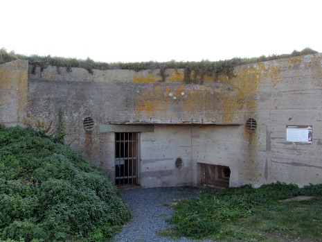
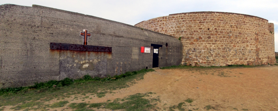
The largest addition to Fort Hommet, however, was by the Germans during World War II; recognising the usefulness of the existing site, they fortified it further to form 'Stützpunkt (Strongpoint) Rotenstein'. Stützpunkt Rotenstein was the name as applied to the headland as a whole and on it the Germans built some 12 defensive structures. The German defences here formed one of a chain of strongpoints along the west coast of the island to defend against beach landings. Construction of these was a consequence of Hitler's directive of 20th October 1941 that ordered that the Channel Islands be converted into an impregnable fortress. The Martello tower itself includes two bunkers which housed a 60cm and a 150cm searchlight and crew accommodation and just west of it, a bunker housed an armoured machine gun cupola. Facing north on the headland are two 10.5cm coast defence gun casemate bunkers, and two other 10.5cm casemates face south from the headland to defend Vazon beach. One of the latter two has been restored and is now open as a museum. The thumbnail gallery below shows photos of and around the Martello tower and of the restored 10.5cm casemate.
The restored casemate on display here [Photos 31 onwards] is one of 21 'Fortress' bunkers built in Guernsey to house 10.5cm K331(f) guns, four of which, as previously mentioned, were installed here at Fort Hommet. Building work on the 'Fortress Standard' bunkers with 2m reinforced concrete external walls and roofs started around April 1943 during a time when the railway had reached here from St Peter Port. The railway was needed for moving the required construction materials. After the war, the bunkers were stripped out and landscaped over. In the first half of the 1990's, excavation work was carried out and by May 1995, the best example of a casemate had been restored and refitted to how it would have appeared in 1943 and opened to the public. The rooms inside include the entrance which includes a gas-lock, a crew standby room (where the duty crew would have spent their time), the main central corridor, the extractor plant room (for removing fumes from the gun room and the spent shell-case room), the gun room itself (containing a French manufactured Schnieder field gun made at the Le Creusot works in 1916) and two rooms used for the storage of ammunition. For the visitor who wishes to find out more about the many carefully restored features on show here, it is recommended to purchase the 10.5cm Coast Defence Gun Casemate Bunker Fort Hommet Souvenir Guide (by Fortress Guernsey) which not only gives a detailed description but also has informative maps inside of the casemate and of the various defences across the headland.
Other defences to explore at Fort Hommet/ Stützpunkt Rotenstein include the site of the Victorian barracks and a Victorian gun position which are adjacent to the Martello tower (on it's southern side), an M19 5cm automatic mortar bunker, a field order emplacement which defended the headland prior to construction of the main defences in 1943, a 4.7cm anti tank gun bunker with an adjacent pre-war shelter and a 'tobruk pit' which mounted a machine gun in a tank turret. The latter two formed part of the southern facing Vazon beach defences. Further defences protected the strongpoint headland itself, including a minefield, barbed wire, trenches and machine gun pits.
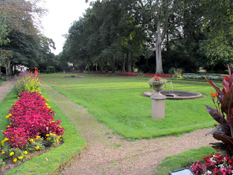
Saumarez Park
 |
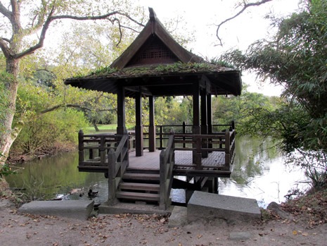 |
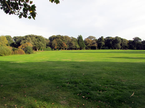
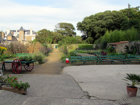
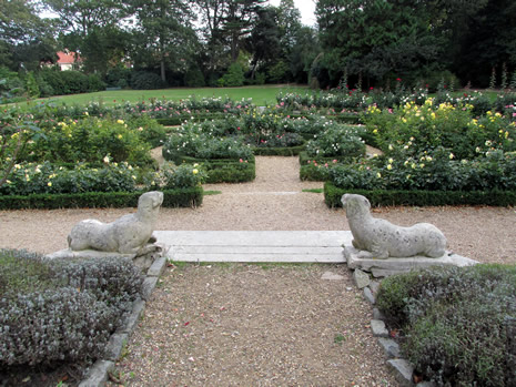
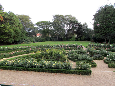
Saumarez Park forms what was once the largest and finest country estates on Guernsey. It was purchased by the States of Guernsey in 1938 and it's park became what is now the largest public amenity area on the island. The park and it's features were originally laid out by James de Saumarez and his wife, Jane Ann Broke from around 1875 and has a large collection of trees. It is also popular place to take children as not only is there plenty of space, but swings and an adventure playground. A series of themed gardens are to be found and these were influenced by James de Saumarez's many years in the diplomatic service. They include formal gardens, the Bamboo Walk and the Japanese Walk. Close to the manor house are formal rose gardens, a walled kitchen garden and lemon house.
 |
 |
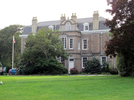
The large manor house set within the grounds is now the site of the Hostel of St John, a residential care home for the elderly. Next to the house are tearooms and lavatories, although it is worth noting these are far from right next to the main car park. Also situated within the park, beyond the tearooms, is the National Trust of Guernsey's Folk & Costume Museum. Housed in restored traditional farm buildings, the museum centres on the island's heritage with respect to domestic life, fishing and farming. exhibits include a working cider press and a Guernsey kitchen reconstructed how it would have appeared over a century ago. In the stable yard is a collection of carts, carriages and farming equipment and also here on show at the museum is a large collection of costumes.
 |
 |
|
 |
 |
The park is open throughout the year from dawn until dusk. Entry is free, except when events are being held, such as agricultural and horticultural shows which are held here during certain days in the summer months.
Golf Courses
 |
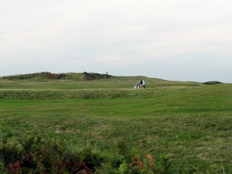 |
And finally, there are three golf clubs on Guernsey: La Grande Mare, Royal Guernsey and St Pierre Park. The photos above show the links course on L’Ancresse Common, where the Royal Guernsey Golf Club is located. Situated at the northern end of the island, it is an 18 hole, par 70 private course, boasting rolling beaches on two sides.
References and Further Reading
1. In Situ Notice Boards and Guides
2. The
Perry's Map of Guernsey 2016 (Free and Indispensable)
3. Channel
Islands. Basingstoke: Pub. Division, Automobile Association, 1987.
Print.
4. Guernsey on Wikipedia
Here
5. Visit Guernsey website
Here