Aoraki/Mount Cook & Westland Tai Poutini National Parks
Aoraki/Mount Cook and Westland Tai Poutini National Parks are two separate National Parks on the western side of central South Island, New Zealand. This webpage contains photos taken from both, because the two National Parks share a common boundary and when visiting one, the views may invariably extend over the other.
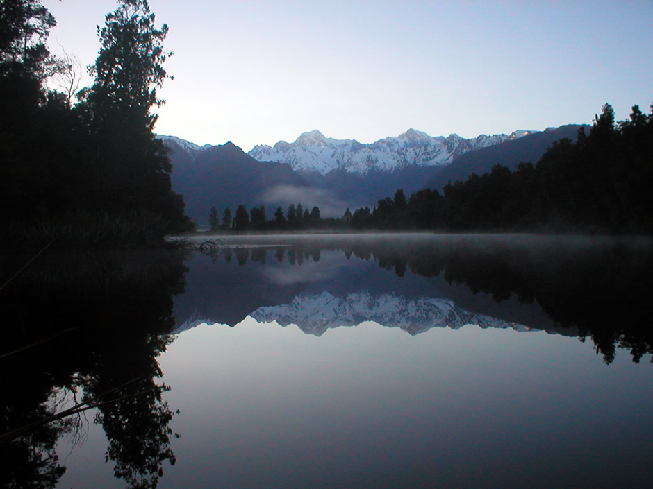
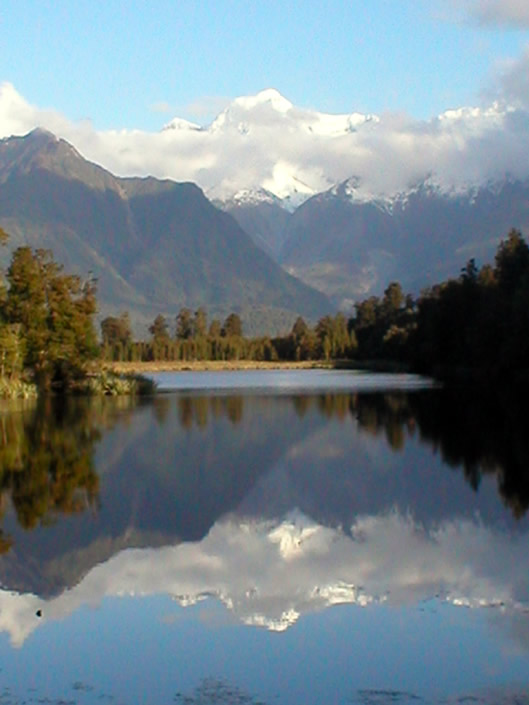
Above: A classic postcard view towards Mount Cook and Mount Tasman from Lake Matheson in Westland Tai Poutini National Park
Aoraki/Mount Cook
This National Park derives its name from Aoraki/Mount Cook, which is New Zealand's Highest mountain, standing 3,724m (12,218 feet) tall. The peak of Aoraki/Mount Cook was previously recorded as 3,764m (12,349 ft). However, in December 1991, a massive rockslide and avalanche, and subsequent erosion cut the top of the mountain off, thus reducing its height. The mountain is sacred to the Ngai Tahu Maori tribe of the South Island; according to traditional legend, the mountain and its companion peaks were formed when a boy named Aoraki and his three brothers came down from the heavens to visit Papatuanuku (Earth Mother) in a canoe. The canoe overturned and as the brothers moved to the rear of it, they turned to stone. The National Park covers some 700km² (270 square miles) and was designated such in 1953. In total, it includes19 peaks over 3,000m (9,842 feet) and some 40% of the park is covered with glaciers, the Tasman Glacier being the largest, both in the park and in all of New Zealand. The National Park attracts many people for various activities including mountaineering, walking (known as tramping in New Zealand), heli-skiing, and taking scenic flights. Here, the latter option was taken. For more information on Aoraki/Mount Cook National Park, see the Department of Conservation (DOC) website on the link Here.
Although the scenic flight by helicopter involved flying around the summit of Aoraki/Mount Cook and offered excellent views over the National Park from the air, it also took in sights which are in the neighbouring Westland Tai Poutini National Park (see below). The flight was taken from the settlement of Fox Glacier Village (in Westland Tai Poutini National Park) and also flew around the summit of Mount Tasman, flying first up the Franz Josef Glacier valley and finishing with a descent down the Fox Glacier valley, including a landing high up on the glacier itself - the glaciers falling within the boundaries of Westland Tai Poutini NP. Photographs from the flight are shown in the thumbnail gallery below.
Westland Tai Poutini National Park
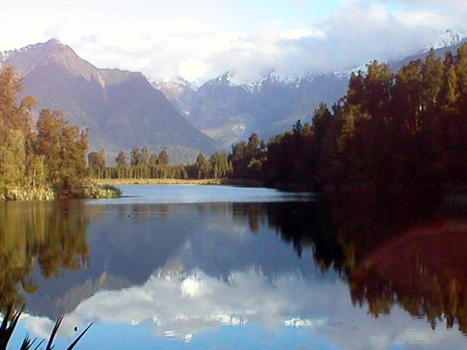
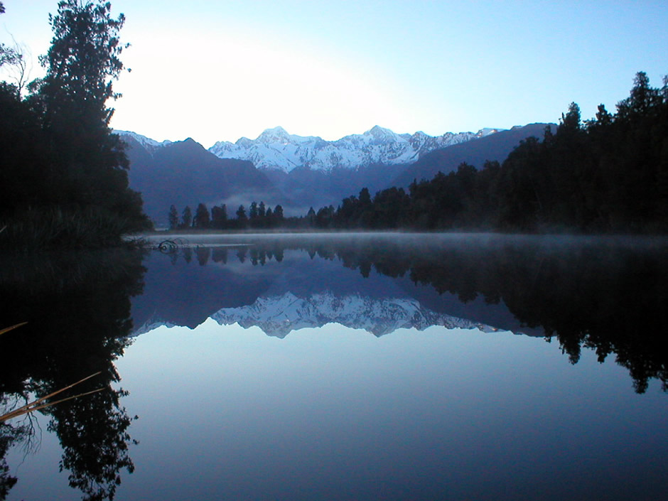
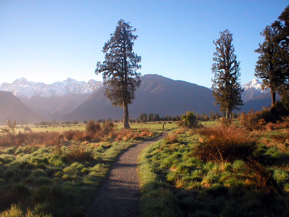
From atop the Southern Alps to the east on the boundary with Aoraki/Mount Cook national Park, westwards to the Tasman Sea is the 1,175km² (450 square mile) Westland Tai Poutini National Park. This National Park is known not only for its mountain peaks, but also some 60 glaciers (the most famous being the Franz Josef and Fox Glaciers, mentioned above), dense rainforest, coastal lagoons and stunning lakes. The area experienced a gold rush in the 1860's and on the river flats, pastoral farming has taken over the land. This aside, the area has remained largely unspoilt. For walkers (trampers) and, in places, experienced climbers, the Copland Valley Track runs through the park. Furthermore, from the Franz Josef Glacier Village, it is possible to walk up to the glacier face, whilst the Fox Glacier (and the largest in the park) is possible to walk on but should be done with a guide - walking on glaciers can be extremely dangerous without specialist and local knowledge. On the northern side of the park is the Okarito Lagoon, one of New Zealand's largest wetland areas which is rich in birdlife and also at this end of the park is the popular Lake Mapourika. From Fox Glacier Village runs a road off the main highway to Gillespies Beach, a historic gold mining settlement and walks can be taken here to see a fur seal colony. But perhaps one of the most stunning sites the park has to offer (and the subject of many a postcard and travel brochure) is Lake Matheson. On a clear still morning, the lake's remarkable reflective properties enable a mirror image view of Mount Cook and Mount Tasman, with the lake's surrounding forest set either side. The walk to see this classic view involves following a trail which loops around the whole of the lake. On this visit, the walk was taken clockwise in the evening and then again, anti-clockwise first thing in the morning. For more information on Westland Tai Poutini National Park, see the Department of Conservation (DOC) website on the link Here. Photos from the park follow.
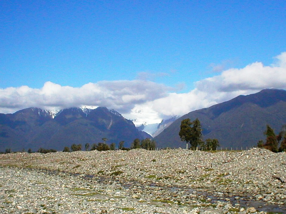
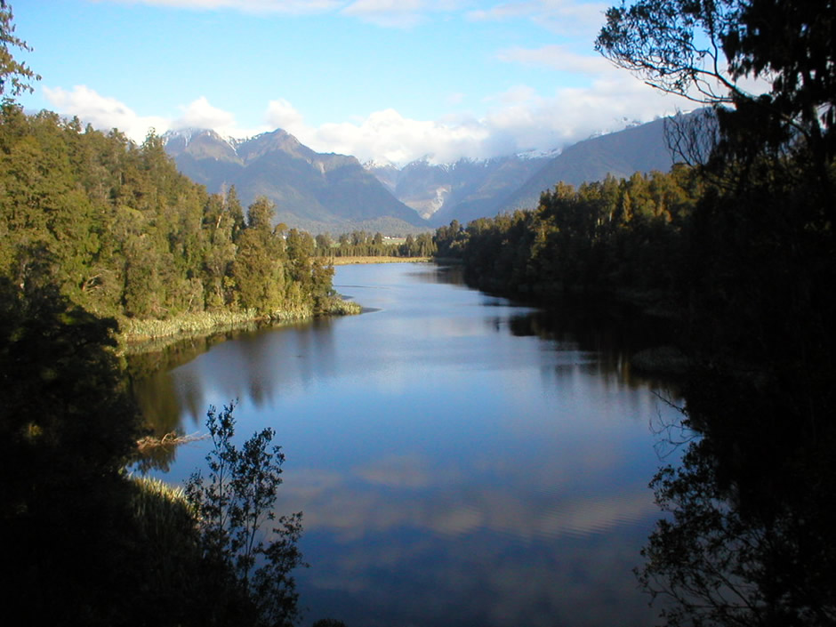
View from Cook River Bank
Lake Matheson Walk
Lake Matheson Walk
Lake Matheson Walk
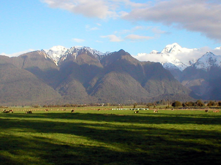
Pastoral farming on the river flats, Westland Tai Poutini National Park
Lake Matheson
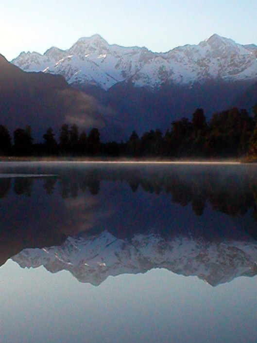
Lake Matheson
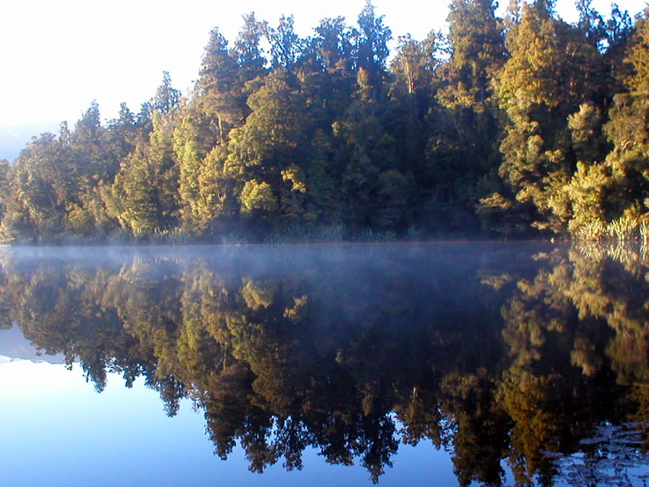
Lake Matheson
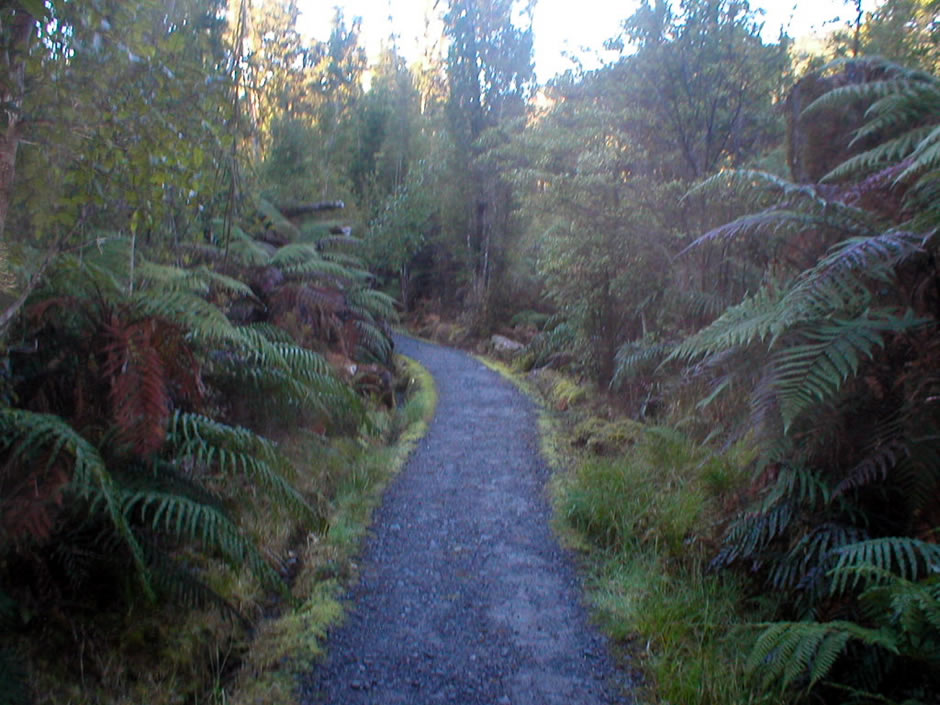
Lake Matheson Walk - The high rainfall in the lowland rainforest here helps create a lush, densely ferned habitat.
Lake Matheson Walk (nr. parking)
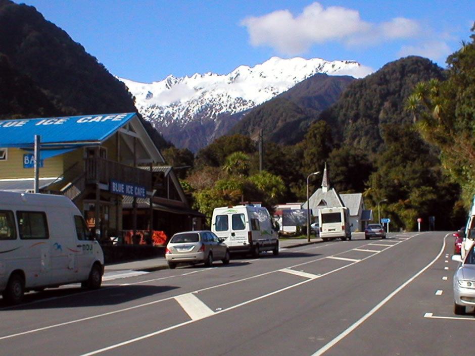
Franz Josef Glacier Village
Back to Top