Uluru-Kata Tjuta National Park
Above: View from the Kata Tjuta Dune Viewing Area taken early afternoon. On the left of the photo is Kata Tjuta (The Olgas) and scrolling further to the right, Uluru (Ayers Rock) can be seen on the horizon.
Uluru-Kata Tjuta National Park is the location of Uluru (Ayers Rock), a sandstone monolith and one of the most famous and recognisable natural wonders of the world. It is located in Australia's Northern Territory, 1431km (889 miles) south of Darwin by road and 440 km (273 miles) south-west of Alice Springs along the Stuart and Lasseter Highways. It's 1,334 square kilometres cover an area surrounding not only Uluru, but also the equally impressive Kata Tjuta (The Olgas), a group of large, domed rock formations which lie 40km (25 miles) west of the park's main attraction. Uluru-Kata Tjuta National Park was established as Ayers Rock-Mount Olga National Park in 1958. In 1987, it became a UNESCO World Heritage Site, recognised for its spectacular geological formations and for forming part of the traditional belief system of one of the oldest human societies in the world, the Anangu Aboriginal people who today are recognised as the traditional owners of the land here.
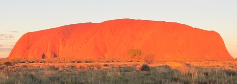
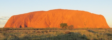
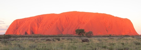
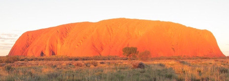
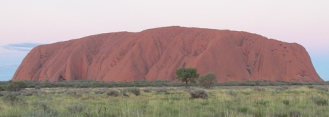
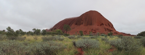
Above: A series of (mainly) panoramic stitch photographs of Uluru (Ayers Rock), which demonstrate the various forms of the monolith as seen from different angles. Some of the angles photographs have been taken from along the Base Walk are deceptive to the eye, in terms of underestimating Uluru's sheer size (3.6km long by 2km wide). Note: If the photos do not change automatically, refresh the page and allow blocked content.
There are a number of options for getting to and from Uluru-Kata Tjuta National Park. Connellan airport lies approximately 4km north of the resort town of Yulara, with Qantas flying direct from several places across Australia and Virgin Australia flying daily from Sydney. Busses run daily shuttle connections between Alice Springs and Uluru, whilst for those driving themselves, there is a single all-sealed route to take here from Alice Springs along the Lasseter Highway which runs from Erldunda on central Australia's main North-South route, The Stuart Highway. Along the Lasseter Highway are regular food and petrol stops.
For the reader, an interactive map centred on Uluru (Ayers Rock) has been embedded into this web page above [Source: OpenStreetMap]. Separate treatment follows on this page (in order) for Yulara (Ayers Rock Resort),Uluru (Ayers Rock) and Kata Tjuta (The Olgas). Beyond the immediate area of the park, due to its geophysical relevance, this page finishes with a brief look at Mount Conner.
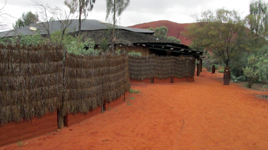
Above: Inside the national park lies The Cultural Centre. As well as interpretive signage throughout the park, the centre gives visitors a greater understanding of Aboriginal culture. Here, it is possible to read and hear about the Anangu people's traditional law through a variety of displays and a video or ask staff any questions you may have. The centre has a cafe and souvenirs on sale here include unique art and crafts made by Aboriginal people. Note: Photography is not permitted in the centre.
Yulara
Yulara is a town which operates as the service village for Uluru-Kata Tjuta National Park. It lies as an unincorporated enclave within MacDonnell Region just outside the park's boundary and is 18 km (11 miles) by road to the north-northwest of Uluru and 55 km (34 miles) from Kata Tjuta. The first tours and establishment of a camp arrived at Uluru in the 1950's. By 1970, it was recognised that unstructured and unmonitored tourism here was having a detrimental effect on the local environment. Consequentially, it was recommended by a Senate select committee to remove all developments near the base of Uluru and build a new tourist resort outside of the boundaries of the national park and in 1976, the Governor General proclaimed the new town of Yulara. The new resort became fully operational in late 1984 and was designed to have minimal impact on the surrounding landscape, including buildings coloured to blend in with the surrounding desert. The design won several architectural awards as a result of this. The name 'Yulara' comes from the local Aboriginal words for howling and dingos.
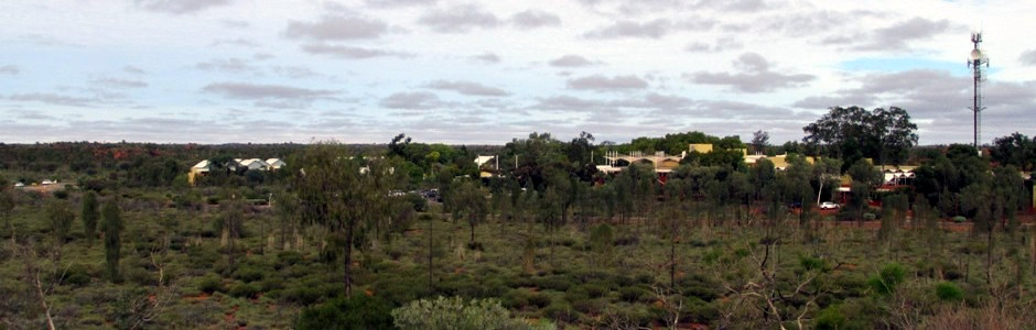
Above: Part of Yulara's Ayers Rock Resort, as viewed from the Imalung lookout
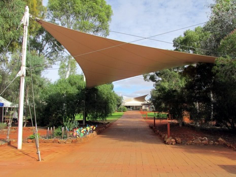
The town has created a comfortable place to stay for visitors to this remote desert location. The complex here comprises hotels, apartments, a large campground, petrol station and a resort town area, complete with its own square, all clustered around the periphery of a looping road. Also heading off this road to the north and away from the main visitor sites lies a residential area for people who live and work locally. The resort town itself contains a number of places to eat and drink, galleries and art centres, a theatre, an amphitheatre, police, fire and medical centres, as well as many other services and facilities and around the town square is to be found a supermarket, bank/ATM, post office, the tour and information centre as well as a number of speciality shops. There are several lookout areas dotted around the resort, including the Imalung lookout, which is perched on a hill in the centre of the loop road. Yulara supplies the only accommodation, food outlets and other services available in the region. As a town, itself, Yulara has a population of around 900 people, many of whom are from outside the Northern Territory.
 |
||
 |
 |
|
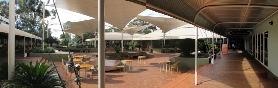
Above: Yulara Town Centre
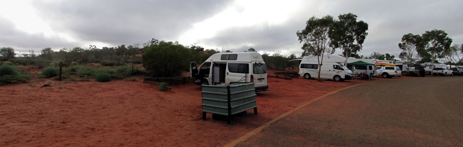
Above: Camping at Ayers Rock Campground
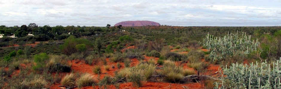
Above: Uluru, as seen from the Imalung lookout, Yulara
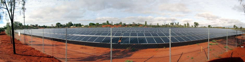
Above: panoramic stitch of part of the Yulara Solar Project, which is spread across five separate locations around the town. The town, which includes Ayers Rock Resort is reliant on electricity generated from the burning of compressed natural gas, which is delivered daily via road train from Alice Springs, approximately 450km from the resort. The abundance of sunshine and available land make it the ideal location to establish a medium scale solar energy plant to supplement the current supply.
Uluru
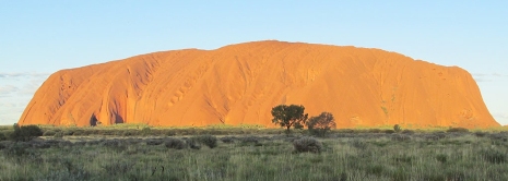
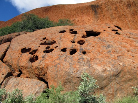
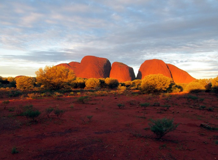
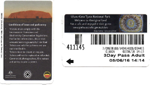
Uluru (Ayers Rock)is perhaps the world's largest monolith and is composed of arkosic sandstone (a type of sandstone containing at least 25% feldspar), which changes according to the position of the sun. It is the most famous of a number of isolated masses of weathered rock situated in the southwest of the Northern Territory. Uluru is best seen at sunset (and also at sunrise), when it is coloured a fiery orange-red by the rays of the sun. Uluru is a sandstone formation and rises some 348m (1,142 feet) above the surrounding plain, which equates to 863m (2,831 feet) above sea level. It is roughly oval in shape, measuring 3.6km long by 2km wide; it is grand in size, and that's just above the ground - it is believed that two thirds of the monolith lies beneath the sand. The lower slopes are fluttered by erosion of weaker rock layers whilst the top is scored by basins and gullies that cause series' of steep giant flows of water to run down the side, during the very occasional rainstorm that occurs here. At the base of the rock are shallow caves which are sacred to several Aboriginal groups and they contain carvings and rock-art. Uluru was sighted by the European Ernest Giles in 1872 and named after Sir Henry Ayers, a former South Australian premier. Uluru is sacred to the Pitjantjatjara Anangu, the Aboriginal people of the area. Official ownership of Ayers Rock was given to the Aboriginal people in 1985 who, in turn, leased it along with the surrounding park to the Australian government for 99 years.
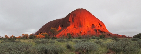
Sunset Viewing
During the afternoon, Uluru appears an ochre-brown colour and when the sun sets, the rock illuminates in burnished orange, followed by a series of deeper reds before fading into a charcoal colour. The main car and bus sunset viewing areas are situated northwest of Uluru in the park on the road leading in from Yulara Ayers Rock Resort. Unlike the Talinguru Nyakunytjaku sunrise viewing area (see below), there are no amenities here, although this is offset by its closer proximity to Yulara. Some photos taken from the sunset viewing are shown below:
 |
 |
|
 |
 |
|
 |
 |
The photos above are from a series of photographs which were taken sequentially, aligned and subsequently combined into an animated GIF file. To see the animated GIF file on a separate web page, click Here.
Sunrise Viewing
To the southeast of Uluru lies Talinguru Nyakunytjaku sunrise viewing area. Although most people come here to view Uluru at sunrise, the visitors map also marks it as a place to go at sunset. In addition to Uluru, it is possible to see Kata Tjuta (The Olgas) on the horizon from here. There is a large car park and toilet facility here with walks leading up to a large wooden platform perched on a sand dune. Along the wheelchair accessible paths are interpretive signs about Aboriginal Men's and Women's work, stories from the Dreaming, the area's geology and also signs describing the local flora. As well as the main viewing platform, there is a shaded viewing area, which appears to double up as a smoking area. This can be, naturally, a busy place during the daily sunrise, so be sure to plan to get here in good time, bearing in mind there is a mass exodus of people heading here first thing from Yulara as it is not permitted to camp in the park overnight.
 |
 |
The photo gallery below is of Talinguru Nyakunytjaku sunrise viewing area, and below that is a composite image taken from here.
Uluru Base Walk
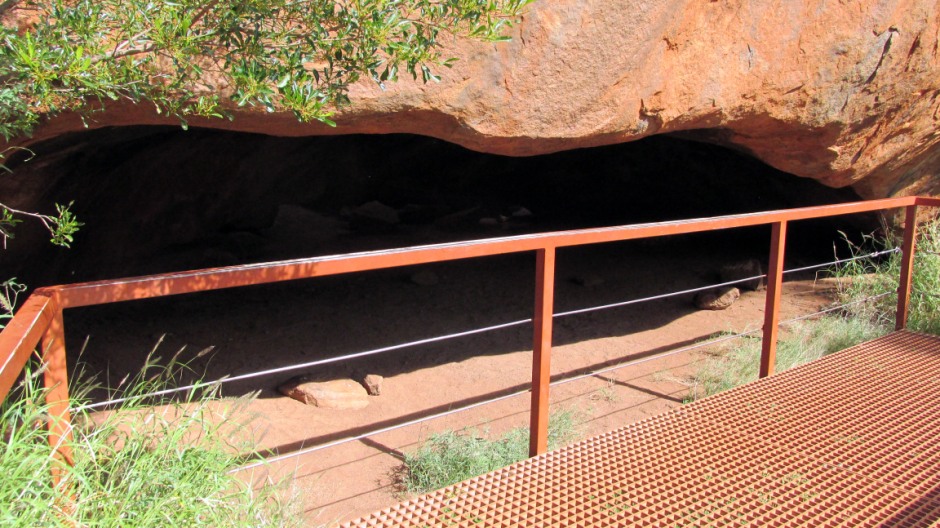
There are several walking tracks around Uluru and for those who wish to learn more, ranger-led walks are available, although literature available at the Cultural Centre gives information on a few self-guided walks. Because of the climatic extremities here, lack of amenities along some of the longer routes and because of cultural sensitivities, it is important to take note of all advice and warnings before and whilst undertaking any of the walks. All of the trails (except the Uluru Climb) are flat. Several areas are off-limits to visitors for their spiritual significance, and these are clearly marked. Walks include the Mala Walk (2km return) which is from the base of the climbing point and includes interpretive signs explaining the creation time of the Mala (hare-wallaby people) and has free ranger-guided walks every morning, the Liru Walk (4km return) which links the Cultural Centre with the start of the Mala Walk, the Kuniya Walk (1km return) which leads from a car park on the southern side to Mutitjulu Waterhole, the Uluru Climb (1.6km return) which is steep and follows the traditional route taken by ancestral Mala men (see next paragraph) and the Base Walk (10.6km /3 to 4 hours) which circumnavigates the rock. The photos in the thumbnail photo gallery below are taken from the Base Walk, accompanied by some side routes, which may additionally be taken for a closer look at the main points of interest. A more detailed description follows the gallery.
The Base Walk featured above began at the Mala car park on the western side of Uluru, completing a full clockwise circuit. The Mala car park is also the start of the Uluru Climb, which on this occasion was closed due to forecast rain (it is often closed for Anangu business, as well as reasons of weather); a dilemma resolved due to the fact that on the occasions it is open, the Anangu people politely request visitors not to undertake it at any time. In addition to the Base Walk, there are a couple of short return detours which were taken here, namely to see the Kantju Gorge and the Mutitjulu Waterhole. It is important to note that along some relatively short sections of the walk, no photos were taken due to particular areas being of cultural sensitivity. Along the path, signs clearly mark these areas; the physical features of the rock are of great significance to the Anangu traditional owners. The caves and rock formations relate to the activities of the ancestral Mala (rufous hare-wallaby) people during the Tjukurpa (creation time). Tjukurpa forms the basis for all the Pitjantjatjara-speaking Anangu people's knowledge, law, religion, social structure and moral values. It is the Mala story and for thousands of years, Anangu have visited this area and lived in it as the Mala people did. The Anangu still to this day continue to celebrate the events of the Mala people through stories and ceremonies. Along the Base Walk are signs telling some of the stories and explaining what the moral of them is. To the traditional owners here, the animals, plants and people are all descendants of these ancestors. Some of the main points of interest along the Base Walk follow.
 |
 |
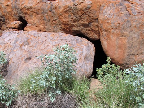
Above: Itjaritjariku Yuu is where during the Tjukurpa, the ancestral Minyma Itjaritjari, or marsupial mole woman, built a shelter and yuu (windbreak). The shelter is a cave and the yuu is the large wedge-shaped rock at the opening to the cave. Holes in the rock above the cave are said to have been tunnelled out by Itjaritjari, who have lived here from the very beginning before the Mala people arrived.
 |
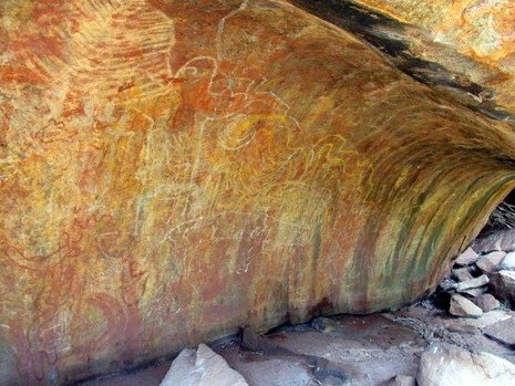 |
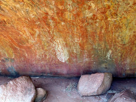
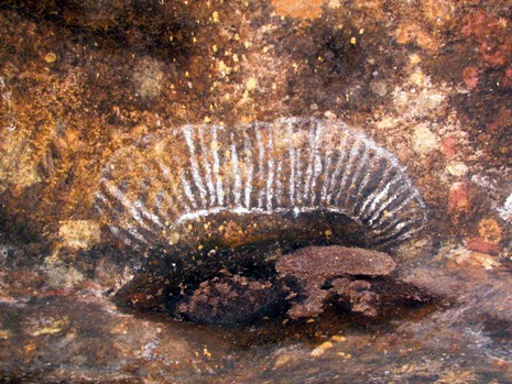
Above: The Teaching Cave (Kulpi Nyiinkaku) has some examples of Anangu rock painting and is where for many generations, elders have taught nyiinka (bush boys) how to travel and survive in the outback. The cave drawings are akin to a school blackboard.
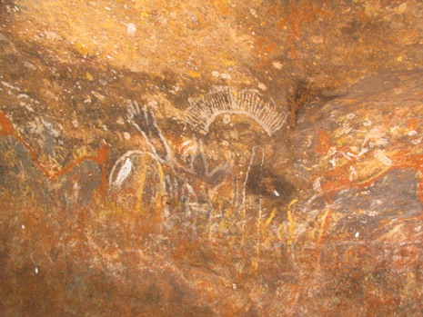
Above: The Men's Cave (Kulpi Watiku), is where senior Mala men made fires and camped, busily preparing for inma (ceremony). From here they could keep an eye on the bush boys in the cave nearby and also be on the lookout for men returning from a hunt for food.
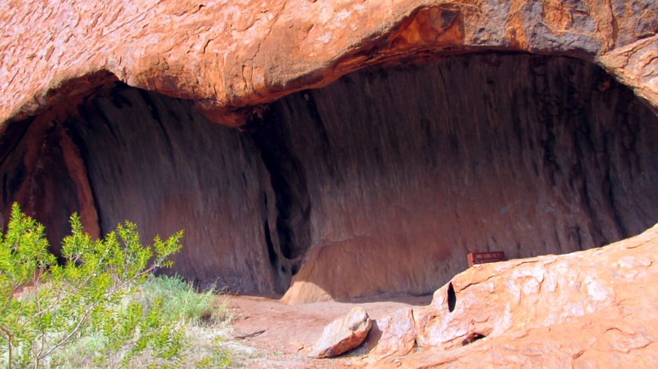
Above: The Kitchen Cave (Kulpi Minymaku) is where women, girls and small children would camp. The women would go out to collect bush foods (mai) and come back to the cave to process them. Here, generations of minymas (women) would pass on their knowledge to the kungkas (girls). The cave has smooth areas on the floor where seeds were pounded with round stones as part of a process to make nyuma (flat bread). The ancestral Mala brought their food here to share and for generations, the people continued this tradition with men bringing meat and women bringing fruit and other bush foods. People would collect their share and deliver it to their family camps, the old people's cave and to the bush boys.
Above: The Old People's Cave (Tjilpi Pampa Kulpi) is where the elders sat around a fire, making sure the women and children did not enter the men's ceremonial areas, telling stories and teaching the children not to go running off and remain in the camp.
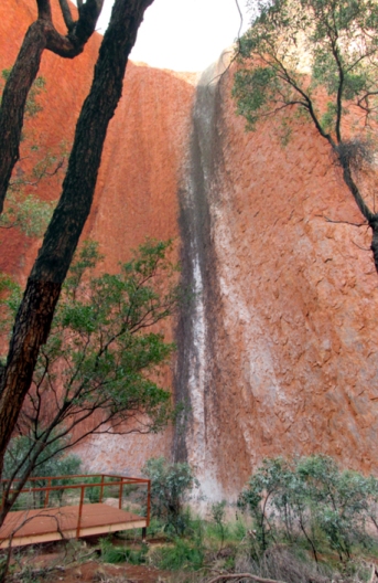
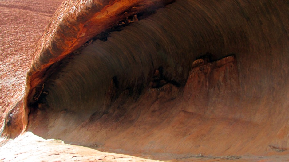
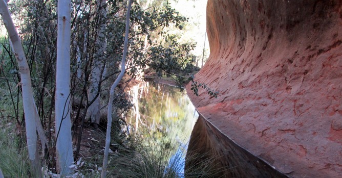
The composite image above is of the Kantju Gorge, which provides a quiet place to sit and reflect. The waterhole here was the main source of water during the Mala ceremonies and generations of people, as well as the wildlife, have depended upon it for survival. The black stain on the rock is algae growing along the route where water falls down the side of the rock after rainfalls.
 |
 |
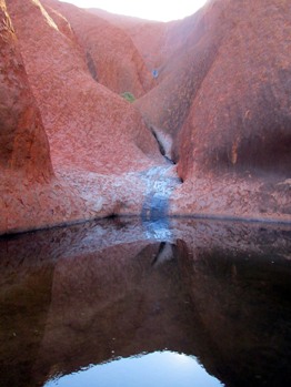
Above: Mutitjulu Waterhole(Kapi Mutitjulu) forms the most reliable source of water (kapi) around the base of Uluru. According to the Anangu people, Wanampi (water snake) lives here today and has the power to control the source of this precious water. In traditional times, Anangu would sing out 'Kuka kuka' and Wanampi would release the water and let it flow into the waterhole below. People camped here for two to three days before moving on; traditionally they led a nomadic lifestyle, travelling all over the land, looking for food and water in family groups, burning country to encourage new bush food plants to grow. Because this site is sacred, swimming or polluting of the water is forbidden. It is an ideal spot for a bit of contemplation about the surrounding nature of for meditation.
 |
 |
|
 |
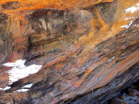 |
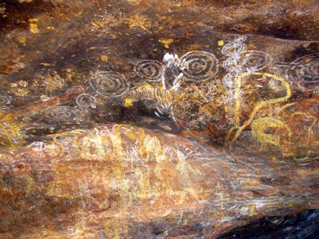
Above: Mutitjulu Cave (Kulpi Mutitjulu) is the family cave and like the Teaching Cave, mentioned earlier, has some examples of Anangu rock painting. For many generations, Anangu families camped here. The men would hunt for meat (kuka) and the women and children would collect bush foods (mai) and the food would be brought back here to share. At night, generations of people would tell stories around a campfire here, teaching the children and painting about this place on the rock. The paints are made from various materials including iron-stained clays and burnt wood.
Above: A composite image taken along the Base Walk from the south-eastern side of Uluru.
Kata Tjuta
Kata Tjuta (The Olgas) is a group of 36 tors (isolated weathered rocks) which although less famous than Uluru are a not-to-be-missed feature of the national park. The red conglomerate domed rocks rise above the desert plains and cover 28km² (11 square miles). They culminate at Mount Olga, 460m (1,509 feet) above the surrounding plain, which equates to 1069m (3,507 feet) above sea level, meaning the summit rises over 100 metres higher than that of Uluru.
 |
 |
Above: Kata Tjuta at sunset viewing (left) and a panoramic stitch of Walpa Gorge (right)
The domed rocks stand huddled together, forming deep valleys and steep sided gorges. Mount Olga is the most westerly of the Red Centre's three giant tors and was named after Queen Olga of Württemberg by the explorer Ernest Giles in 1872. The aboriginal name used today, Kata Tjuta, means "many heads" and the rocks are of significance to the local Aboriginal people, particularly the men. The Anangu believe Kata Tjuta was formed by their ancestors during the Tjukurpa. Like Uluru, the domed rocks show a constantly changing array of colour during sunrise and sunset. A description follows the photos in the thumbnail gallery below.
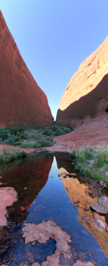
Along the approach road and to the south of the formation is the Kata Tjuta Dune Walk [Photos 3-17] which leads from a car park to a viewing platform with a spectacular panoramic view (first photo under this page's title). From here, it is also possible to see Uluru in the distance to the right. The sand dune (tali) here contains a large variety and number of plants which help stabilise it. The plants have also provided an important resource for the Aboriginal people. The road heading here continues running in an east-west direction along the southern side of the rocks, before heading northwards to their western side, where the main stops are located. The Walpa Gorge Walk [Photos 23-69] is a 2.6km return route (graded moderate) runs from a dedicated car park. The spectacularly deep gorge has played a role as a source of water and contains rare plants, providing an ideal shady refuge for native animals. The Valley of the Winds Walk starts off at another car park with a walk, firstly, to the Karu Lookout [Photos 70-97]. Beyond here (not pictured) a loop track continues on to the Karingana Lookout, forming a 7.4km walk in total. This is regarded as one of the most challenging bushwalks in the park (as a point of note, the path beyond the Karu lookout is closed at 36°C). The Valley of the Winds Walk offers excellent views of the domes and covers various forms of terrain, requiring sturdy footwear, alongside other precautions typical throughout the park, such as taking ample water. Finally, for those weary feet, or visitors who aren't walking, a must-see is to view the domes from the Sunset Viewing area [photos 100-160]. There is a picnic site here and the only toilets at Kata Tjuta, which despite being modern in all respects are still a hole-in-the-ground affair.
Mount Conner
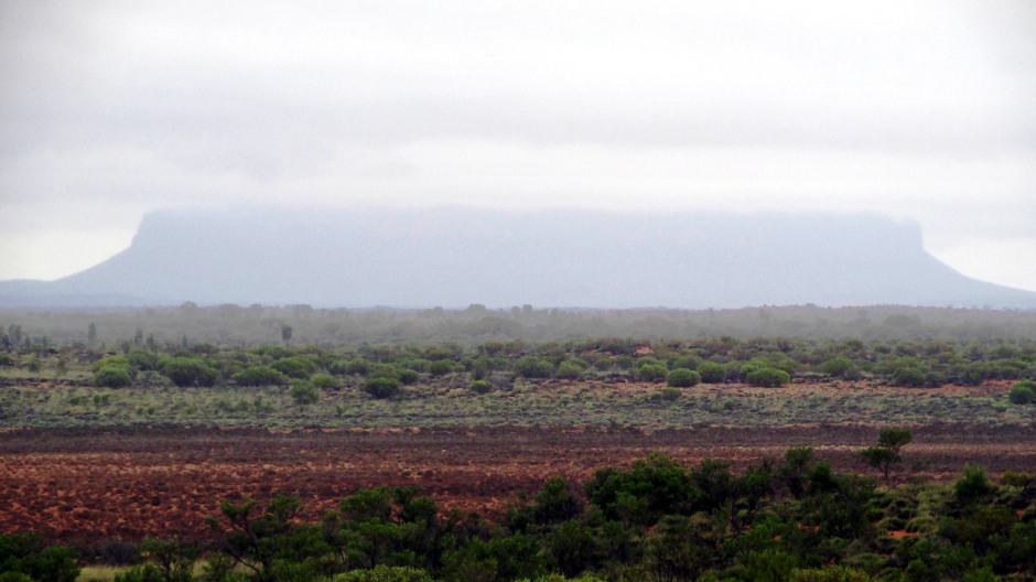
Above: Mount Conner, shrouded in mist, as seen from the Lasseter Highway which connects Uluru-Kata Tjuta National Park with the Stuart Highway
To those heading along the main route towards Uluru, Mount Conner (also known as Attila or Artilla) is occasionally mistaken for it's more famous neighbour. It is not part of the Uluru-Kata Tjuta National Park which is the subject of this webpage, but briefly mentioned here due to it's contextual relevance. Mount Conner is the easternmost of the three giant tors, or monoliths, that rise above the desert plain southeast of Lake Amadeus. It is a flat-topped and horseshoe-shaped mesa, reaching 760m (2,500 feet) above sea level, or 343m (1125 feet) above the surrounding terrain . The lower 150m of its sides are covered by a slope of scree (talus), whilst the uppermost 90m is comprised of sheer cliffs. Mount Conner consists of conglomerates, sandstones, siltstones, and mudstones, with variations in geology from the upper to lower parts. e is surrounded by alluvium. The summit of Mt Conner is a remnant of a Cretaceous geomorphic surface, created by erosion of surrounding strata; this age and form of rock is also seen at the summit levels of Uluru and the summits of the low domes of the Kata Tjuta complex. Mount Conner was visited by William Gosse, a government surveyor, in 1873, who named it after M.L. Conner, a South Australian politician. To the Aboriginal people, it is the home of icemen, who created cold weather. Tours are available from Springs Roadhouse, which is on the main Lasseter Highway, the road leading to and from Uluru-Kata Tjuta National Park.
[Note: This page is intended as 'infotainment' for those interested in travel. The photographs are subject to copyright and all material contained herein has not been produced for any commercial purposes.]
References and Further Reading
1. Exploring the Stuart Highway and Oodnadatta
Track Adelaide to Darwin. Balhannah, SA: Tourist Information
Distributors Australia.
2. In situ public information boards
3. Bright,
M. (2005). 1001 natural wonders you must see before you die. London:
Cassell Illustrated, p.836-837, 850.
4. Rawlings-Way, C., Worby, M. and
Brown, L. (2013). Central Australia. Footscray, Vic.: Lonely Planet.
5.
Bourke, C., Bourke, E. and Edwards, W. (1998). Aboriginal Australia. St.
Lucia, Qld., Australia: University of Queensland Press.
6. Uluru-Kata
Tjuta National Park on the UNESCO Website
Here
7. Red Centre - Alice Springs to Uluru
(Map with visitor information). Hema Maps Pty Ltd.
Back to Top