The Walks is a 42-acre (17ha) park in the English town of King’s Lynn, Norfolk. It was originally established in the 1700’s and is considered a historically important area not only locally, but in the national context. It was designated by English Heritage as a grade II historic park in 1998 and was brought back to its former glory in 2007-2008 by a £4.3 million joint Borough Council and Heritage Lottery Fund restoration project.
 |
 |
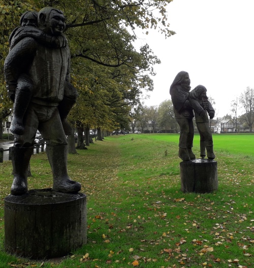
Modern amenities have been added and facilities include a children’s play area, toilets and a café. It makes for an ideal location to explore some of the town’s history, picnicking, or taking a relaxing stroll along its well-maintained footpaths. For the more athletic, King's Lynn parkrun takes place here every Saturday morning at 9 am. The Walks is located at the heart of the town and has won awards as a well-maintained open space for the public to enjoy. Some of the key features of The Walks are shown and described below.
Above: Fully zoomable map centred on The Walks (Source: openstreetmap.org)
 |
 |
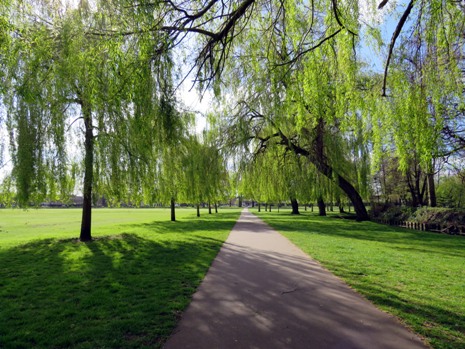
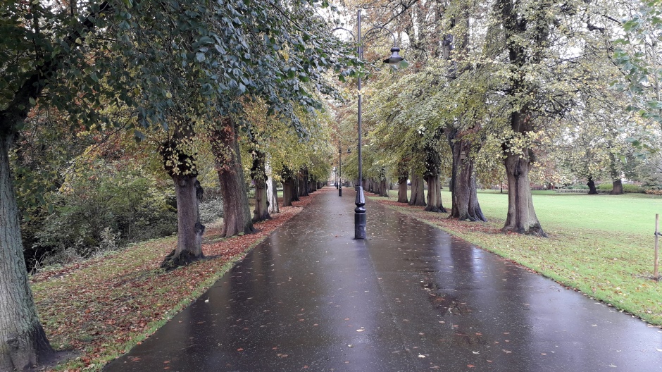
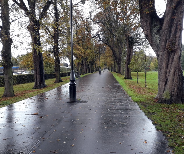
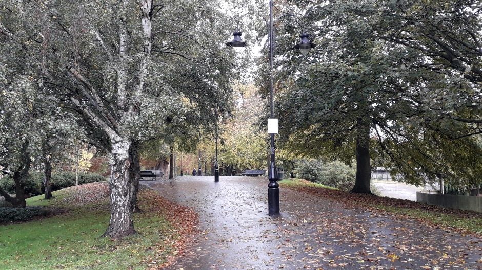
The first Walk, St John's Walk (shown above), runs along the northern edge of The Walks and was originally designed for use only for Lynn’s more well-to-do citizens. Here, they could take gentle exercise in the town, socialise and take walks away from the dirty and crowded streets. St John’s Walk was laid out in 1851 and its trees were added in 1868. In 1906, it was extended through to Tennyson Road.
 |
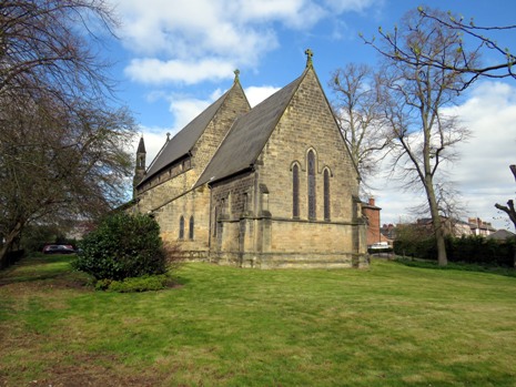 |
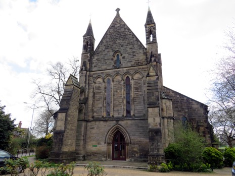
Next to St John’s Walk, at its town centre end, on the north-western corner of The Walks, stands St John the Evangelist Church. In 1843, John Motteux, a rich silk merchant and former owner of the Sandringham Estate, gave £2,000 to build a “poor man’s church” where worshippers could sit for free; in other Anglican churches at the time, the congregation had to pay for their seats. The building was designed by Anthony Salvin and built in 1846 in the Gothic Revival style. The church is open by arrangement via the Church Office.
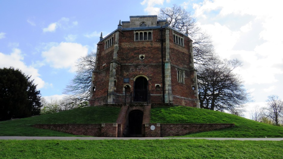
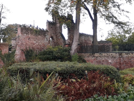
Shown above, perhaps one of the highlights of The Walks is the Chapel of St Mary on the Mount (or “Our Lady's Chapel”), built 1483-85. It is more commonly known as the Red Mount Chapel, a name dating back as far as the 1700’s. Sitting in the centre of The Walks, it was built to contain a relic of the Virgin and as a wayside chapel for the use of pilgrims on their way to the shrine of Our Lady of Walsingham. The Red Mount Chapel was built by Robert Corraunce on instructions from the prior of Lynn and sited just outside the town’s defensive bank, but inside its protective ditch. The octagonal brick-built chapel has supporting buttresses at each corner. It has three entrances, with the one at the back probably being used by the priests; buildings such as this one were intended to provide the pilgrim or worshipper with a religious experience. The building contains two chapels. The Lower Chapel lies partly underneath the surrounding mound, whilst the Upper Chapel is the architectural highlight of the building. It was built in 1506 in the shape of a cross, most likely replacing an earlier one of brick, and features a fan vaulted ceiling decorated with quatrefoils. One of the unusual features of the Red Mount Chapel is its two staircases, which run anticlockwise from the entrances around the central core to the Upper Chapel. In the 1530’s, after the Dissolution of the Monasteries, the building became property of the town council, who began to dismantle it. The building was then used for a variety of purposes, including water storage, as a study, a gunpowder store during the English Civil War, as an observatory and even as a stable. By the turn of the nineteenth century, it was in a poor state of repair, but was fortunately restored in 1828 with public money. Further restorations took place in the 1920’s and 30’s. In more recent times, the structure has had its roof replaced and it has undergone sensitive structural repairs. The medieval entry passage into the Lower Chapel has been partially reconstructed along with a section of the outer wall. According to local legend, a tunnel connected the Red Mount with Castle Rising Castle, nearly four miles away, although no evidence has been found supporting this fanciful notion. Following restoration works, visitors can now see inside this Scheduled Ancient Monument and Grade 1 Listed building (contact King’s Lynn Tourist Information for opening times).
 |
||
 |
 |
|
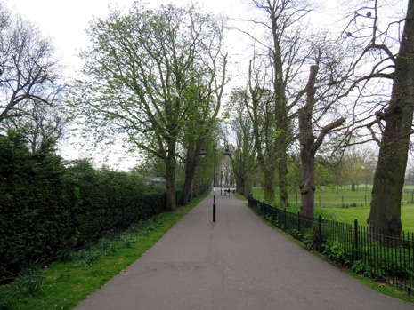
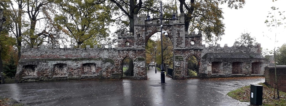
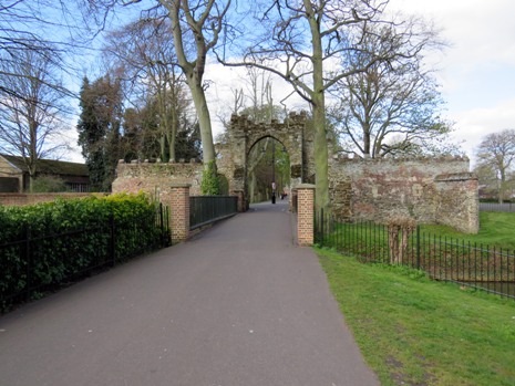
The restored Guannock Gate (above) is located on Broad Walk. Broad Walk runs west to east, parallel and to the south of St John’s Walk, the two being connected by Red Mount Walk, which runs through the centre of the park. Guannock Gate (sometimes spelt with one “n”) was originally part of the town’s defences, which included the nearby South Gate on London Road. “Guannock” is the name of the bank which formed part of the defences, which enclosed a large area and ran from north of The Fisher Fleet, through The Walks, to the South Gate and beyond to Whitefriars. It is believed that only the gates and a small section of wall either side were made from brick or stone, the rest being earth banks and ditches. The defences would have been important during the English Civil War (1642-1651), when Parliamentarian soldiers blockaded the Royalist town. The defences were never breached, although lack of supplies eventually caused the town to surrender. The Parliamentarians subsequently improved Lynn’s defences, making the town effectively the strongest fortress in the region. After the end of the English Civil War, the defences were no longer needed and they started to decay; part of them were removed during the 1800’s, to make way for increased traffic and new developments, including the railway line. Today, only the Guannock Gate, the magnificent South Gate and a remnant of the wall survive, the former becoming an ornamental feature of The Walks.
 |
||
 |
 |
|
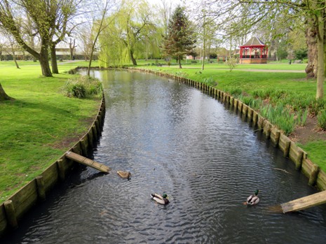
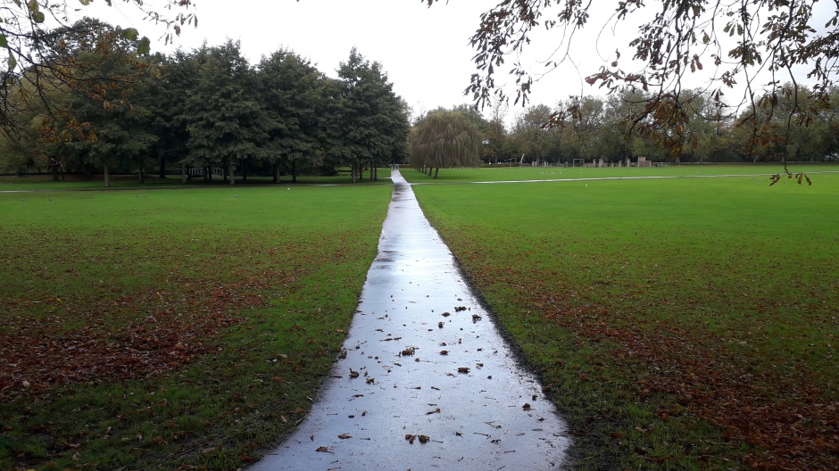
Running along the southern edge of The Walks from the town’s London Road to Guannock Gate is the Broad Walk (shown above). This “Walk” had another section added in 1843 (the “Extension Walk”, which continues from Guannock Gate to Tennyson Road. Adjacent to the Broad Walk Extension, on its southern side is the King’s Lynn Football Club ground (see further down the page). Lynn’s first public swimming pool and washhouse opened in 1854, although these facilities were replaced in 1921 by a new open-air swimming pool, in the area towards the bandstand (see lower down the page). The pool proved very popular with local children, particularly during the summer months. It was, however, replaced by the new St James indoor pool in 1975, situated just to the west of The Walks.
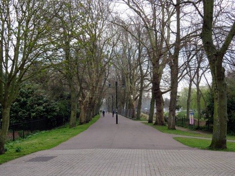
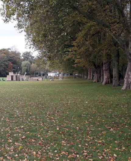
Running south from Guannock Gate is a narrow section of The Walks known as the Seven Sisters (photograph, above). Characterised by its trees, its name comes from the seven stars known as the Pleiades. The ancient Greeks referred to these stars as the “Seven Sisters”. In 1760, the first group of elm trees were planted along here by William Mixon, a former town mayor. They were plated several times, but all of them were unfortunately destroyed in 1971 by Dutch Elm Disease. The area has since been replanted and also in more recent times, a seating area added. This area of The Walks has a gruesome history; in 1587, 16 pirates were hung here on Gallows Pasture. New gallows were constructed in 1677 and during that year, a payment of one shilling was paid for the use of a “ladder to hang a lady”. Most public hangings, however, actually happened outside the nearby South Gate. Walking along here, one may note the slight rise in the ground; this was also the site of one of the town’s windmills, first constructed in 1595. The windmill was blown down in 1741, during a strong gale which damaged a significant part of the town. The mill was rebuilt, although in 1749, the miller (Richard Simpson) stated that the path to it was no longer usable and requested the mayor’s assistance in relocating operations to nearby Gaywood. Lynn’s main corn mill stood near the London Road entrance to The Walks and was powered by water from the Millfleet. The King’s Lynn and West Norfolk Hospital (1834) also once stood in this part of the town, although it was demolished in the 1980’s to make way for housing.
 |
||
 |
 |
|
 |
||
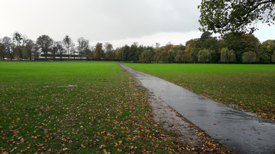
In the eastern part of The Walks is the Recreation Field (shown above). It was created in the early 1900’s as a result of drainage of marshy land. It is flanked on its northern side by the extended section of St John’s Walk, which was laid out in 1906, and by the Broad Walk Extension on its southern side. Changes in working hours and holidays brought about during the Victorian and Edwardian times meant people found themselves with more leisure time. Sports, such as cricket, cycling and tennis became more popular and demanded space in The Walks, sometimes causing issues between the different activities vying for space. During World War I, army horses were kept on the Recreation Field and a prisoner of war camp was built with huts made of wattle. In 1920, the army agreed to drain and reinstate the field as a recreation ground. Many other activities have since taken place on the open field, such as fun days, pageants and travelling circuses.
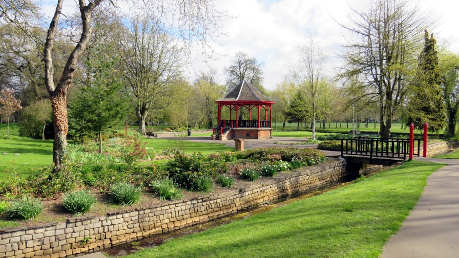
The final feature of The Walks described here is the Vancouver Garden (shown above), which lies just to the east of Guannock Gate. This garden dates from the 1920’s and its prominent feature is an ornamental bandstand. The garden is now named after the naval officer and explorer Captain George Vancouver, who was born in Lynn in 1757. Vancouver sailed with Captain Cook and during his own great voyage of 1791-95, he established British interests in North West America, where his name lives on; the city of Vancouver and Vancouver Island in Canada were named after him, as was the city of Vancouver in Washington State, USA.
St James’ Park and adjacent to The Walks park area
 |
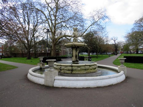 |
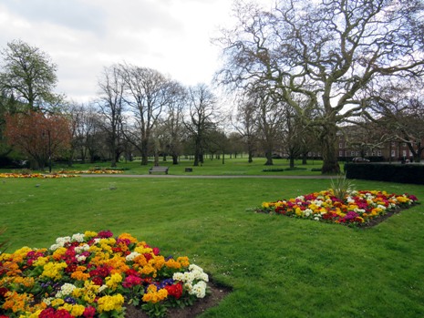
Just west of the St John the Evangelist Church, a path running alongside Blackfriars Road leads to St James’ Park (shown above). It opened to the public in 1903 following the removal of tombstones from the St James’ cemetery that was once located at the site. Plans dated 1900 describe a proposed park here as “pleasure gardens”. The ornamental St James’ Park has formal gardens, which include seasonal decorative flowerbeds. There is also an ornate fountain in the centre, which was presented by Frederick Carpenter, Mayor of Lynn, in 1903. After World War I, a tank was given to the town and this stood in the park for a number of years. On the far side of the park, it is possible to see the closely-packed tombstones that were relocated from the burial ground when the park was created; one of the gravestones describes how three healthy young men went swimming in the “Lynn Roads”, the shipping channel in the Wash, and were drowned. At the southern end of St James’ Park, in the garden of the King’s Lynn nursery school, it is possible to see a ruined window from the St James’ workhouse. It was originally a medieval chapel, founded in the 1100’s. In 1682, the chapel was restored as a workhouse for poor children and later on, adults were admitted. From 1835, it became a Union workhouse. However, in 1854, the central part of the building collapsed, during a failed attempt to fix the workhouse clock and the site is now largely occupied by the Vancouver House tax office and the social hall of the nearby Methodist Church.
 |
||
 |
 |
|
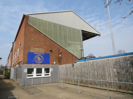
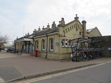
Finally, shown above (top and lower-left), is the King's Lynn Town Football Club ground, known as “The Walks”. It is located adjacent to the park area. The football club is popularly known as “The Linnets” and they have played here since 1879. In its early years, the club had one of the strongest teams in the country, along with its own newspaper, “The Lynn Football Star”. Today, the ground has a capacity of approximately 6,000 spectators. Also shown above (lower-right) is a photograph of King’s Lynn Railway Station (first built in 1871), which is located close to the town-centre end of the aforementioned St John’s Walk. Below is a thumbnail gallery showing some more photographs of The Walks and St James’ Park (click on an image to enlarge):
[Photographs and Text: April 2019 and October 2020]
Back to Top