The Algarve is the southernmost region of mainland Portugal. It's permanent population of approximately 450,000 people live in 16 municipalities covering a total area of some 1,929 square miles. In the peak holiday season, the Algarve's population triples to nearly 1.5 million people. Geographically speaking, the region is a land of contrasts. On the sotavento, or leeward shore, there are long beaches with dunes of fine sand, whilst on the barlavemto, the windward side, there are sandy coves winged by cliffs. In the north of the region lies the verdant Serra, whilst in the northeast lie harsh upland areas. In addition, the coastline is notable for picturesque limestone caves and grottoes. At the Algarve's easternmost edge runs the gleaming Guadiana River, separating it from the Spanish region and autonomous community of Andalusia.
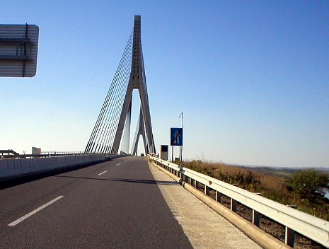
Above: Driving over the Guadiana International Bridge. Connecting Spain and Portugal, it is 666 metres long with the central span between the towers measuring 324 metres.
From the Guadiana River, in the east, to the Atlantic Ocean in the west, the land is known as Al-Garb. This name means "The West" and came from the Arabs, whose links with the region both as traders and as conquerors date back to the 8th century. Attracted by the scenery and sunshine, the Arabs turned the region into a leisurely destination for the rich and powerful and a place to inspire philosophers and poets. Prior to this, the Romans were too attracted to the Algarve as a place of leisure. The Portuguese crown regained the region from the Arabs in the 13th century. The region has a tradition as a cultural melting pot and today it remains a crossroads for people from all over the world.
The Algarve region is the most popular place for tourists to go in Portugal; many people will know it as a holiday destination. Indeed, tourism and various related activities make up the bulk of the region's summer economy. Another large industry of the region is food production, such as seafood, whole fruits and other plant products, such as almonds.
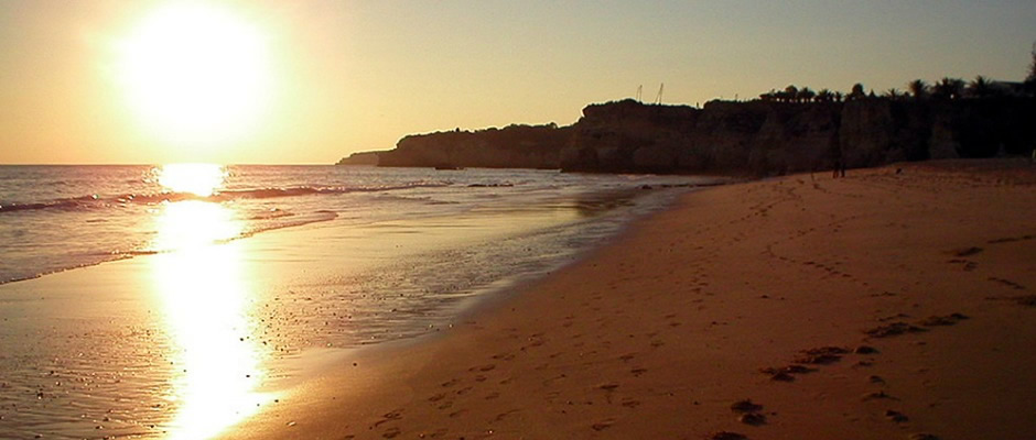
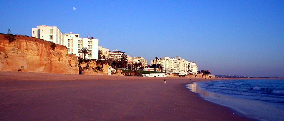
Whilst some visitors to the Algarve may prefer to spend their time there sitting on the beach, or by the hotel pool, here at Robin's Website, we don't seem to sit around much and so, a brief look below at a small sample of the many places the region has to offer. The photos on this web page were taken in December, 2005.
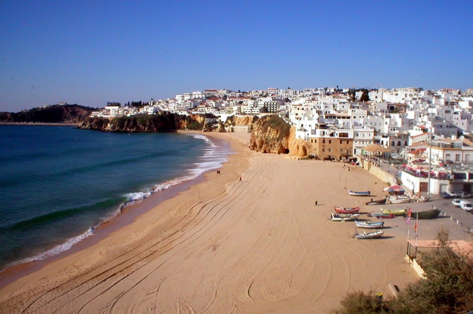
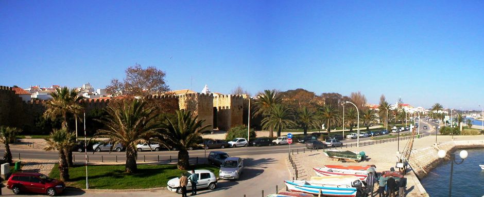
Albufeira
The photo of Albufeira below shows it somewhat off-season. Formerly a fishing village, it is now a major holiday destination, with millions of tourists annually attracted to its sandy beaches, bars, cafes and nightlife. There are two main tourist areas, Areias de São João, known colloquially as 'The Strip', and the Old Town. The strip is very nightlife-orientated and is open to traffic, whilst the old town is situated right at the seafront and is predominantly a pedestrianised area. Despite having a much greater number of bars and cafes than the strip, the old town has still maintained its Moorish feel. Albufeira has a modern marina which, today, the local fishermen use and this also forms a base for diving activities, dolphin-watching and boat trips.
Faro
Faro is the Algarve region's administrative centre and it is here it's international airport and public university (the University of the Algarve) are located. It lies at the heart of the Formosa estuary, a labyrinth of marshland, islands and inlets. The ever changing estuary is both the result of the forces of nature, and, of man. Faro (Óssonoba in Roman times)is thought to have been founded for fishing and defence and the present name comes from Ben Said Ben Harun, an Arab prince who established a city state here in 1031, under his brief principality. The port here became a trading post under the Phoenicians and Greeks, then became part of the Roman empire, followed by Arab occupation and the founding of a principality. In 1294, it was conquered by King Afonso III, who proclaimed himself king of Portugal and The Algarves. Today, the old town is the only evidence of the distant past. Faro grew in importance, although it had to be rebuilt after attack by the English (1596) and an earthquake (1755). Various political issues affected the city, but against all odds, today it continues to thrive as a key centre for the region. The photos below show Faro Cathedral [1], Palácio Episcopal [2], City Hall [4, centre], Capela dos Ossos [3,6,7] and Igreja do Carmo [8].
Lagos
Lagos is one of the most popular places to visit in the Algarve, due to its beautiful beaches and numerous bars, restaurants and hotels. As well as the modern attractions of a tourist resort, it is also known as the historic centre of the Portuguese Age of Discovery. On a more poignant note, it was once the centre of the European slave trade. It lies in the mouth of Bensafrim River. The main municipality has a population of 31,000, whilst the main town itself has approximately 22,000 inhabitants, with many more people coming to stay notably in the Summertime. Considered the jewel in the Algarve crown, the town has preserved much of its heritage whilst embracing the modern tourist industry. The first caravels of Henry the Navigator set off from here 500 years ago on voyages of exploration, which would bring Europeans to new lands and peoples. There are many attractions for the visitor and these include the city walls [photo above and photos 25, 26 below], the Igreja (church) de Santo António [photo 29 below], the Church of Saint Sebastian, the waterfront and the city's main square, many old historic streets and the Bandeira Fortress which was built to defend the harbour from attacks [Photos 16-22].
Cabo de São Vicente and Ponta de Sagres
Cabo de São Vicente (Cape St. Vincent) is usually taken as the south-westernmost tip of Europe. According to Christian legend, the body of St. Vicente was washed ashore here, hence the name. The body of St. Vicente remained at the cape, guarded by crows, until it was taken to Lisbon in 1173. Cape St. Vincent was sacred to the Romans and it is thought that a temple dedicated by the Greeks and Phoenicians was sited here. And so, the site has been important for divinity and worship for thousands of years. Because of its geographical significance, a number of significant naval battles have taken place here throughout history. Today, sited in a national park, a lighthouse stands on the cape to safely guide ships around its rocky shores.
Just 4km to the east and 3km to the south of Cape St. Vincent lies Ponta de Sagres (Sagres Point), a windswept shelf-like promontory. It was in Sagres, described by the poet Luís de Camões as the place where land ends and sea begins, that Henry the Navigator, son of King João (John) I, contemplated the opening up of new routes around the world and chose here to be the site for his school for mariners. Thus here is considered the site where the saga of the Portuguese Discoveries began. The promontory here has historically offered a shelter on its leeward side for sailors and their ships, whilst waiting for favourable winds to assist in a safe navigation around the dangerous waters surrounding Cape St. Vincent. A fortress was built on the promontory in the 16th century to help guard the bays of Tonel and Mareta which lie either side. This bulwark-like fortress was severely damaged during the Great Earthquake of 1755 and restored in the mid 20th century. Today, a 16th-century turret is still to be seen.
For those who fancy a rather long walk, Cape St. Vincent forms the south-western end of the 5,000km (3,100 mile) E9 European Coastal Path, which has its other end at Narva-Jõesuu in Estonia.
Fóia
For those wishing to escape the heat of the beaches and looking for a great panoramic view of the region, it is possible to reach the summit of Fóia, the highest mountain of the Algarve, by road. The summit is of 902m (2,959 ft) above sea level and is part of the Serra de Monchique range. At the top, the visitor will find a number of telecommunication facilities including the main Radar Station of the Portuguese Air Force, but the main attraction is, of course, simply just taking in the stunning views which can extend as far as the coastline on a clear day.
Silves Castle
The Castle of Silves lies in a civil parish and municipality of the same name. It was built between the 8th and 13th century and is one of the best preserved Moorish fortifications in Portugal. In 1910, it was classified as a National Monument. Further information on Wikipedia Here.
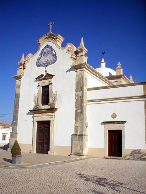
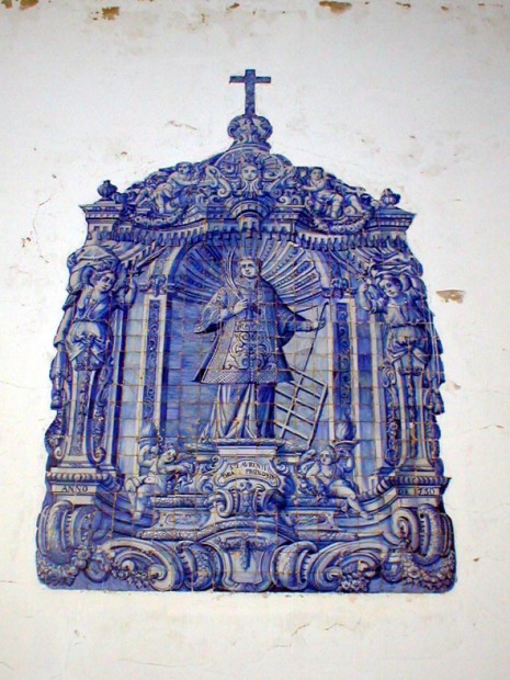
Church of São Lourenço (Almancil)
Almancil is a town and civil parish in the municipality of Loulé, 13km northwest of Faro. Just to the east of the village lies the church of São Lourenço, which is shown in the two photos below. The building is typically Algarvian in architectural style and is covered with 18th-century ceramic tiles on the inside. The oldest recorded reference to the church comes from 1672 and it has, throughout the years, seen a number of construction and reconstruction works; in historical terms, most recently following damage caused by the earthquake of 1969.
 |
 |
Back to Top