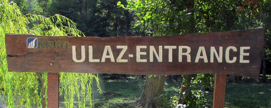
Krka National Park is located along the middle-lower course of the River Krka (which it encloses) in central Dalmatia, Croatia. The park lies within Šibenik-Knin County and includes the Krka River (from 2km downstream of the town of Knin to Skradin) and the lower course of the Čikola River. With a total area of 109km² of the Krka River and it's basin, it was proclaimed Croatia's seventh National Park in 1985. The park is one of outstanding beauty and valued for it's karst river, natural phenomena and it's cultural and historical monuments; the National Park was not only formed to protect the river itself, but to help best manage scientific, cultural, educational and recreational activities here, including tourism. Krka is known for a series of 7 waterfalls, with Skradinski Buk Waterfall flanked by traditional watermills in the south and Roški slap waterfall to the north. Historic sites in the park include monasteries and Roman ruins. This webpage mainly focuses on the southern (and more popular) areas of the National Park.
Above: A view towards the town of Skradin which sits near the southern end of Krka National Park as seen from a service station/welcome centre on Croatia's A1 Autocesta.
Geographical factors and the various types of habitats found along the Krka River have resulted in this area having an exceptional wealth of flora and fauna. Over 1000 plant species and subspecies have been recorded here. Many amphibians can be found in the lake sections of the river and wetland areas, reptiles in the thickets and rocky areas and in the river itself, many endemic fish species may be found. The area is important for bird migrations in the spring and autumn making it one of Europe’s premier ornithological areas.
Map courtesy of Openstreetmap.org
Examples of cultural and historical monuments in the Krka National park are plentiful. Traces of early human activity are in evidence here and sites include the remnants of the aqueduct in the Roman settlement Scardona and of a Roman military camp at Burnum and numerous ruins of medieval Croatian fortresses from the 14th century. One such fortress, Ključica, is one of the most important fortified structures in Croatia in terms of size and the level of preservation. A series of water mills and washing columns along the river banks are a testimony to the rural architecture of the area. Religious structures include the Franciscan Church of Our Lady of Visovac and the 15th century monastery Our Lady of Mercy which stands on Visovac Island (see below) and the Krka Monastery (Holy Archangel). In the town of Skadrin, there is a multimedia room in the park’s branch office where visitors can find out more about Krka National Park and it’s many attractions.
Above: Hydroelectric plant near Skradinski buk on the Krka River (Composite Image)
Skradinski buk (below) is the longest and most popular waterfall on the Krka River and one of Croatia's best known natural features. The combined waters of the Krka and Čikola Rivers flow here over 17 steps with a combined total drop height of 45.7m. The width of these cascades varies between 200 and 400m over a length of 800m. The waterfalls were created by travertine (see below) barriers, islands and lakes. Around the waterfalls is a well laid out network of trails and bridges for the visitors to enjoy. Along the riverbank here, there are several water mills, rolling mills and washing columns that have used the river as a source of power for centuries.
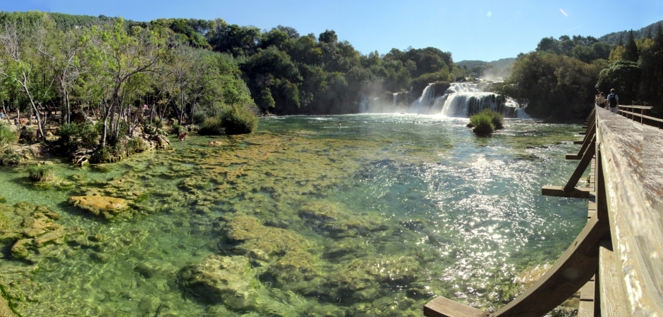
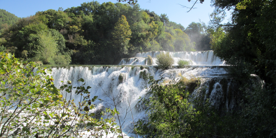
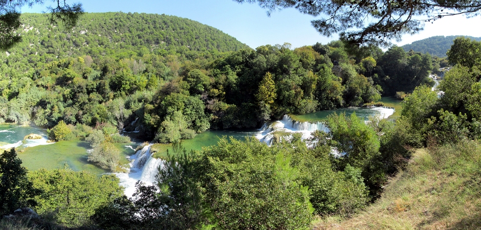
The three photos above are each composite images which show Skradinski buk as seen from a 1.9km educational trail which follows the river, passing over naturally formed barriers. The trail helps visitors become more acquainted with the wealth of flora and fauna of the park.
Skradinski buk can be reached either via the Lozovac entrance (April to October) or via Skradin (April to November). The former can be accessed by bus and has an 875m (approx. 10min) walking trail to the falls whilst the latter is via a boat service which connects the town of Skradin with the lower end of the cascade. As an alternative, on this particular visit, a walk was taken to Skradinski buk (approx. 45min) from a small layby on the road leading out of Skradin. Following for the main part the section of the river taken by the boat, the walk was along a good quality track and made the first sight of the falls ever so more rewarding. At the base of the falls are a good range of amenities (refreshments, toilets, souvenir stalls) and many people may be seen at times bathing in the lower plunge pool, kept at a safe distance from the falls by a floating boom. The thumbnail gallery below shows photos taken from the walk described above and the trail which follows the waterfall cascade at Skradinski buk:
The watermills at Krka belong to a system of pre-industrial water-powered plants. Their importance economically meant they were often a source of conflict in earlier days. The preserved 19th century mills represent monuments of rural architecture and illustrate the economy of the past. They are of ethnographical importance and today, demonstrations are held in the restored water columns, showing the milling process for grain and how cloth was washed and woven into various products such as carpets and many other activities of the day.
 |
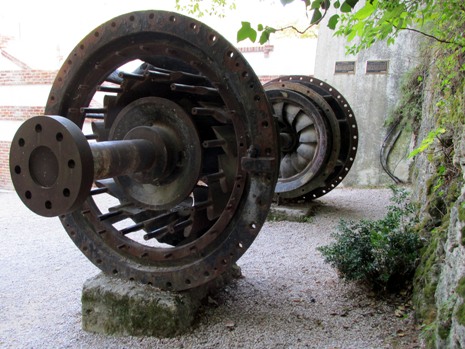 |
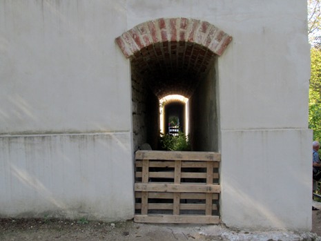
The photos above show remnants of the former Krka Hydroelectric Power Plant, which can be seen along the trail at Skradinski buk. The power plant was put into operation on 28 August 1895, just two days after the hydroelectric plant at Niagara Falls, making it the second such hydro dam of its kind in the world. The plant at Niagara Falls was based on Nikola Tesla's design and patent (Tesla was himself born in modern-day Croatia). Thanks to the builders, Mayor Ante Šupuk and engineer Vjekoslav Meischner, Šibenik received electricity before many other cities in Europe. The Krka hydro dam was in operation up until World War I.
 |
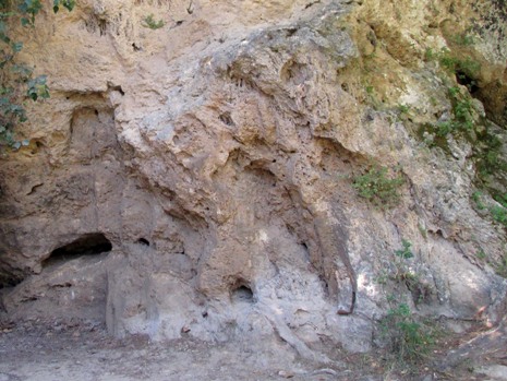 |
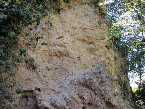
The two photos above illustrate the travertine formations at Krka. Travertine is formed by deposits made of calcium carbonate (limestone) which precipitate out of running water, creating barriers, thresholds, dams, cones and other geomorphological forms. They are biolithic rocks, formed in a biodynamic process of the combined activities of physical and chemical factors and the living organisms in the water, such as mosses and algae. The travertine formations of Skradinski buk are approximately 7000 years old. These are known as a 'living travertine' as the deposits are still growing today (approx. 3mm p/a). Away from the river where there is no active geological development, travertine is to be found up to 125,000 years old and this is known as 'dead travertine'. The series of 7 waterfalls along the Krka are effectively travertine barriers making the river a rare and natural type of karst phenomenon. For the reader interested in finding out more about the formation of travertine and it's occurrence, click here (Wikipedia page).
 |
 |
|
 |
||
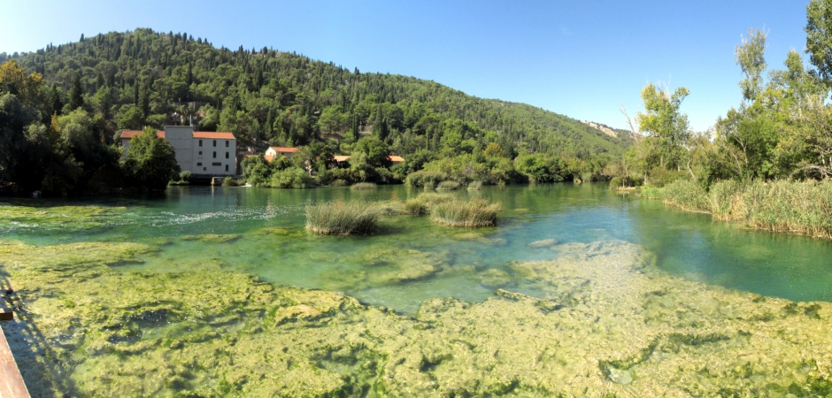
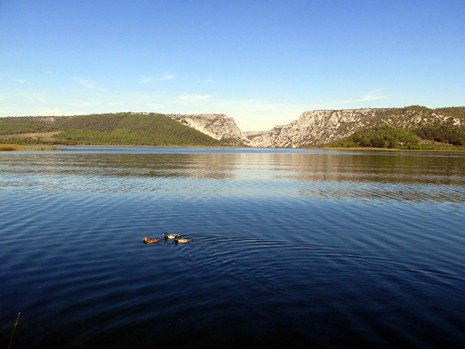
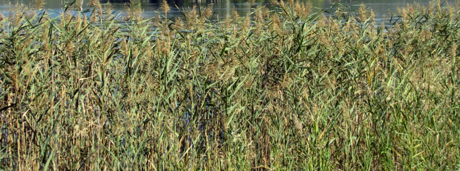
Visovac Lake, shown above, is the largest expansion on the Krka River. It is located north of Skradinski buk waterfall and south of Roški slap waterfall. Named after Visovac Island, the lake was formed in the Post-Würm period of sedimentation and raising of travertine deposits on Skradinski buk. Würm, often spelt "Wurm", refers to the last glacial period in the Alpine region (about 70,000-11,700 years ago). The lake is a flowing karst lake system and forms an important part of the Krka River's ecosystem. At 3.5km long, a width ranging from 350 to 850m and a depth of approximately 25m, the lake is edged by wetland habitats overgrown by the common reed (Phragmites australis) and lesser bulrushes (Typha angustifolia). Where the water deepens, the lake is characterised by yellow water-lilies (Nuphar lutea) and European white water-lilies (Nymphaea alba). Over 300 native plants have been recorded around Visovac Lake, including several species endemic to the Illyrian-Adriatic region. Twelve fish species are to be found in the lake including trout, rudd and goby which are endemic to Croatia and other species which are endemic to the wider Adriatic and Mediterranean areas. Furthermore, Krka River and Lake Visovac is one of the few habitats of the otter left in the Mediterranean region.
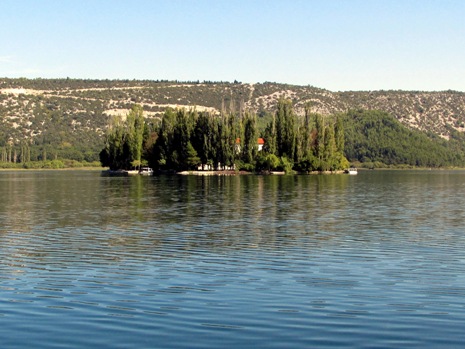
Visovac Island is home to The Franciscan Monastery of Our Lady of Mercy and the Church of Our Lady of Visovac. these have stood here since 1445 and form one of Croatia's most important cultural sites. The monastery maintains a valuable collection of archaeological artefacts, historical church items and a library containing valuable books, manuscripts and incunabula (early printed books). Due to it's history of worship to the Mother of God, the island is also referred to as Our Lady's Island. The island is a pilgrimage site and visitors can access it by boat either from Remetić or Stinica on the immediate shoreline either side of the lake, or via a boat excursion from the top end of 5kradinski buk.
As mentioned earlier, this webpage mainly focuses on the southern (and more popular) areas of the National Park. A brief description of some of the other sites in Krka National Park Follows. Further north from Visovac Island lies the Roški slap waterfall which is 36km downstream of the source of the Krka River. Roški slap waterfall was named after the Rog (meaning horn) fortress that stood on the right bank of the River. 35km east of Kistanje in a bay on the river stands the Orthodox Krka Monastery. It was built on the foundations of an earlier Eremite monastery and the first known written record of it dates back to 1402. Standing next to the monastery is a church built in the Byzantine style and underneath the church are early Roman catacombs which can be seen on a visit here. The Archaeological site Burnum, which can only be reached by road, is an ancient Roman military camp which contains many remains including the only military amphitheatre in Croatia. A few hundred metres from Burnum stands the third waterfall in the series on the Krka River, Manojlovac slap. Consisting of a series of travertine barriers, with a total height of 596m (322m being the highest barrier), Manojlovac slap is the tallest waterfall on the Krka River. Many consider it to be the most spectacular.
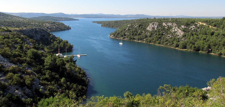
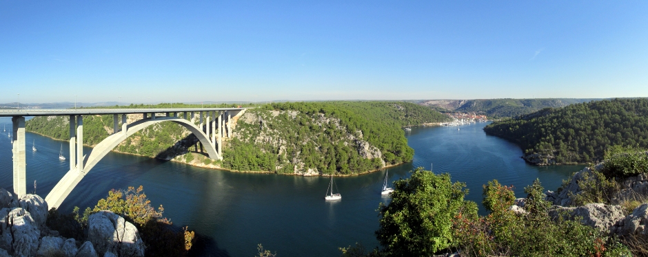
The photo above is taken from just outside Krka National Park, following the river as it heads off out towards the Adriatic Sea. The area from Skradin bridge(by the Krka National Park boundary) to the mouth of the river, although not in the National Park, has been a protected area since 1986. This area is looked after by The Public Institute of Management of Protected and Other Natural Values of Šibenik-Knin County. This area includes Prokljan Lake (at 11.5km², Croatia's second largest lake) and the Channel of St Joseph that is connected to the Bay of Šibenik. This area is typical of a ria, a submerged river valley, and was formed when the sea level rose by about 100m after the last glaciation, at the end of the Pleistocene about 10,000 years ago. Whilst from looking at a map, it may not be apparent where the actual mouth of the Krka River is, it is in fact over the entire ria area from Skradin to the fortress of St Nicholas, on the shores of the Adriatic.
References and Further Reading
1. In Situ Information Boards and Pamphlets
2.
Krka National park - Javna ustanova „Nacionalni park Krka“
Here
3. Krka
National Park on Visit Croatia
Here
4. Travertine on Wikipedia
Here
5.
Würm Glacial Stage on Britannica.com
Here
Back to Top