Kings Canyon is part of the Watarrka National Park in Australia's Northern Territory. Approximately 320km southwest of Alice Springs. It sits at the western end of the George Gill Range. The land here was named Watarrka National Park in 1989, which is the Luritja Aboriginal people's name for the Umbrella Bush, a common plant found on the sand plain that lies south of the site.
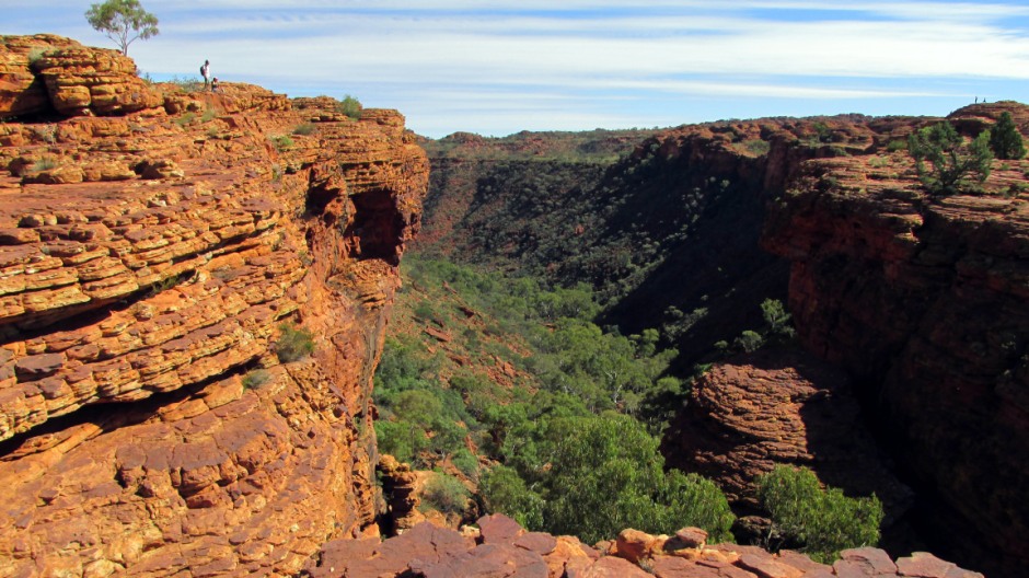
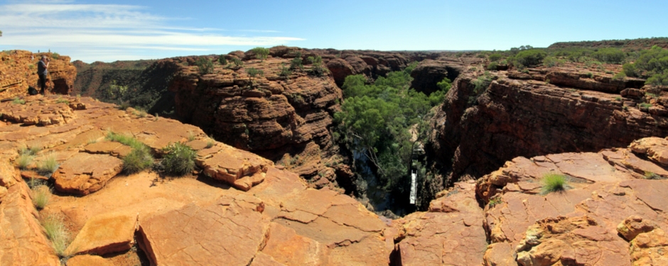
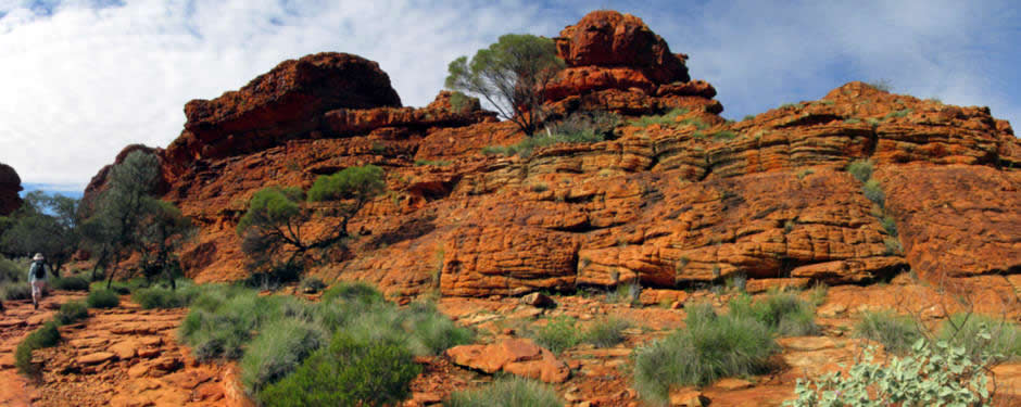
The canyon features ancient sandstone walls that have been shaped by the elements. Rising 100 metres (330 feet) to a plateau of rocky domes, the canyon is a giant amphitheatre formed of the same terracotta-coloured rock as Uluru (Ayers Rock) and Kata Tjuta (The Olgas). It is the deepest gorge in the Red Centre, plunging from an escarpments on the surrounding plain to the west of the plateau of the George Gill Range.
Kings Canyon is an important conservation area, rich in flora which includes a number of rare plant species. The site acts as a refuge for animals from the surrounding desert and here, three major bio-geographical regions overlap; to the south and west are the sand plains of the Lake Amadeus region and the western deserts, to the southeast are low hills and mesas of the Simpson Desert and northeast from here are the MacDonnell Ranges. Plants typical of all three areas are all found here at Watarrka National Park. Kings Canyon is home to some 60 rare plant species including relic species such as cycads (a palm-like plant) which have survived since the age of the dinosaurs, when the earth's climate was different. There are 80 bird species, 36 reptile species and 19 mammal species; kangaroos and wallabies do inhabit the canyon's plateau, although due to their excellent camouflage and nocturnal habits are difficult to see.
The canyon has been inhabited by the Luritja people for more than 20,000 years and their culture remains strong. The canyon's year-round waterholes and moist gullies have sustained the Luritja people through many droughts. There are a number of important rock carvings and paintings to be found within the Park, although most of these are protected by virtue of being away from the main walking tracks.
Many of the Parks natural features, such as the notable rock formations are of great cultural significance to the Luritja people who say they were created by spirit ancestors who are still present in the landscape. The canyon has an important ceremonial role for Luritja men associated with the Kuninga Dreaming. Kuninga is the Luritja name for the Western Quoll, an Australian marsupial sometimes called 'native cats'.
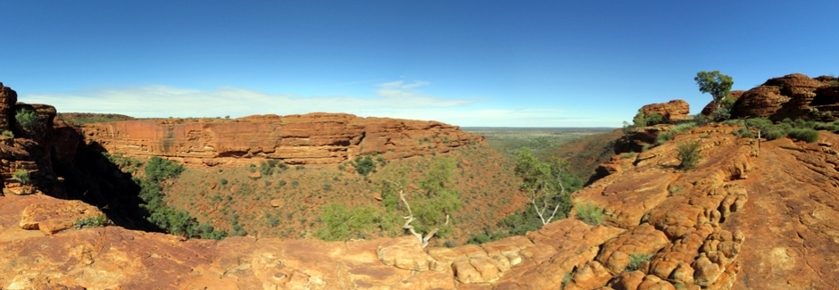
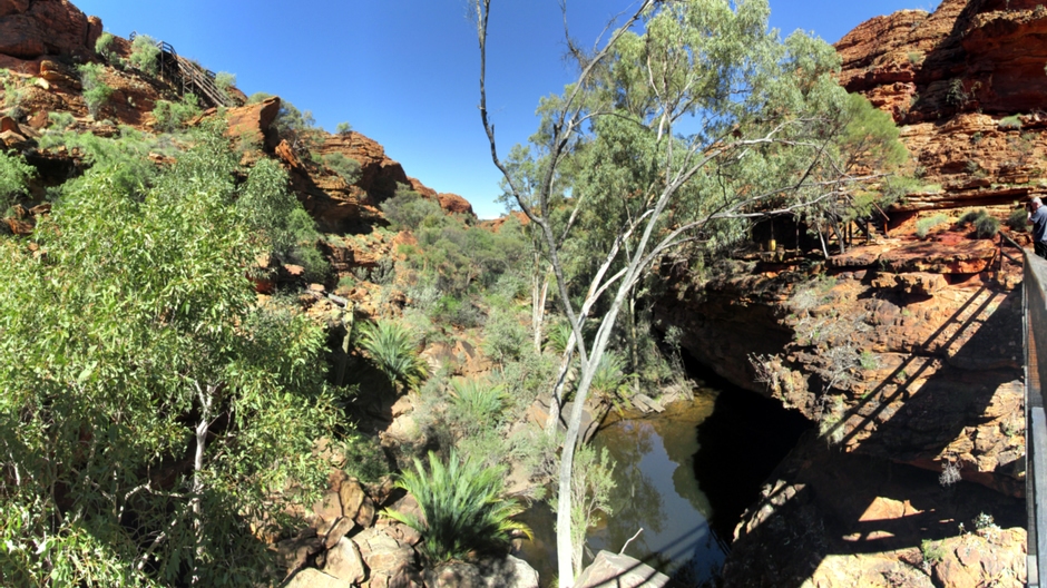
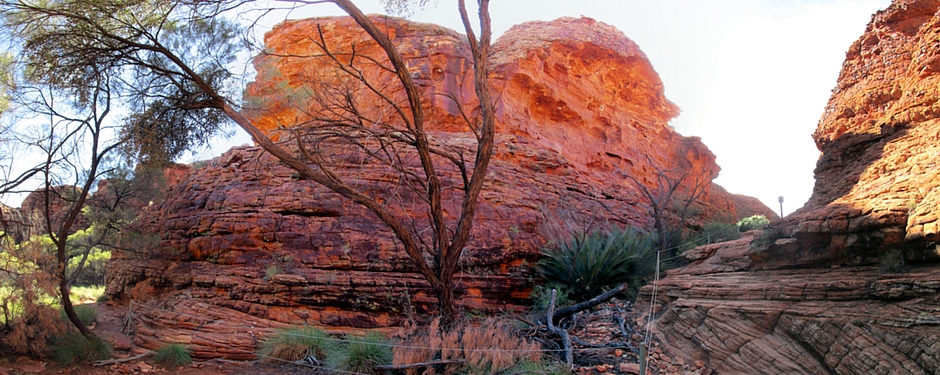
Above: Panoramic stitch showing the starting point of the Kings Canyon Rim Walk
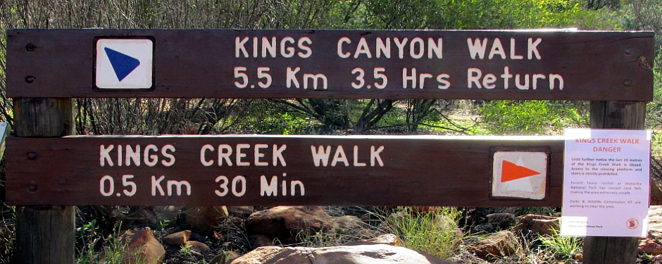
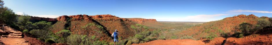
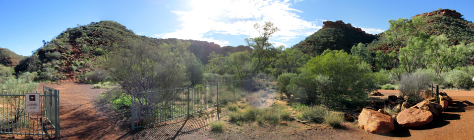
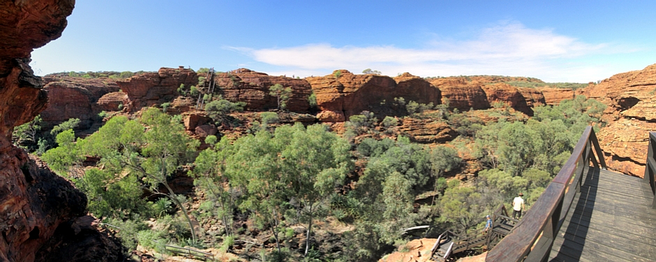
There are a number of walks to take at Watarrka and it is important before setting off on any of them to observe local notices relating to safety, as well as relating to respecting sites important to the Luritja people. The walk taken featured in the photographs on this webpage is the Kings Canyon Rim Walk (6km loop, 3-4 hours, graded moderate) which starts with a steep climb to the top of the canyon, then generally following the canyon plateau, before descending back down again. Signs state that this must be undertaken in a clockwise direction.
Other walks here are the more moderate Kings Creek Walk (2km return, 1 hour, graded easy) which follows the Kings Creek up the canyon floor, the Giles Track (22km, 1-2 days, graded moderate) which links to Kathleen Springs and the Kathleen Springs walk (2.5km return, 1 hour, graded easy) which is at the head of Kathleen Gorge and suitable for visitors with limited mobility.
Some points of interest seen on the Kings Canyon Rim Walk follow.
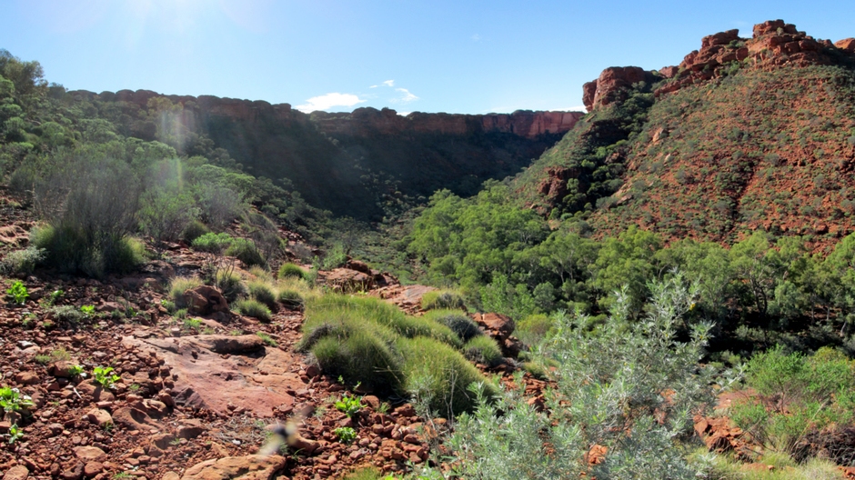
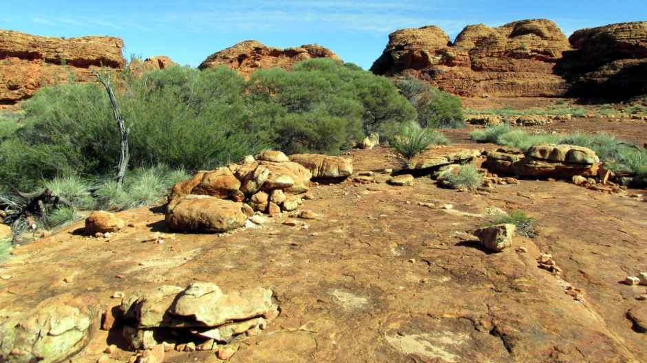
Above: The rocks atop the canyon date back to a time when plant life had barely began to evolve and help piece together the canyon's geological history. Watarrka appears to have been a windswept plain 400 million years ago, covered with sand dunes. The sand has become the Mereenie Sandstone seen here and is hard and brittle, due to its composition mostly of tough quartz grains cemented with silica. The 440 million year old Carmichael Sandstone of the slopes is more crumbly, because it is composed of softer minerals mixed with quartz.
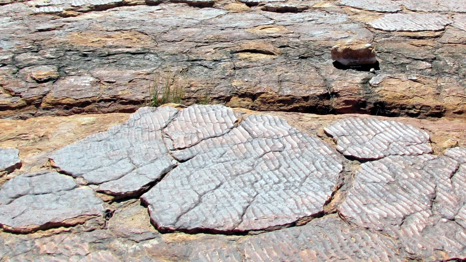
Above: On top of the range it is possible to see examples of cross-bedding in beehive-like domes which provide geologists with evidence that the Mereenie Sandstone was originally sand dunes. Cross-bedding is typical of rocks that originated as desert sand dunes and occurs when wind deposits sand in different directions over a period of time. It also occurs in tidal environments, although the layers seen are much thinner.
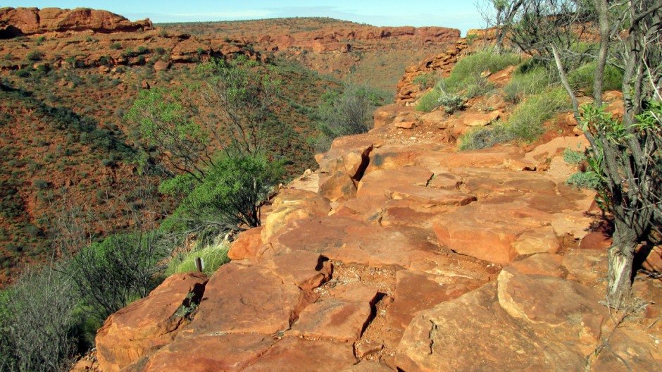
Above: 350 million years ago, forces cracked the plateau's brittle Mereenie Sandstone and they can be seen today. Lines of vegetation grow along these cracks with plant roots penetrating deep into the sandstone. In essence, Kings Canyon, which has formed over millions of years, originated from a crack; wind, rain and floodwaters widened and deepened a main crack in the Mereenie Sandstone, eventually reaching down to the Carmichael Sandstone below, which now forms the lower slopes of the canyon. As the Carmichael Sandstone eroded, it undercut the Mereenie Sandstone above, resulting in large blocks of it tumbling down.
Above: Still along the canyon rim, ripple marks in the lower layers of the Mereenie Sandstone provide evidence that there were once shallow lakes at Watarrka millions of years ago. And so, geological evidence shows that 400 million years ago, Central Australia was most likely a windswept plain, covered with sand dunes and although the climate was dry, there were still rivers and lakes present in the landscape.
Above: The sandstone of Kings Canyon soaks up rain like a sponge from which moisture seeps into a deep gulley, known as The Garden of Eden. Here, the Kings Canyon Rim Walk goes down a series of wooden steps to the gulley (and back up again), where a microclimate is abundant in flora and fauna. As the name suggests, this is a small paradise and the traditional owners of Watarrka National Park ask visitors to take care to ensure water from the tranquil pool found here is kept clean: “If you keep the water healthy, you keep the plants and animals healthy... splash your face to cool off, that's ok, but don't swim.”. In addition, to the traditional owners, this is an important men's sacred place, although their dreaming stories associated with it are too sensitive to share.
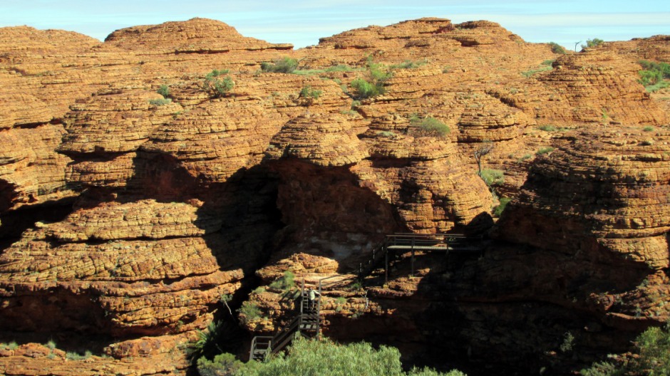
Above: Erosion of vertical cracks in the sandstone has created beehive-like domes, giving the plateau the appearance of a 'lost city'. As seen from the air, the cracks are seen to follow a grid-like pattern of parallel cracks sunning perpendicular to each other. To the Luritja people, the domes are young Kuninga men who travelled here during the dreamtime (creation).
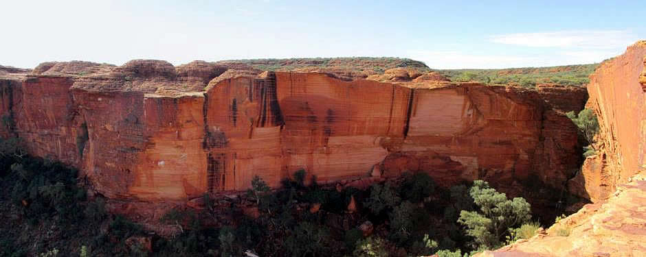
Above: The north wall of the canyon is a patchwork of different colours caused by a variety of processes, such as rock breaking off from the red-brown Mereenie Sandstone plateau to expose a lighter colour, dark rusty vertical streaks caused by rainwater filtering down through the rock then evaporating, leaving iron oxide, and green and black patches caused by patches of algae.
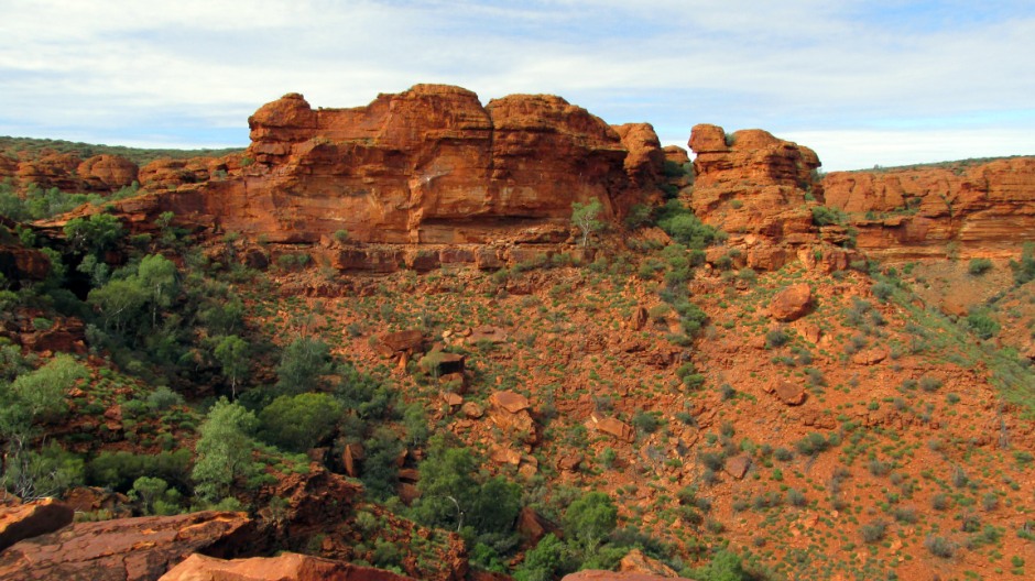
Above: The dry cliff seen here opposite becomes a waterfall after heavy rain and is known as Kestrel Falls because of the Australian Kestrels that roost in the cliffs.
References
1. Red Centre - Alice Springs to Uluru (Map with
visitor information). Hema Maps Pty Ltd.
2. Bright, M. (2005). 1001 natural wonders
you must see before you die. London: Cassell Illustrated, p.838.
3.
In situ public information boards
4. Rawlings-Way, C., Worby, M. and
Brown, L. (2013). Central Australia. Footscray, Vic.: Lonely
Planet.
Back to Top