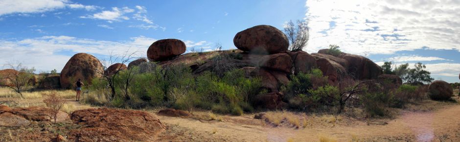
The Devils Marbles Conservation Reserve is an impressive outcrop of giant weathered boulders located between Wauchope and Tennant Creek in Australia's Northern Territory, beside the Stuart Highway and 393km north of Alice Springs. Sitting precariously balanced, the huge boulders are the result of millions of years of erosion. To Aboriginal traditional owners, it is known as Karlu Karlu (Karlwekarlwe) and is a spiritual and cultural site - Karlwekarlwe literally means "round objects", but to the local Aboriginal people, this name means much more than just that. They believe the rocks to be the eggs of the Rainbow Serpent and that many special events have happened here in the past.
In the Dreamtime (the Aboriginal beginning of knowledge, from which came the laws of existence), the traditional owners used this place for ceremony. Four tribes (Warlpiri, Warumungu, Kaytetye and Alyawarra) came from different parts of the land to spend their time together for three to four weeks, to perform their spiritual ceremonies. The ceremonies involved singing and dancing to the spirit people, giving praises in return for a blessing of the land to provide. During the ceremonies, the women were separated from the men. Since the arrival of Europeans in this area, a number of major events have affected the traditional Aboriginal owners, although through all of this, the traditional owners of Karlu Karlu continued to maintain their strong cultural links to this important site. In more recent times, they have pursued every opportunity to regain ownership with a view to protecting and restoring it's cultural integrity. Today, the four tribes have come together to manage the land alongside the Parks and Wildlife Commission, working together to protect the site for generations to come.
The first known record of the name Devils Marbles comes from an account by John Lewis during the construction of the Overland Telegraph Line in 1872. The marbles are what remains of a solid mass of granite, the bulk of which still lies underneath them. An explanation of the geological formation of the boulders is beyond the scope of this webpage, although one is provided to the visitor on the local notice boards and for the reader, it is also explained with a useful accompanying diagram on Wikipedia here.
The above thumbnail photo gallery is taken from a short 350m walk, which takes the visitor around the main boulder cluster. Some of the photos containing people in have been left intentionally to aid perception of scale. During the walk, it is possible to see some of the ongoing processes that is still shaping the boulders today. Many of the boulders contain fine secondary cracks (joints). Rain water penetrates into the cracks, reacting with minerals in the rock to form clays. This process (weathering) can cause a boulder to weaken along a near-vertical crack. The weight of the rock either side of the crack then causes the boulder to fall apart (as seen in photo 15, above). Weathering of the boulders can also be seen where water has filtered into their outer layers, causing large flakes of granite to peel away, a process known as onion-skin weathering, or exfoliation (e.g. in centre of photo 39). Weathering and erosion over thousands of years will eventually transform the boulders into gravely sand.
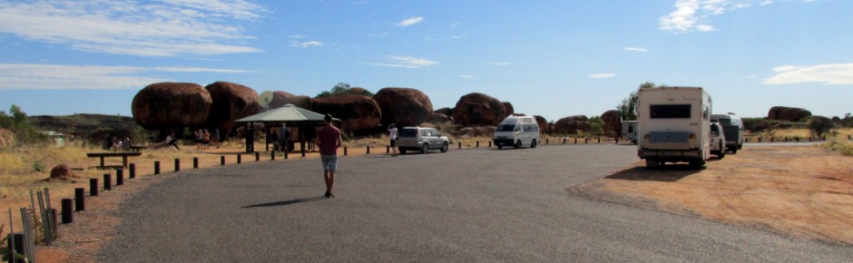
So, Karlu Karlu is an important meeting place for the local Aboriginal people and rich in dreaming sites. As a sacred site, a natural wonder and for reasons of personal safety, strictly refraining from climbing on the boulders is one of several requests from the Conservation Reserve Rangers and Tradition Owners made to visitors who come here. Not pictured here is Karlu Karlu at sunset or sunrise when, like Uluru (Ayers Rock), the rock formation attracts visitors due to it taking on beautiful glowing colours. There is a designated area for camping and fires, although the facilities here are somewhat limited.
References and Further Reading
1. Exploring the Stuart Highway and Oodnadatta
Track Adelaide to Darwin. Balhannah, SA: Tourist Information
Distributors Australia.
2. In situ public information boards
3.
Rawlings-Way, C., Worby, M. and Brown, L. (2013). Central Australia.
Footscray, Vic.: Lonely Planet.
4. Karlu Karlu / Devils Marbles
Conservation Reserve on Wikipedia
here
Back to Top